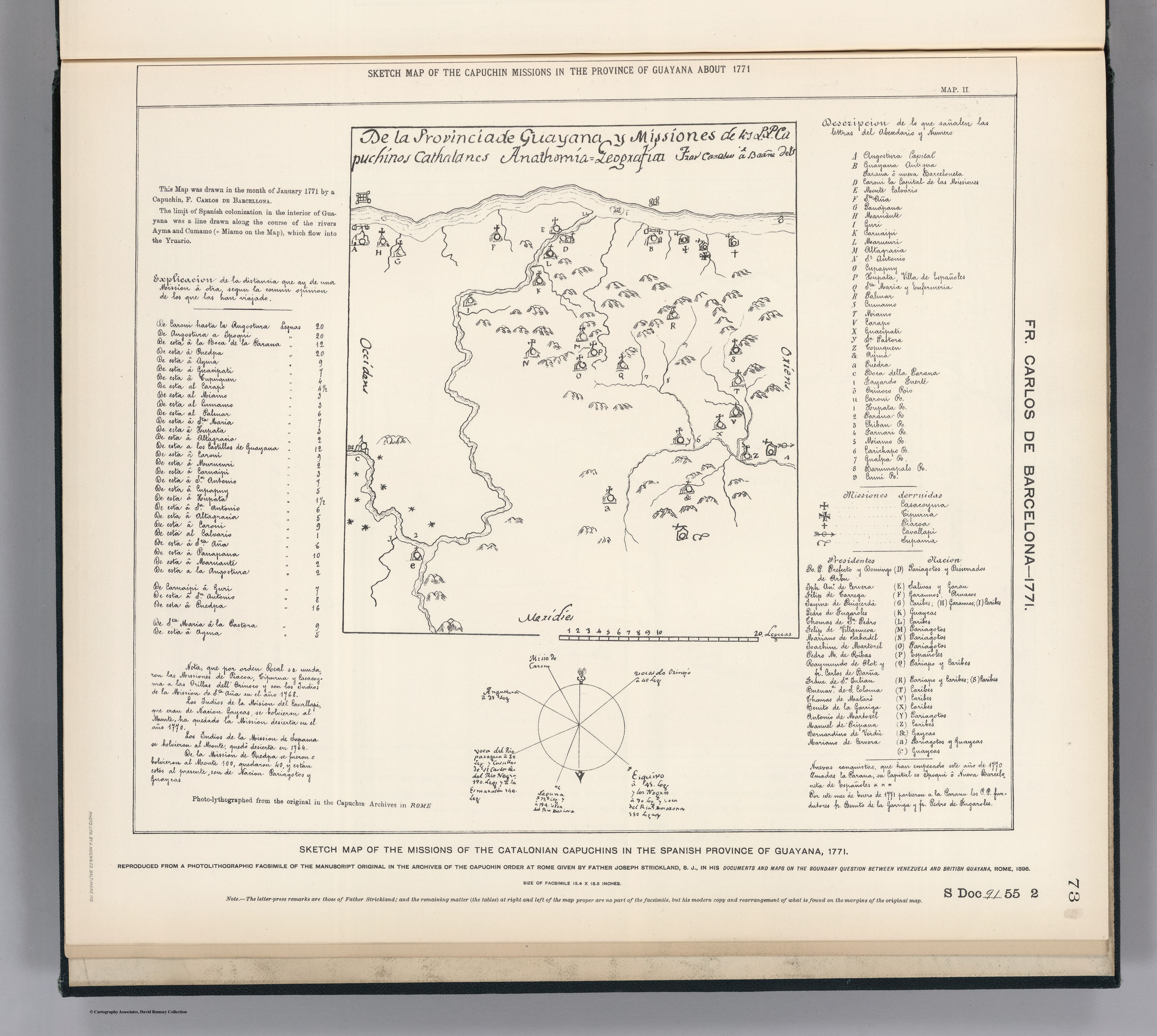
Povos
- PARIAGOTOS
- DISSERRADOS
- SALIVAS
- GARAN
- GARAUNOS
- ARUACOS
- CARIBES
- GUAYCAS
- PARIAPO
Citation
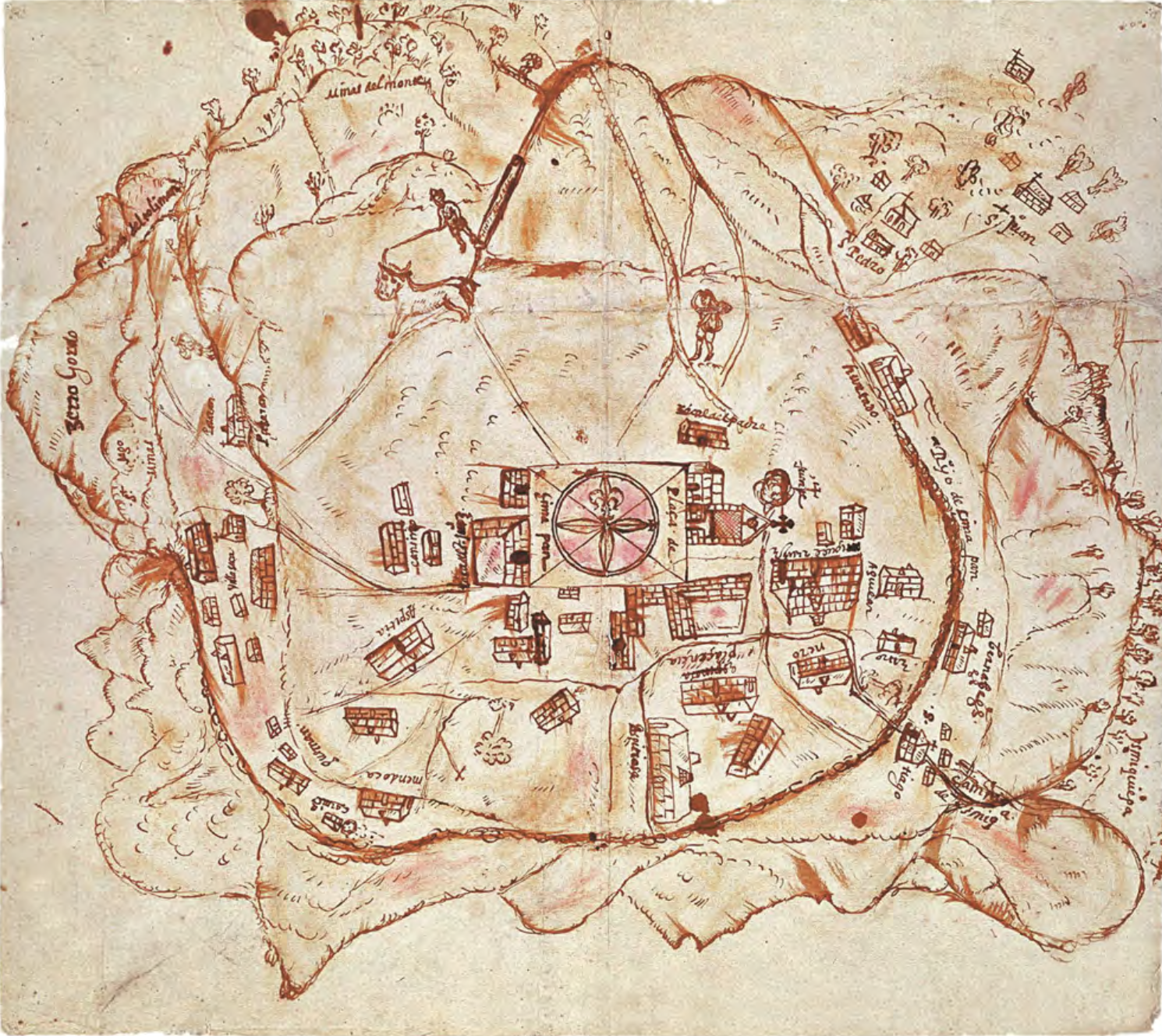
Carlos de Barcelona;F. Sketch Map of the Missions of the Catalonian Capuchins in the Spanish Province of Guayana about 1771. Map. Reproduced from a Photolithographic Facsimile of the Manuscript Original in the Archives of the Capuchin Order at Rome given by Father Joseph Strickland, S.J., in his Documents and Maps on the Boundary Question between Venezuela and British Guayana, Rome, 1898. Photo. Lith. by A. Hoen & Co., Baltimore MD. Accessed March 4;2023. https://searchworks.stanford.edu/view/bw170wt2006.
![Carta ó Mapa Geográfico de una gran parte del Reino de N. E. [Nueva España], comprendido entre los 19 y 42 grados de latitud Septentrional y entre 249 y 289 grados de longitud del Meridiano de Tenerife, formado de orden del Exc[elentísi]mo S[eño]r B[eilí]o Fr[ey] D[o]n Ant[oni]o Maria Bucarely y Vrsúa p[ar]a indicar la division del Virreinato de México y de las Provincias internas erigidas en Comandancia General en virtud de Reales Órdenes el año 1770](https://dnet8ble6lm7w.cloudfront.net/maps_sm/MEX/MEX0190.png)