Povos
- ENEPA
- TAPARITAS
- ARNACOTO
- PEMON
- CADUPINAPOS
- YEKUANA
- GUAINARES
- ABERIANA
- MAVITZI
- GUINAUS
- MAIONGEONG
- MAKU
- QUEVACU
- PURIGOTOS
- ZAPARA
- KIRISHANA
- VARIAMARES
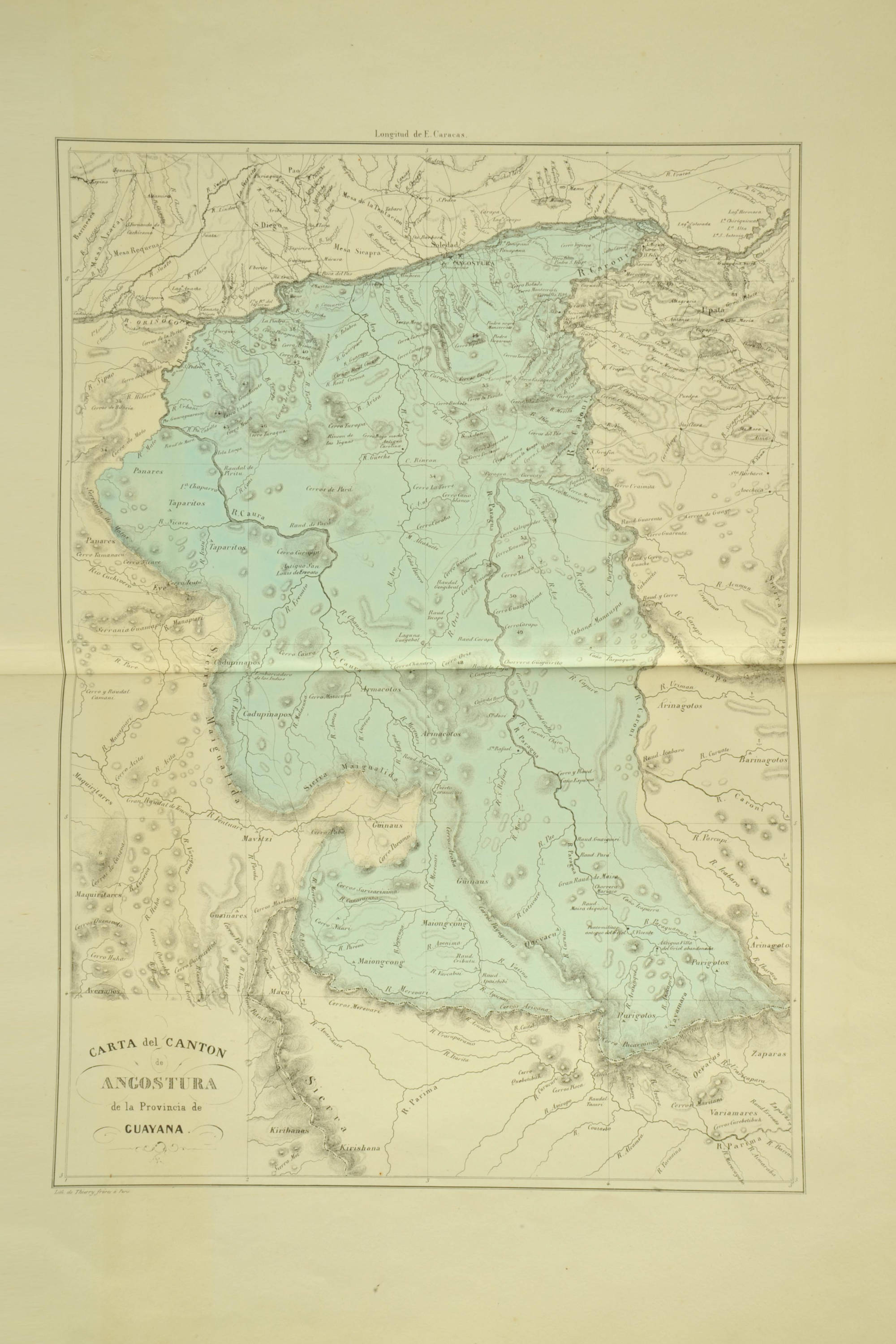
Citation
Codazzi;Agustín. Carta del cantón de Angostura de la provincia de Guayana. Map. Caracas;1840. Accessed February 2;2023. https://babel.banrepcultural.org/digital/collection/p17054coll13/id/127/rec/91.