Povos
- CARIBE
- INDIOS BRAVOS
Citação
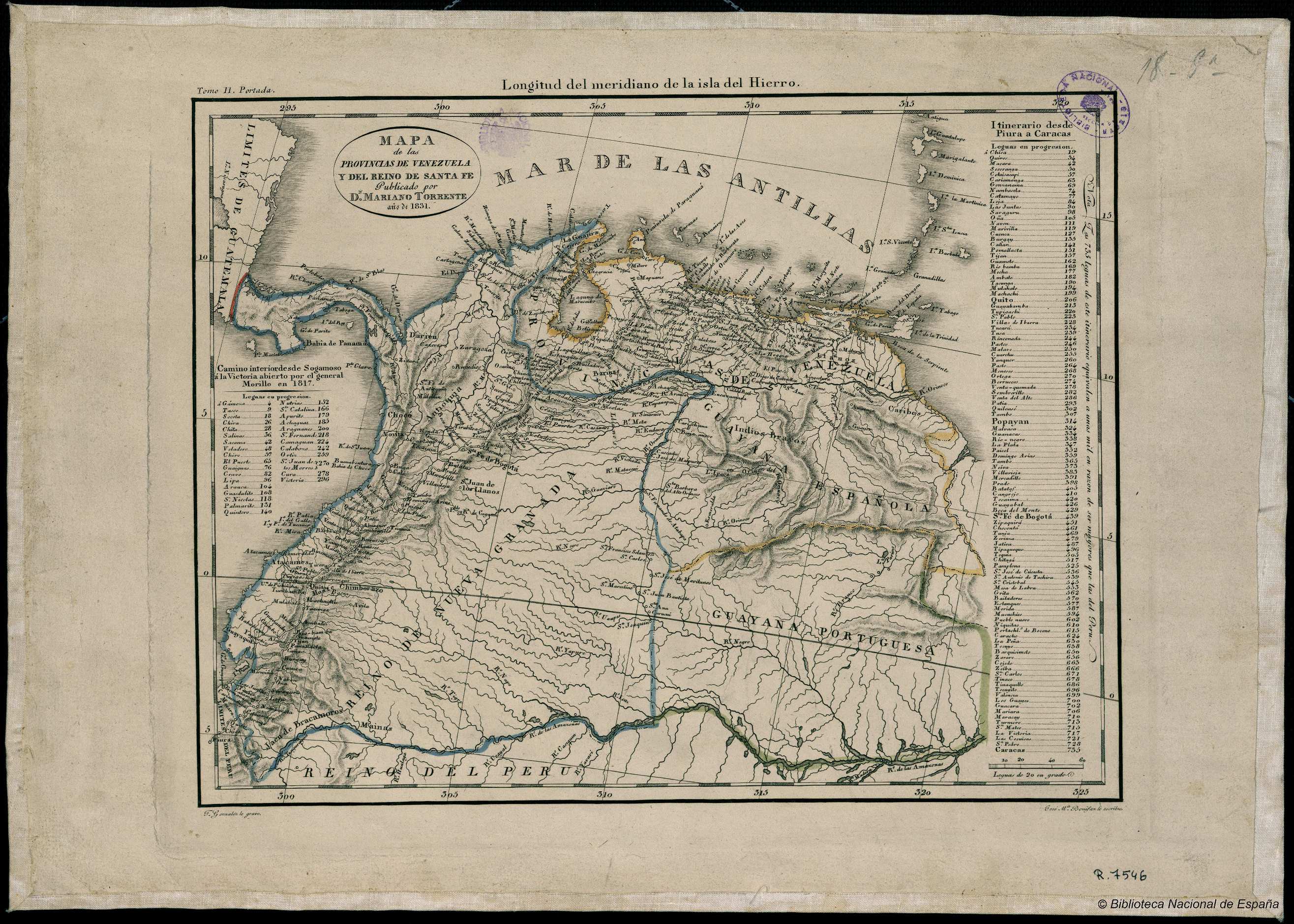
González;F. Mapa de las Provincias de Venezuela y del Reino de Santa Fe. Map. Madrid: Mariano Torrente;1831. Accessed January 1;2023. http://bdh.bne.es/bnesearch/detalle/bdh0000018658.
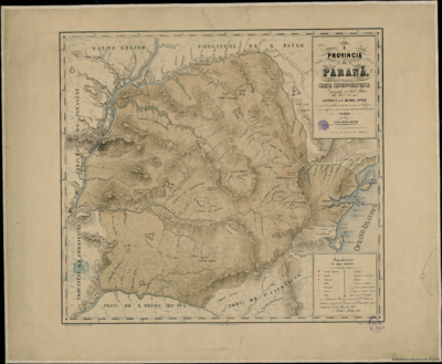
A PROVINCIA do PARANÁ. CARTA CHOROGRAFICA
Mapa 1866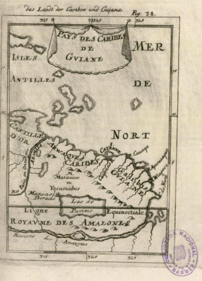
Pays des Caribes de Guiane
Mapa 1600 - 1699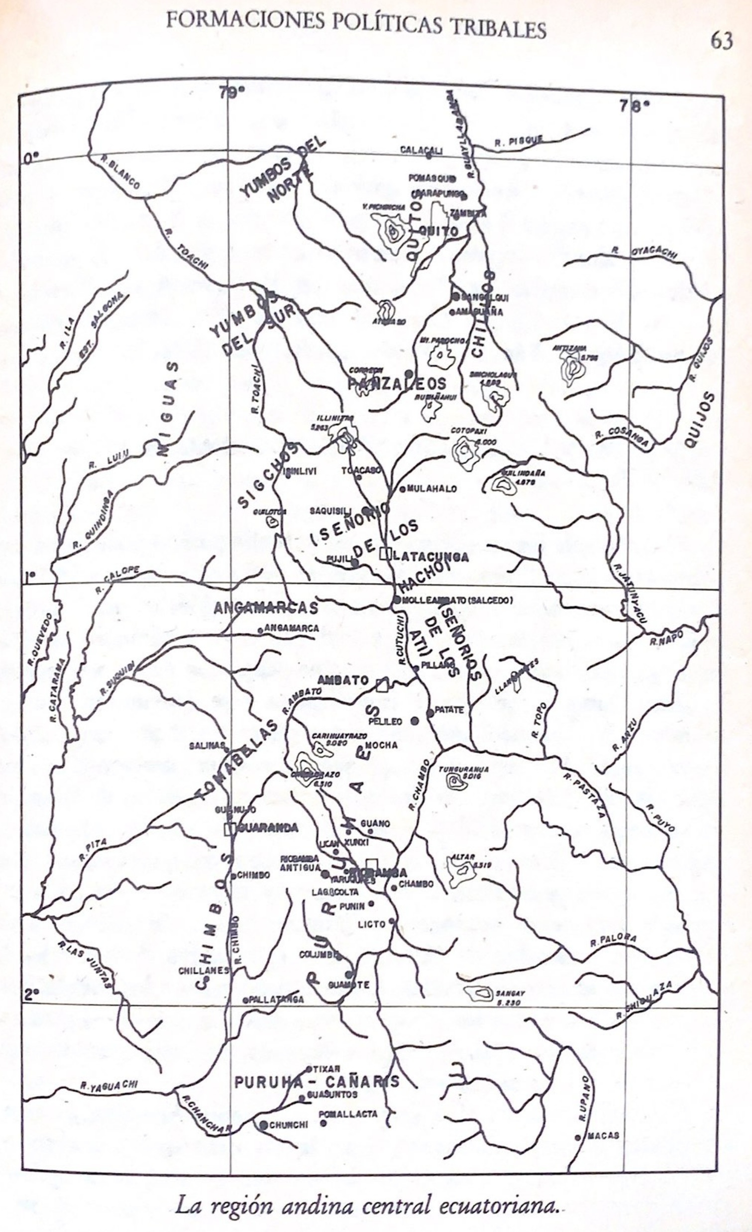
La región andina central ecuatoriana
Mapa -500 - 1550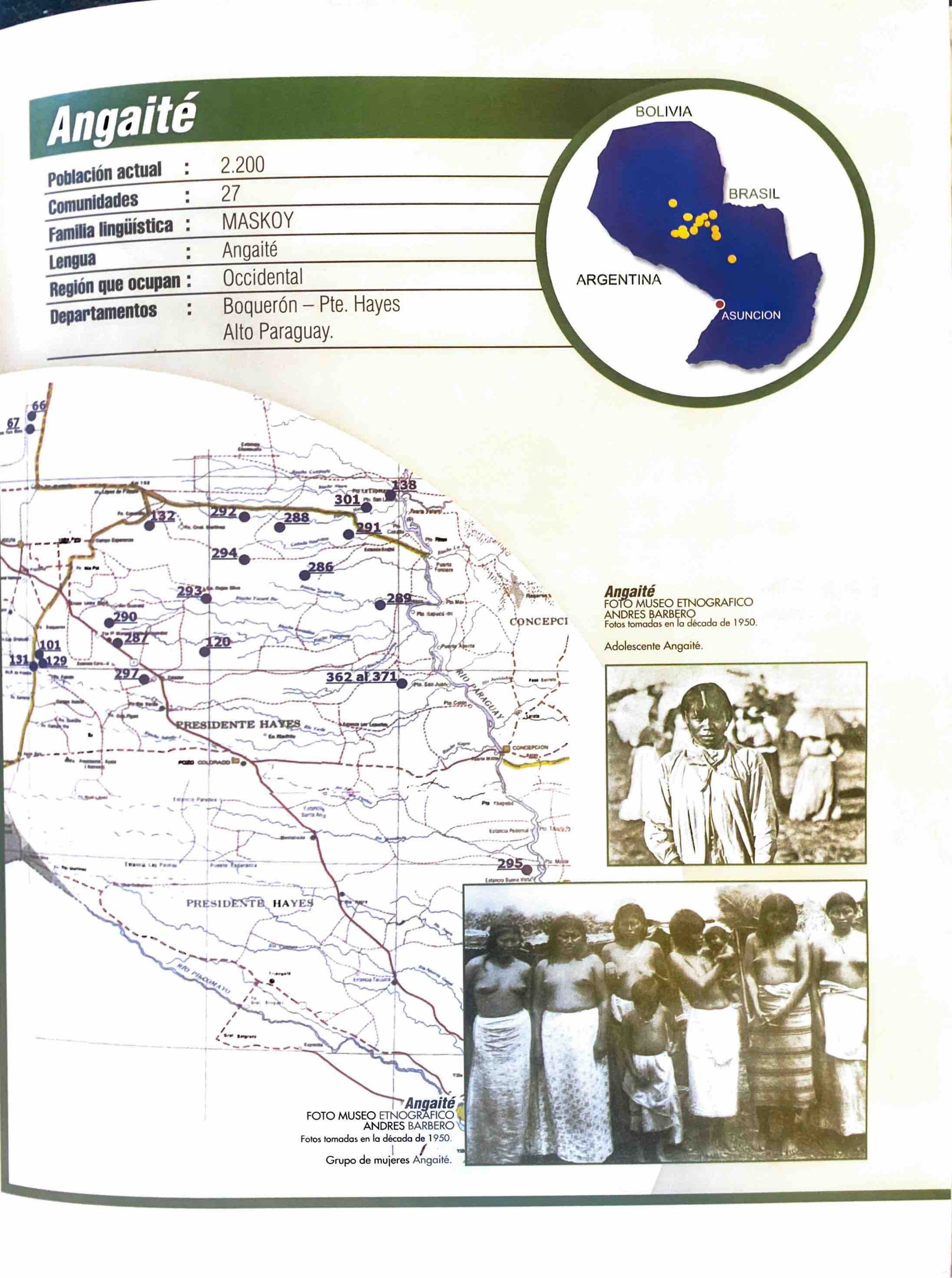
Angaité
Mapa 2001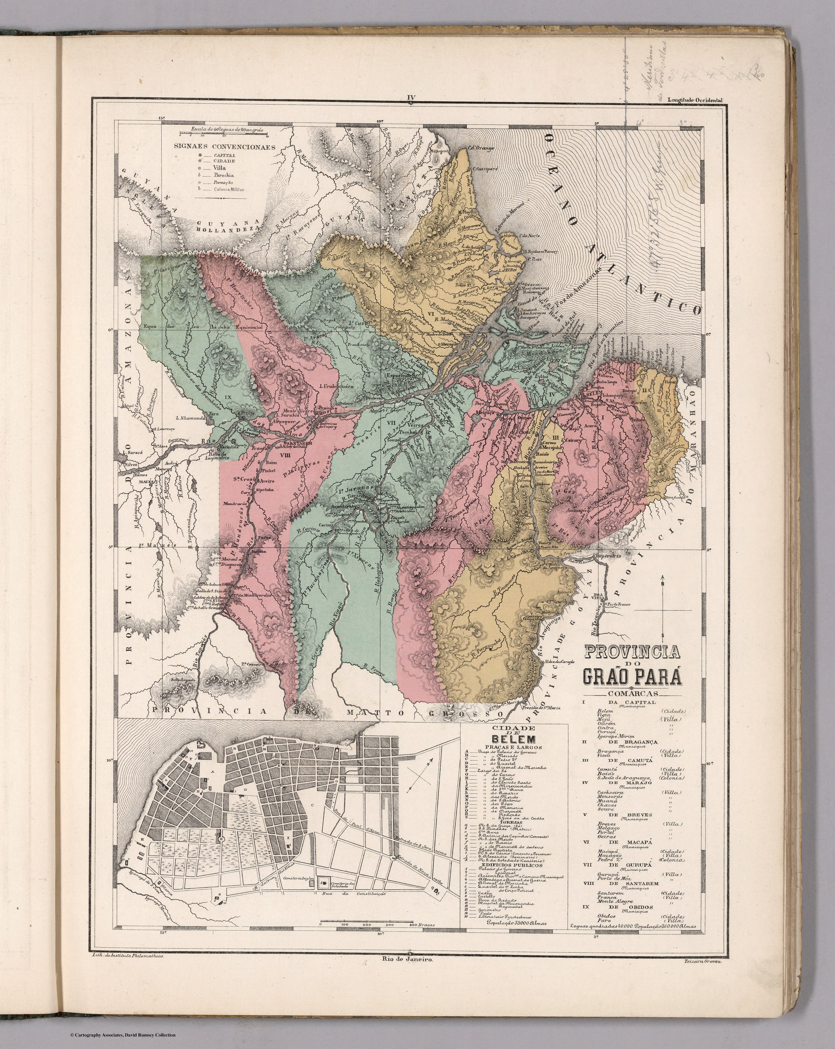
PROVINCIA DO GRAO PARÁ
Mapa 1800 - 1850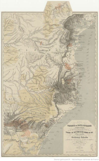
MAPPA da PROVINCIA DE SANTA CATHARINA do imperio do Brasil come as partes adjacentes das Provincias PARANA E DE SAO PEDRO DO RIO GRANDE DO SUL
Mapa 1859 - 1860
THE KARANQAS AYMARA POLITY - Instant shot of trans-border connections around 1900 (Google Earth adaptation)
Mapa 1860 - 1930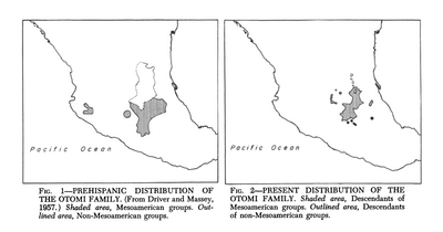
Present Distribution of the Otomi Family
Mapa 1969