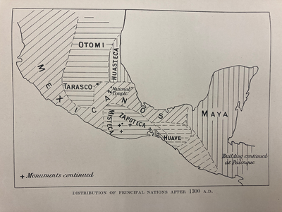
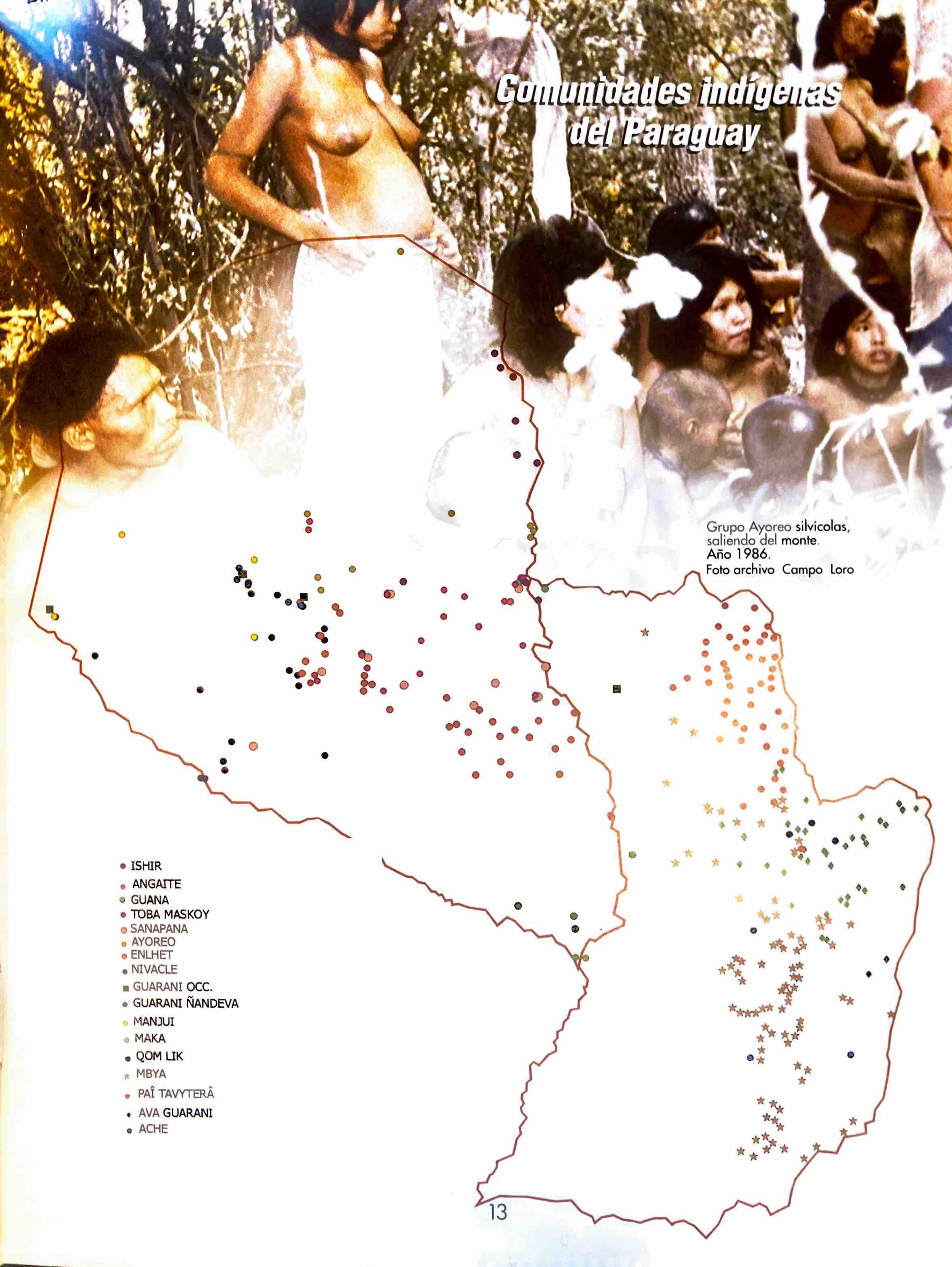
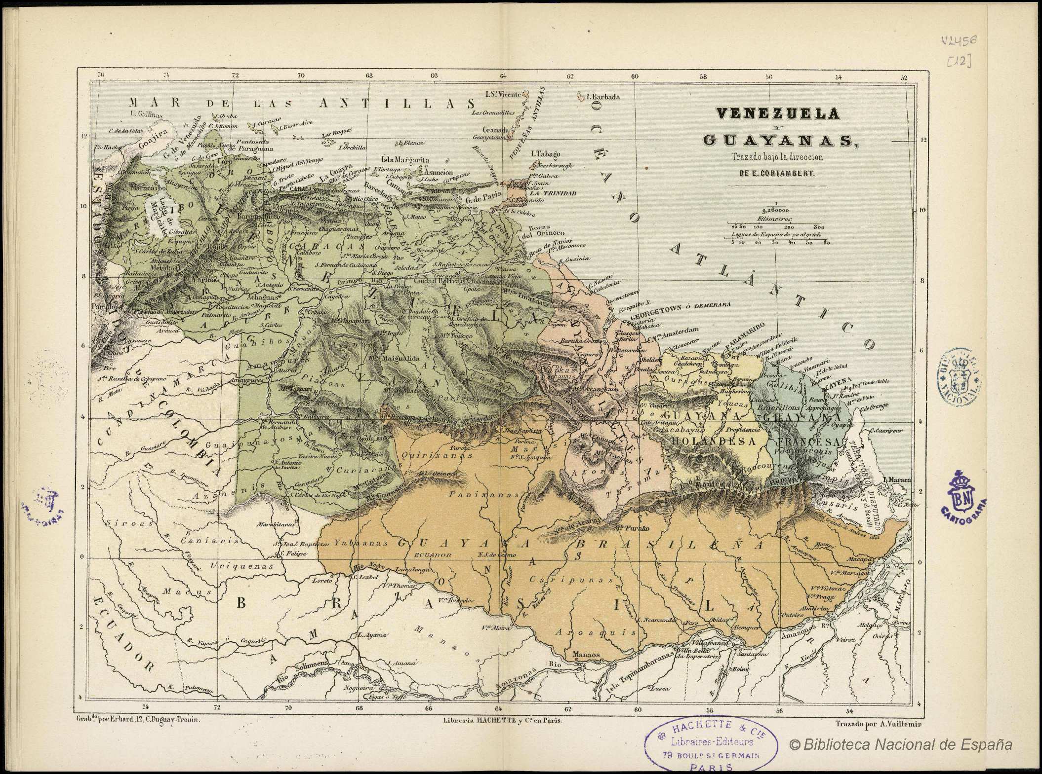
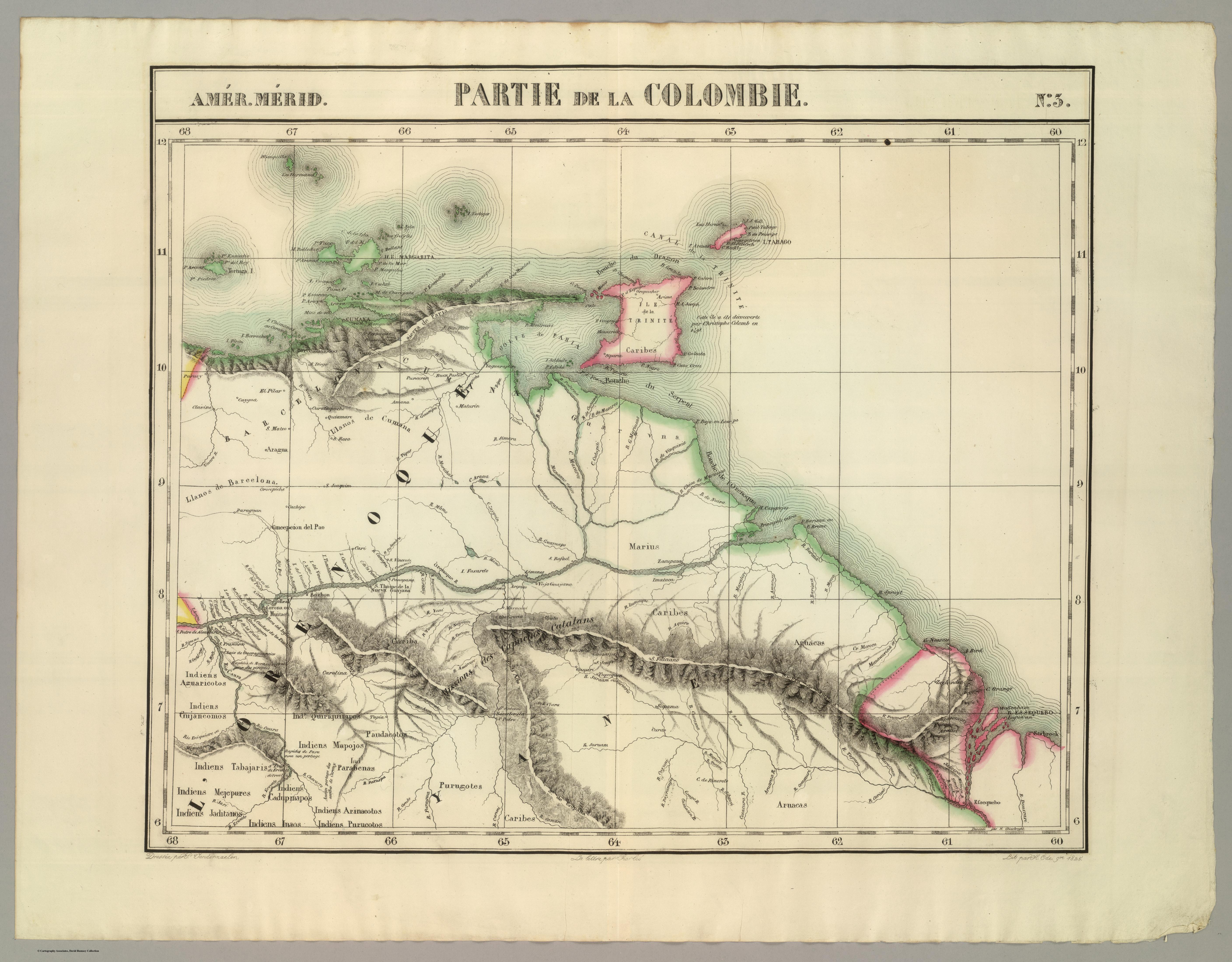
Dispossesions in the Americas

Dispossesions in the Americas

  • Lar
  • Explorar
  • Autores
  • Sobre
  • Arte
  • Corpos
  • Currículos
  • Patrimônio Cultural
  • Mapas
  • Territórios
Voltar à seção Explorar

Lendo em Inglês

Mapa 1825

PARTIE DE LA COLOMBIE

  • VANDERMAELEN;PHILIPPE

Publicado: 1827

  • Baixar Imagens
  • Baixar Imagens

Lendo em Espanhola

Mapa 1825

PARTIE DE LA COLOMBIE

  • VANDERMAELEN;PHILIPPE

Publicado: 1827

  • Baixar Imagens
  • Baixar Imagens
Mapa 1825

PARTIE DE LA COLOMBIE

  • VANDERMAELEN;PHILIPPE

Publicado: 1827

  • Baixar Imagens

Povos

  • MARIUSA
  • ARUACA
  • CARIBE
  • CARIBA
  • AGUARICOTOS
  • GUJANCOMOS
  • QUIRIQUIRIPAS
  • TABAJARI
  • MEJEPURE
  • JADITANOS
  • INAOS
  • CUDUPINAPOS
  • PURUGOTO
  • ARNACOTO
  • PARAVENAS
  • MAPOJOS
  • PAUDACOTOS

Citation

Vandermaelen;Philippe. Partie de la Colombie. Amer. Merid. no. 3. Map. Brussels: Ph. Vandermaelen;1825. Accessed December 28;2022. https://www.davidrumsey.com/luna/servlet/detail/RUMSEY~8~1~25241~5500101:Partie%2C-Colombie--Amer--Merid--3-?sort=pub_list_no_initialsort%2Cpub_date%2Cpub_list_no%2Cseries_no&qvq=w4s:/where%2FVenezuela;q:venezuela;sort:pub_list_no_initialsort%2Cpub_date%2Cpub_list_no%2Cseries_no;lc:RUMSEY~8~1&mi=168&trs=267#.

  • Baixar Imagens

Itens Relacionados

DISTRIBUTION OF PRINCIPAL NATIONS AFTER 1300 AD

DISTRIBUTION OF PRINCIPAL NATIONS AFTER 1300 AD

Mapa 1300
TIERRA FIRME E ISLAS ADYACENTES

TIERRA FIRME E ISLAS ADYACENTES

Mapa 1817
A New Map of Part /of the Great River / De la Plata, /of Tucuman / and the adjacent Countries, from Buenos Ayres to Potosí

A New Map of Part /of the Great River / De la Plata, /of Tucuman / and the adjacent Countries, from Buenos Ayres to Potosí

Mapa 1716
Comunidades indígenas del Paraguay

Comunidades indígenas del Paraguay

Mapa 2001
Carte de la Goÿanne Françoise depuis le fort de Barou et la Rte. d Yari jusqu'a Maroni. Les principaux établissements des François tant dans l'isle de Caÿenne que dans la Terre Ferme

Carte de la Goÿanne Françoise depuis le fort de Barou et la Rte. d Yari jusqu'a Maroni. Les principaux établissements des François tant dans l'isle de Caÿenne que dans la Terre Ferme

Mapa 1741
RESGUARDOS Y TERRITORIOS INDIGENAS EN COLOMBIA

RESGUARDOS Y TERRITORIOS INDIGENAS EN COLOMBIA

Mapa 2015
VENEZUELA Y GUAYANAS

VENEZUELA Y GUAYANAS

Mapa 1800 - 1899
Map of Coatlinchan, Valley of Mexico, 1578, Archivo General de la Nación, no. 1678

Map of Coatlinchan, Valley of Mexico, 1578, Archivo General de la Nación, no. 1678

Mapa 1578

Desapropriações nas Américas

Um projeto de

University of Pennsylvania

Copyright 2024

Com o apoio de

Mellon Foundation

Projeto e desenvolvimento do site

Element 84

Créditos da arte

Vandermaelen;Philippe. Partie de la Colombie. Amer. Merid. no. 3. Map. Brussels: Ph. Vandermaelen;1825. Accessed December 28;2022. https://www.davidrumsey.com/luna/servlet/detail/RUMSEY~8~1~25241~5500101:Partie%2C-Colombie--Amer--Merid--3-?sort=pub_list_no_initialsort%2Cpub_date%2Cpub_list_no%2Cseries_no&qvq=w4s:/where%2FVenezuela;q:venezuela;sort:pub_list_no_initialsort%2Cpub_date%2Cpub_list_no%2Cseries_no;lc:RUMSEY~8~1&mi=168&trs=267#.

Páginas do site

  • Lar
  • Explorar
  • Autores
  • Sobre
  • Arte
  • Corpos
  • Currículos
  • Patrimônio Cultural
  • Mapas
  • Territórios