Povos
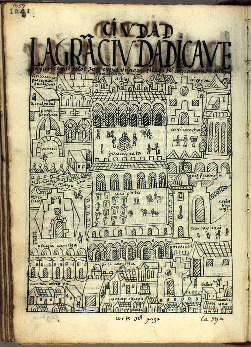
- CORTE DEL YNGA
Citation
Poma de Ayala, F. G. (Cartographer). (1615). LA GRAN CIVDAD [Map]. Det Kgl. Bibliotek. https://poma.kb.dk/permalink/2006/poma/1059/en/text/?open=idm656&imagesize=XL
![[Carte de la Guyane depuis le Marony jusqu'au Yary]](https://dnet8ble6lm7w.cloudfront.net/maps/FGU/FGU0046.jpeg)
[Carte de la Guyane depuis le Marony jusqu'au Yary]
Mapa 1766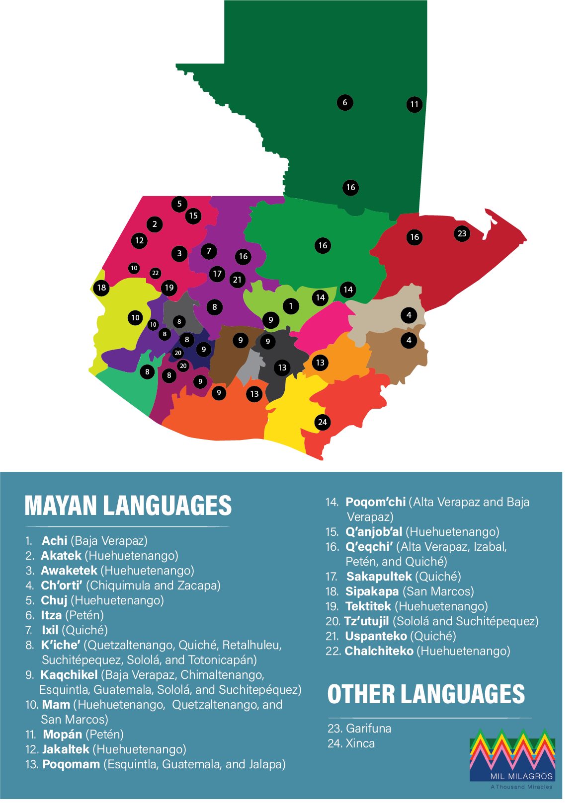
Indigenous languages in Guatemala
Mapa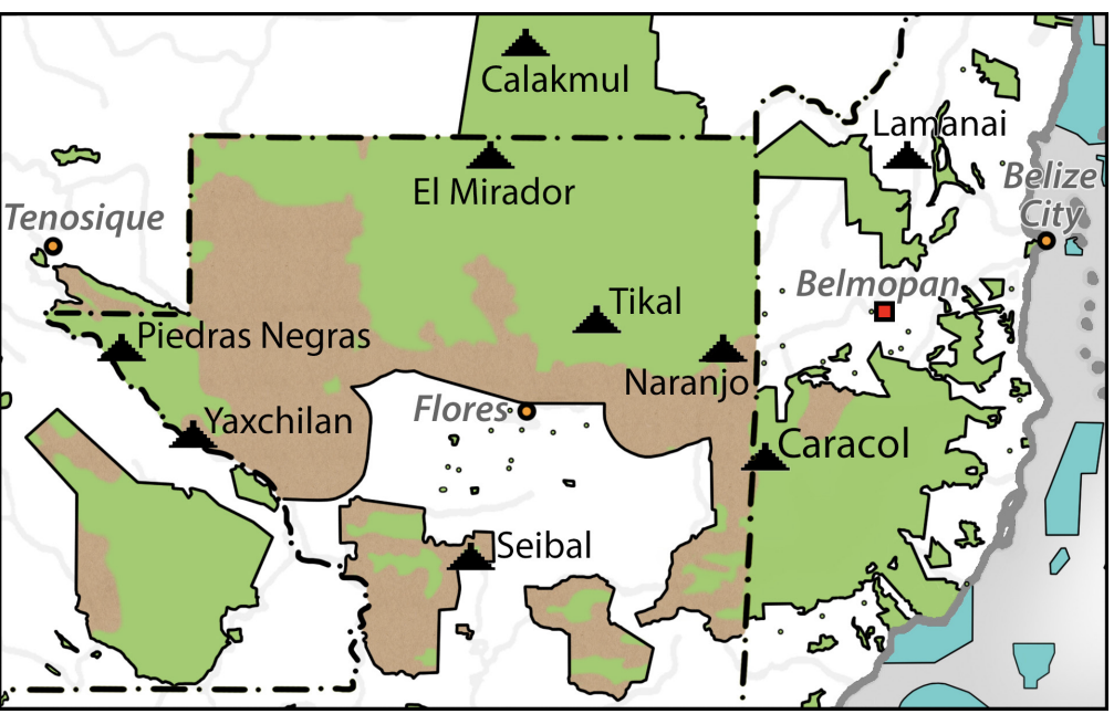
Map of deforestation within protected areas in Guatemala and adjoining areas
Mapa 2000 - 2100
Carte de la Guiane française dressée à Cayenne par ordre du Gouvernement, dans la construction de laquelle, employant tous les matériaux géographiques qui se troucent actuellement au dépôt des Cartes et Plans de la Colonie, après les avoir assujétis à plusieurs observations astronomiques.
Mapa 1782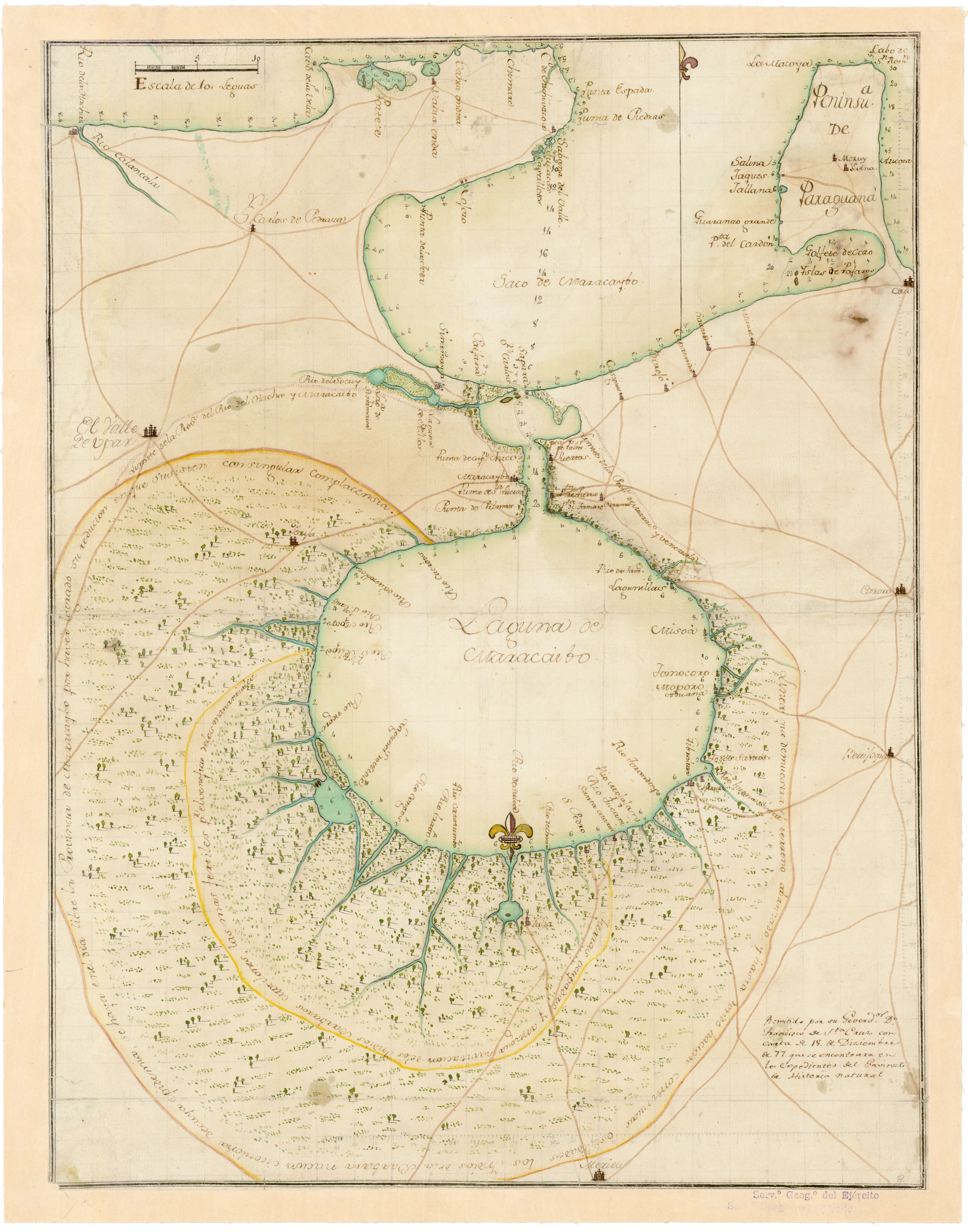
No Title
Mapa 1777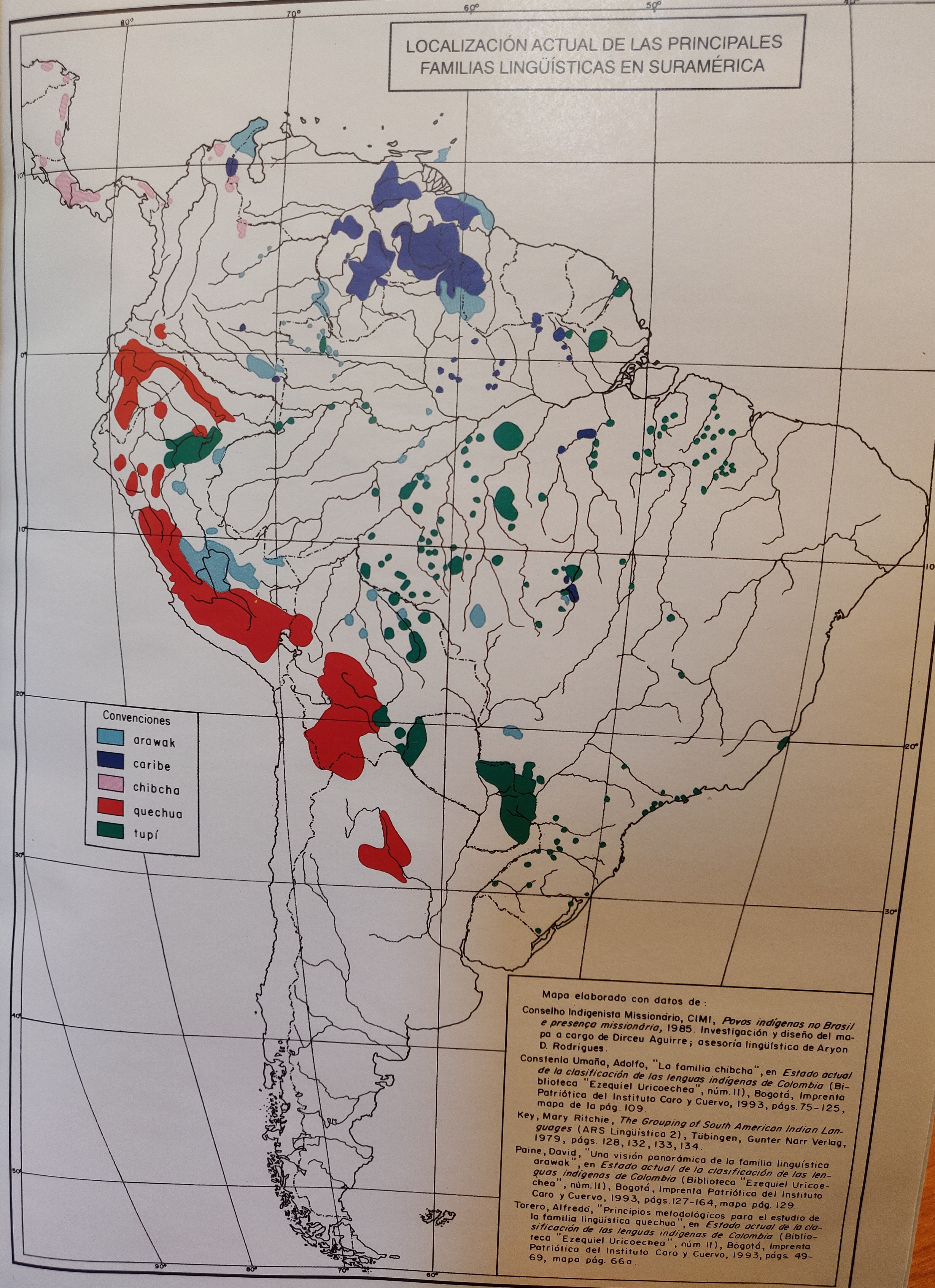
LOCALIZACIÓN ACTUAL DE LAS PRINCIPALES FAMILIAS LINGÜÍSTICAS EN SURAMÉRICA
Mapa 2000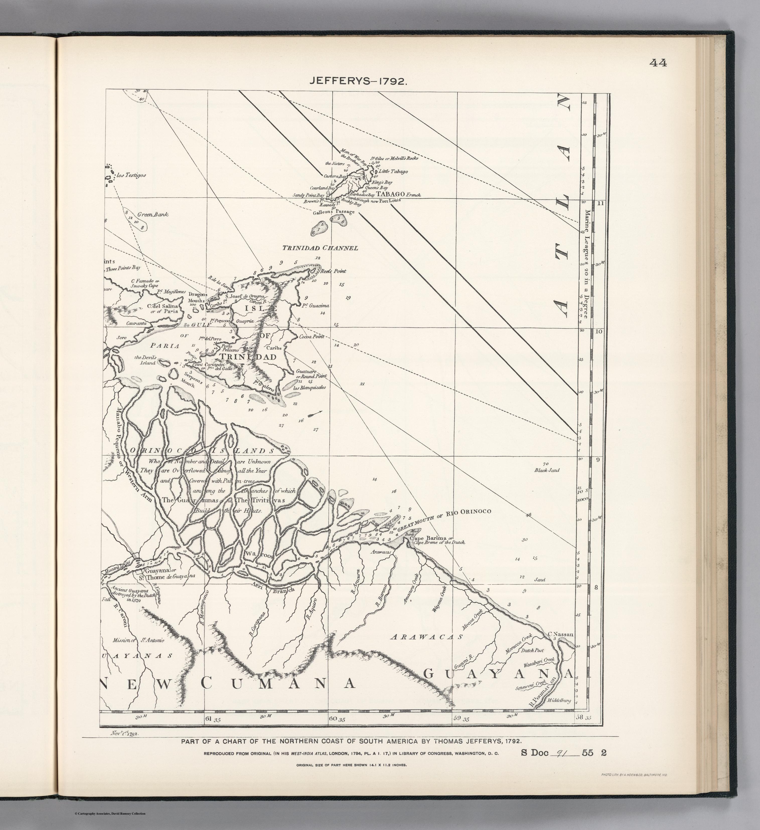
PART OF A CHART OF THE NORTHERN COAST OF SOUTH AMERICA BY THOMAS JEFFERYS
Mapa 1792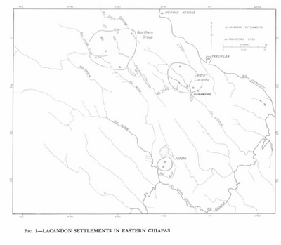
Lacandon Settlements in Eastern Chiapas
Mapa 1969