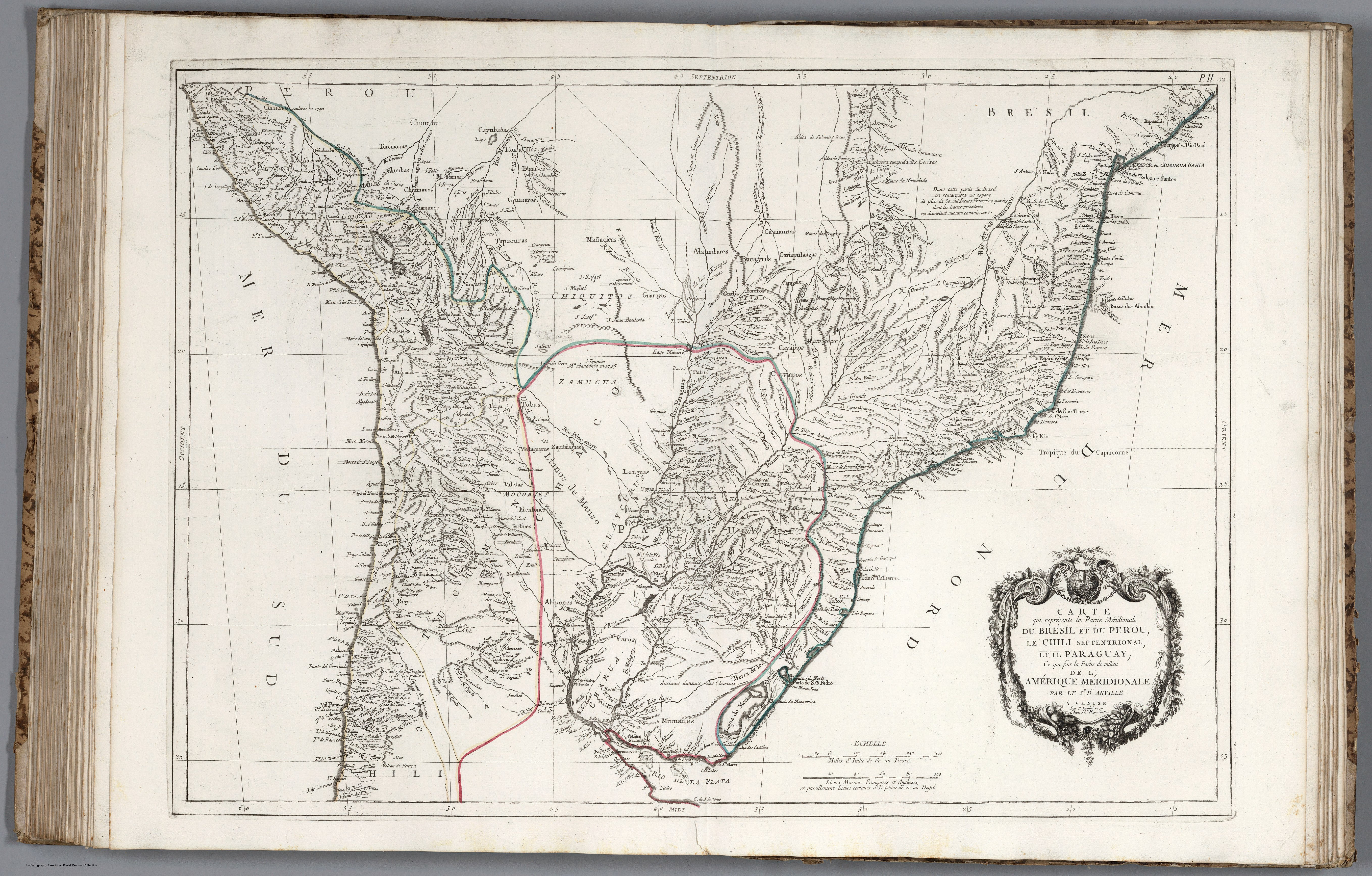
Povos
- COLOTAS
- OJOTAES
- TEQUETS
- CHORARACAS
- CUCUTADES
- ZAMUCO
- EMBOCARAOANAS
- FURUNES
- JONOCOTES
- AGUSE
- PILDORIS
- IBITAYAS
- PALALIS
- TOPAYES
- GUATUTAS
- POREREGUANOS
- GURRUCANES
- YUCUNAMPAS
- NAPARUS
- PALOMOS
- MUSTAUAS
- PALCIPAS
- AMOGEMBAS
- CALAGAES
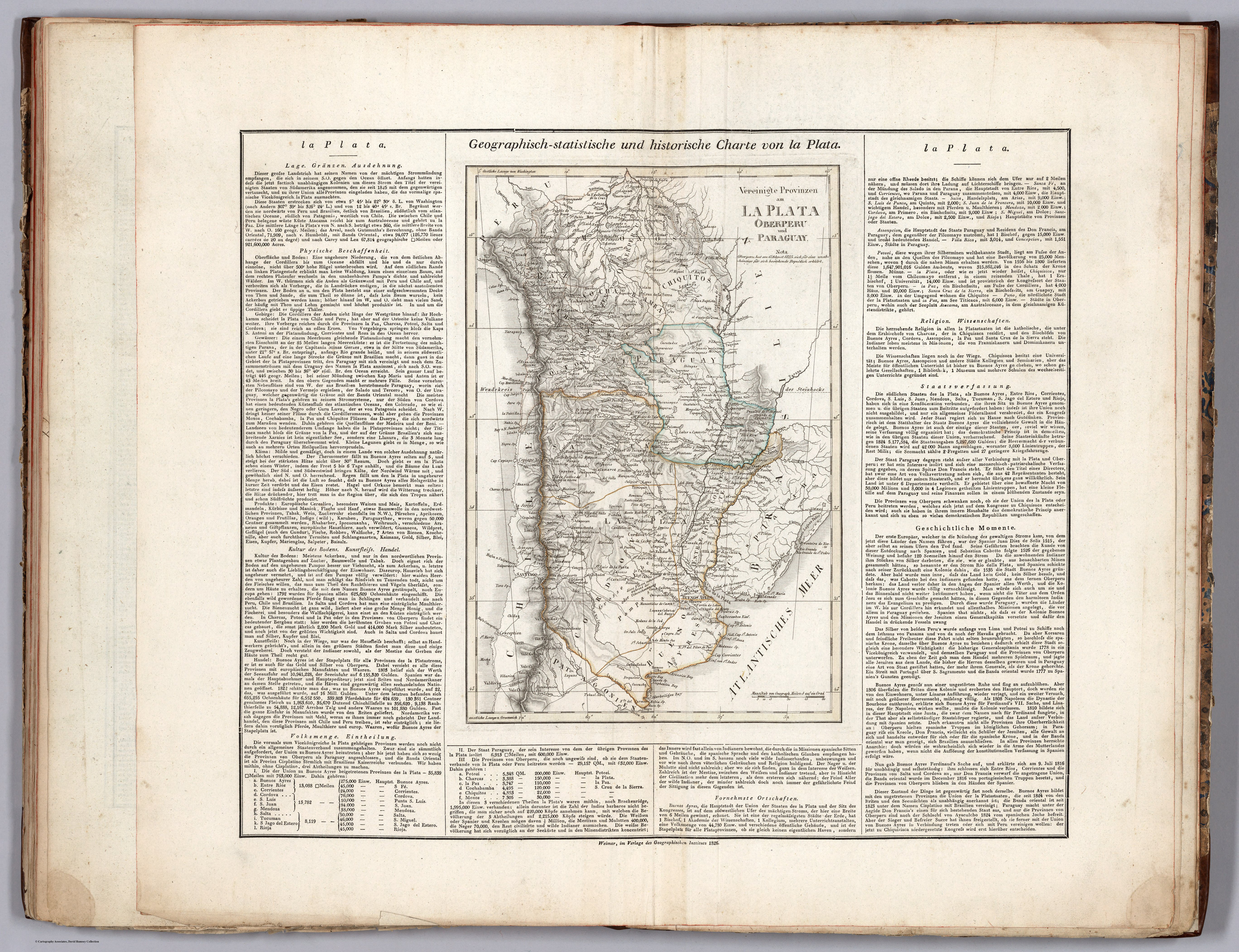
Citation
Weiland, Carl Ferdinand, and Georg Hassel. Geographisch-statistische und historische Charte von la Plata. Map. Weimar: Geographischen Instituts, 1826. Accessed April 20, 2023. https://www.davidrumsey.com/luna/servlet/detail/RUMSEY~8~1~297502~90069125:La-Plata-?sort=pub_list_no_initialsort%2Cpub_date%2Cpub_list_no%2Cseries_no#.
![Modelo para armar y desarmar una fuente de agua [Modelo para armar e desarmar uma fonte de água]](https://dnet8ble6lm7w.cloudfront.net/art_sm/APER064.png)
![Bedxe´Guie´ [Terra Sagrada]](https://dnet8ble6lm7w.cloudfront.net/art_sm/AMEX002.png)