
Povos
- POSESIONES DE LOS INDIOS
Citation
"Darien, navegación" (1852). Archivo General de la Nacion de Colombia, Sección Mapas y Planos, Mapoteca 1, Mapa 63. http://consulta.archivogeneral.gov.co/ConsultaWeb/index.jsp
Carte n°7: Limite septentrionale des poissons Paraiba et Pirarucu
Mapa 1740 - 1978
MAPA DE LA PROVINCIA Y MISSIONES DE LA COMPANIA DE IHS DEL NUEVO REYNO DE GRANADA
Mapa 1741
Der Nordliche Theil von Sud-America
Mapa 1800 - 1899
Mosquitia or The Mosquito Shore with The Eastern Part of Yucatán as far as the 20th Degree of North Latitude
Mapa 1787
NLE. GRENADE;VENEZUELA;EQUATEUR;GUYANES.
Mapa 1860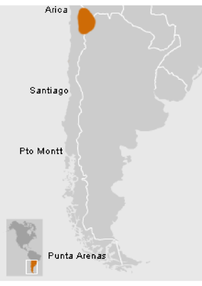
Atacameños - Location
Mapa 2012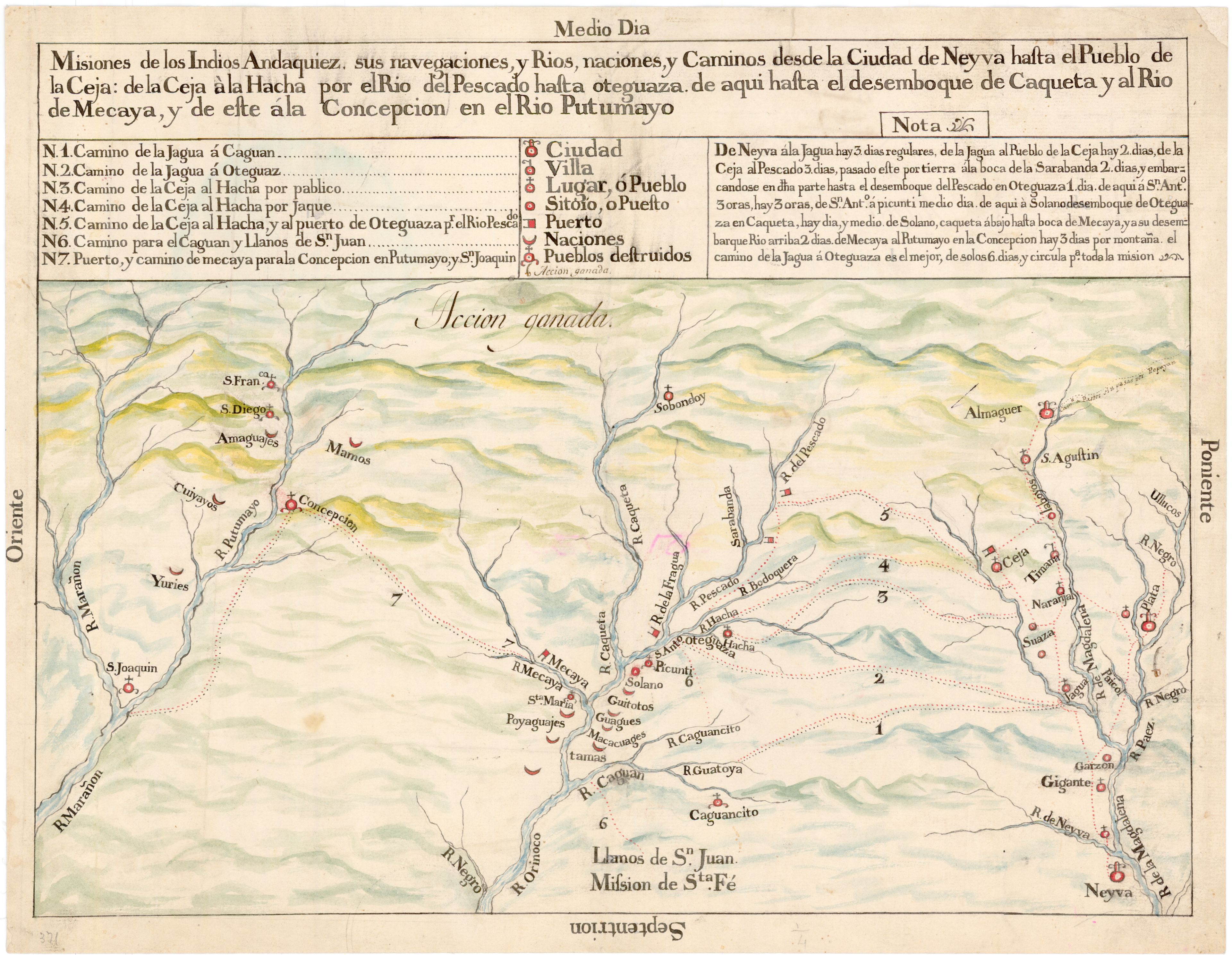
Misiones de los Indios Andaquiez : sus navegaciones, y Ríos, naciones, y Caminos desde la Ciudad de Neyva hasta el Pueblo de la Ceja, y de este ála Concepción en el Río Putumayo
Mapa 1792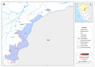
PUEBLO MATSÉS
Mapa 2021