Citação
Hidalgo, Alex. Trail of Footprints: A History of Indigenous Maps from Viceregal Mexico. Austin: University of Texas Press, 2019. https://www.jstor.org/stable/10.7560/317518.6.
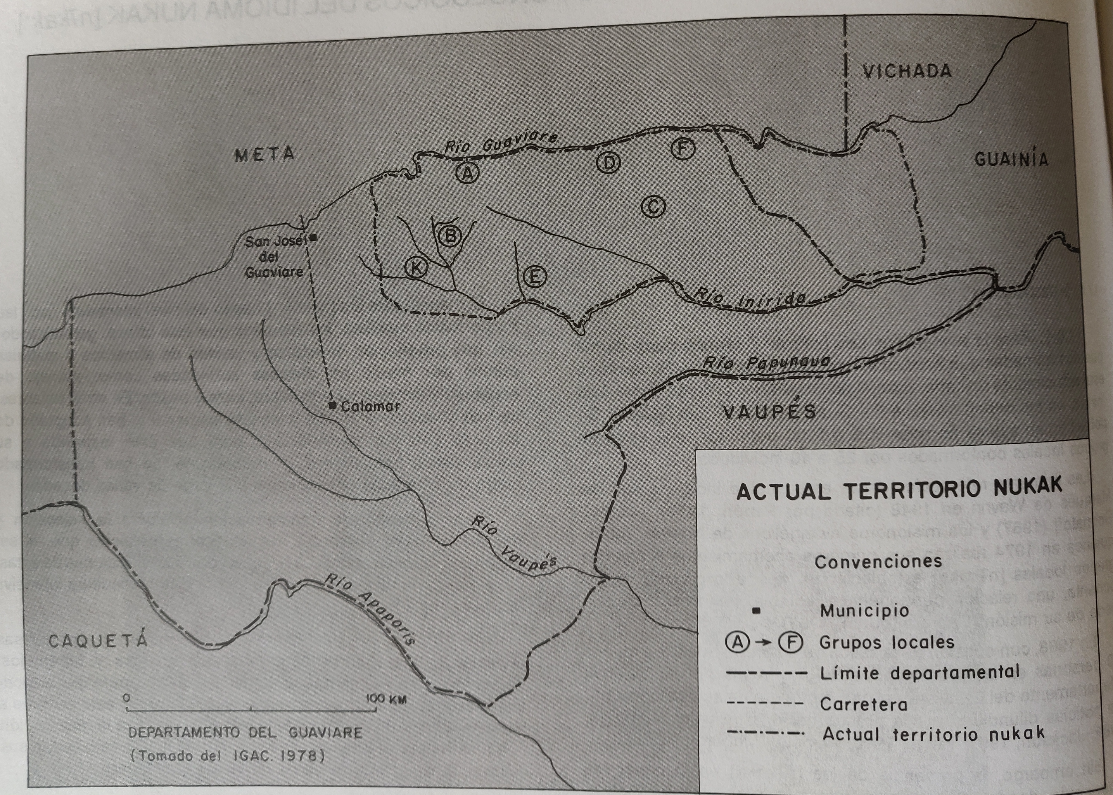
ACTUAL TERRITORIO NUKAK
Mapa 1978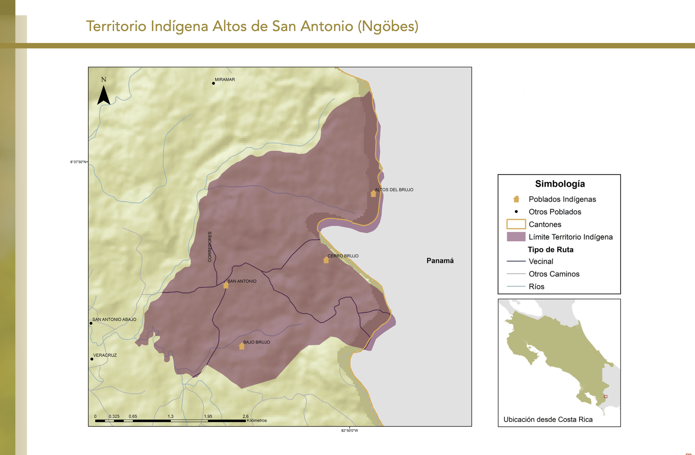
"Territorio Indígena Altos de San Antonio (Ngöbes)"
Mapa 2010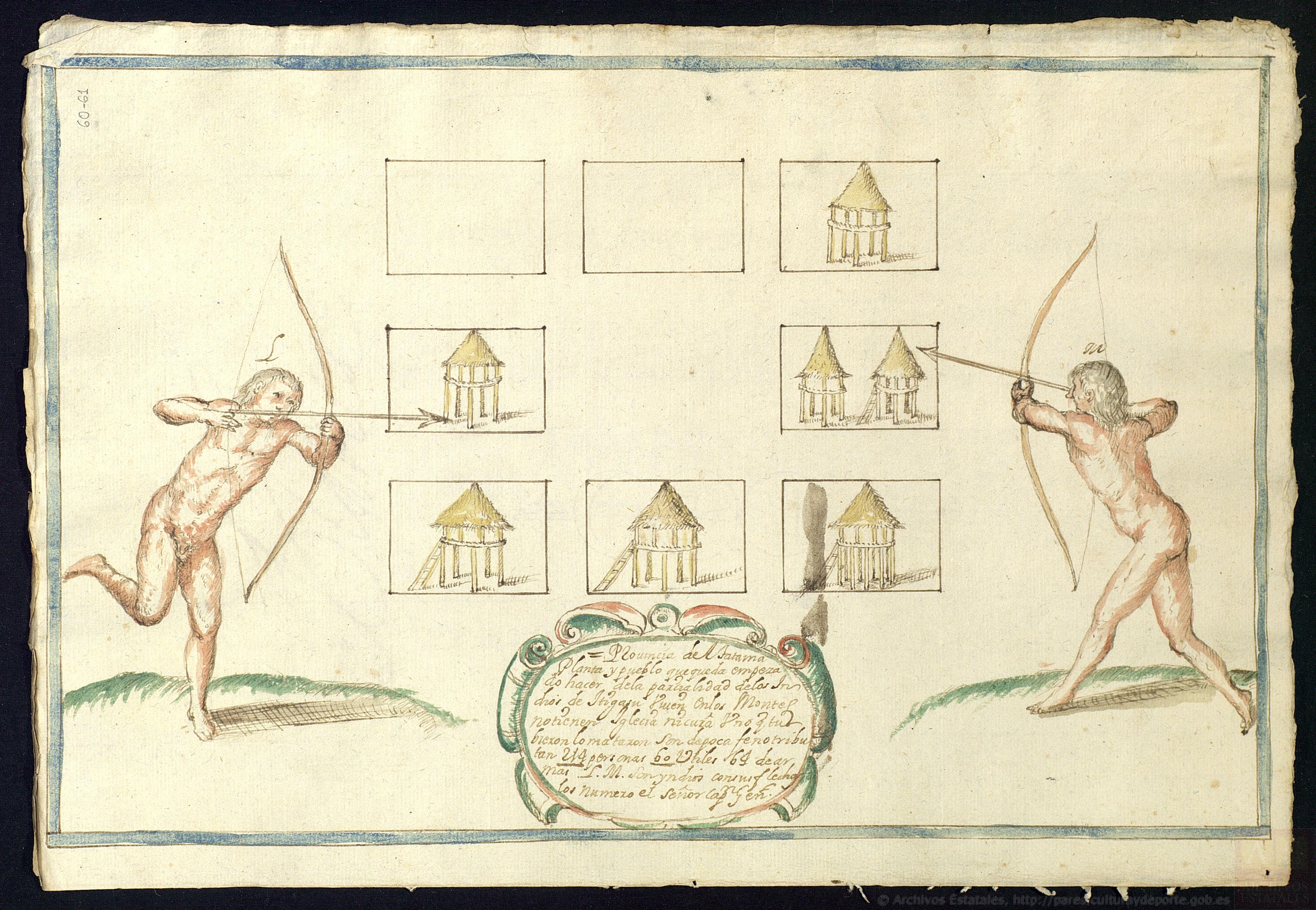
Provincia de Tatama: Planta y pueblo que queda empezado hacer de la parcialidad de los indios de Itigasu
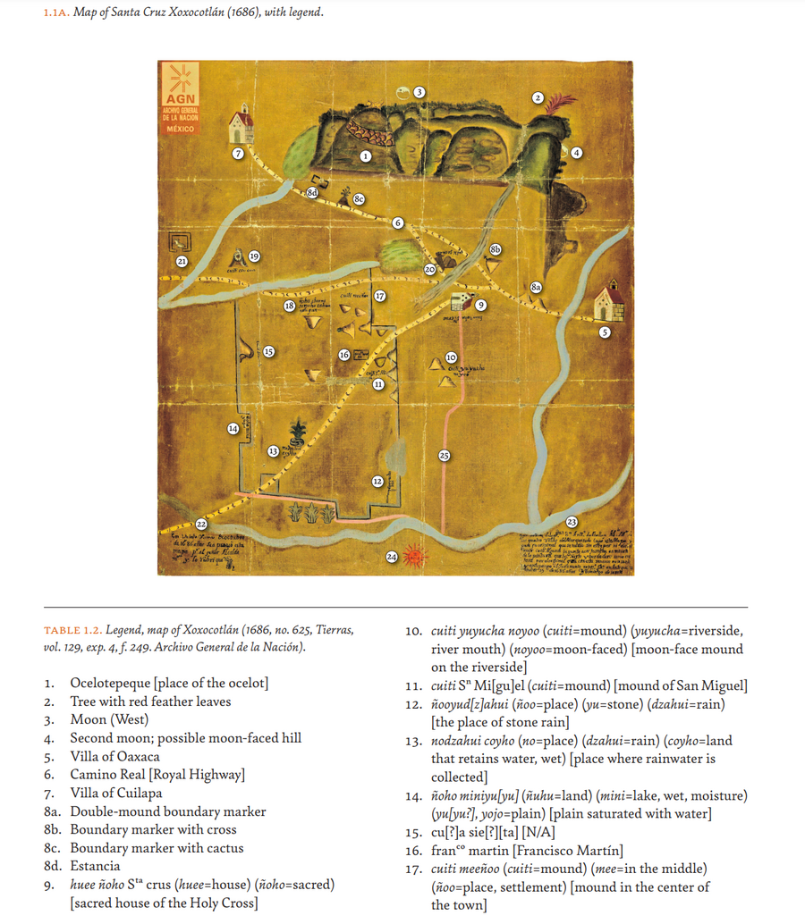
Mapa 1687
PUEBLO AWAJÚN
Mapa 2021
PUEBLO JAKALTECO
Mapa 2020
CHART containing the greater part of the SOUTH SEA to the South of the LINE, with the ISLANDS dispersed thro' the same
Mapa 1794
Carte d'une partie de la Riviere de Marony qui separe la Guïanne Françoise des Hollandois Levée depuis son embouchure, Jusqu'au premier Sault.
Mapa 1700 - 1799![La selva está kaliente [A selva está kente]](https://dnet8ble6lm7w.cloudfront.net/art_sm/APER028.png)
La selva está kaliente [A selva está kente]
Obra de arte