
Povos
- MAYA
Citation
Instituto Nacional de los Pueblos Indígenas. "Distribución por Entidad Federativa." Atlas de los pueblos indígenas de México. http://atlas.inpi.gob.mx/distribucion-por-entidad-federativa/.
Grupos étnicos en la actualidad (1999)
Mapa 1999![Mapa de la costa de la provincia de [Santa Marta con las bahías], Rios y Sitios](https://dnet8ble6lm7w.cloudfront.net/maps/COL/COL0086.jpg)
Mapa de la costa de la provincia de [Santa Marta con las bahías], Rios y Sitios
Mapa 1770
CHART containing the greater part of the SOUTH SEA to the South of the LINE, with the ISLANDS dispersed thro' the same
Mapa 1794![Preliminary Map;portion of north east [sic] Nicaragua: Brown's Camp to Pis Pis District.](https://dnet8ble6lm7w.cloudfront.net/maps/NIC/NIC0040.jpg)
Preliminary Map;portion of north east [sic] Nicaragua: Brown's Camp to Pis Pis District.
Mapa 1927
OTROS MUNICIPIOS INDÍGENAS O CON PRESENCIA DE POBLACIÓN INDÍGENA
Mapa 2000
BRASILIA
Mapa 1662 - 1665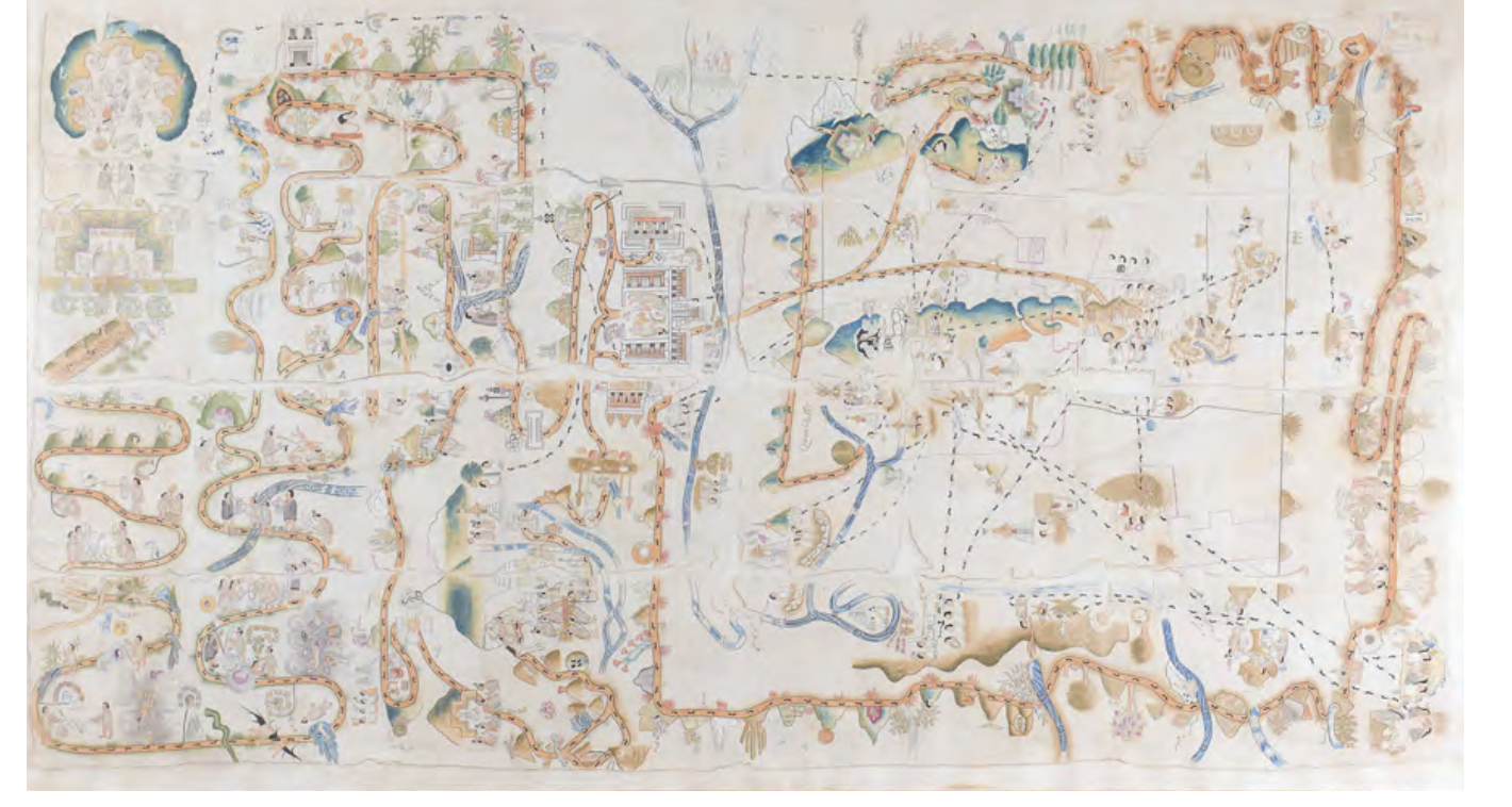
MAPA DE CUAUHTINCHAN N0. 2
Mapa 1500 - 1599![Descricción [sic] Plan del Río Tinto con su Pueblo, Barra y pies de agua que hai como demuestran los números;fortalezas como marca el Abezedario](https://dnet8ble6lm7w.cloudfront.net/maps/HON/HON0035.jpg)
Descricción [sic] Plan del Río Tinto con su Pueblo, Barra y pies de agua que hai como demuestran los números;fortalezas como marca el Abezedario
Mapa 1743 - 1744