
Citation
Tanck de Estrada, Dorothy. Atlas Ilustrado de los Pueblos de Indios: Nueva España, 1800. México: El Colegio de México, 2005. N/A - NO DIGITAL ACCESS
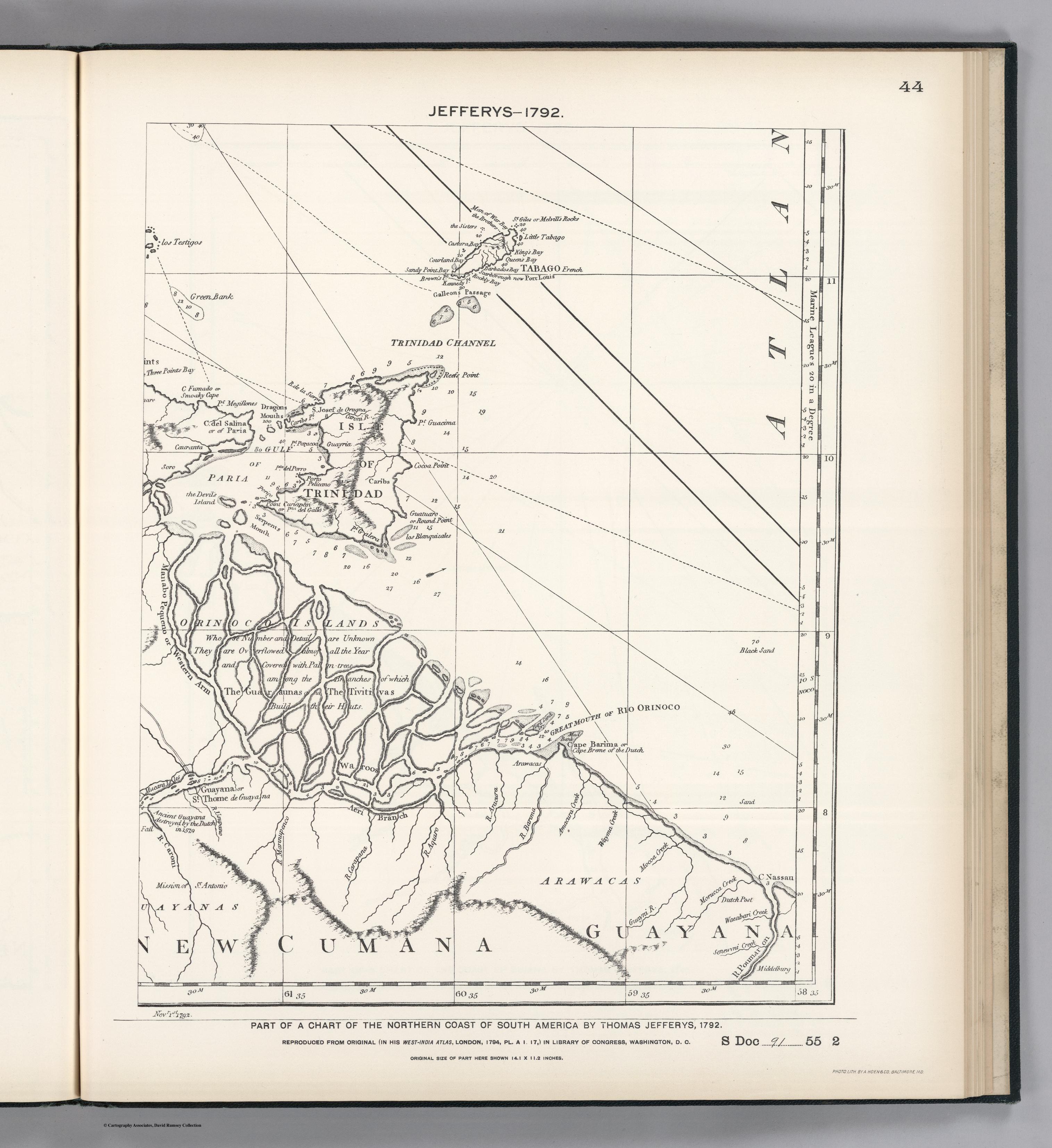
PART OF A CHART OF THE NORTHERN COAST OF SOUTH AMERICA BY THOMAS JEFFERYS
Mapa 1792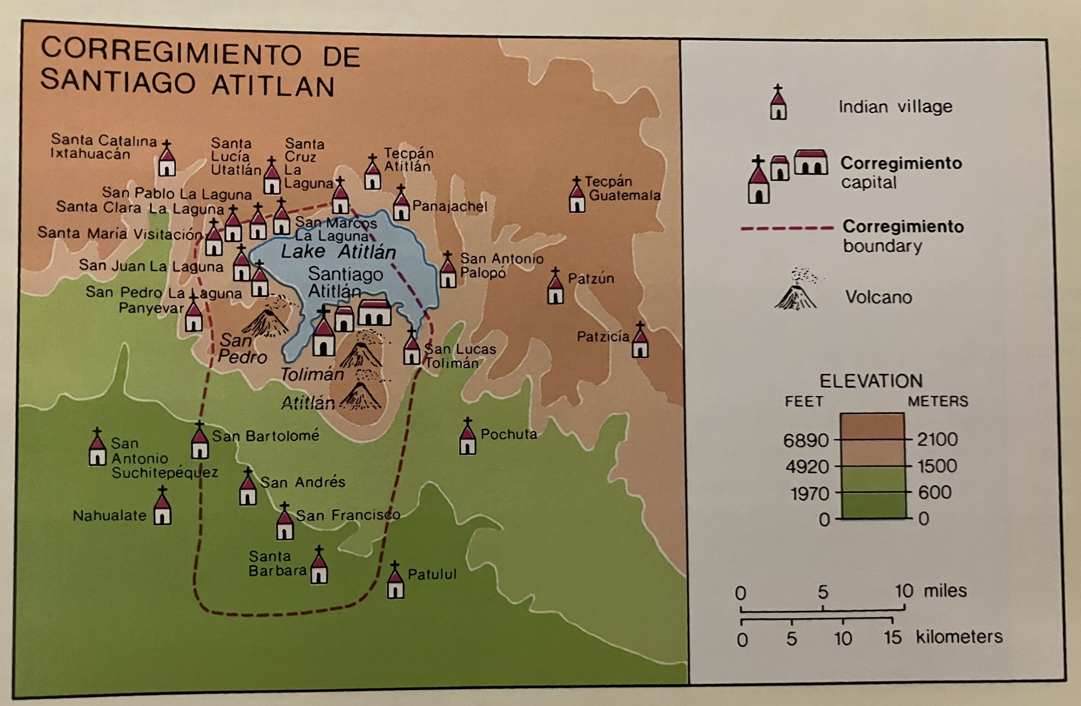
Corregimiento de Santiago Atitlan
Mapa 1550 - 1580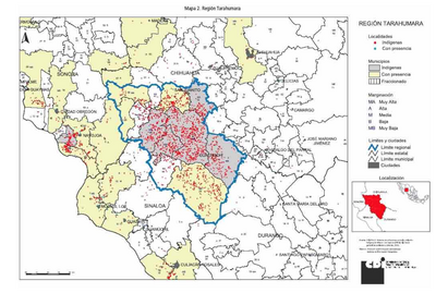
REGIÓN TARAHUMARA
Mapa 2000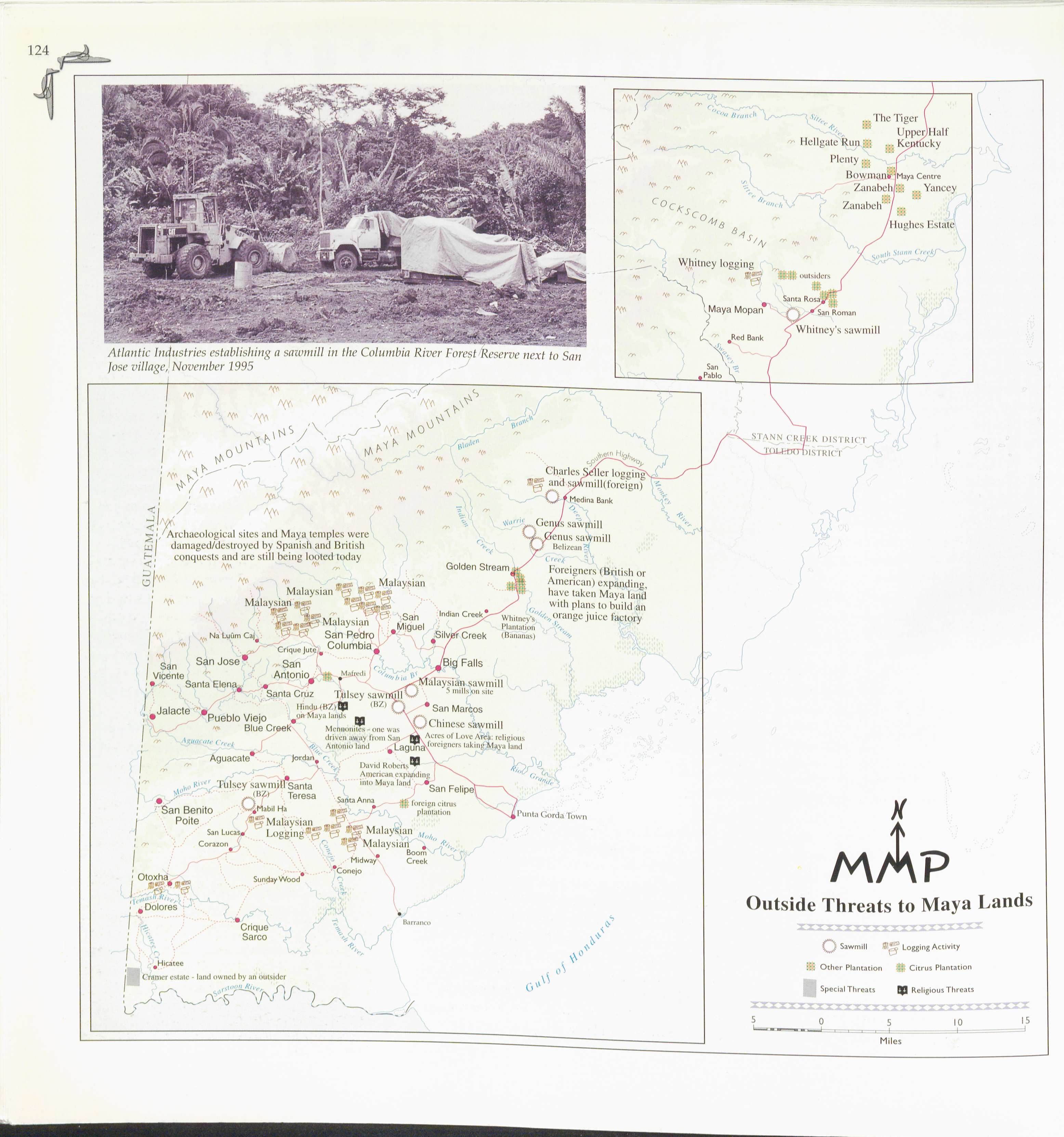
Outside Threats to Maya Lands
Mapa 1997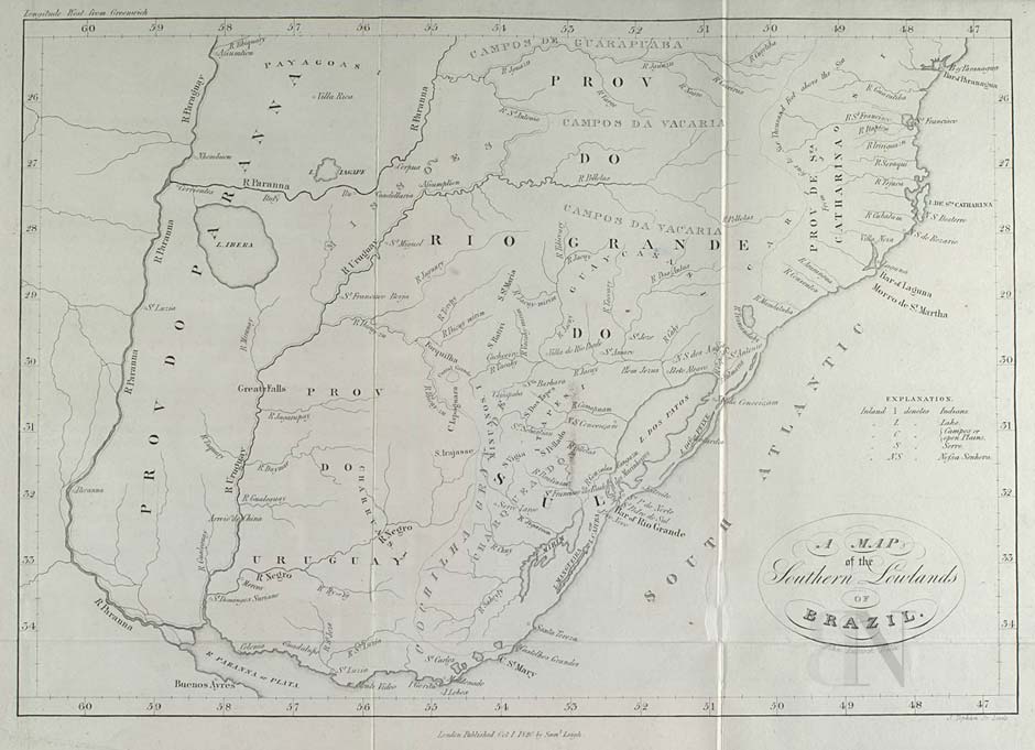
A MAP of the Southern Lowlands of BRAZIL
Mapa 1808 - 1818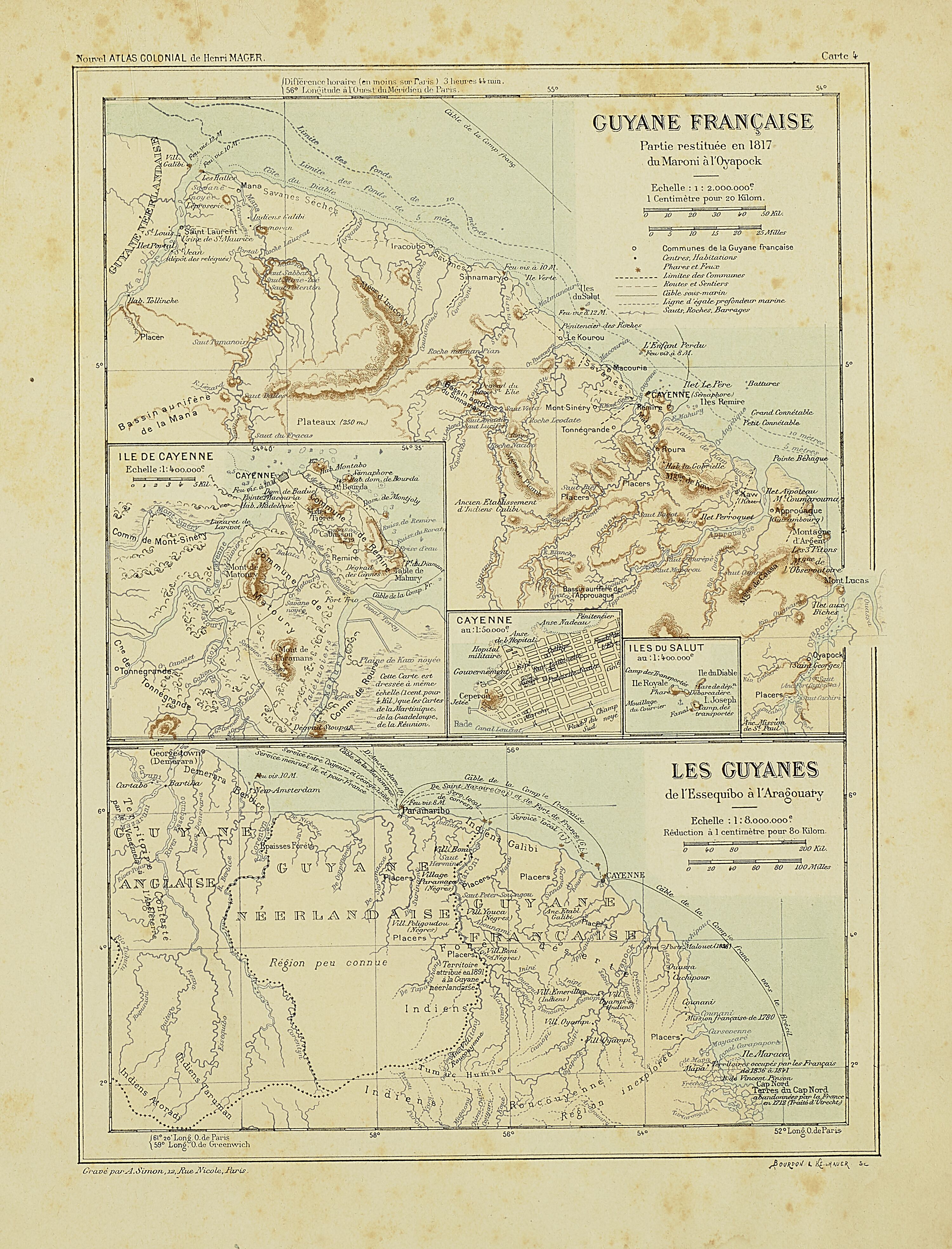
Carte IV: Guyane française.
Mapa 1899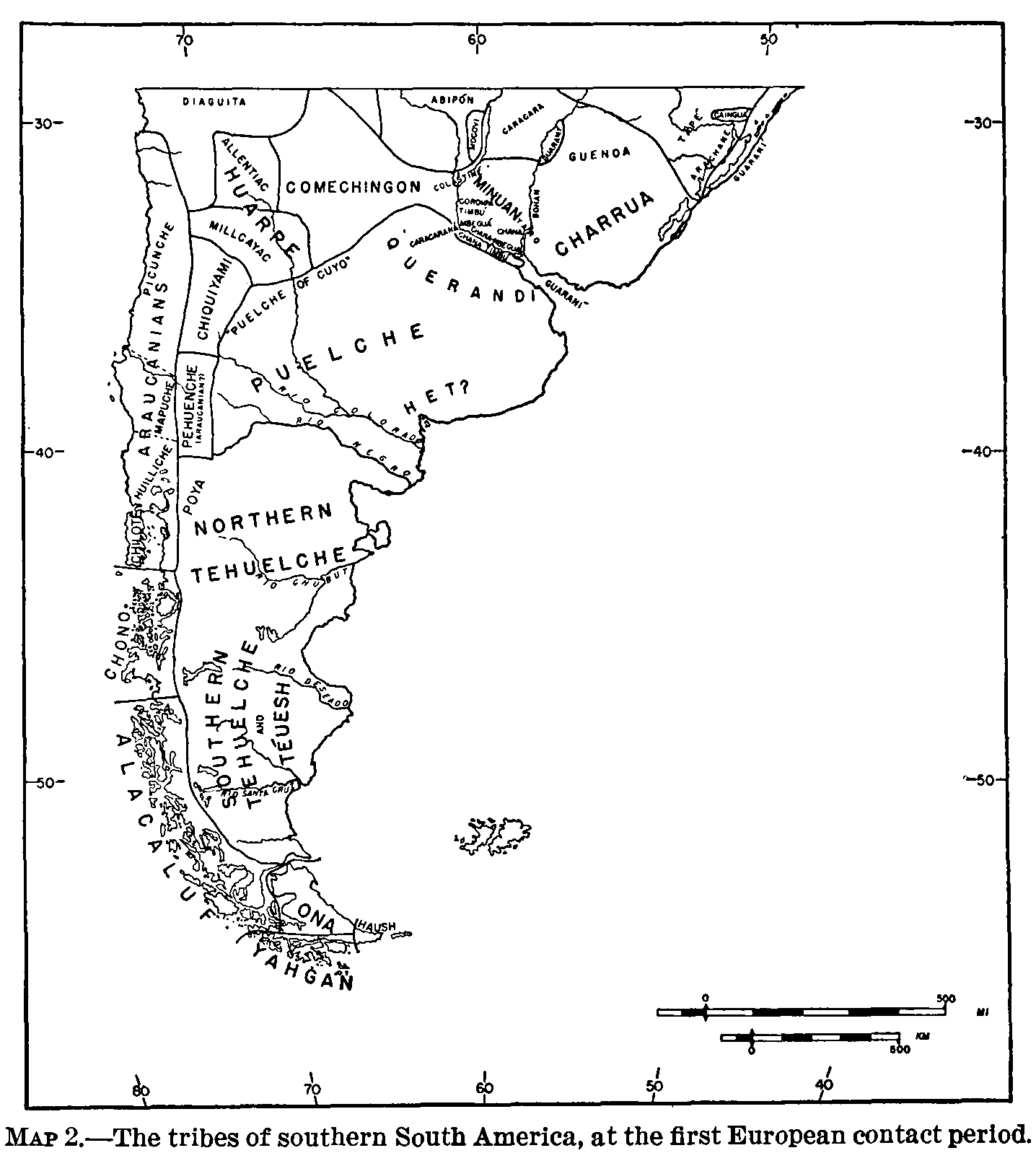
The tribes of southern South America, at the first European contact period
Mapa 1600 - 1799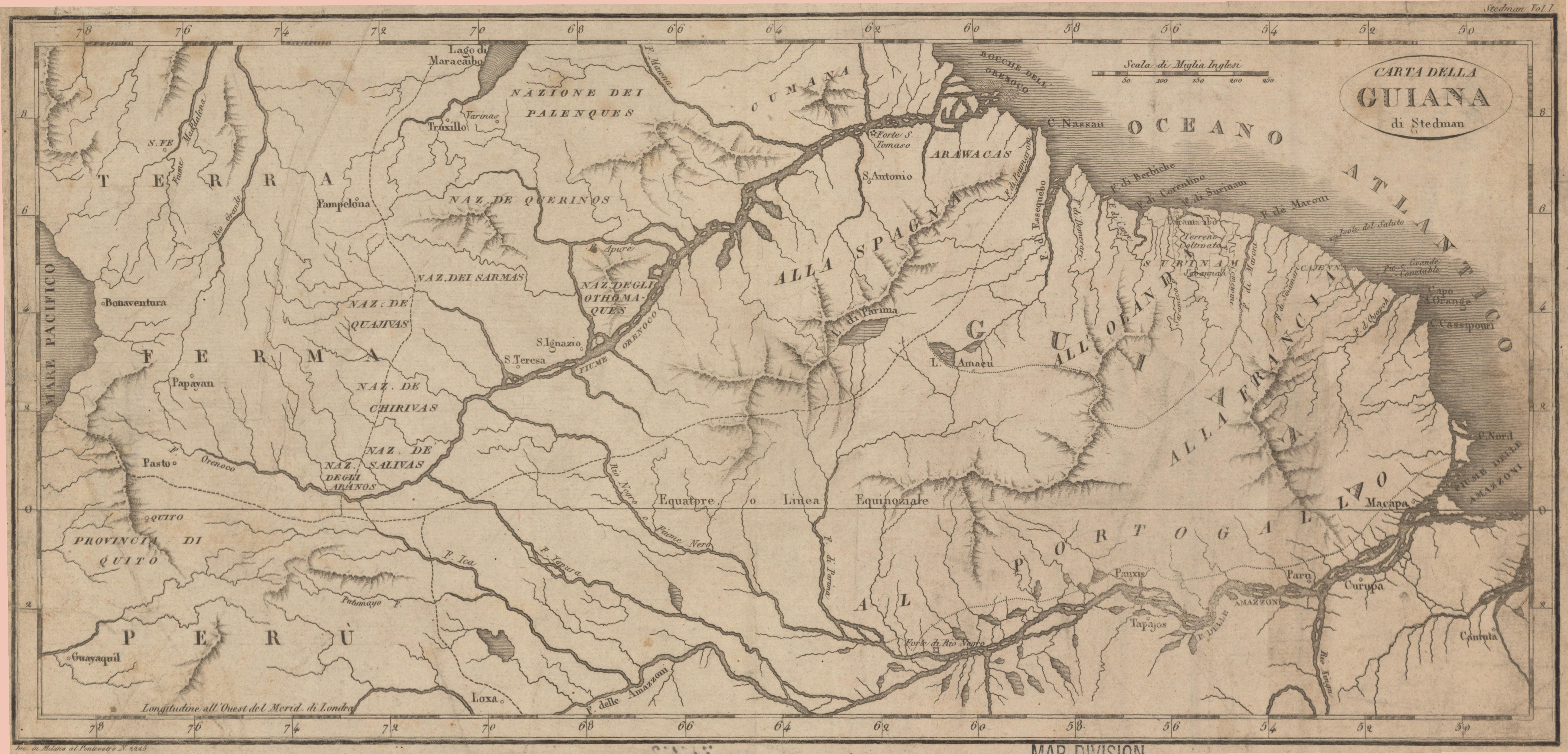
Carta della Guiana
Mapa 1700 - 1799