Citação
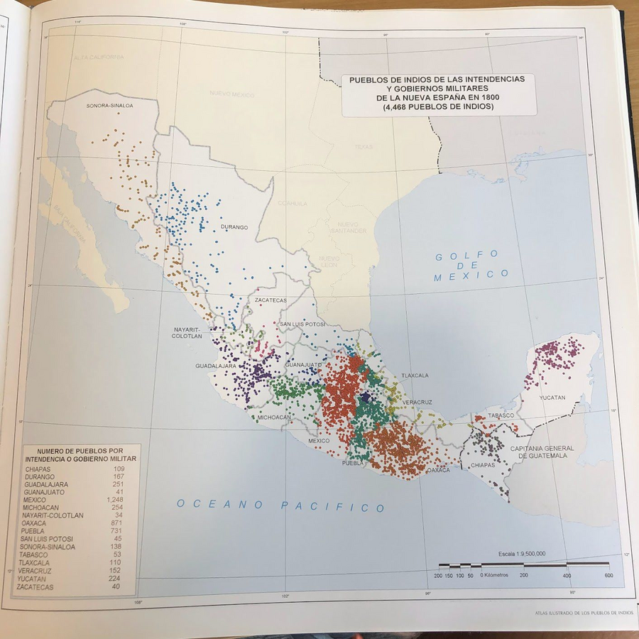
Tanck de Estrada, Dorothy. Atlas Ilustrado de los Pueblos de Indios: Nueva España, 1800. México: El Colegio de México, 2005. N/A - NO DIGITAL ACCESS
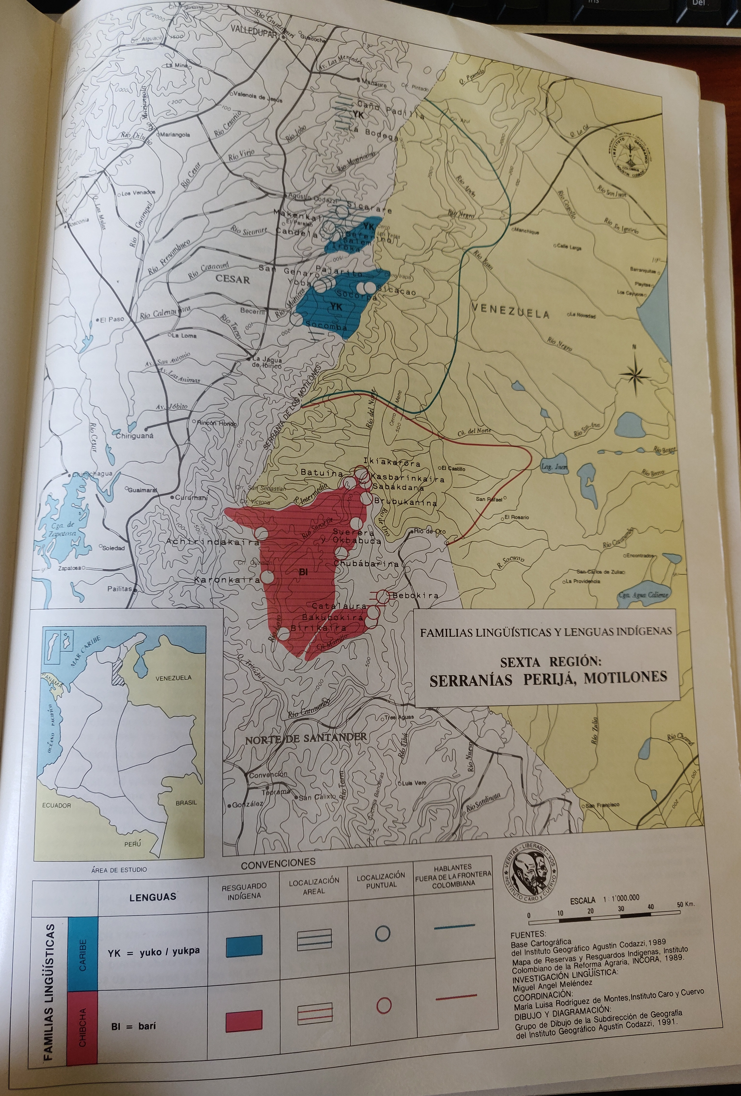
FAMILIAS LINGUÍSTICAS Y LENGUAS INDÍGENAS. SEXTA REGION: SERRANÍAS PERIJA, MOTILONES
Mapa 1989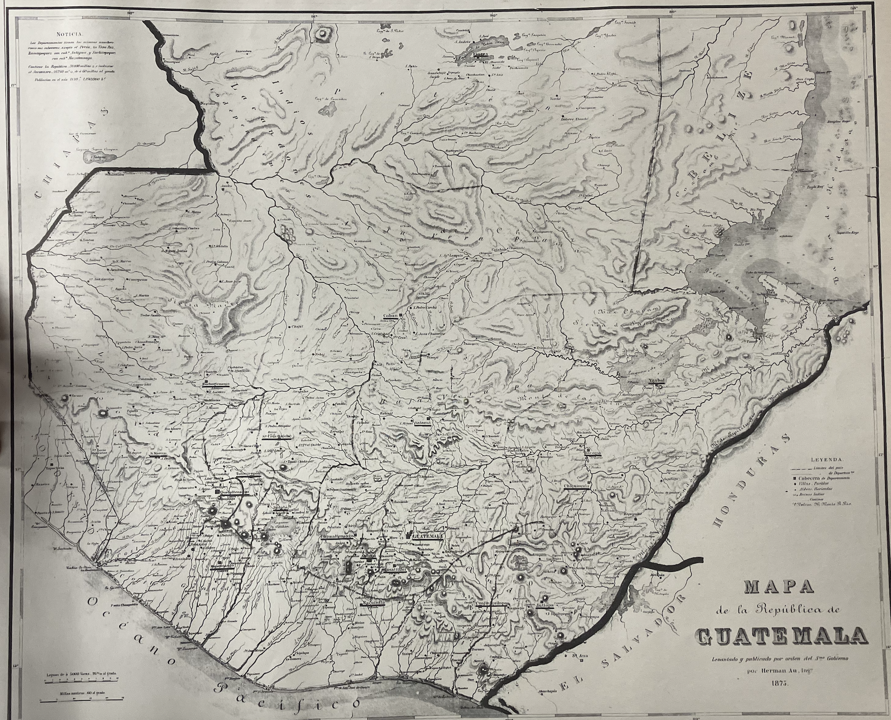
Mapa de la República de Guatemala
Mapa 1800 - 1900
Mosquitia or The Mosquito Shore with The Eastern Part of Yucatán as far as the 20th Degree of North Latitude
Mapa 1787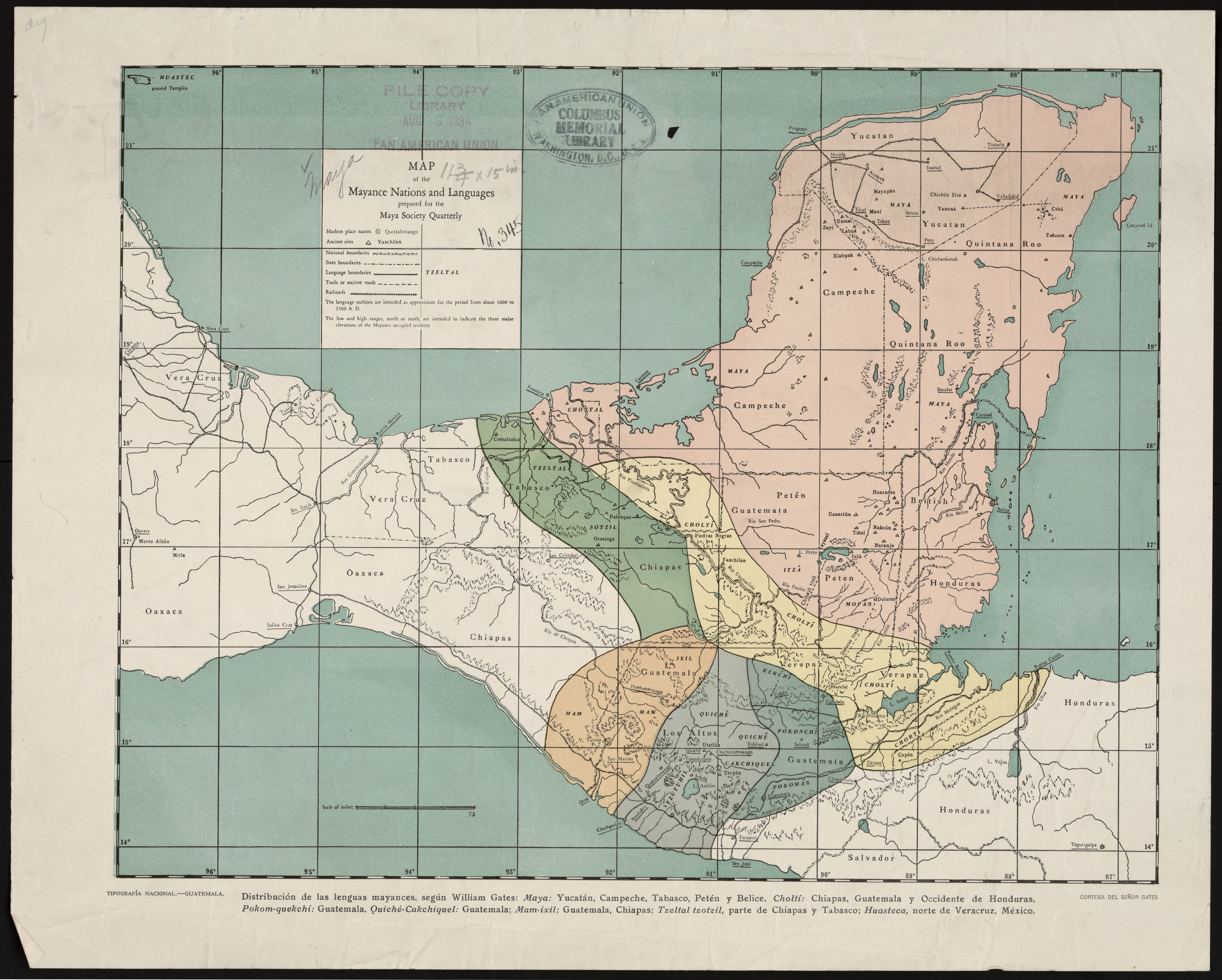
Map of the Mayance Nations and Languages
Mapa 1000 - 1500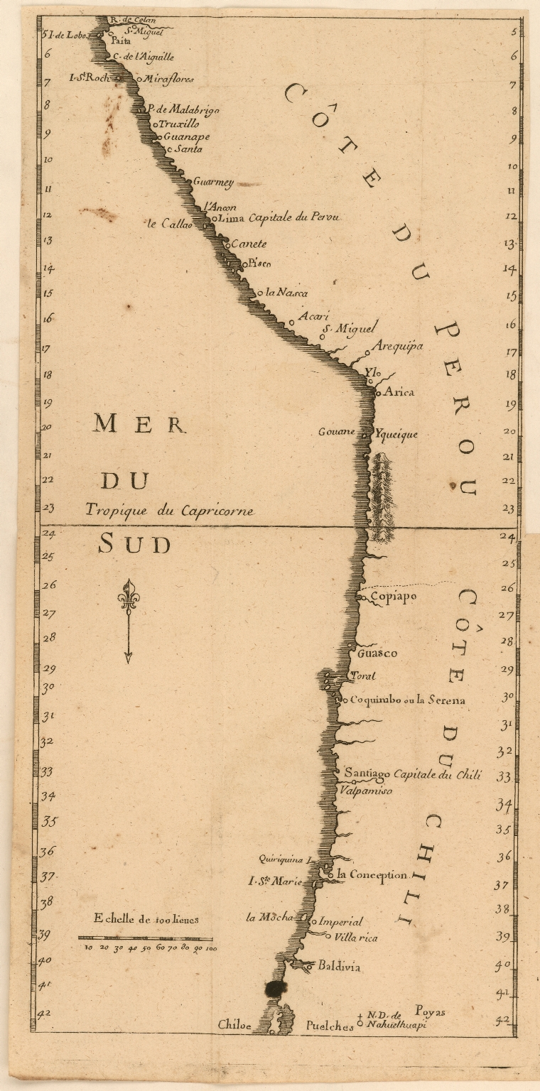
Côte du Perou
Mapa 1707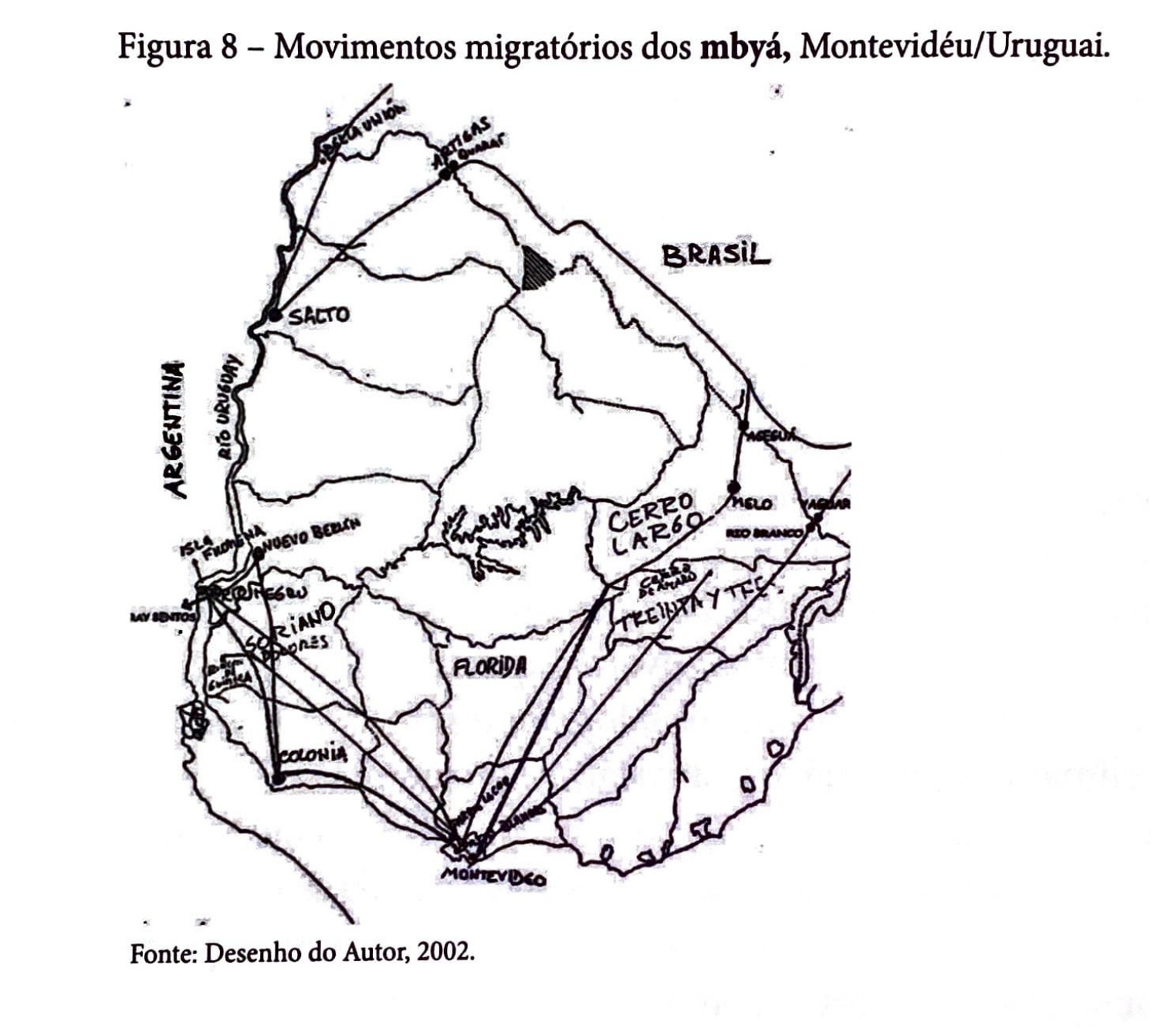
Movimentos migratórios dos mbyá, Montevidéu/Uruguai
Mapa 1980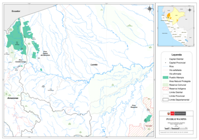
PUEBLO WAMPIS
Mapa 2021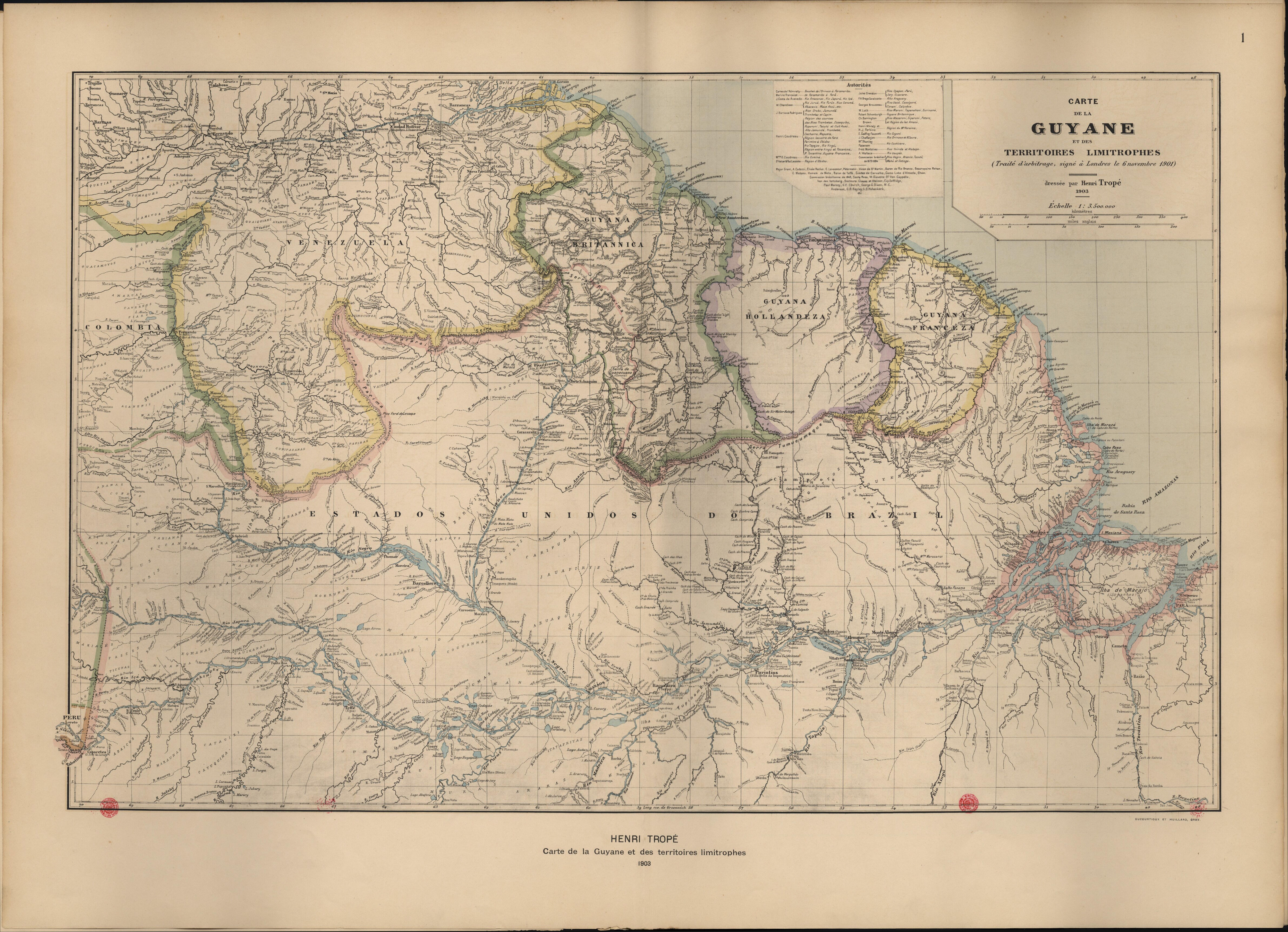
Carte de la Guyane et des territoires limitrophes (Traité d'arbitrage, signé à Londres le 6 novembre 1901)
Mapa 1900 - 1999