
Citação
Gruzinski, Serge. Painting the Conquest: the Mexican Indians and the European Renaissance. Paris: Unesco-Flammarion, 1992. NO ONLINE ACCESS TO SOURCE
![Dibujo de las tierras de los padres regulares espulsos y litixio con los indios, Pulares, Palogastas y Cachis. 1782-1783 [1790]](https://dnet8ble6lm7w.cloudfront.net/maps/ARG/ARG0092.jpeg)
Dibujo de las tierras de los padres regulares espulsos y litixio con los indios, Pulares, Palogastas y Cachis. 1782-1783 [1790]
Mapa 1782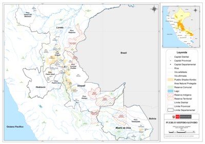
PUEBLO SHIPIBO-KONIBO
Mapa 2021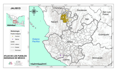
JALISCO
Mapa 2015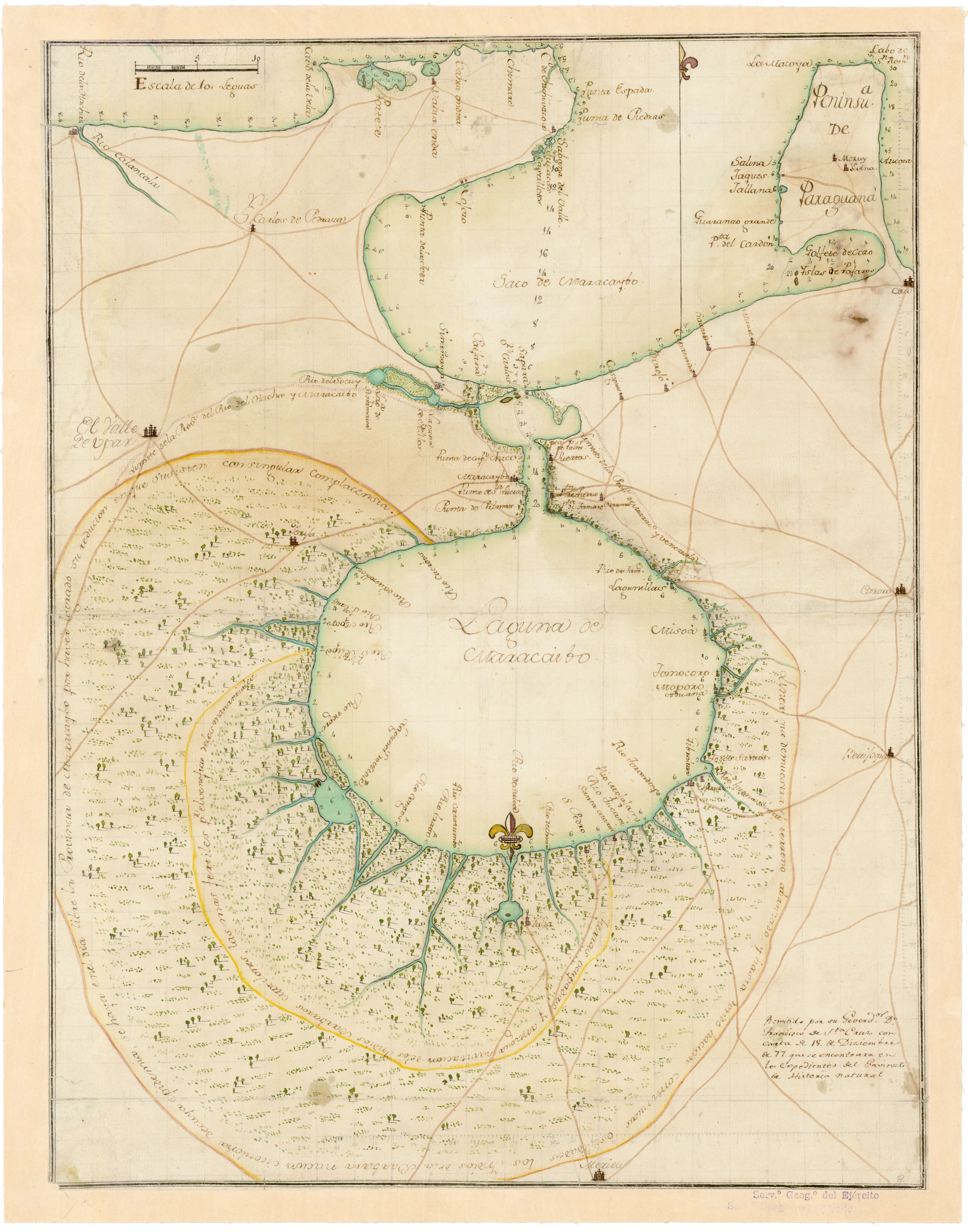
No Title
Mapa 1777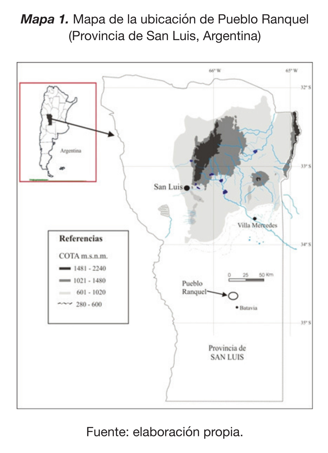
Mapa de la ubicación de Pueblo Ranquel
Mapa 2016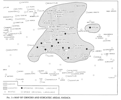
Map of Chocho and Ichcatec Areas, Oaxaca0
Mapa 1969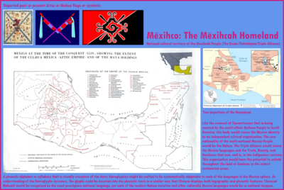
Mexico at the time of the conquest (1519), showing the extent of the Culhua Mexica (Aztec Empire) and of the Maya holdings
Mapa 1519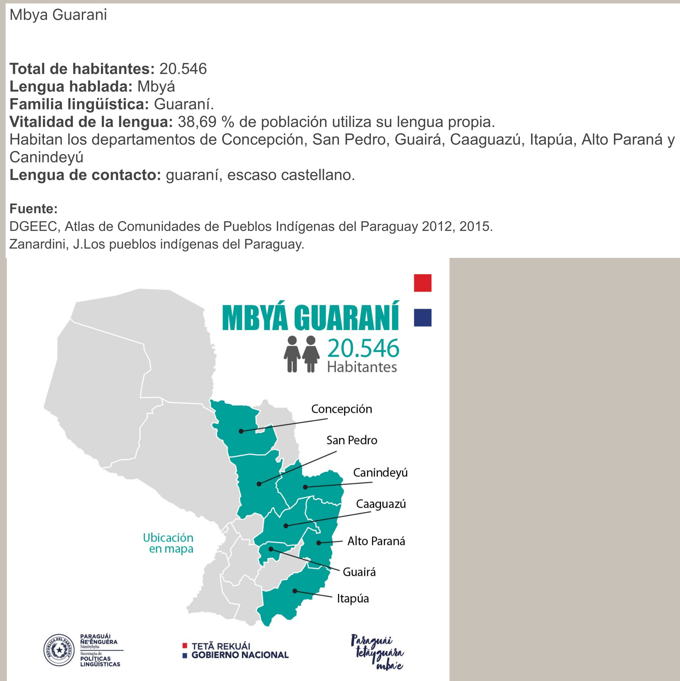
MBYÁ GUARANÍ
Mapa 2015