Povos
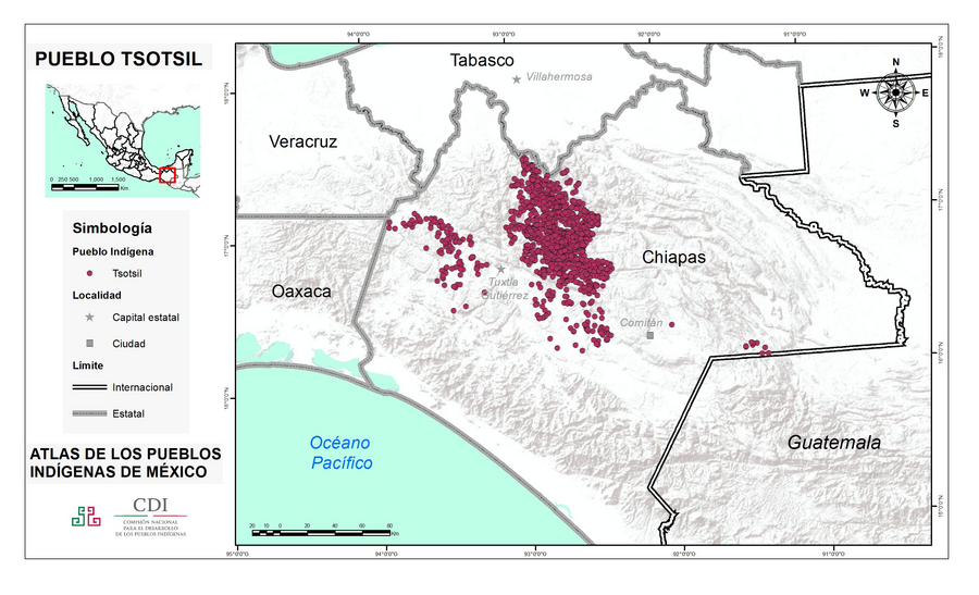
- TSOTSIL
Citation
Instituto Nacional de los Pueblos Indígenas. "Tsotsiles – Ubicación." Atlas de los Pueblos Indígenas de México. http://atlas.inpi.gob.mx/tsotsiles-chiapas/.
No Title
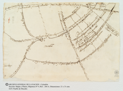
Mapa 1619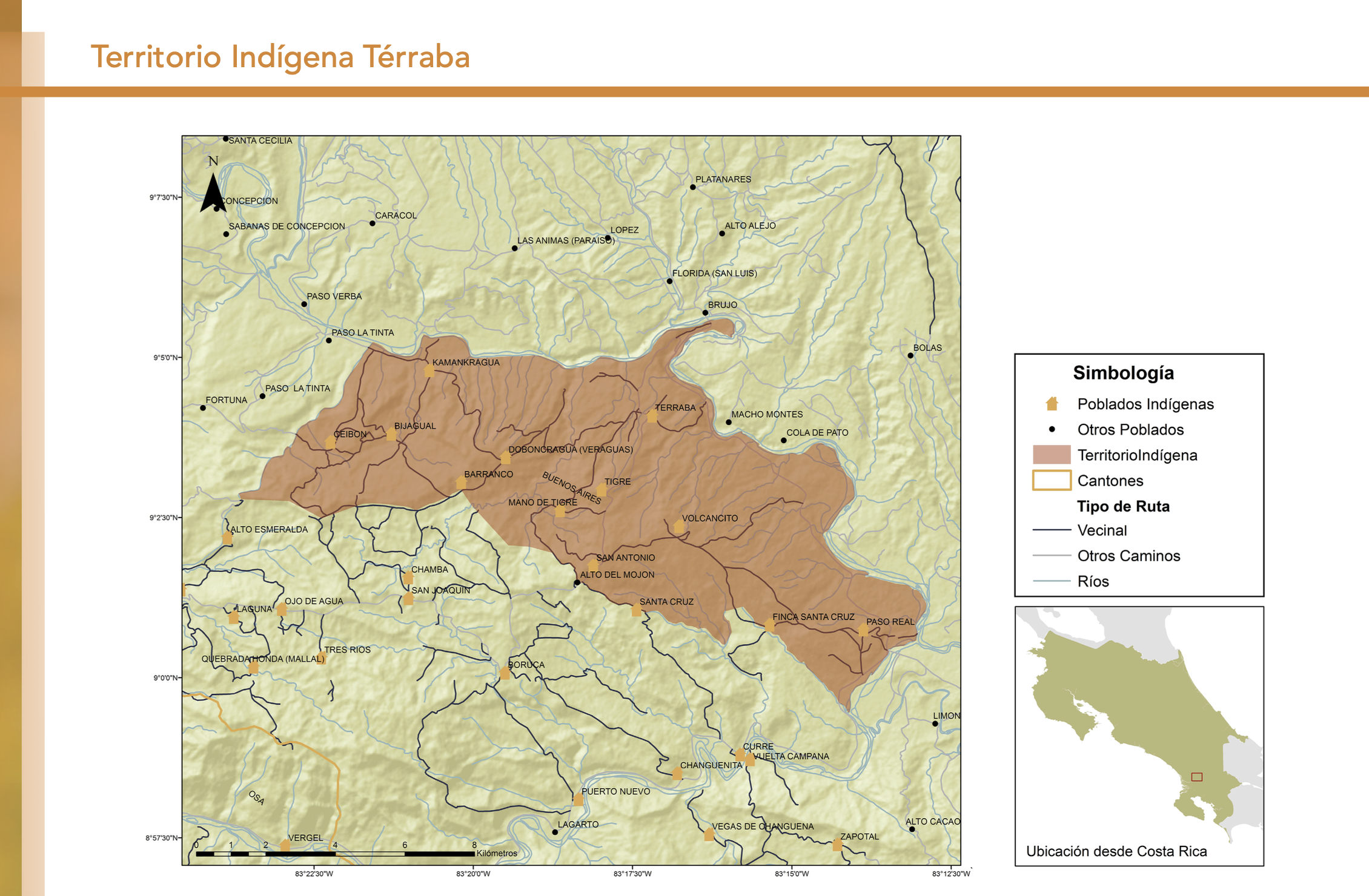
"Territorio Indígena Cabécar de Ujarrás"
Mapa 2010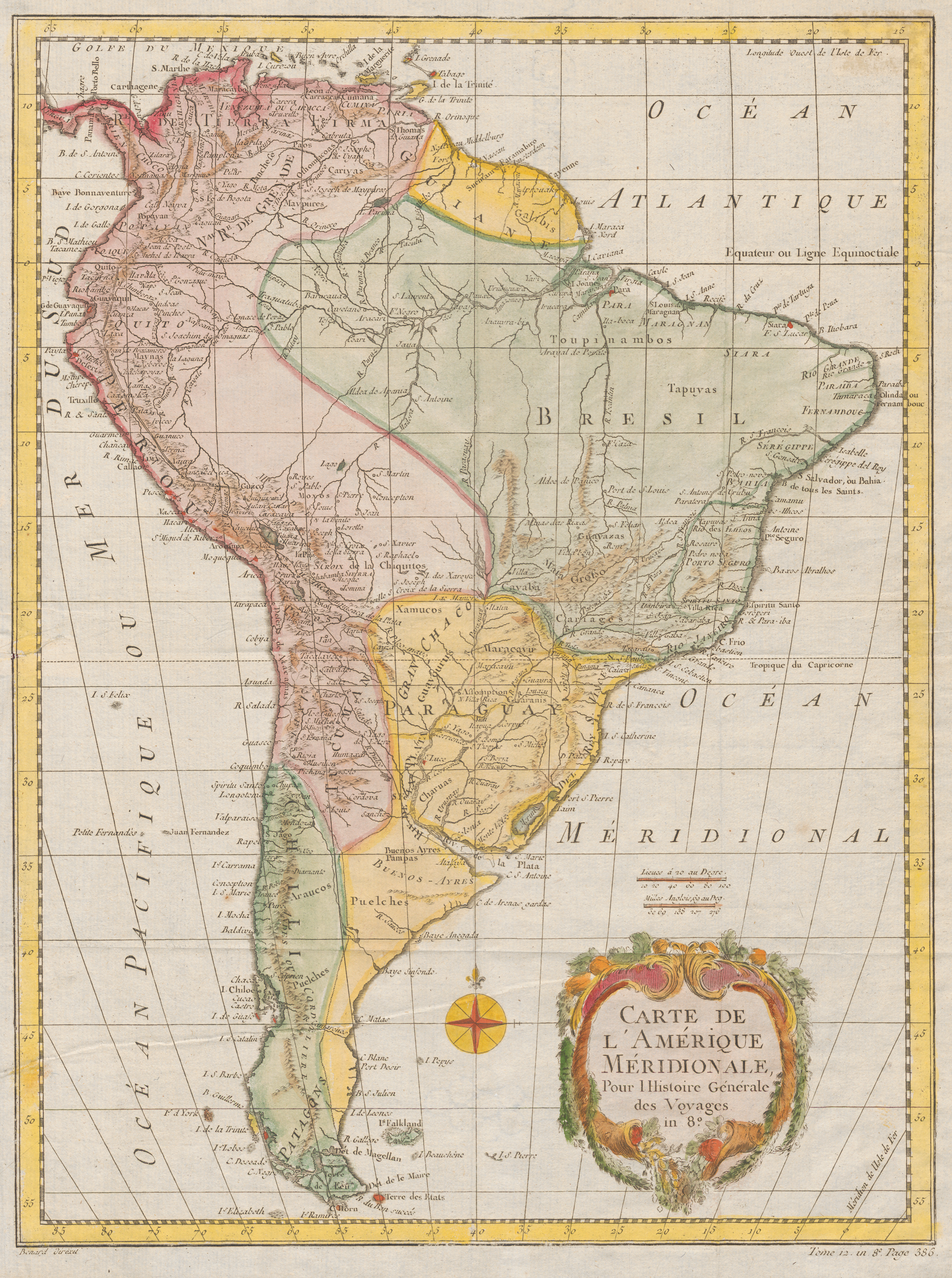
Carte De L'Amérique Méridionale. Pour l Histoire Générale
Mapa 1700 - 1770
Detail from the 1770 copy of Francisco Álvarez Barreiro’s 1728 map of northern New Spain illustrating Spanish mapping of Indian domains in southern Texas and along the Gulf Coast, especially through the repetition of labels: “tierra de los Pampopas,” “tierra de los Carrizos,” “tierra de los Cujanes,” etc.
Mapa 1728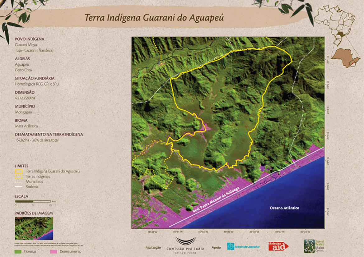
Terra Indígena Guarani do Aguapeú
Mapa 2011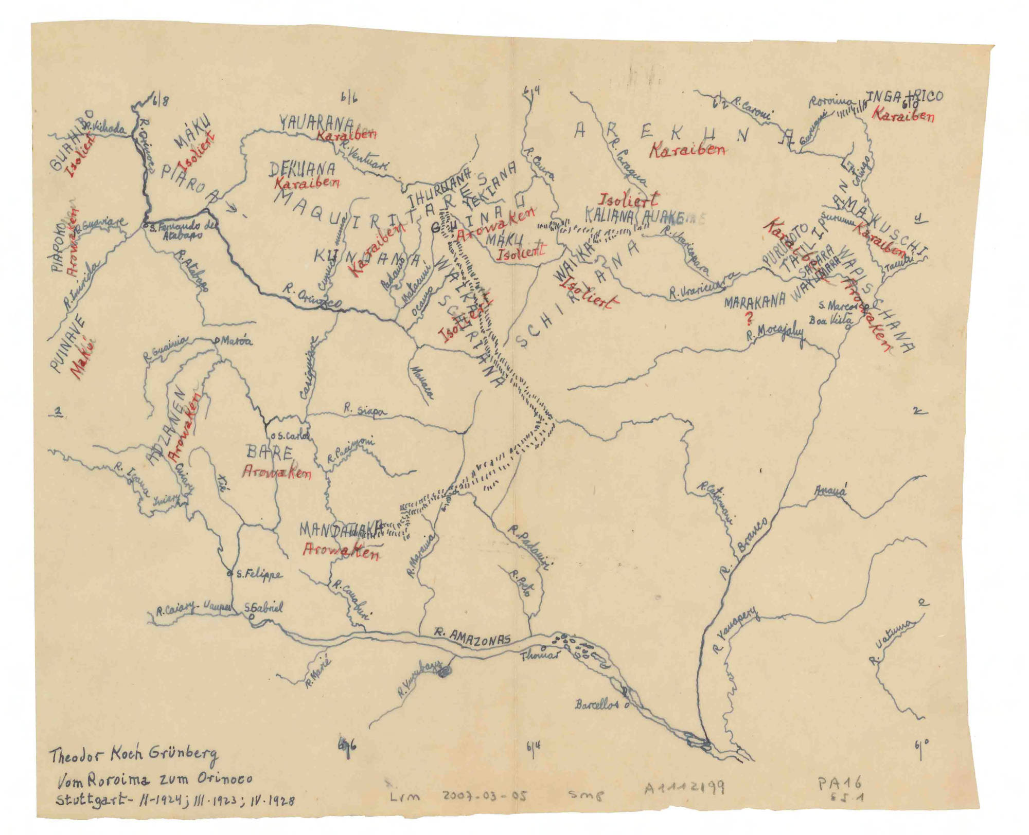
Vom Roroima zum Orinoco
Mapa 1923 - 1928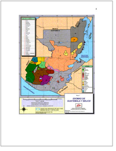
IDIOMAS DE GUATEMALA Y BELICE
Mapa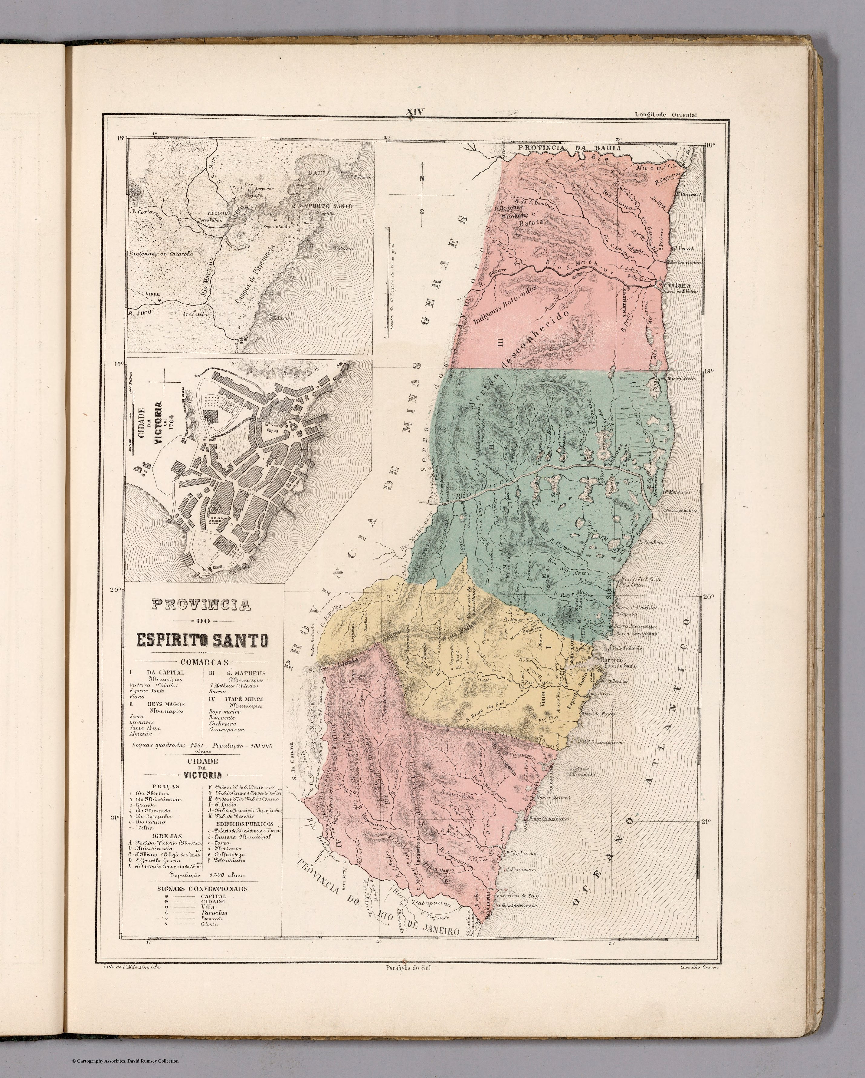
PROVINCIA DO ESPIRITO SANTO
Mapa 1800 - 1850