
Povos
- CHUJ
Citação
Instituto Nacional de los Pueblos Indígenas. "Chujes – Ubicación." Atlas de los Pueblos Indígenas de México. Accessed April 30, 2021. http://atlas.inpi.gob.mx/chuj-ubicacion/.
REGIÓN COSTA Y SIERRA SUR DE OAXACA
Mapa 2000
Detail from the 1770 copy of Francisco Álvarez Barreiro’s 1728 map of northern New Spain illustrating Spanish mapping of Indian domains in southern Texas and along the Gulf Coast, especially through the repetition of labels: “tierra de los Pampopas,” “tierra de los Carrizos,” “tierra de los Cujanes,” etc.
Mapa 1728
N. 24: Guyane.
Mapa 1800 - 1899
LOCALIZACIÓN GEOGRÁFICA DE BORAS Y MIRAÑAS
Mapa
PUEBLO TSOTSIL
Mapa 2020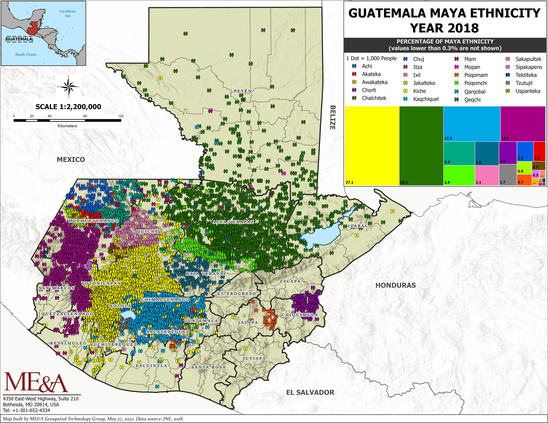
Guatemala Maya Ethnicity Year 2018
Mapa 2000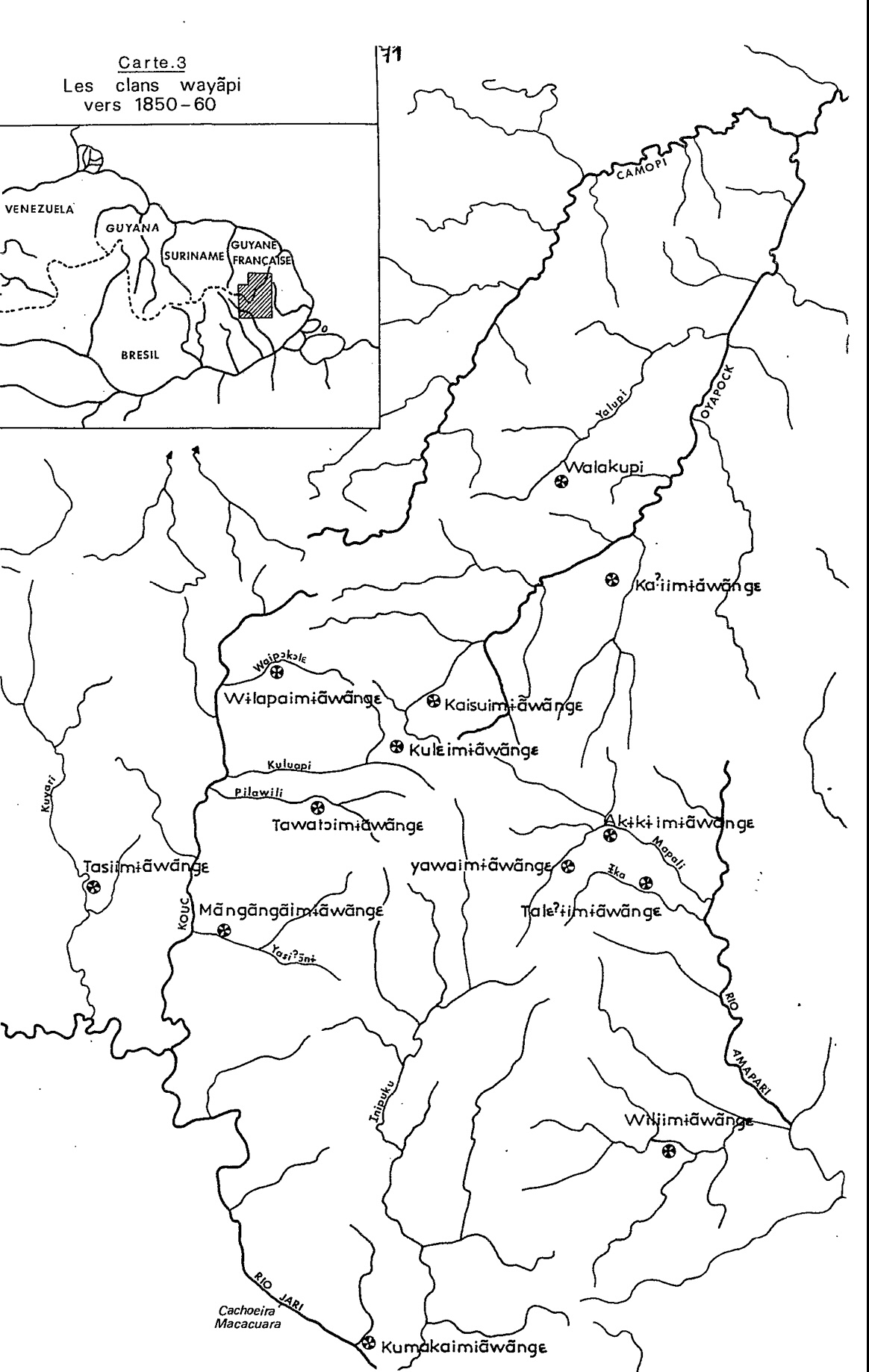
Carte 3. Les clans wayãpi vers 1850-1860
Mapa 1850 - 1860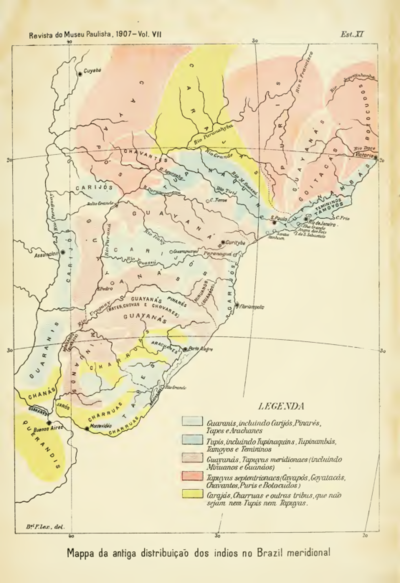
Mappa da antiga distribuição dos indios no Brazil meridional
Mapa 1900 - 1999