
Citation
Burley, David V., Robyn P. Woodward, Shea Henry, and Ivor C. Conolley. "Jamaican Taíno Settlement Configuration at the Time of Christopher Columbus." Latin American Antiquity 28, no. 3 .2017. : 337-52. https://doi.org/10.1017/laq.2017.14.

A Sequel of the Seat of War in the West Indies containing… Sub-map title: A large & accurate MAP of part of the Isthmus of Panama, taken from a Spanish drought exhibiting the Country adjacent to that City and Puerto Bello, with the Roads and Course of the River CHAGRE, by which the Treasure of the South Sea is conveyed a cross the Isthmus
Mapa 1740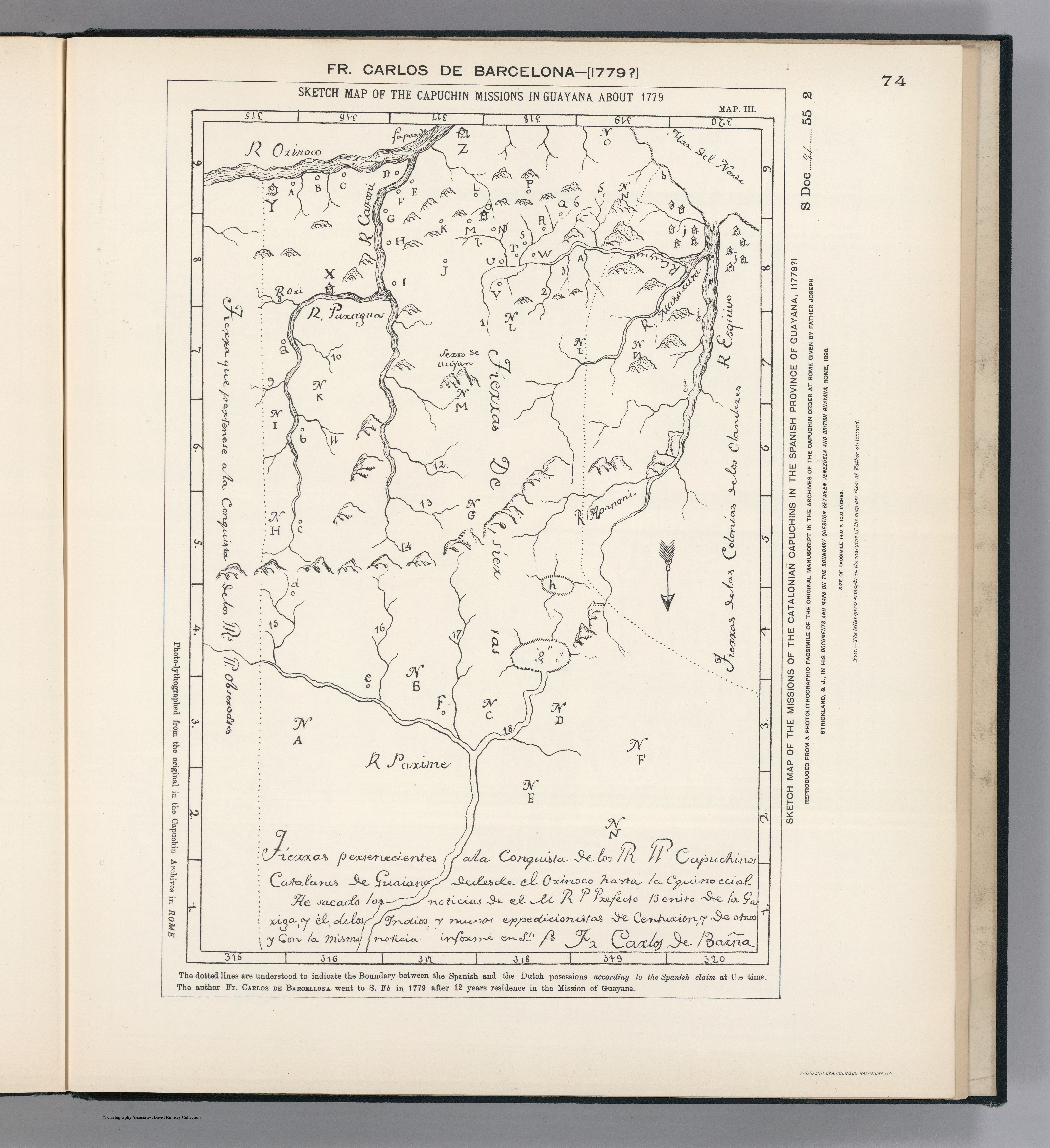
SKETCH MAP OF THE CAPUCHIN MISSIONS IN GUAYANA ABOUT 1779
Mapa 1779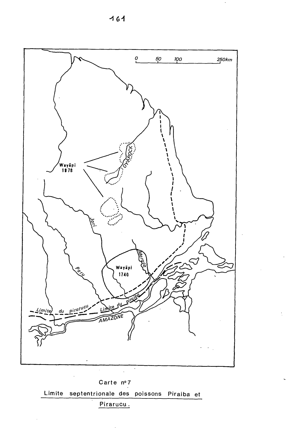
Carte n°7: Limite septentrionale des poissons Paraiba et Pirarucu
Mapa 1740 - 1978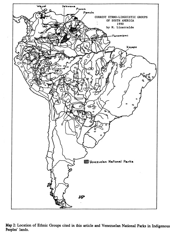
Current Ethno-Linguistic Groups of South America
Mapa 1990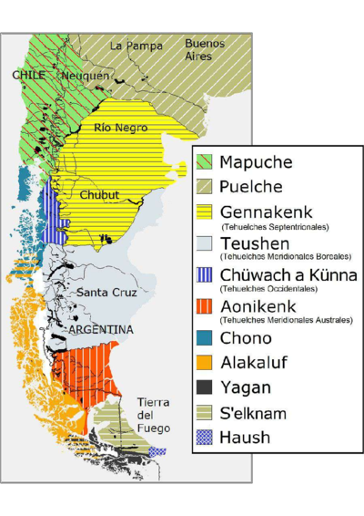
Haush Indians of Tierra del Fuego
Mapa 1800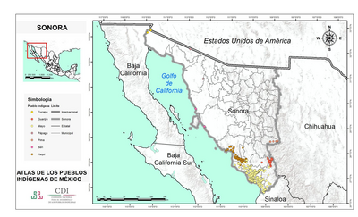
SONORA
Mapa 2015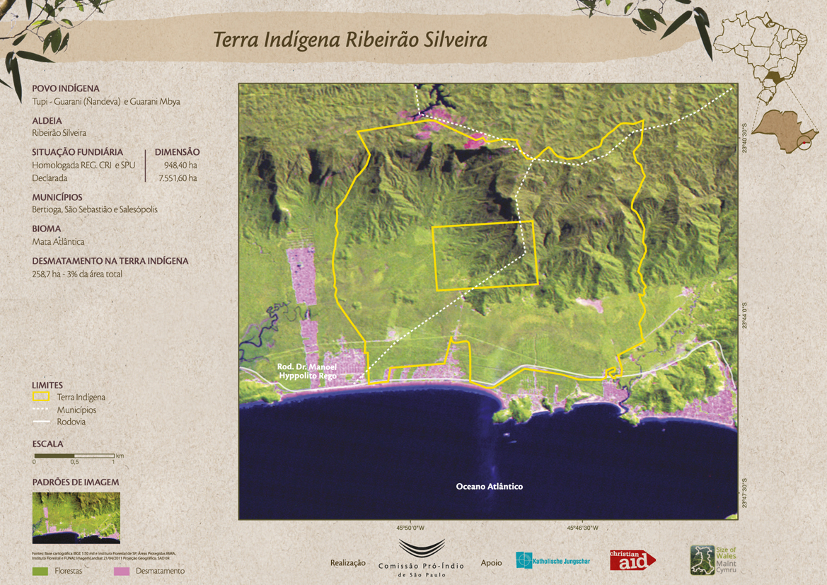
Terra Indígena Ribeirão Silveira
Mapa 2011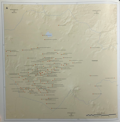
INTENDENCIA DE TLAXCALA
Mapa 1800