
Povos
- TOLUPAN
Citation
Davidson, William V. Ethnic Geography of Honduras, 2001: Tables and Maps based on the National Census. Memphis, TN, 2011. PDF. http://williamvdavidson.com/pdf/Ethnic-Geography-of-Honduras-2001-Davidson.pdf
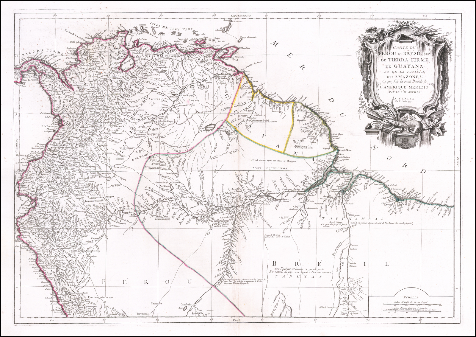
Carte du Pérou et Brésil sep.l de Tierra-Firme, de Guyana, et de la Rivière des Amazones: Ce qui fait la partie Boréale de l'Amérique Meridio. le. Par le Sr. D' Anville
Mapa 1700 - 1799![El lugar de los espíritus [O lugar dos espíritos]](https://dnet8ble6lm7w.cloudfront.net/art_sm/APER084-0.png)
El lugar de los espíritus [O lugar dos espíritos]
Obra de arte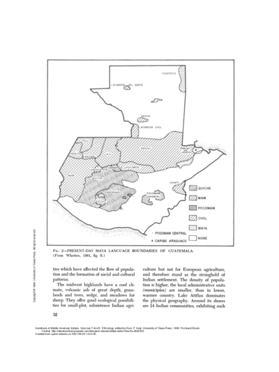
PRESENT-DAY MAYA LANGUAGE BOUNDARIES OF GUATEMALA
Mapa 1961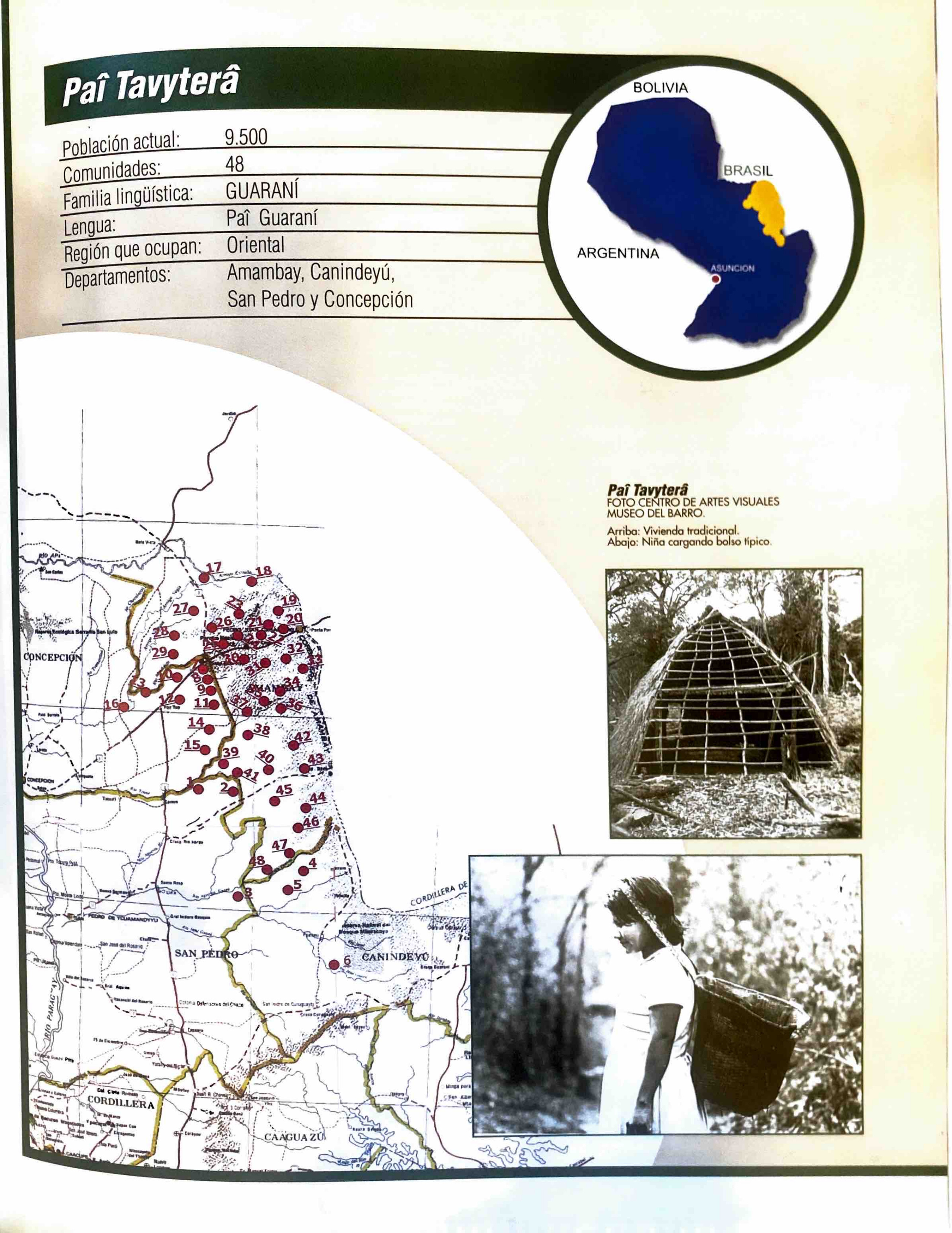
Paî Tavyterâ
Mapa 2001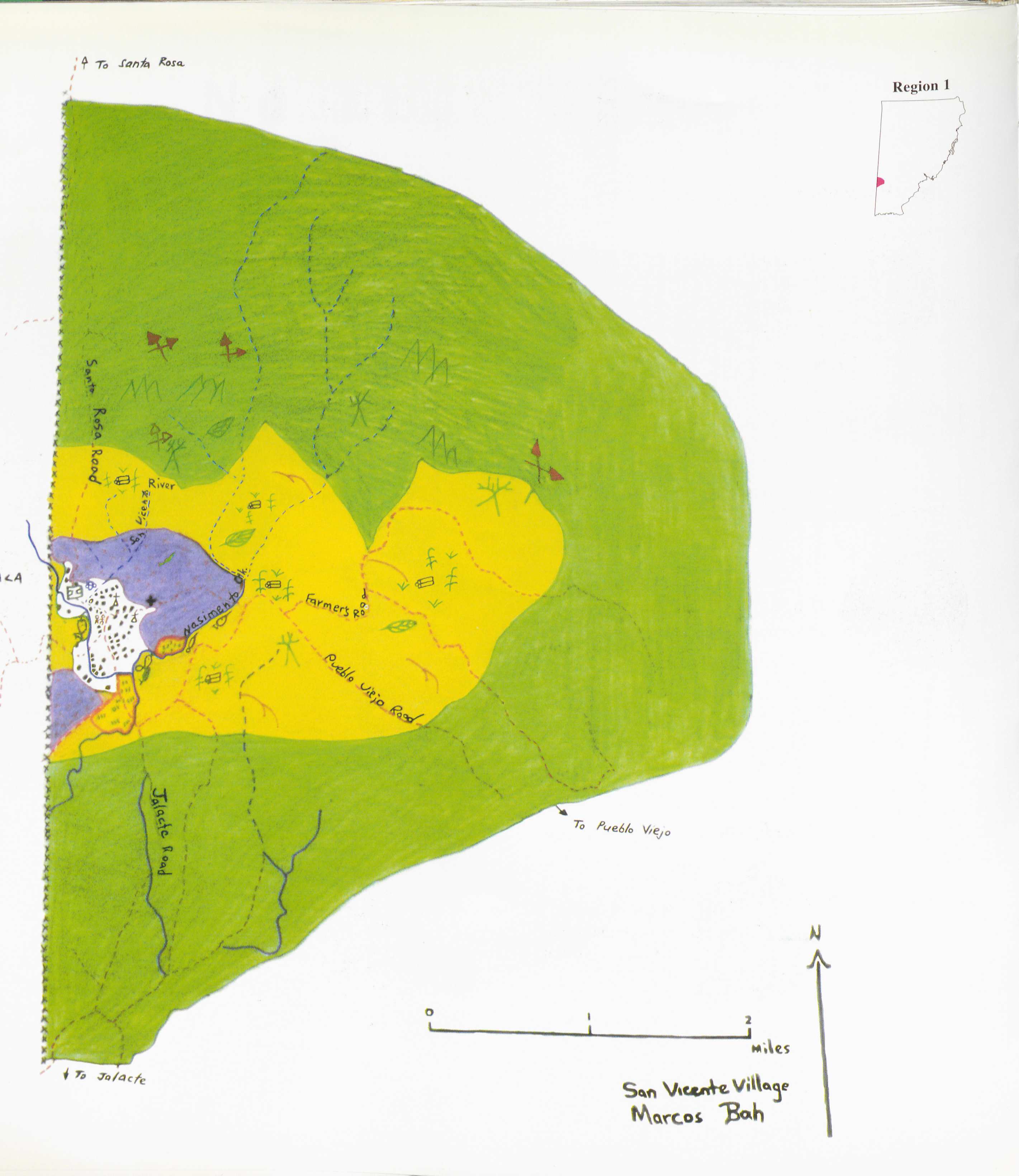
San Vicente
Mapa 1997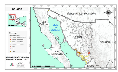
SONORA
Mapa 2015
Fig. 1 Map of the Guianas with schematic locations of the indigenous groups relevant to our study, based on the linguistic map of South America (http://www.muturzikin.com/cartesamerique/ 7.htm). Carib-speaking groups are indicated in yellow, Arawak-speaking groups in blue, Tupi-speaking Wayãpi in pink and the Warao-speaking group in green
Mapa 2000 - 2024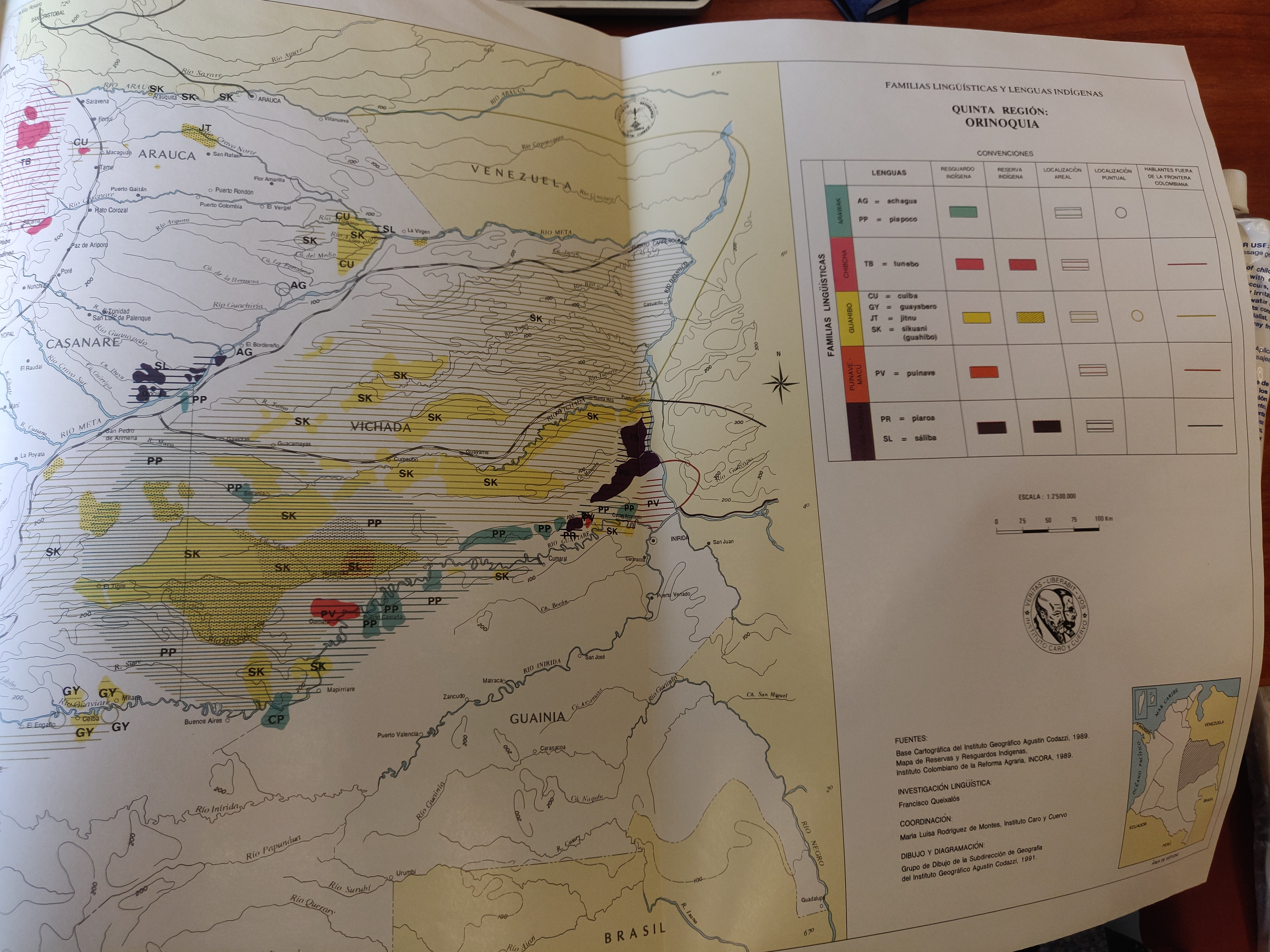
FAMILIAS LINGUISTICAS Y LENGUAS INDÍGENAS. QUINTA REGION: ORINOQUIA.
Mapa 1989