Povos
- LACANDON
Citação
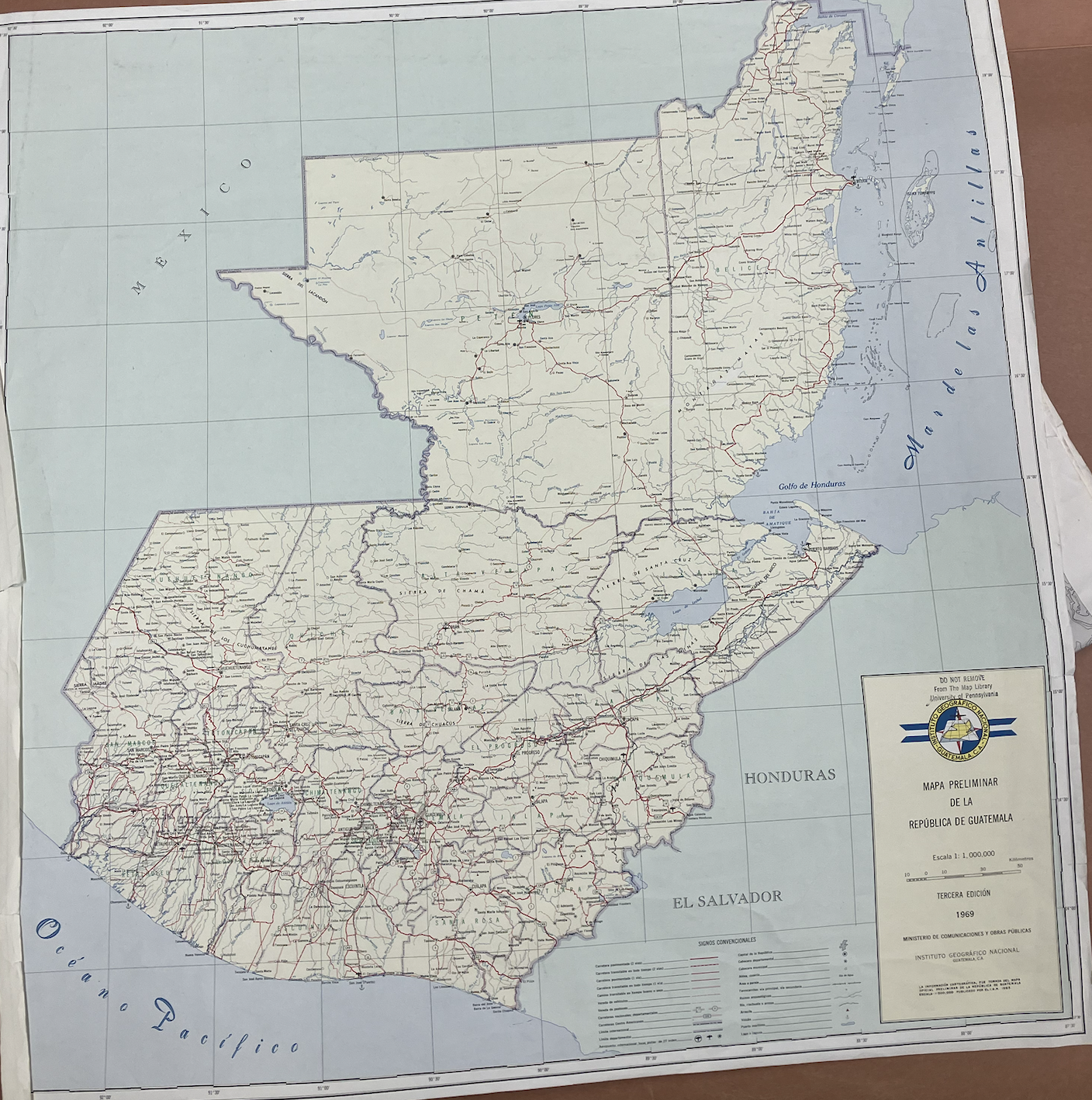
"Mapa Preliminar de la República de Guatemala." Ministerio de Comunicaciones y Obras Públicas: Instituto Geográfico Nacional, Guatemala, CA, 1969. From the Map Library, University of Pennsylvania.
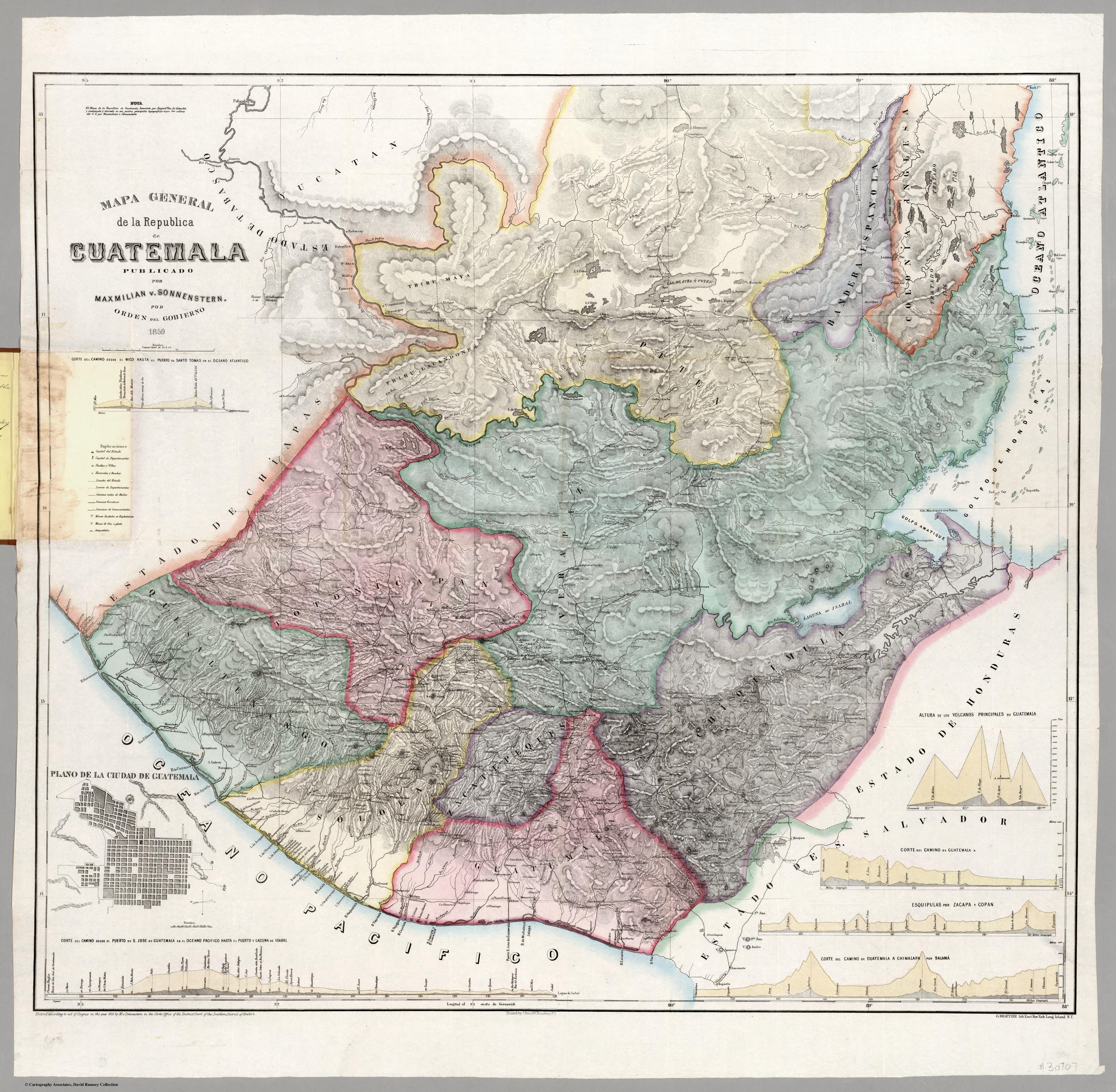
Mapa general de la Republica de Guatemala. Publicado por Maximilian v. Sonnenstern por orden del gobierno, 1859. Printed by J. Rau, 33 Broadway, NY. G Kraetzer lith, East New York Long Island, N.Y. "Entered according to act of Congress in the year 1859 by M.v Sonnenster...New York. (insets) Plando de la Ciudad de Guatemala;and 6 releif profiles.
Mapa 1800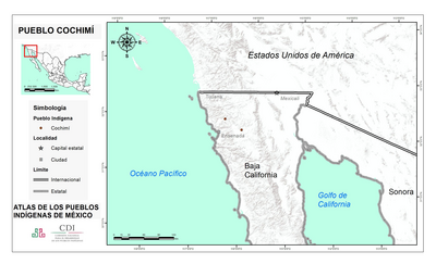
PUEBLO COCHIMI
Mapa 2020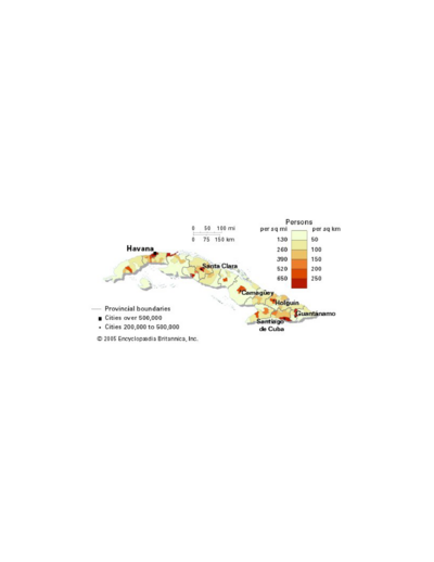
Population density of Cuba
Mapa -4000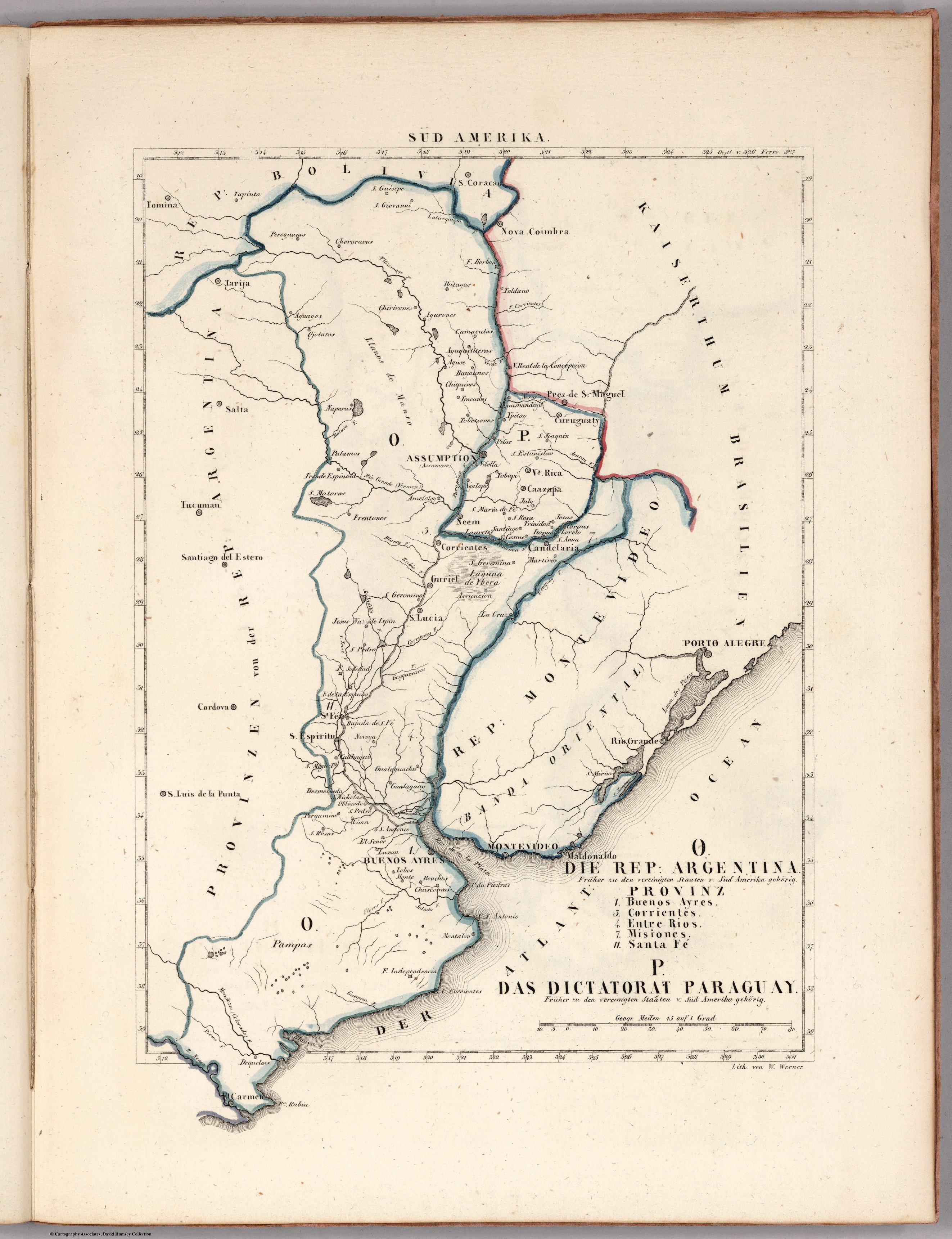
O. DIE REP: ARGENTINA. P. DAS DICTATORAT PARAGUAY.
Mapa 1830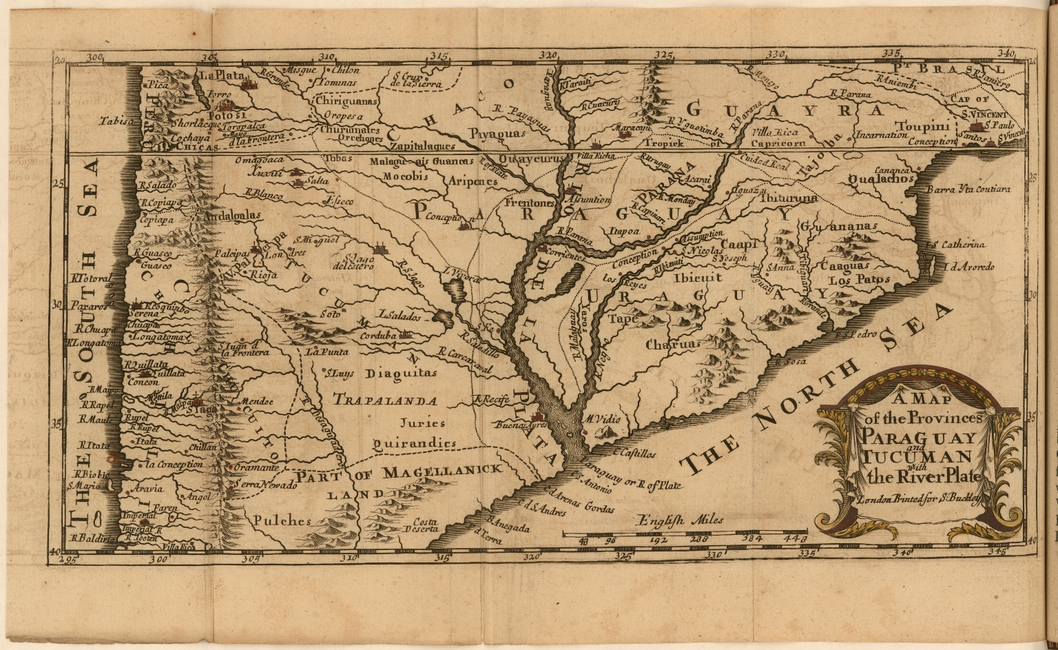
A Map of the Provinces Paraguay and Tucuman with the River Plate
Mapa 1698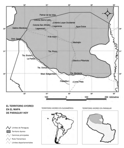
EL TERRITORIO AYOREO EN EL MAPA DE PARAGUAY HOY
Mapa 2010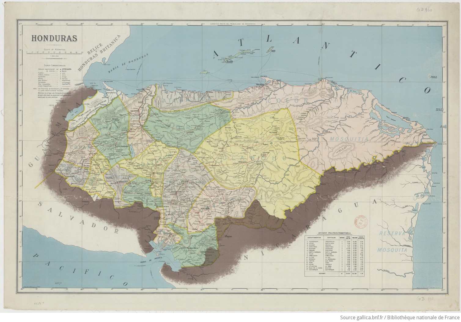
Honduras 1/800.000. Copyright 1909 by E. C. Fiallos
Mapa 1909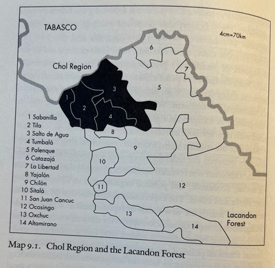
CHOL REGION AND THE LACANDON FOREST
Mapa 1998