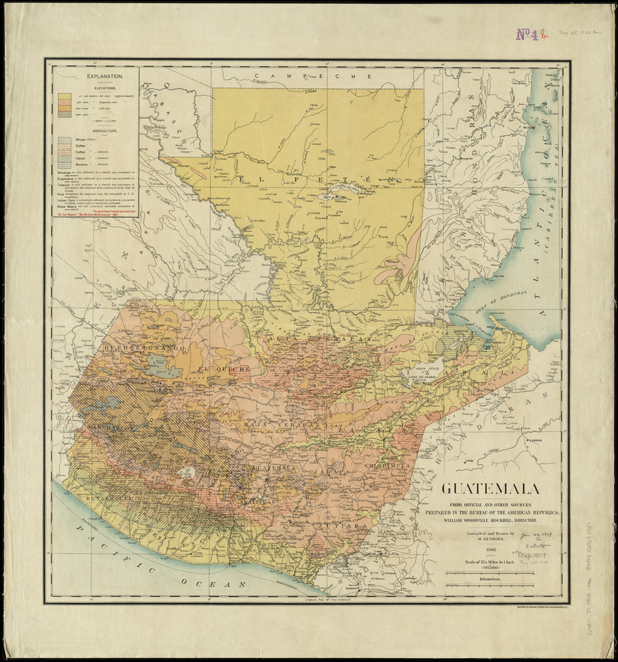
Dispossesions in the Americas

Dispossesions in the Americas

  • Lar
  • Explorar
  • Autores
  • Sobre
  • Arte
  • Corpos
  • Currículos
  • Patrimônio Cultural
  • Mapas
  • Territórios
Voltar à seção Explorar

Lendo em Inglês

Mapa 1900

Guatemala, from official and other sources.

  • M. HENDGES

Publicado: 1902

  • Baixar Imagem
  • Baixar Imagem

Lendo em Espanhol

Mapa 1900

Guatemala, from official and other sources.

  • M. HENDGES

Publicado: 1902

  • Baixar Imagem
  • Baixar Imagem
Mapa 1900

Guatemala, from official and other sources.

  • M. HENDGES

Publicado: 1902

  • Baixar Imagem

Povos

  • MAYA

Citação

Hendges, M. Guatemala, from official and other sources. Guatemala [agriculture]. Prepared in the Bureau of the American Republics;compiled and drawn by M. Hendges. 1902. Norman B. Leventhal Map Center Collection. G4811.J1 1902 .H46 Accessed June 19 2023. https://collections.leventhalmap.org/search/commonwealth:4m90fj93v

  • Baixar Imagem

Itens Relacionados

Detail from the 1770 copy of Francisco Álvarez Barreiro’s 1728 map of northern New Spain illustrating Spanish mapping of Indian domains in southern Texas and along the Gulf Coast, especially through the repetition of labels: “tierra de los Pampopas,” “tierra de los Carrizos,” “tierra de los Cujanes,” etc.

Detail from the 1770 copy of Francisco Álvarez Barreiro’s 1728 map of northern New Spain illustrating Spanish mapping of Indian domains in southern Texas and along the Gulf Coast, especially through the repetition of labels: “tierra de los Pampopas,” “tierra de los Carrizos,” “tierra de los Cujanes,” etc.

Mapa 1728
CARTE particuliere du cours de la RIVIERE DES AMAZONES ou de MARAGNON Depuis l'entrée du Para en remontant jusqu'au Confluent de la Rivière Noire.

CARTE particuliere du cours de la RIVIERE DES AMAZONES ou de MARAGNON Depuis l'entrée du Para en remontant jusqu'au Confluent de la Rivière Noire.

Mapa 1729
TERRITORIO DE YUKPA DE PERIJA

TERRITORIO DE YUKPA DE PERIJA

Mapa 2018
O. DIE REP: ARGENTINA. P. DAS DICTATORAT PARAGUAY.

O. DIE REP: ARGENTINA. P. DAS DICTATORAT PARAGUAY.

Mapa 1830
N. 24: Guyane.

N. 24: Guyane.

Mapa 1800 - 1899
REGIÓN TUXTLAS, POPOLUCA-NÁHUATL DE VERACRUZ

REGIÓN TUXTLAS, POPOLUCA-NÁHUATL DE VERACRUZ

Mapa 2000
Nivaclé

Nivaclé

Mapa 2001
PUEBLO CHITONAHUA

PUEBLO CHITONAHUA

Mapa 2021

Despossessões nas Américas

Um projeto de

University of Pennsylvania

Copyright 2024

Com o apoio de

Mellon Foundation

Projeto e desenvolvimento do site

Element 84

Créditos da arte

Hendges, M. Guatemala, from official and other sources. Guatemala [agriculture]. Prepared in the Bureau of the American Republics;compiled and drawn by M. Hendges. 1902. Norman B. Leventhal Map Center Collection. G4811.J1 1902 .H46 Accessed June 19 2023. https://collections.leventhalmap.org/search/commonwealth:4m90fj93v

Páginas do site

  • Lar
  • Explorar
  • Autores
  • Sobre
  • Arte
  • Corpos
  • Currículos
  • Patrimônio Cultural
  • Mapas
  • Territórios