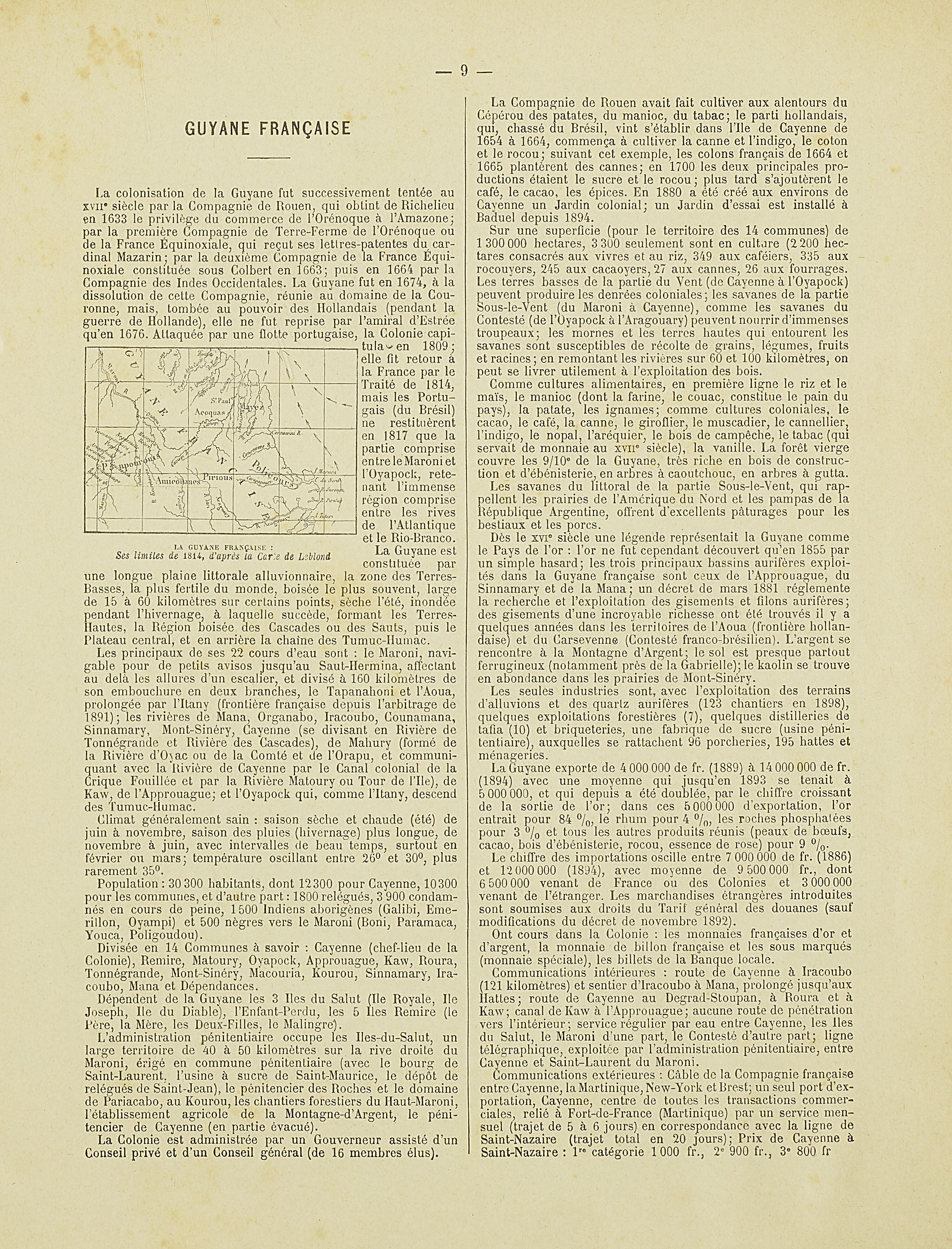
Povos
- ACOQUAS
- AMICOUANES
- MAYEZ
- PAPOUROUIS
- PIRIOUS
- POLICOURS
Citation
Nouvel Atlas colonial. Gallica. Last modified: May 24, 2020. Accessed, August 1, 2023. https://gallica.bnf.fr/ark:/12148/bpt6k1100234w/f10.item
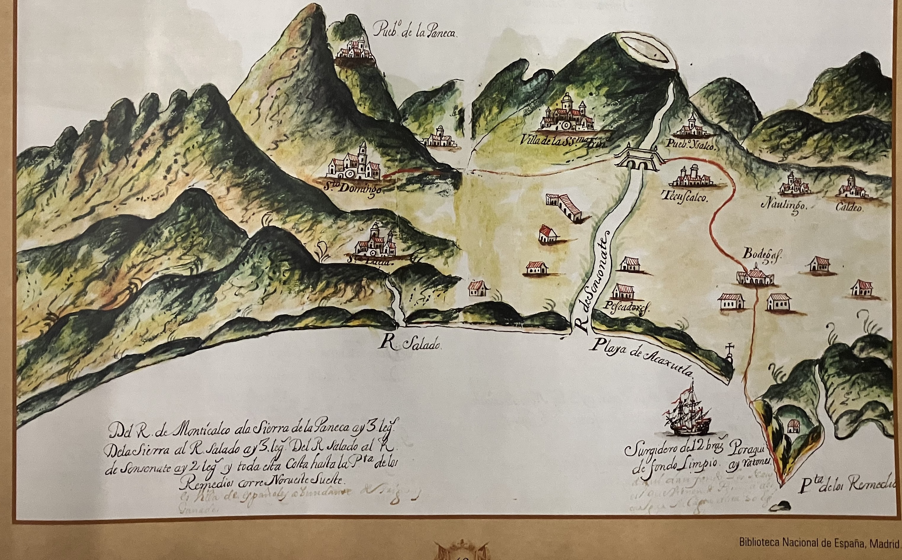
Derrotero de las cartas de América desde la ciudad de Compostela hasta el estrecho Magallanes, con el de las islas de Juan Fernández y las de Salomón
Mapa 1601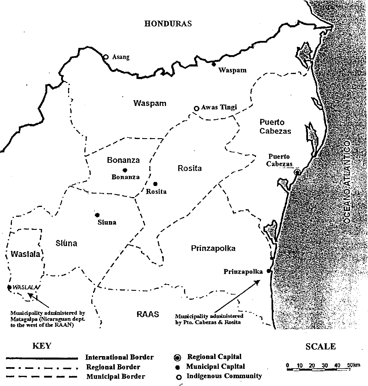
Map of the North Atlantic Autonomous Region (RAAN);Northeastern Nicaragua.
Mapa 1900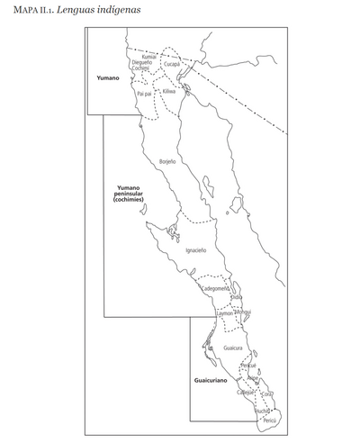
LENGUAS INDÍGENAS
Mapa 2016
Government map of Nicaragua : from the latest surveys ordered by President Patricio Rivas and Genl. William Walker ;executed under the supervision of the Señor Fermín Ferrer;Governor of the Western Department;1856
Mapa 1800 - 1856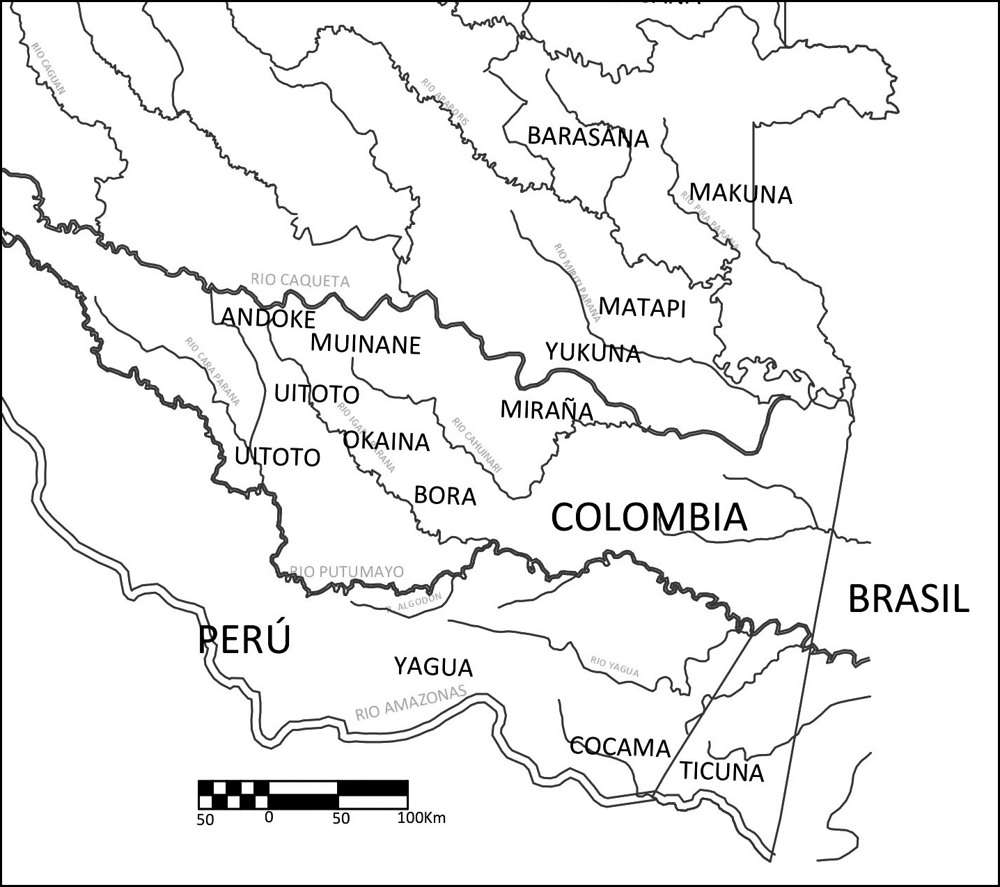
Figura 1 – Mapa de la zona de studio
Mapa 2005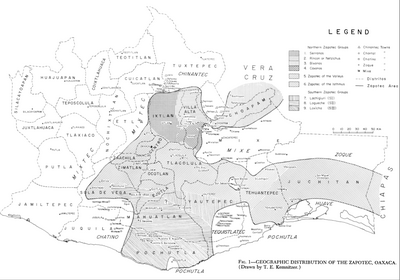
Geographic Distribution of the Zapotec, Oaxaca
Mapa 1969
CHARTE VON SÜD AMERICA;NACH ASTRONOMISCHEN BEOBACHTUNGEN;DEN BESTEN VORHANDENEN CHARTEN;UND DEN BERICHTEN DER MISSIONARIEN
Mapa 1803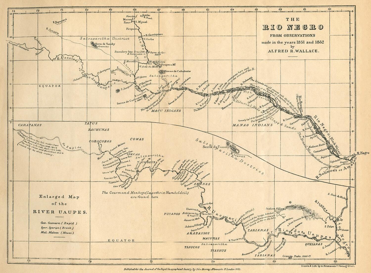
THE RÍO NEGRO
Mapa 1851 - 1852