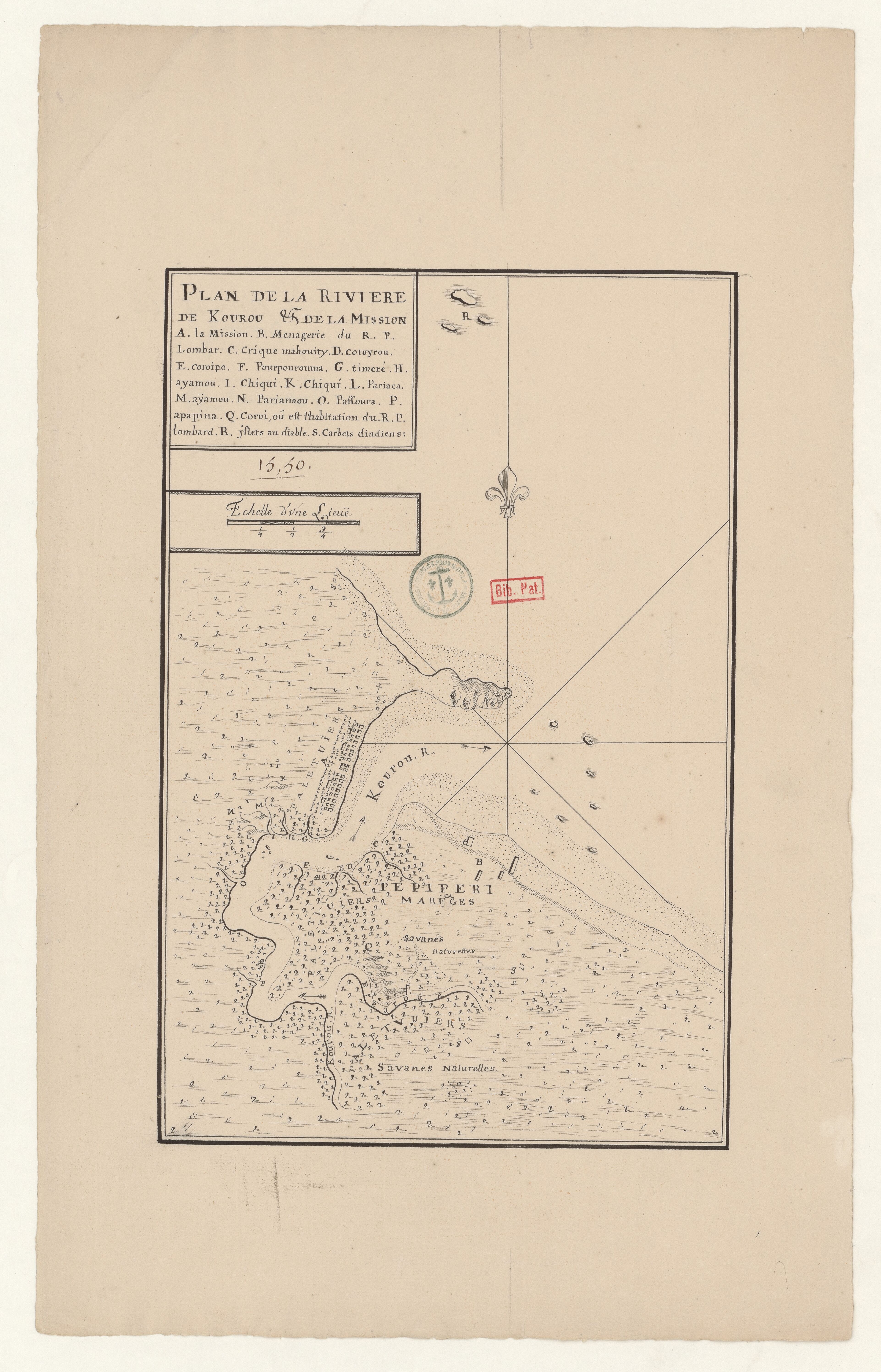
Povos
- CARBETS DINDIENS
Citação
Plan de la Rivière de Kourou et de la mission. Gallica. Last modified: September 28, 2015. Accessed, August 1, 2023. https://gallica.bnf.fr/ark:/12148/btv1b53103747z
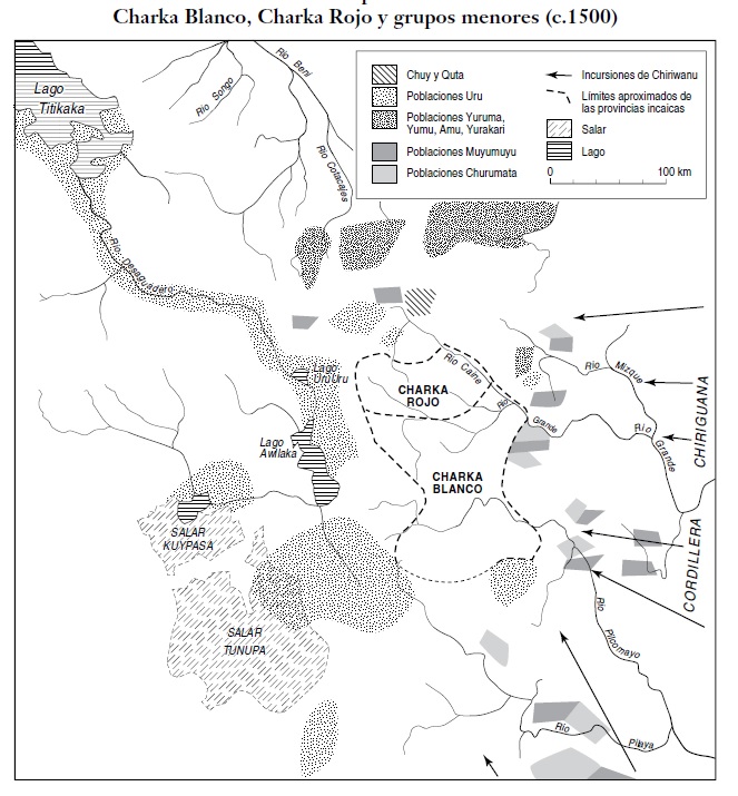
SEÑORÍOS AYMARAS DE LOS CHARKA Y ENTIDADES POLÍTICAS VECINAS NO AYMARAS, A FINALES DEL SIGLO XV Y PRINCIPIOS DEL SIGLO XVI
Mapa 1500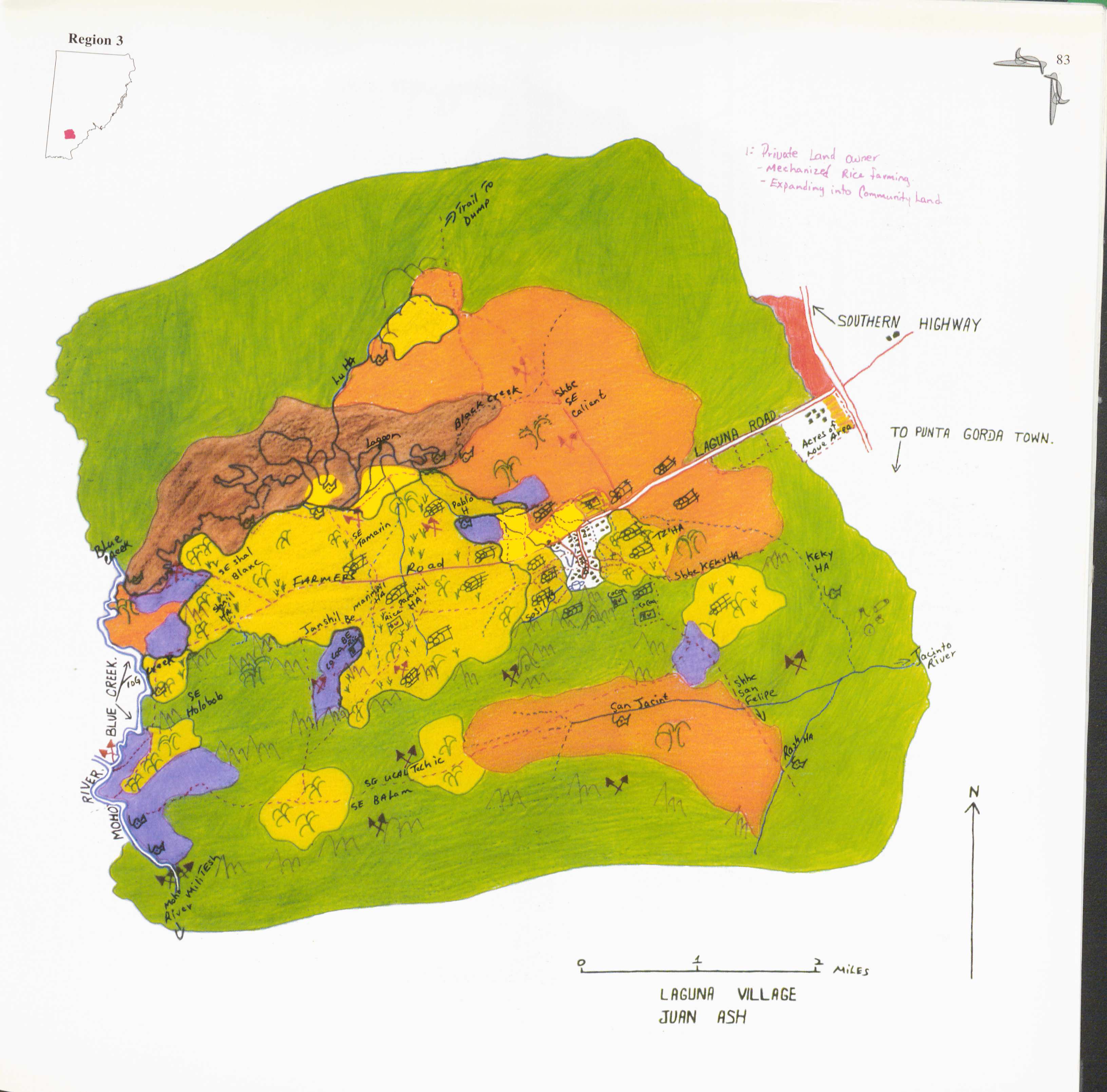
Laguna
Mapa 1997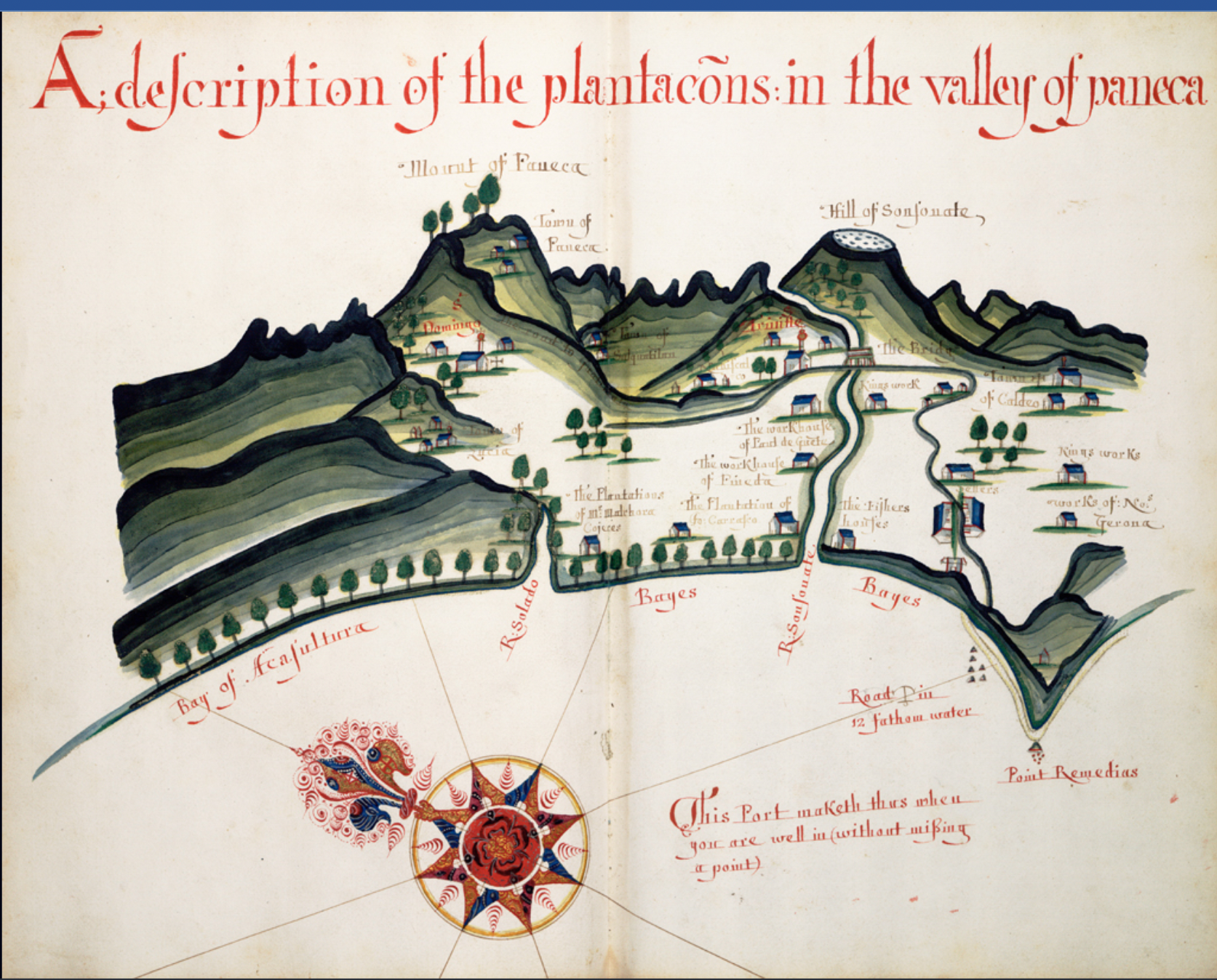
A Description of the Plantations in the Valley of Paneca
Mapa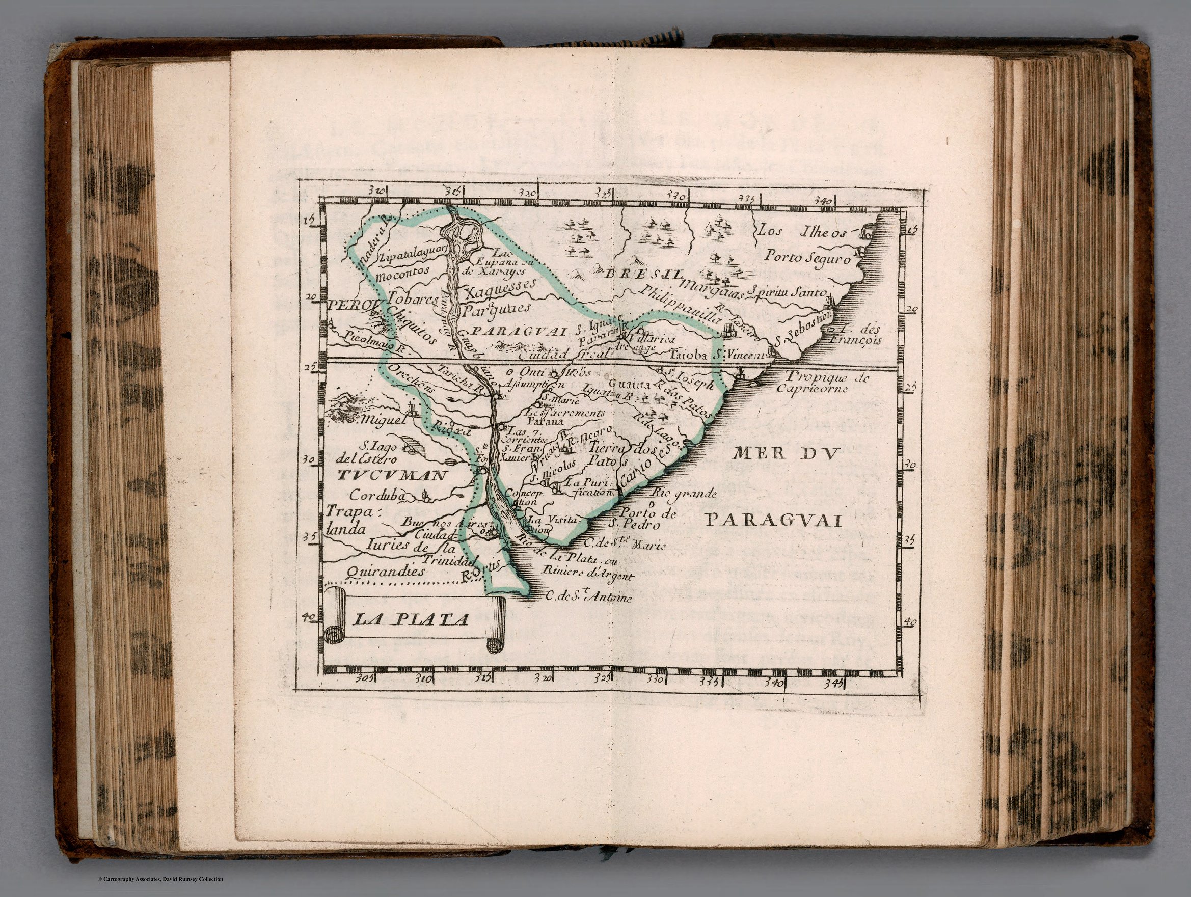
LA PLATA
Mapa 1658![Tierra [Terra]](https://dnet8ble6lm7w.cloudfront.net/art_sm/AECU011.png)
Tierra [Terra]
Obra de arte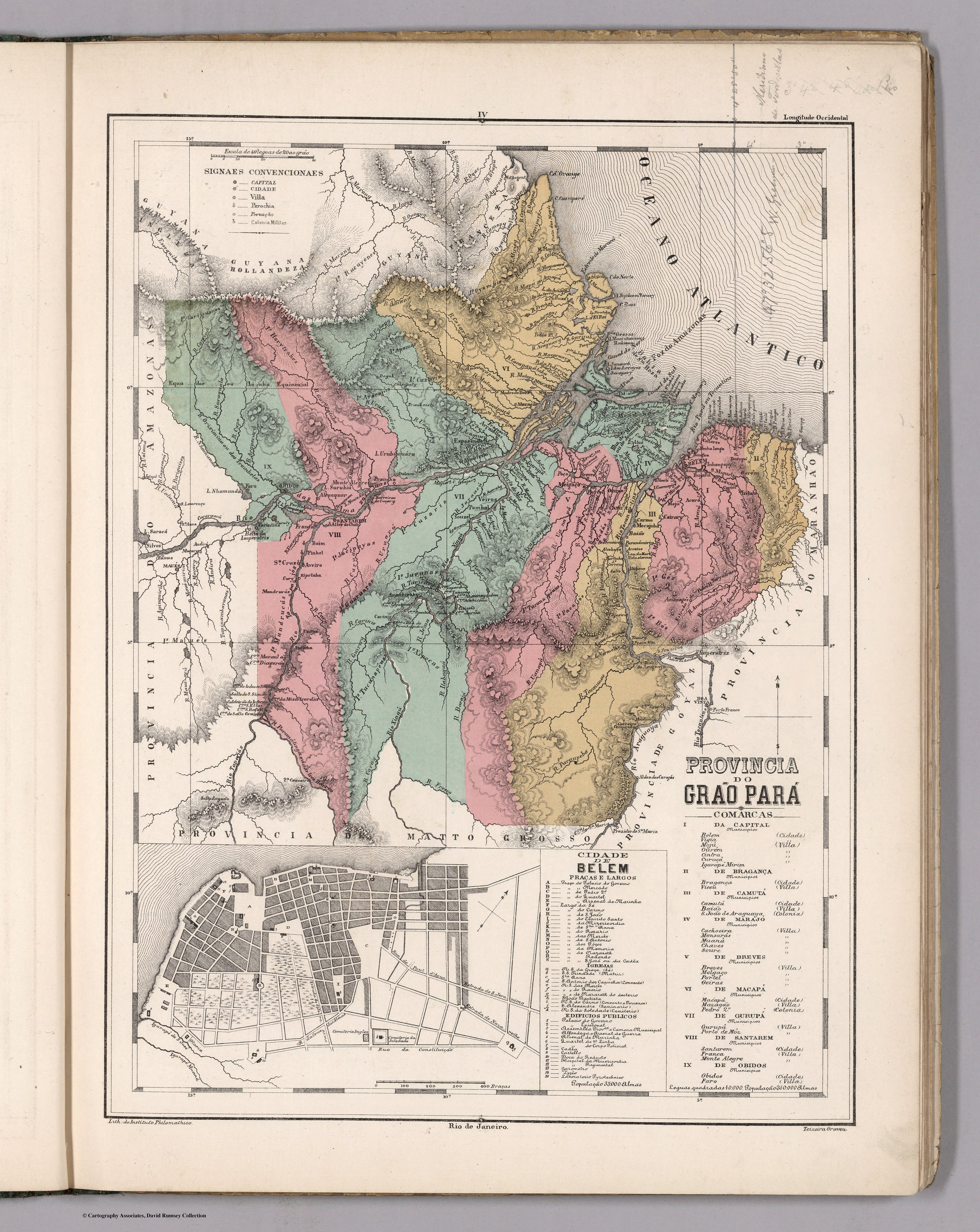
PROVINCIA DO GRAO PARÁ
Mapa 1800 - 1850
Detail from the 1770 copy of Francisco Álvarez Barreiro’s 1728 map of northern New Spain illustrating Spanish mapping of Indian domains in southern Texas and along the Gulf Coast, especially through the repetition of labels: “tierra de los Pampopas,” “tierra de los Carrizos,” “tierra de los Cujanes,” etc.
Mapa 1728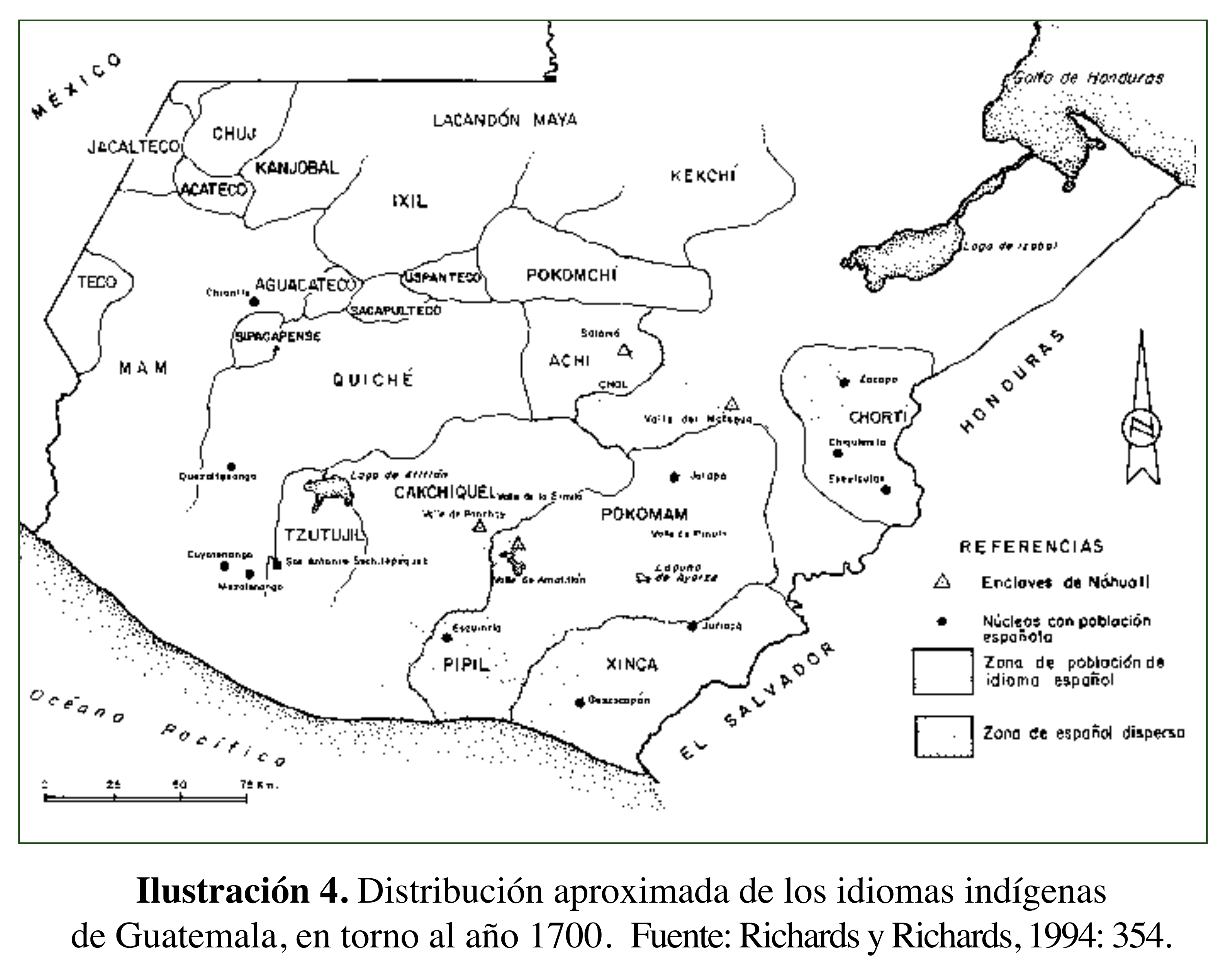
Distribución aproximada de los idiomas indígenas de Guatemala, en torno al año 1700
Mapa 1700