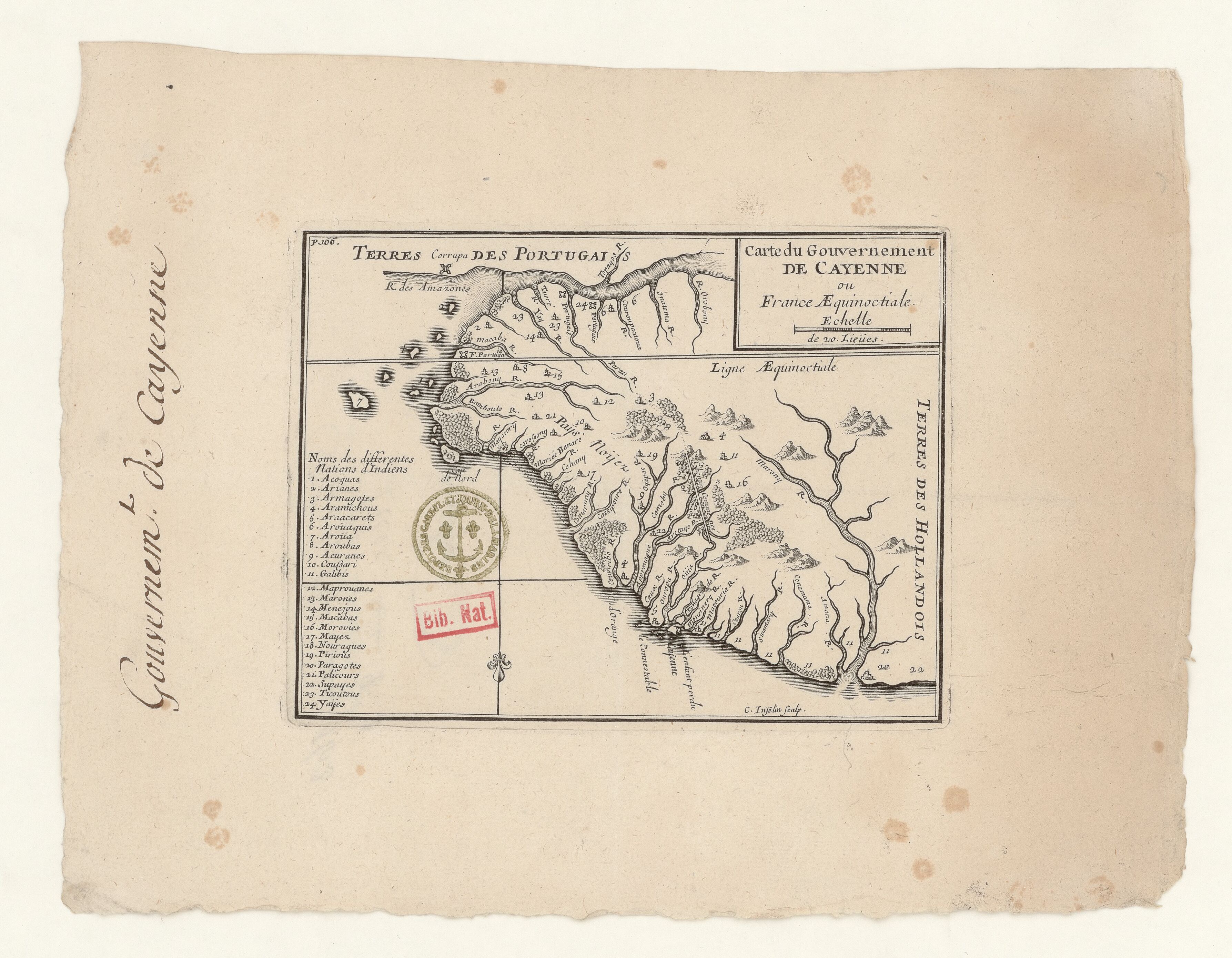
Povos
- ACOQUAS
- ARIANES
- ARMAGOTES
- ARAMICHOUS
- ARAACATES
- AROUAQUIS
- AROUA
- AROUBAS
- ACURANES
- COUSSARI
- GALIBIS
- MAPROUANES
- MARONES
- MENEJOUS
- MACABAS
- MOROVIES
- MAYEZ
- NOURAGUES
- PIRIOUS
- PARAGOTES
- PALICOURS
- SUPAYES
- TICOUTOUS
- YAYES
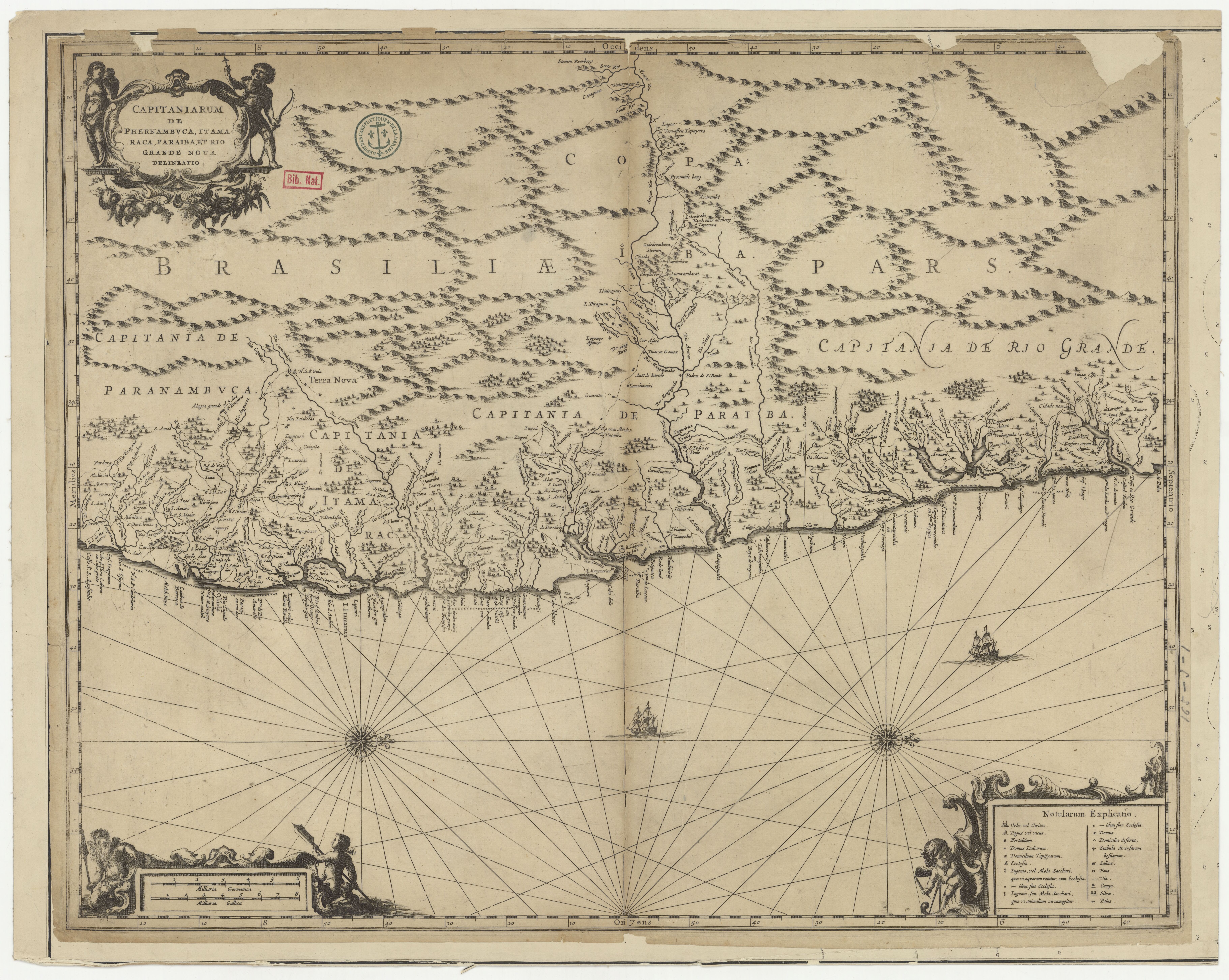
Citation
Carte du Gouvernement de Cayenne ou France Aequinoctiale. Gallica. Last modified: September 21, 2015. Accessed, July 17, 2023. https://gallica.bnf.fr/ark:/12148/btv1b53103525g