Povos
- GALIBI
Citação
Carte de la Guyane française (2ème édition) / Service géographique des colonies. Gallica. Last modified: April 12, 2022. Accessed, June 27, 2023. https://gallica.bnf.fr/ark:/12148/btv1b53171844g

Sketch of the country from reduction to Buenos Ayres, shewing the movements of B. Genl. Beresford, when he captured that place June 1806. Drawn from memorandums furnished by Capt: Donnelly
Mapa 1806![PEI desvío de un río [PEI desvio de um rio]](https://dnet8ble6lm7w.cloudfront.net/art_sm/AARG022.png)
PEI desvío de un río [PEI desvio de um rio]
Obra de arte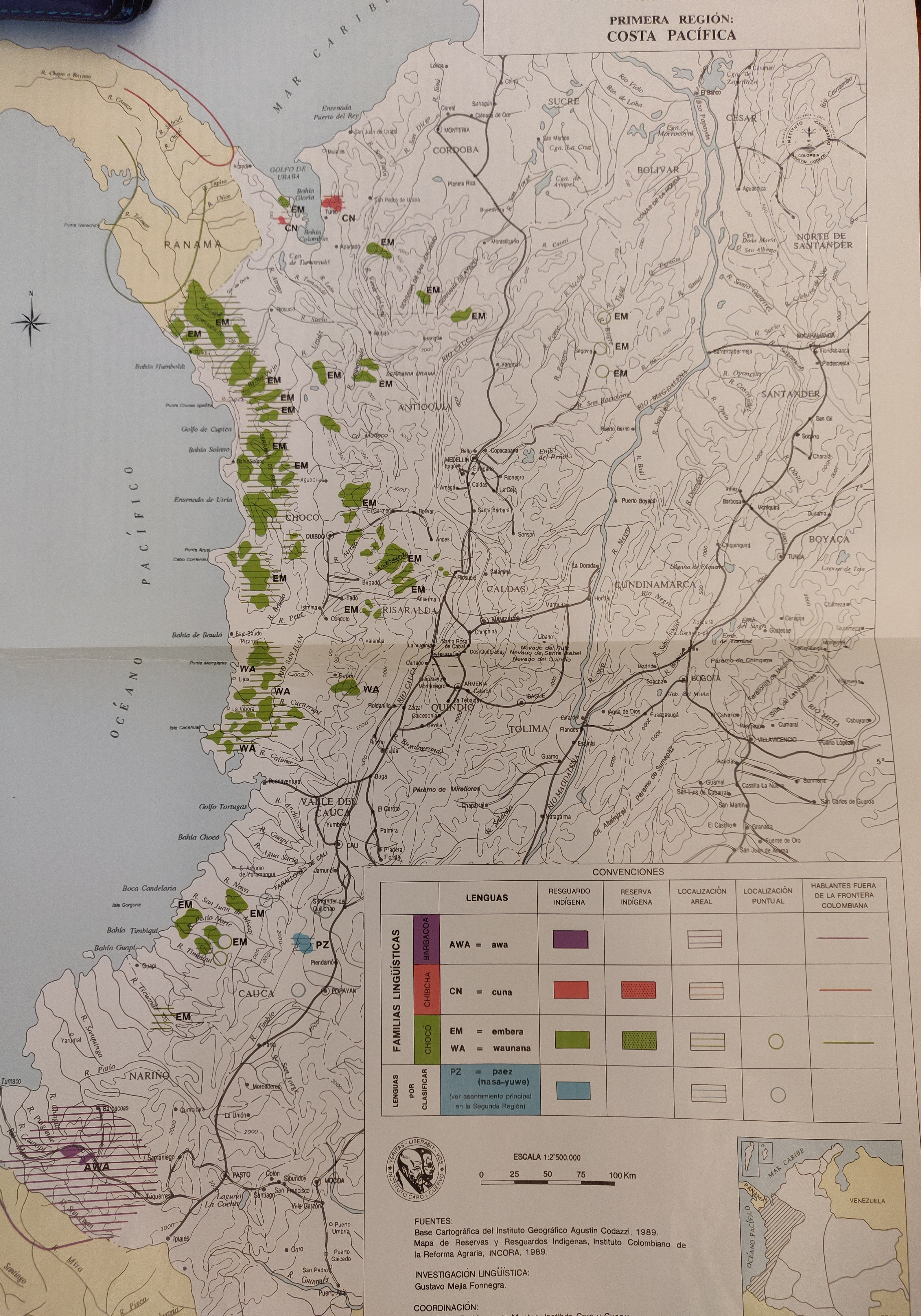
FAMILIAS LINGUISTICAS Y LENGUAS INDIGENAS - PRIMERA REGION: COSTA PACIFICA
Mapa 1989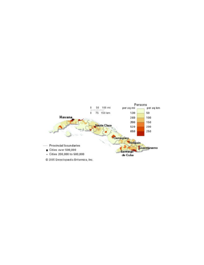
Population density of Cuba
Mapa -4000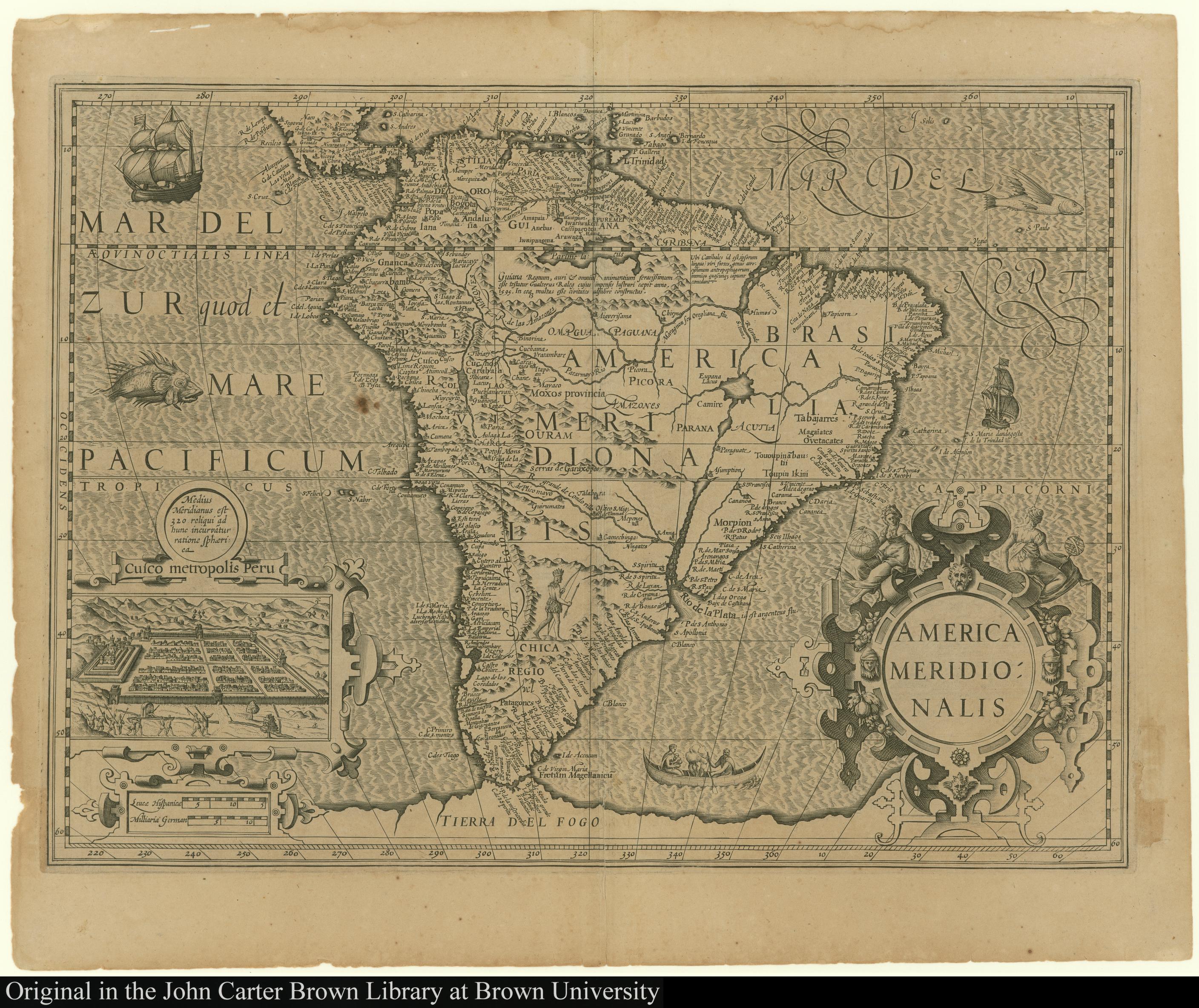
America Meridionalis
Mapa 1619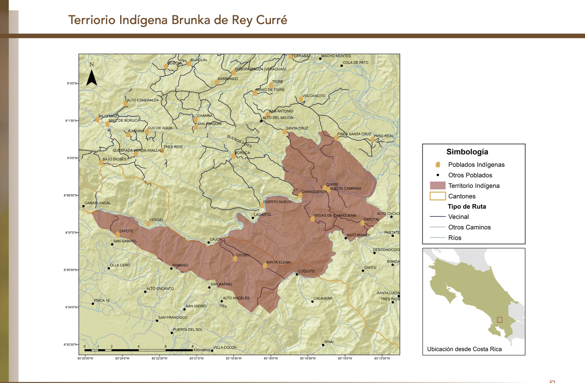
"Territorio Indígena Brunka de Rey Curré"
Mapa 2010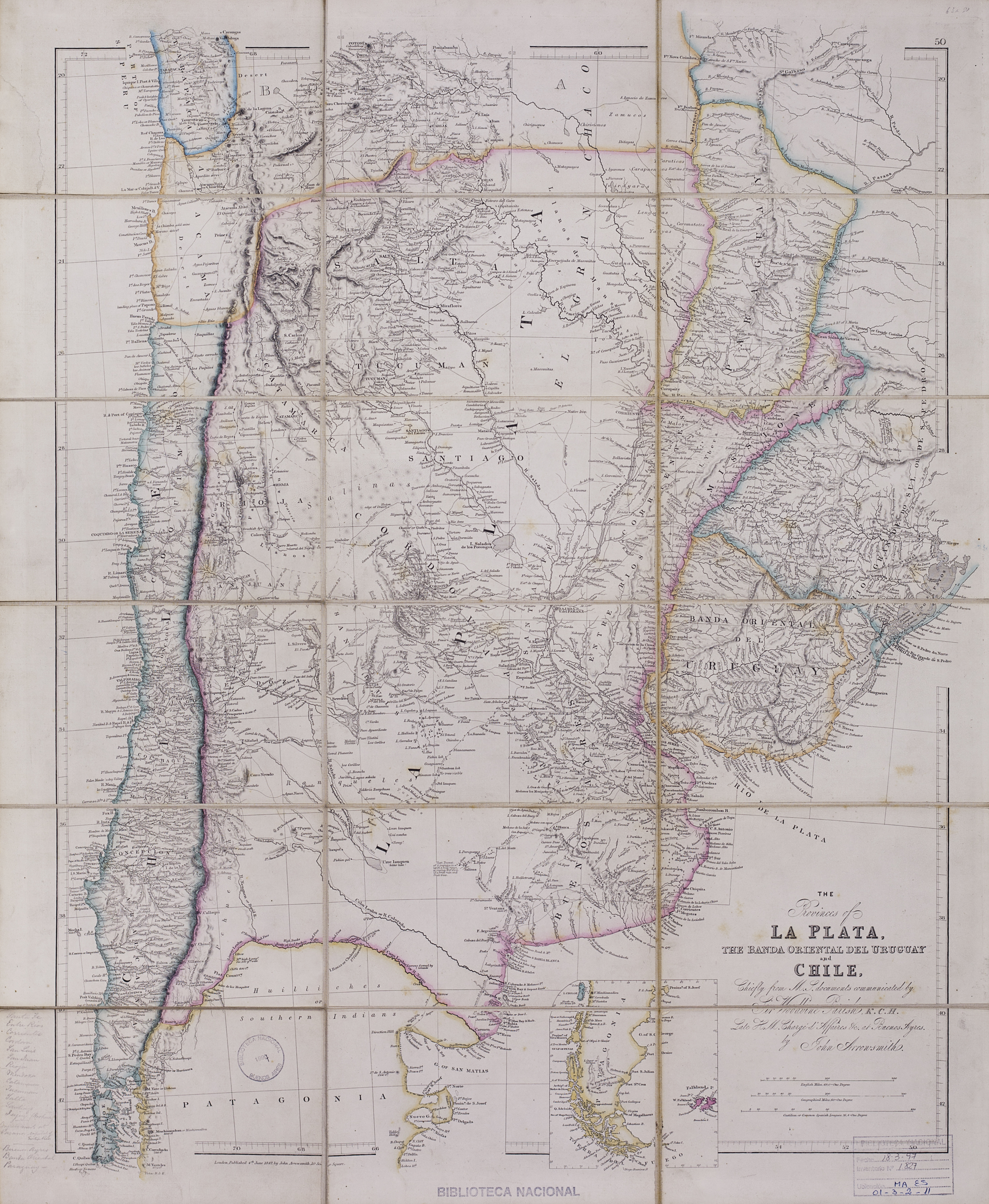
The provinces of La Plata, the Banda Oriental del Uruguay and Chile.
Mapa 1842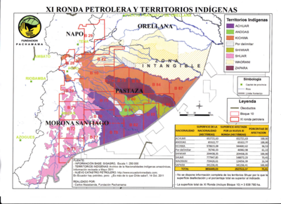
XI RONDA PETROLERA Y TERRITORIOS INDIGENAS
Mapa 2011