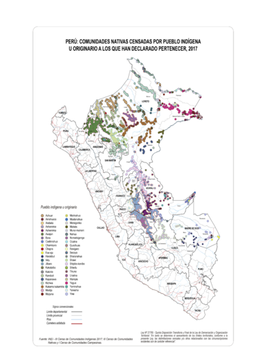
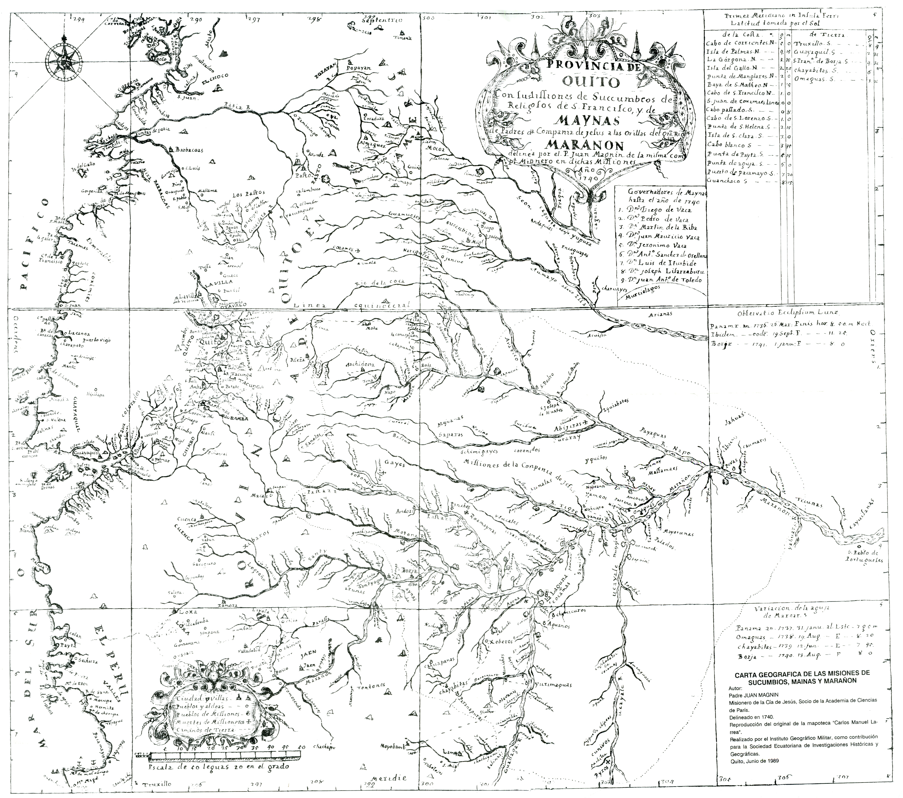
Dispossesions in the Americas

Dispossesions in the Americas

  • Lar
  • Explorar
  • Autores
  • Sobre
  • Arte
  • Corpos
  • Currículos
  • Patrimônio Cultural
  • Mapas
  • Territórios
Voltar à seção Explorar

Lendo em Inglês

Mapa 1740

CARTA GEOGRAFICA DE LAS MISIONES DE SUCUMBIOS;MAINAS Y MARAÑON

  • PADRE JUAN MANGUIN

Publicado: 1989

  • Baixar Imagens
  • Baixar Imagens

Lendo em Espanhola

Mapa 1740

CARTA GEOGRAFICA DE LAS MISIONES DE SUCUMBIOS;MAINAS Y MARAÑON

  • PADRE JUAN MANGUIN

Publicado: 1989

  • Baixar Imagens
  • Baixar Imagens
Mapa 1740

CARTA GEOGRAFICA DE LAS MISIONES DE SUCUMBIOS;MAINAS Y MARAÑON

  • PADRE JUAN MANGUIN

Publicado: 1989

  • Baixar Imagens

Povos

  • ANDOAS
  • TSACHILA
  • OTAVALO
  • SHUAR
  • SAPARA
  • PALTAS
  • ROAMAYNAS
  • YUMBOS
  • JIPIPAJAS

Citation

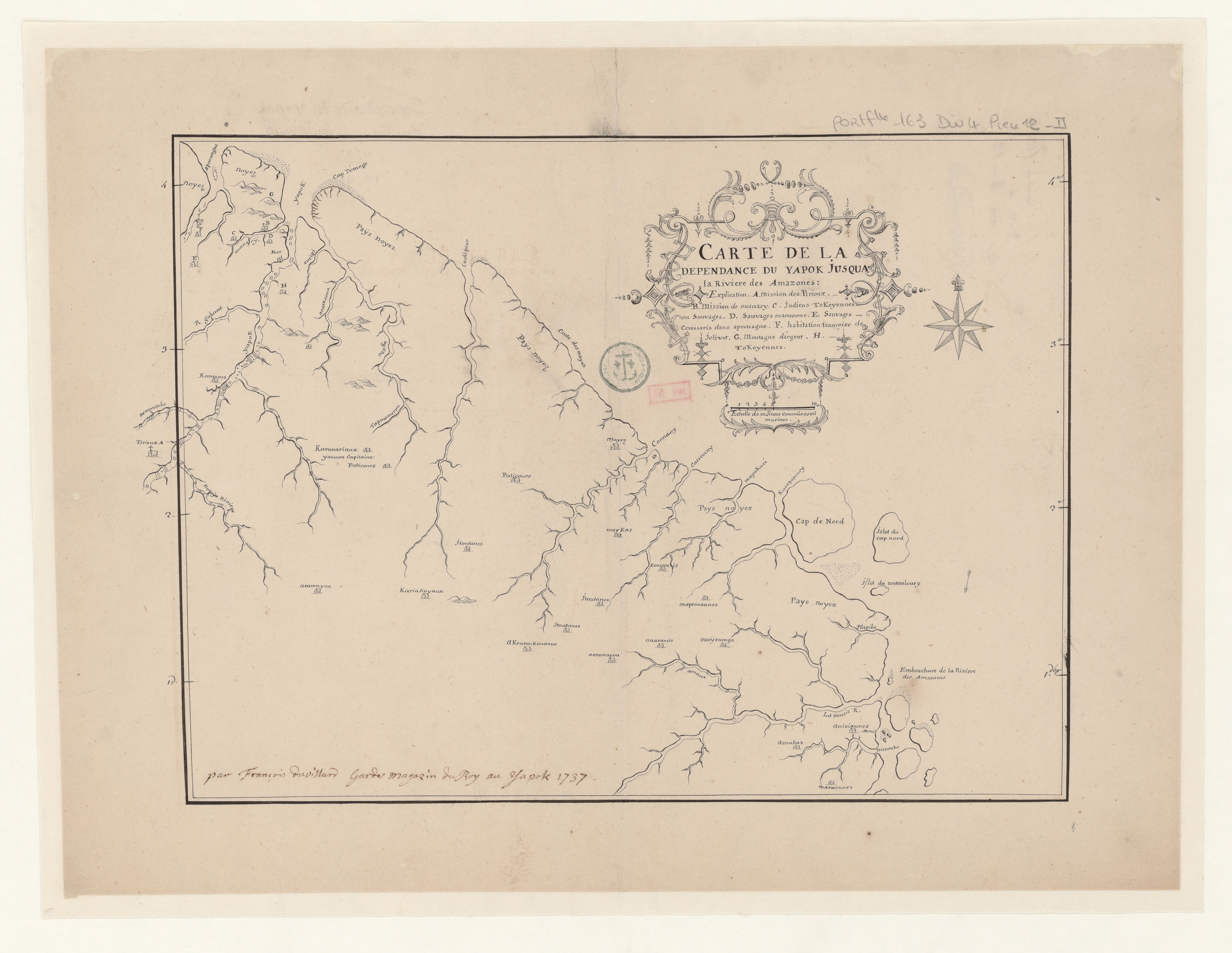
Instituto Geográfico Militar. “File:Mapa De La Audiencia De Quito (1740);Según El Padre ...” Wikimedia;1989. https://commons.wikimedia.org/wiki/File:Mapa_de_la_Audiencia_de_Quito_(1740);_seg%C3%BAn_el_Padre_Juan_Magnin_Misionero_de_la_Compa%C3%B1ia_de_Jes%C3%BAs_-_AHG.jpg.

  • Baixar Imagens

Itens Relacionados

DIVISION DE CORREGIMIENTOS EN LA PROVINCIA DE SANTA FE

DIVISION DE CORREGIMIENTOS EN LA PROVINCIA DE SANTA FE

Mapa 1575
Seropositivo - No positivo [Soropositivo – Não positivo]

Seropositivo - No positivo [Soropositivo – Não positivo]

Obra de arte
PERÚ: COMUNIDADES NATIVAS CENSADAS POR PUEBLO INDÍGENA U ORIGINARIO A LOS QUE HAN DECLARADO PERTENECER, 2017

PERÚ: COMUNIDADES NATIVAS CENSADAS POR PUEBLO INDÍGENA U ORIGINARIO A LOS QUE HAN DECLARADO PERTENECER, 2017

Mapa 2017
Territorio forestal de la Biosfera del Sureste de Nicaragua.

Territorio forestal de la Biosfera del Sureste de Nicaragua.

Mapa 1984 - 2019
CARTE DE LA DEPENDANCE DU YAPOK JUSQU'A la Riviere des Amazones

CARTE DE LA DEPENDANCE DU YAPOK JUSQU'A la Riviere des Amazones

Mapa 1737
4. Ubicación de las comunidades indígenas y composición étnica de la región del Vaupés.

4. Ubicación de las comunidades indígenas y composición étnica de la región del Vaupés.

Mapa 2013
Carta inédita de la extremidad austral de América construída por el P. José Cardiel, S. J. en 1747

Carta inédita de la extremidad austral de América construída por el P. José Cardiel, S. J. en 1747

Mapa 1700 - 1750
No Title

No Title

Mapa 1777

Desapropriações nas Américas

Um projeto de

University of Pennsylvania

Copyright 2024

Com o apoio de

Mellon Foundation

Projeto e desenvolvimento do site

Element 84

Créditos da arte

Instituto Geográfico Militar. “File:Mapa De La Audiencia De Quito (1740);Según El Padre …” Wikimedia;1989. https://commons.wikimedia.org/wiki/File:Mapa_de_la_Audiencia_de_Quito_(1740);_seg%C3%BAn_el_Padre_Juan_Magnin_Misionero_de_la_Compa%C3%B1ia_de_Jes%C3%BAs_-_AHG.jpg.

Páginas do site

  • Lar
  • Explorar
  • Autores
  • Sobre
  • Arte
  • Corpos
  • Currículos
  • Patrimônio Cultural
  • Mapas
  • Territórios