Povos
- PATAGONES
- OREJONES
- TOBAS
- MATARAES
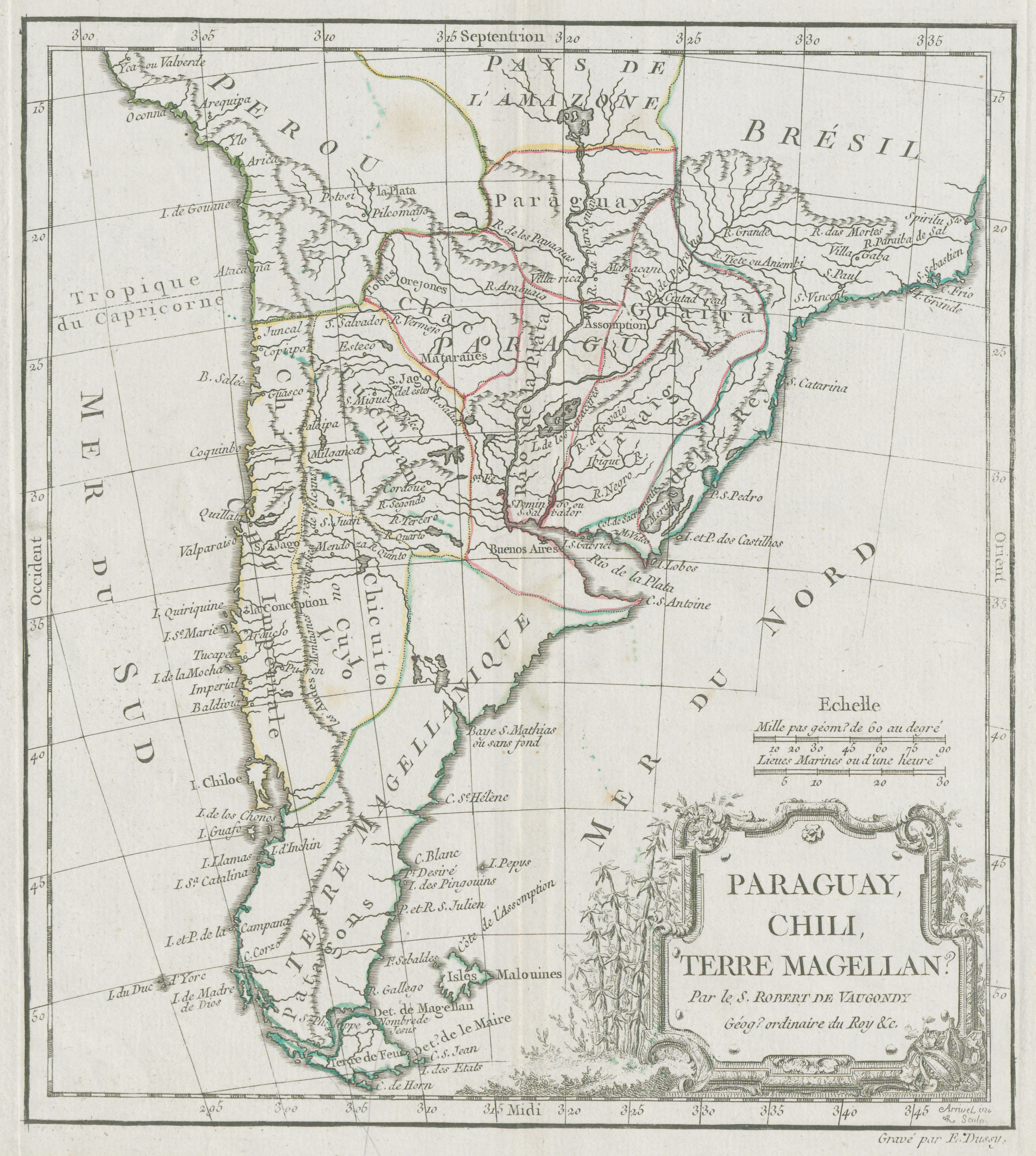
Citação
De Vaugondy, Robert. "Paraguay, Chili, Terre Magellan." Map. 1770. Accessed June 30, 2023. https://digital.iai.spk-berlin.de/viewer/image/630121583/1/LOG_0000/.
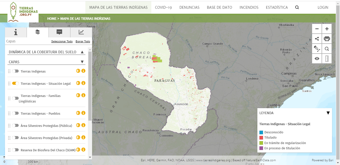
Mapa de las tierras indígenas - Situación legal
Mapa 2017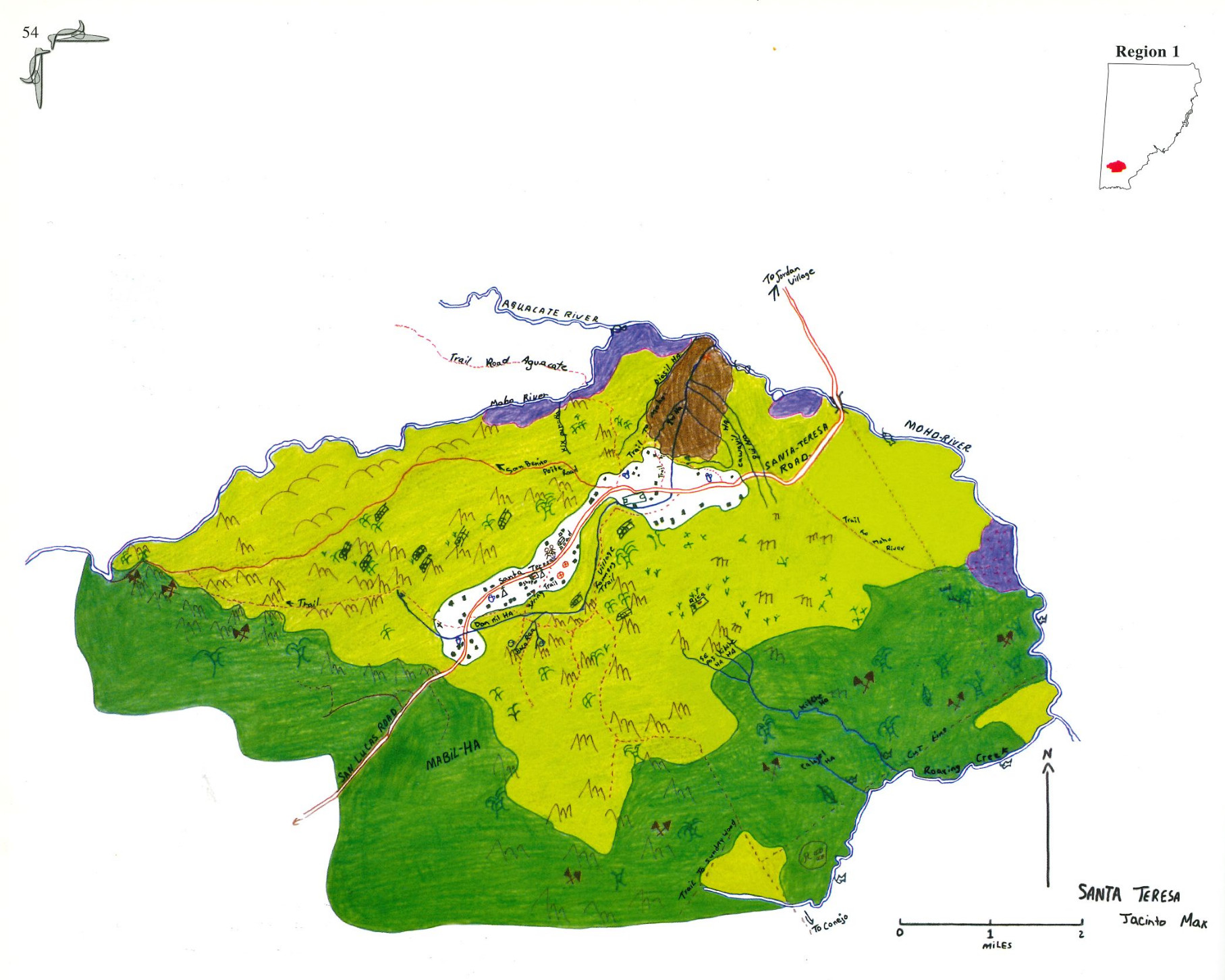
Santa Teresa
Mapa 1997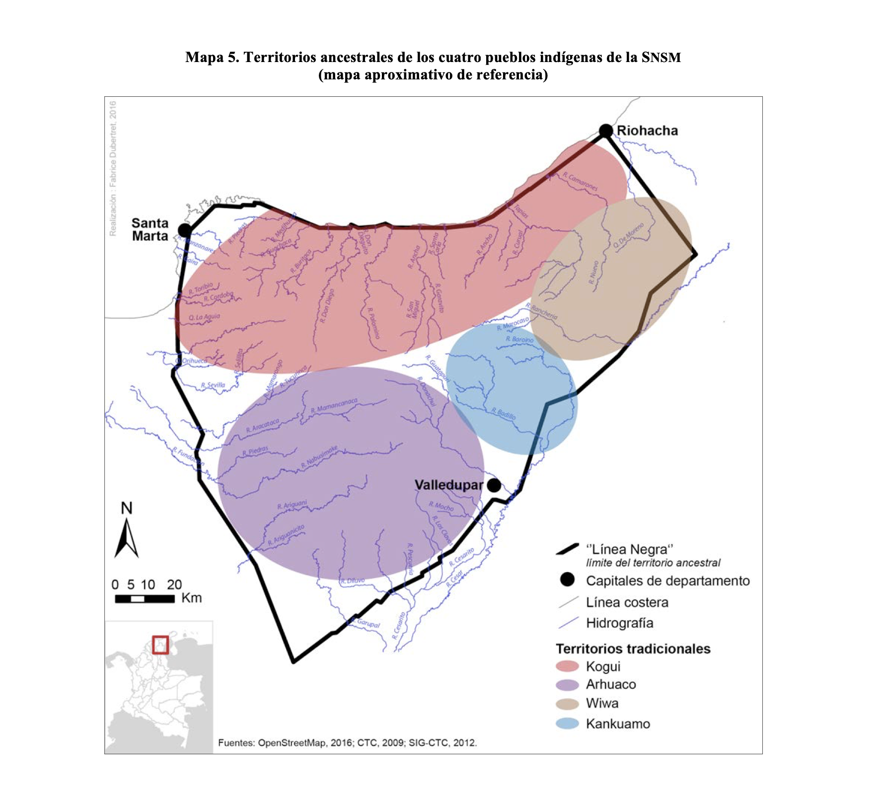
TERRITORIOS ANCESTRALES DE LOS CUATRO PUEBLOS INDIGENAS DE LA SSNM (MAPA APROXIMATIVO DE REFERENCIA)
Mapa 2009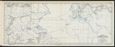
Specialkarte von A. v. HUMBOLDT’S REISEN in VENEZUELA und am ORINOKO-STROM
Mapa 1799 - 1800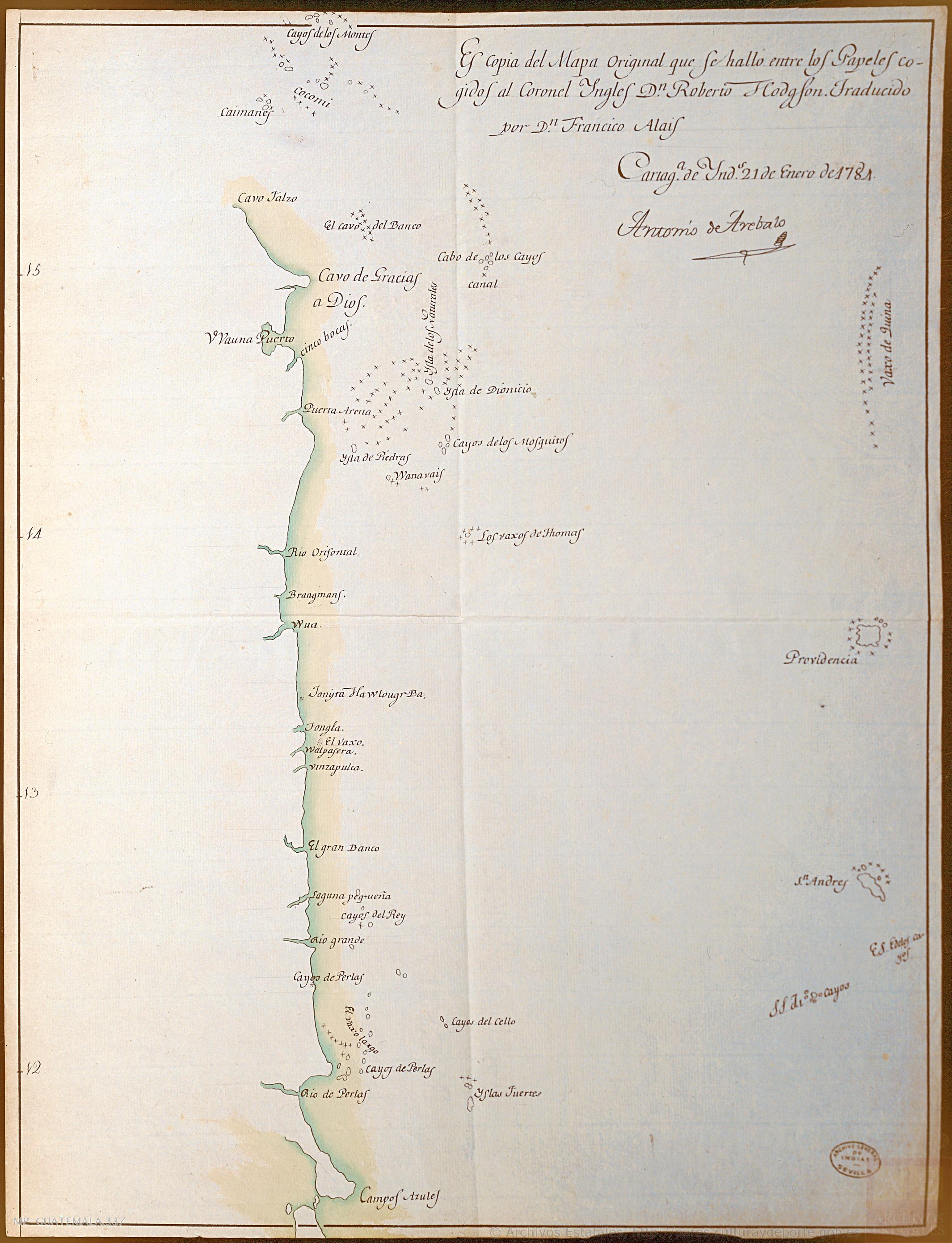
Costa desde Cabo Falso;cerca del Cabo de Gracias a Dios;hasta Bluefields ("Campos Azules") (Nicaragua)
Mapa 1784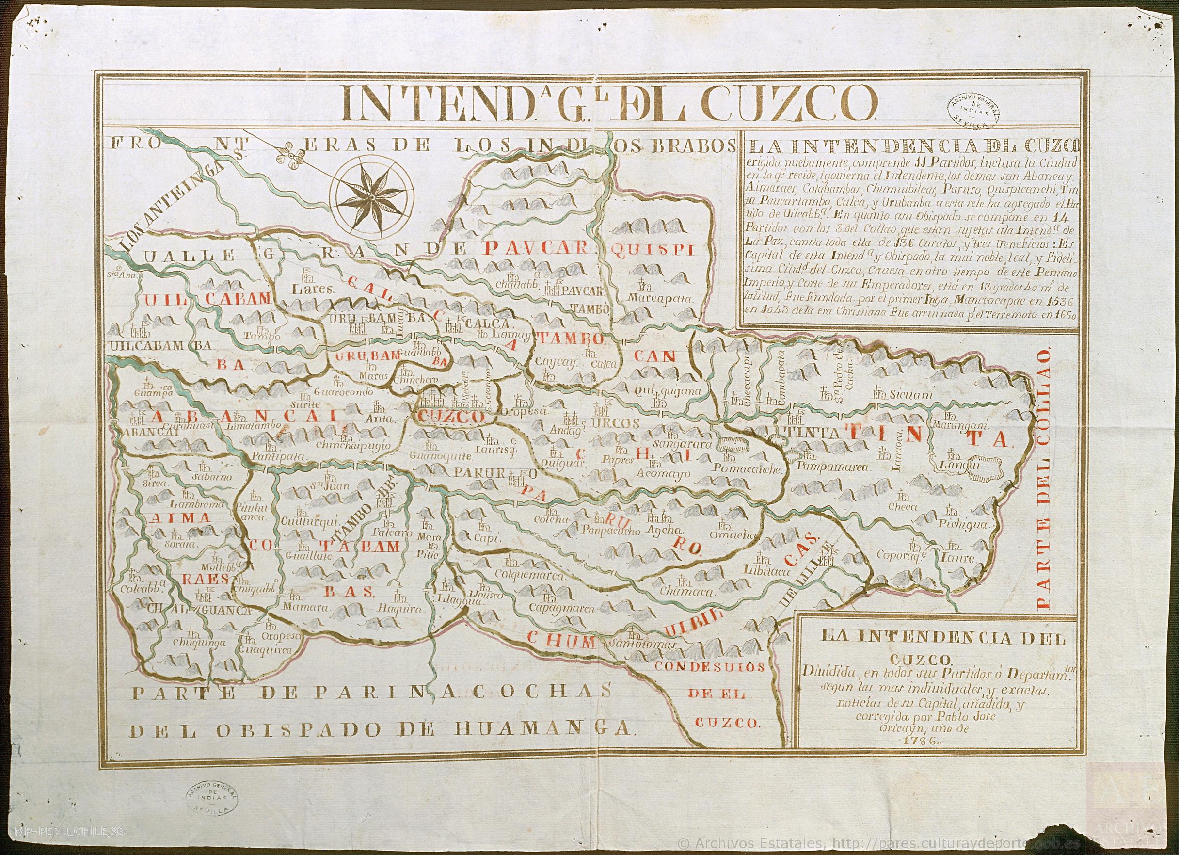
La Intendencia del Cuzco : Diuidida en todos los partidos o departamentos según las más individuales y exactas noticias de su capital, añadida y corregida por Pablo José Oricayn, año de 1786.
Mapa 1786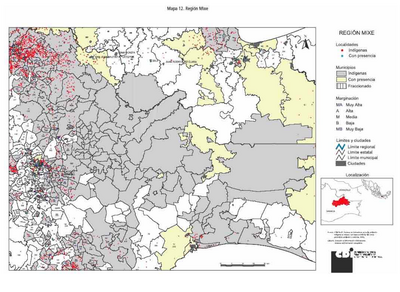
REGIÓN MIXE
Mapa 2000
CARTA DA PROVINCIA DE S. PAULO
Mapa 1887