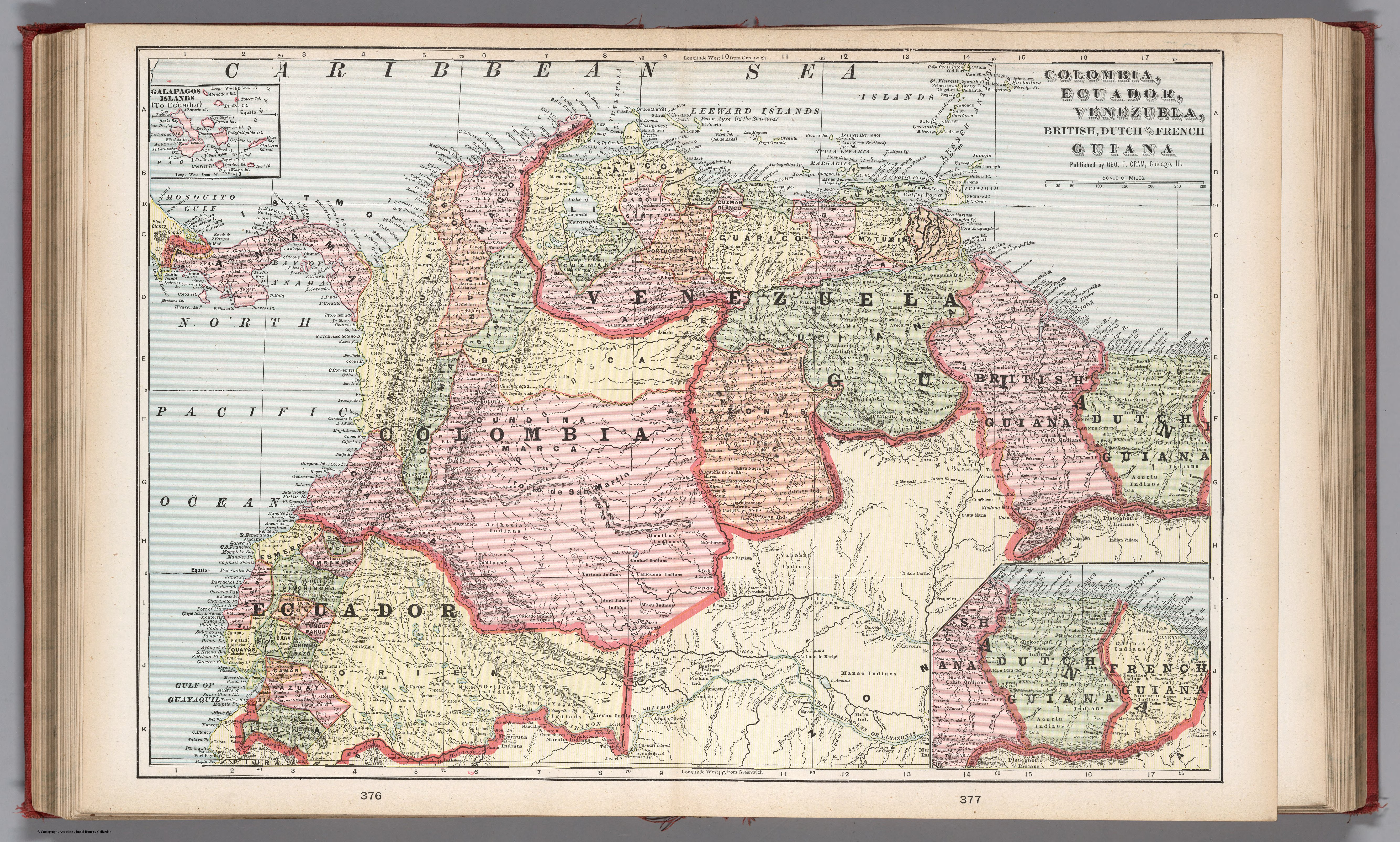
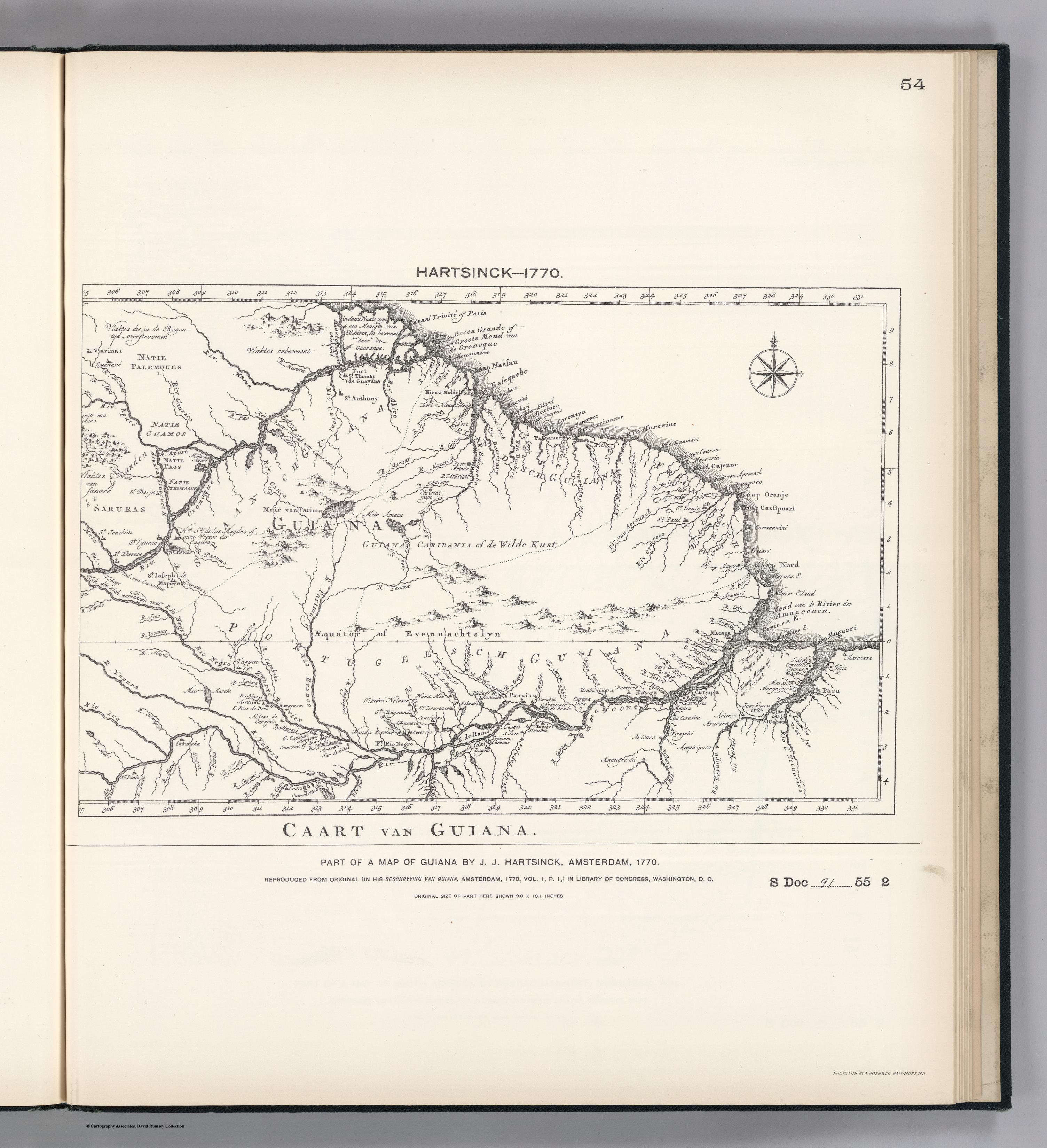
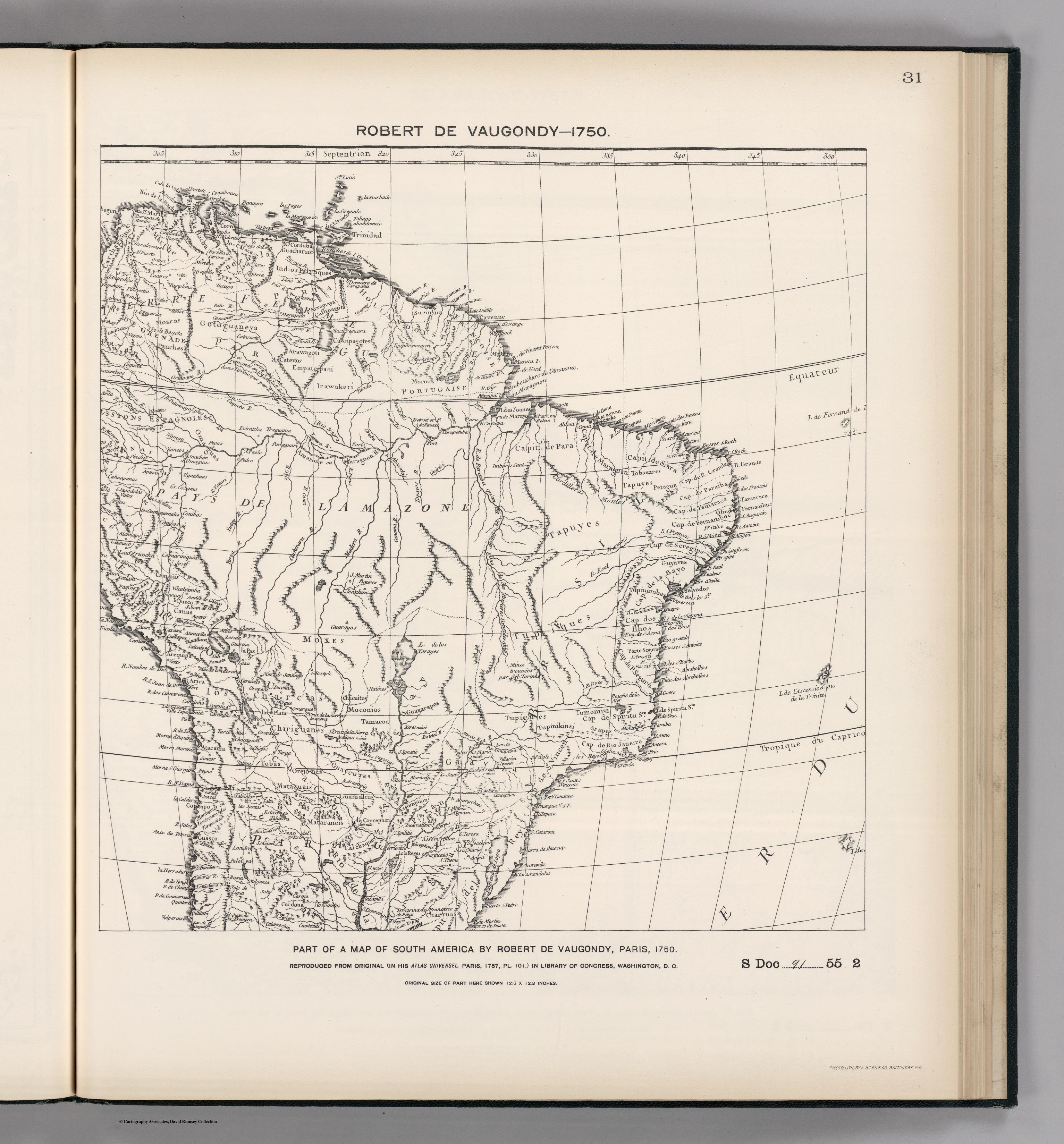
Dispossesions in the Americas

Dispossesions in the Americas

  • Lar
  • Explorar
  • Autores
  • Sobre
  • Arte
  • Corpos
  • Currículos
  • Patrimônio Cultural
  • Mapas
  • Territórios
Voltar à seção Explorar

Lendo em Inglês

Mapa 1750

FACSIMILE: PART OF SOUTH AMERICA BY DE VAUGONDY

  • DE VAUGONDY;ROBERT

Publicado: 1897

  • Baixar Imagem
  • Baixar Imagem

Lendo em Espanhol

Mapa 1750

FACSIMILE: PART OF SOUTH AMERICA BY DE VAUGONDY

  • DE VAUGONDY;ROBERT

Publicado: 1897

  • Baixar Imagem
  • Baixar Imagem
Mapa 1750

FACSIMILE: PART OF SOUTH AMERICA BY DE VAUGONDY

  • DE VAUGONDY;ROBERT

Publicado: 1897

  • Baixar Imagem

Povos

  • PALENQUES
  • ARROMAYA
  • CASSIPAGOTES
  • MOROUX
  • IRAWAKERI
  • EMPATEPAM
  • CATEITOS
  • ARAWAGOTI
  • GOTOGUANEYA
  • MOXCAS
  • PANCHES
  • OMAGUAS
  • TOBAXARES
  • TAPUYES
  • PETAGUE
  • TUPIQUES
  • TUPMAMBES
  • GUYAVES
  • GUAXARAPOS
  • MOCONIOS
  • MOXES
  • TOBAS
  • CHIRIGUANES
  • GUAYCURES
  • OREJONES
  • MATAGUAIS
  • TAMACOA
  • TIPIGUES
  • TUPINIKINSI
  • TOMOMIVI
  • ARAPES
  • CALCHAQUES
  • GUAMALCAS
  • MATARANEIS
  • CHARRUAS

Citação

de Vaugondy, Robert. Facsimile: Part of South America by de Vaugondy. Map. Washington, D.C.: United States of America, 1750. Accessed October 30, 2022. https://www.davidrumsey.com/luna/servlet/detail/RUMSEY~8~1~203979~3001750:Facsimile--Part-of-South-America-by?sort=pub_list_no_initialsort%2Cpub_date%2Cpub_list_no%2Cseries_no#.

  • Baixar Imagem

Itens Relacionados

The tribes of southern South America, at the first European contact period

The tribes of southern South America, at the first European contact period

Mapa 1600 - 1799
PUEBLO MAIJUNA

PUEBLO MAIJUNA

Mapa 2021
PUEBLO CHAPRA

PUEBLO CHAPRA

Mapa 2021
COLUMBIA;ECUADOR;VENEZUELA;BRITISH DUTCH AND FRENCH GUIANA

COLUMBIA;ECUADOR;VENEZUELA;BRITISH DUTCH AND FRENCH GUIANA

Mapa 1900 - 1999
The Spanish and Musketor shore and the bay of Honduras and the islands adjacent

The Spanish and Musketor shore and the bay of Honduras and the islands adjacent

Mapa 1735
PART OF A MAP OF GUIIANA BY J.J. HARTSINCK

PART OF A MAP OF GUIIANA BY J.J. HARTSINCK

Mapa 1770
BRASIL

BRASIL

Mapa 1835
Carte de la dépendance du Yapok jusqu'à la rivière des Amazones.

Carte de la dépendance du Yapok jusqu'à la rivière des Amazones.

Mapa 1600 - 1699

Despossessões nas Américas

Um projeto de

University of Pennsylvania

Copyright 2024

Com o apoio de

Mellon Foundation

Projeto e desenvolvimento do site

Element 84

Créditos da arte

de Vaugondy, Robert. Facsimile: Part of South America by de Vaugondy. Map. Washington, D.C.: United States of America, 1750. Accessed October 30, 2022. https://www.davidrumsey.com/luna/servlet/detail/RUMSEY~8~1~203979~3001750:Facsimile--Part-of-South-America-by?sort=pub_list_no_initialsort%2Cpub_date%2Cpub_list_no%2Cseries_no#.

Páginas do site

  • Lar
  • Explorar
  • Autores
  • Sobre
  • Arte
  • Corpos
  • Currículos
  • Patrimônio Cultural
  • Mapas
  • Territórios