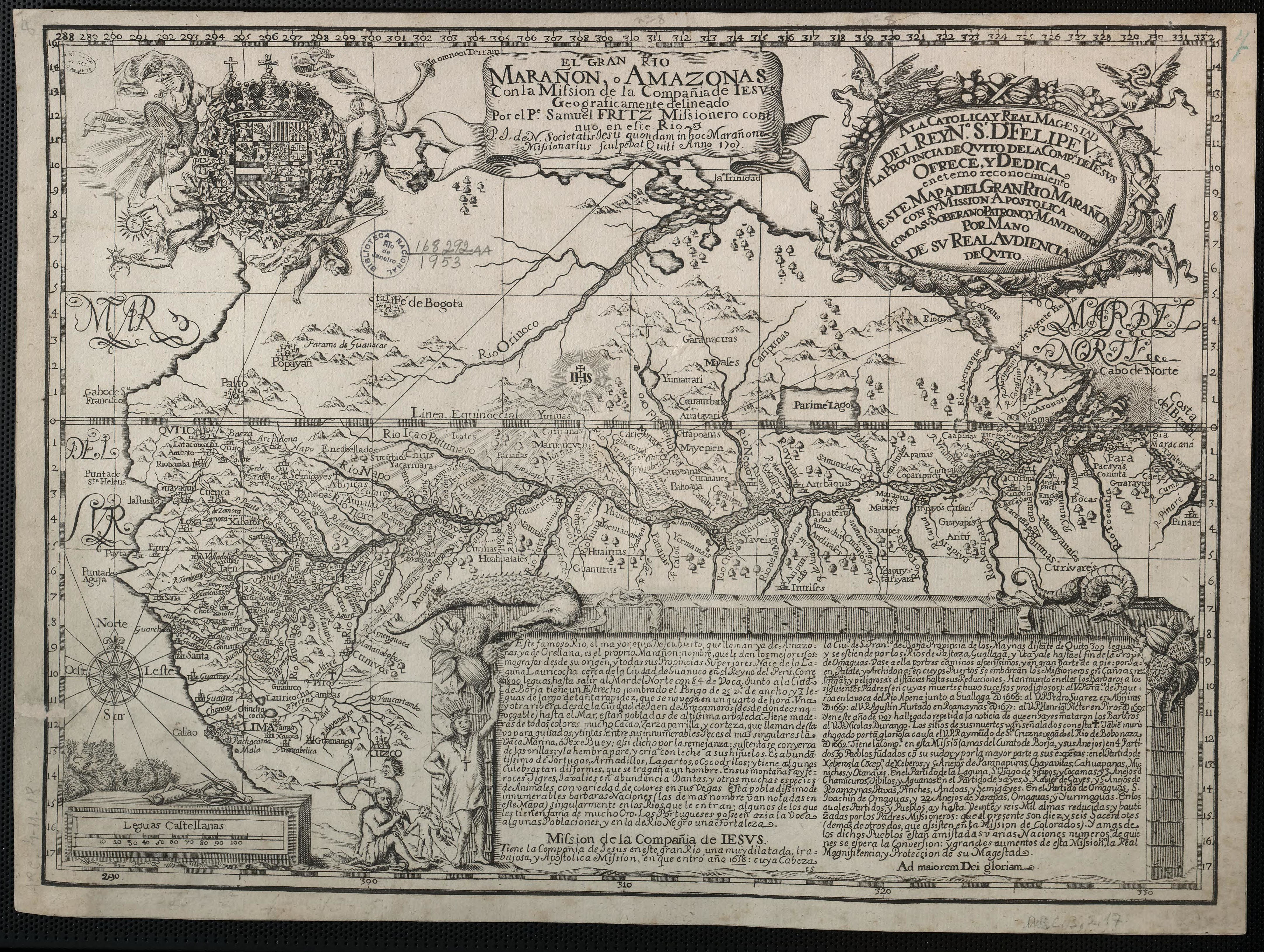
Povos
- WAYUU
- ARAWAK
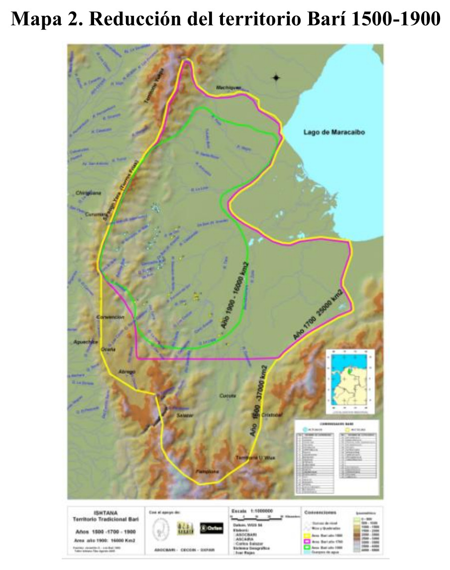
- BARI
- OTOMACO
- SALIVA
- CABERRE
- MAIPURE
- GUAIPUNABE
- AREVIRIANA
- YAVARANA
- YEKUANA
- CARIBE
- XIBAROS
- MAYNAS
- ROAMAYNAS
- OMAGUAS
- CURINAS
- MAMAYANAS
- ORELLUDOS
- ABANOS
- ENCABELLADOS
- CANELOS
- ACANEJOS
- GUYPUNAVIS
- CABRES
- MANETIBITANNAS
- MACUSIAS
- MAJANAOS
- IBASIDANOS
- ARINACUTOS
- NORAGUES
- MACRINAVIS
- MOTILONES
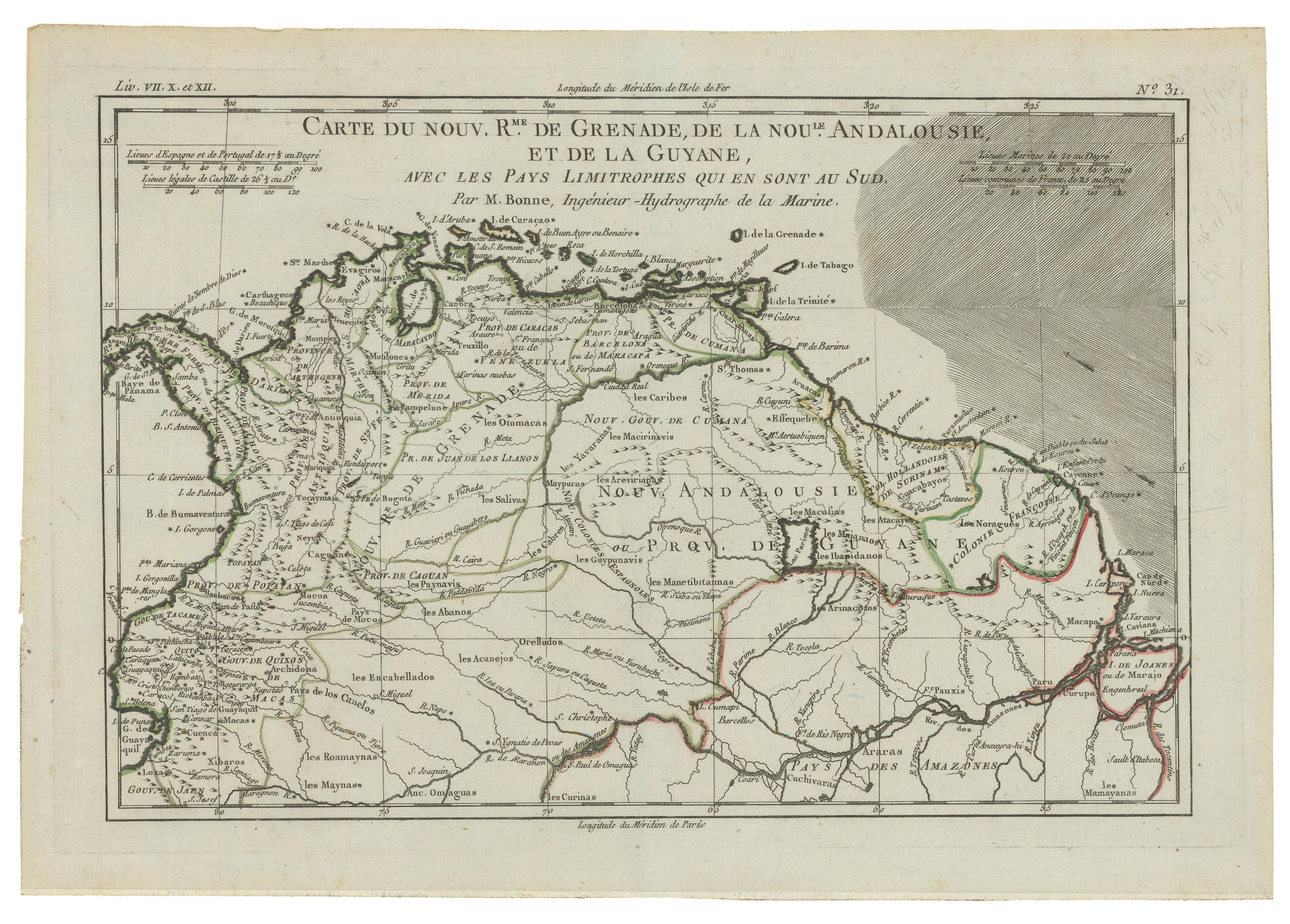
Citação
Bonne, Rigobert. Carte du Nouveau Royaume de Grenade, de la Nouvelle Andalousie, et de la Guyane, avec les Pays limitrophes qui en sont au Sud, 1770. Accessed April 11, 2022. https://babel.banrepcultural.org/digital/collection/p17054coll13/id/88