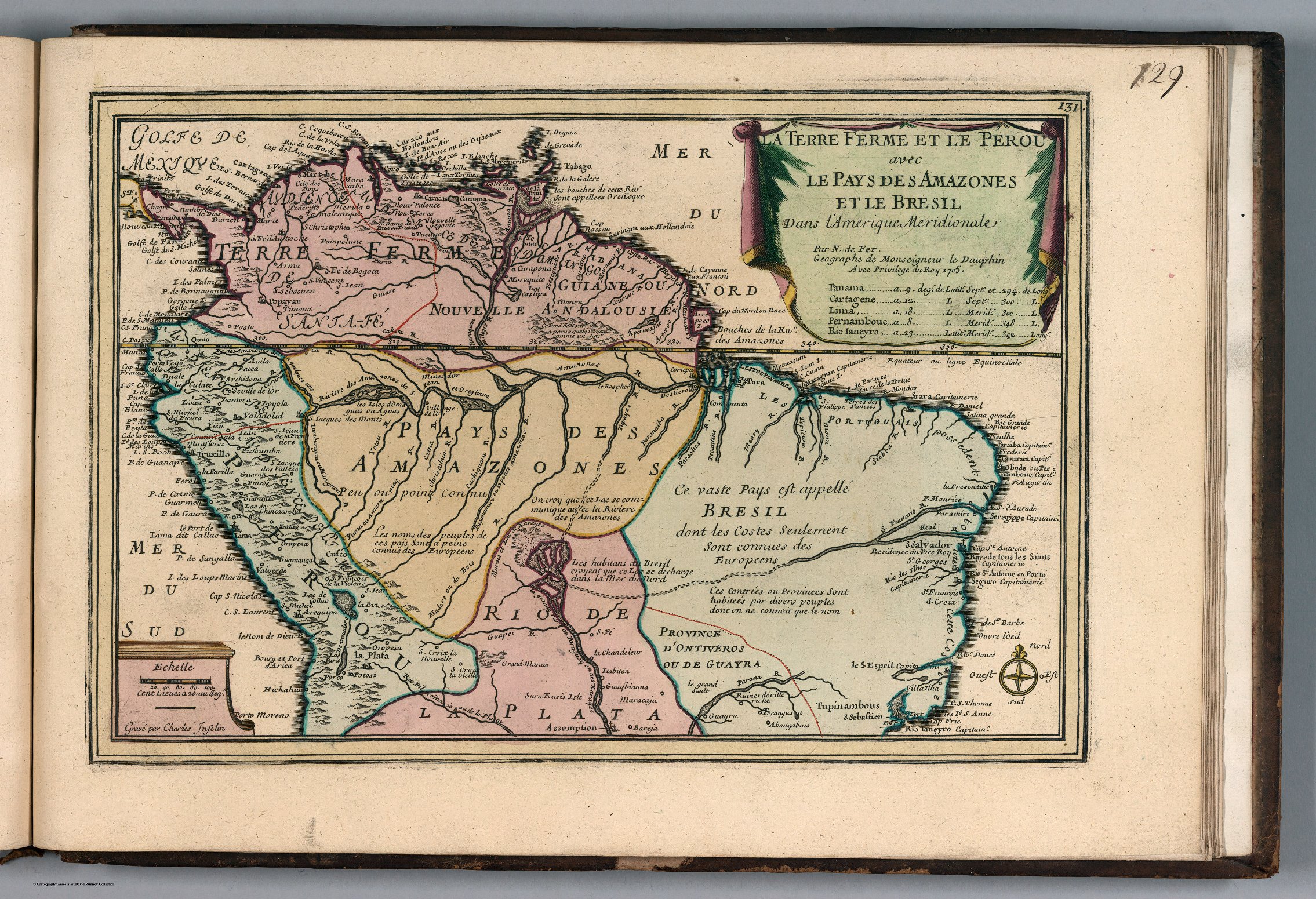
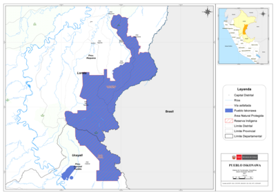
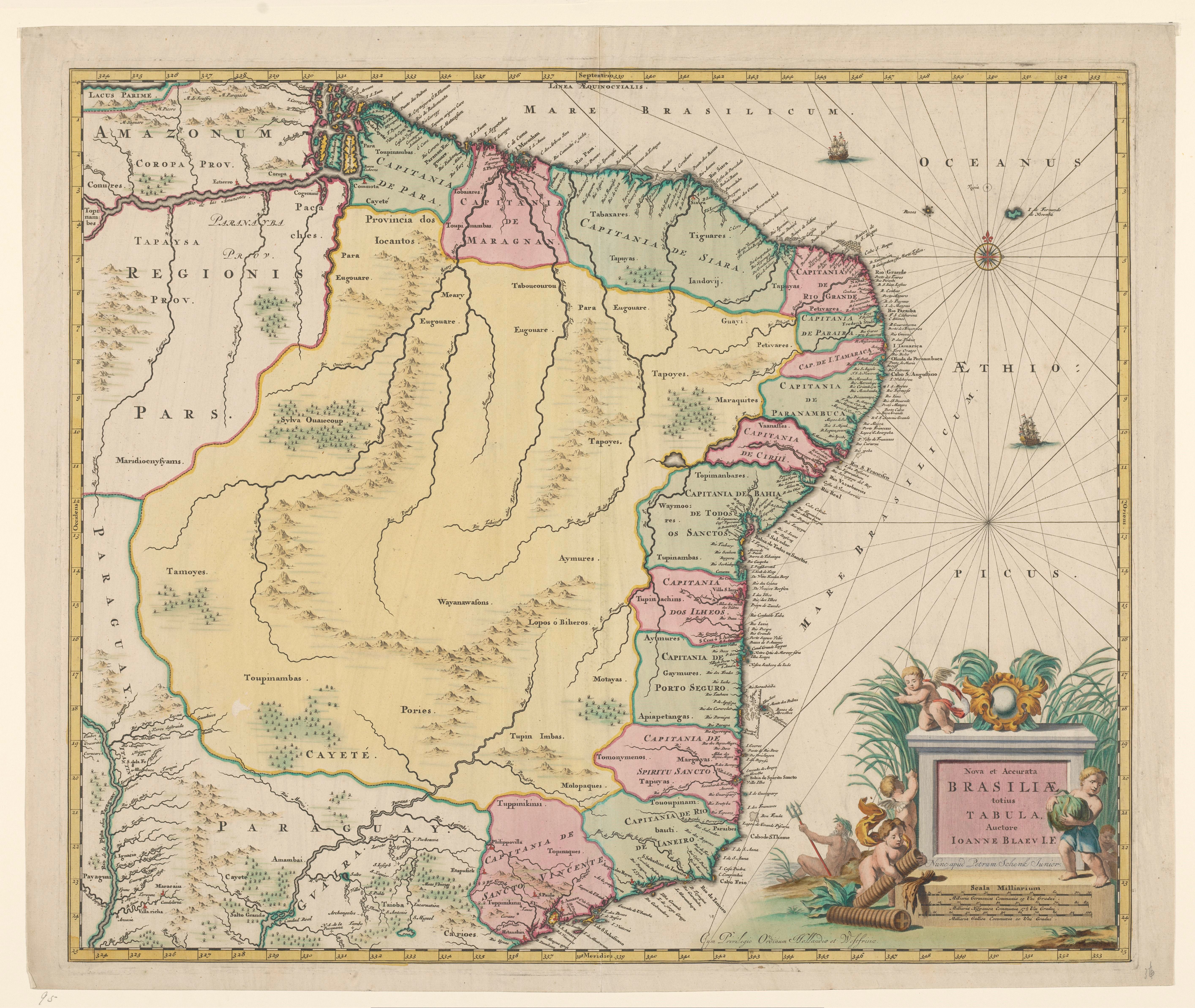
Dispossesions in the Americas

Dispossesions in the Americas

  • Lar
  • Explorar
  • Autores
  • Sobre
  • Arte
  • Corpos
  • Currículos
  • Patrimônio Cultural
  • Mapas
  • Territórios
Voltar à seção Explorar

Lendo em Inglês

Mapa 1700 - 1745

Nova et Accurate BRASILIAE totius TABULA

  • BLAEU, JOHANNES WILLEMSZ

Publicado: 1735-1745

  • Baixar Imagem
  • Baixar Imagem

Lendo em Espanhol

Mapa 1700 - 1745

Nova et Accurate BRASILIAE totius TABULA

  • BLAEU, JOHANNES WILLEMSZ

Publicado: 1735-1745

  • Baixar Imagem
  • Baixar Imagem
Mapa 1700 - 1745

Nova et Accurate BRASILIAE totius TABULA

  • BLAEU, JOHANNES WILLEMSZ

Publicado: 1735-1745

  • Baixar Imagem

Povos

  • CONURES
  • PACACHES
  • TAPAYSA
  • MARIDIOCNYSYAMS
  • PAYAGUAS
  • MARACAIU
  • AMAMBAI
  • TAIOBA
  • CARIOES
  • TOUPINAMBAS
  • CAYETE
  • TOBAIARES
  • COMMOTA
  • TABAXARES
  • TAPUYAS
  • TIGUARES
  • IANDOVIJ
  • PETIVARES
  • VAANAFFES
  • TOPIMANBAZES
  • WAYMOORES
  • TUPINACHINS
  • AYMURES
  • GAYMURES
  • APIAPETANGAS
  • TOMONYMENOS
  • MARGAYAS
  • TAPUYAS
  • TOUOUPINAMBAUTI
  • PARAIBES
  • TUPPINIKINSI
  • TOPINAQUES
  • TUPPINIKINS
  • MEARY
  • EUGOUARE
  • TABOUCOUROU
  • EUGOUARE
  • PARA
  • TAPOYES
  • GUAYI
  • PETIVARES
  • MARAQUITES
  • AYMURES
  • LOPOS O BIHEROS
  • MOTAYAS
  • TUPIN IMBAS
  • MOLOPAQUES
  • PORIES
  • WAYANAWASONS
  • SYLVA OUAIECOUP
  • CAETE
  • TABAJARA
  • POTIGUARA
  • AYMORE
  • TUPINIKIM
  • TUPINAMBA
  • PURI

Citação

Blaeu, Johannes Willemsz. Nova et Accurate Brasiliae totius tabula. Map. Amsterdam: Pieter Schenk & Johannes de Broen, 1735-1745. Accessed June 30, 2023. https://www.rijksmuseum.nl/nl/collectie/NG-501-95.

  • Baixar Imagem

Itens Relacionados

Comunidad "Territorio Indígena General E. Mosconi Tres Paraísos" - Pueblo Wichí

Comunidad "Territorio Indígena General E. Mosconi Tres Paraísos" - Pueblo Wichí

Mapa 2020
Die LANDSCHAFT nider = Paraguaria

Die LANDSCHAFT nider = Paraguaria

Mapa 1728
A Sequel of the Seat of War in the West Indies containing… Sub-map title: A large & accurate MAP of part of the Isthmus of Panama, taken from a Spanish drought exhibiting the Country adjacent to that City and Puerto Bello, with the Roads and Course of the River CHAGRE, by which the Treasure of the South Sea is conveyed a cross the Isthmus

A Sequel of the Seat of War in the West Indies containing… Sub-map title: A large & accurate MAP of part of the Isthmus of Panama, taken from a Spanish drought exhibiting the Country adjacent to that City and Puerto Bello, with the Roads and Course of the River CHAGRE, by which the Treasure of the South Sea is conveyed a cross the Isthmus

Mapa 1740
A TERRE FERME ET LE PEROU AVEC LE PAYS DES AMAZONES ET LE BRESIL

A TERRE FERME ET LE PEROU AVEC LE PAYS DES AMAZONES ET LE BRESIL

Mapa 1705
SOUTH AMERICA FROM THE BEST AUTHORITIES

SOUTH AMERICA FROM THE BEST AUTHORITIES

Mapa 1802
PUEBLO ISKONAWA

PUEBLO ISKONAWA

Mapa 2021
Ethnolinguistic territories of the Californias

Ethnolinguistic territories of the Californias

Mapa 2007
Mapa de Idiomas Nacionales, República de Guatemala B'o'oylu'um Xokt'an ti a' Nojlu'umil ti Paxi (Itza')

Mapa de Idiomas Nacionales, República de Guatemala B'o'oylu'um Xokt'an ti a' Nojlu'umil ti Paxi (Itza')

Mapa 2016

Despossessões nas Américas

Um projeto de

University of Pennsylvania

Copyright 2024

Com o apoio de

Mellon Foundation

Projeto e desenvolvimento do site

Element 84

Créditos da arte

Blaeu, Johannes Willemsz. Nova et Accurate Brasiliae totius tabula. Map. Amsterdam: Pieter Schenk & Johannes de Broen, 1735-1745. Accessed June 30, 2023. https://www.rijksmuseum.nl/nl/collectie/NG-501-95.

Páginas do site

  • Lar
  • Explorar
  • Autores
  • Sobre
  • Arte
  • Corpos
  • Currículos
  • Patrimônio Cultural
  • Mapas
  • Territórios