
Citação
United States Department of Commerce, Transportation Department. 1920. "Railroad Map of British Honduras." https://hdl.loc.gov/loc.wdl/wdl.11329
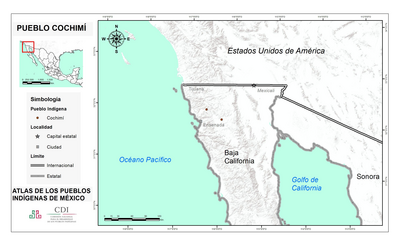
PUEBLO COCHIMI
Mapa 2020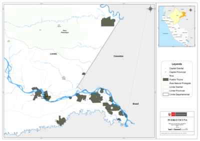
PUEBLO TICUNA
Mapa 2021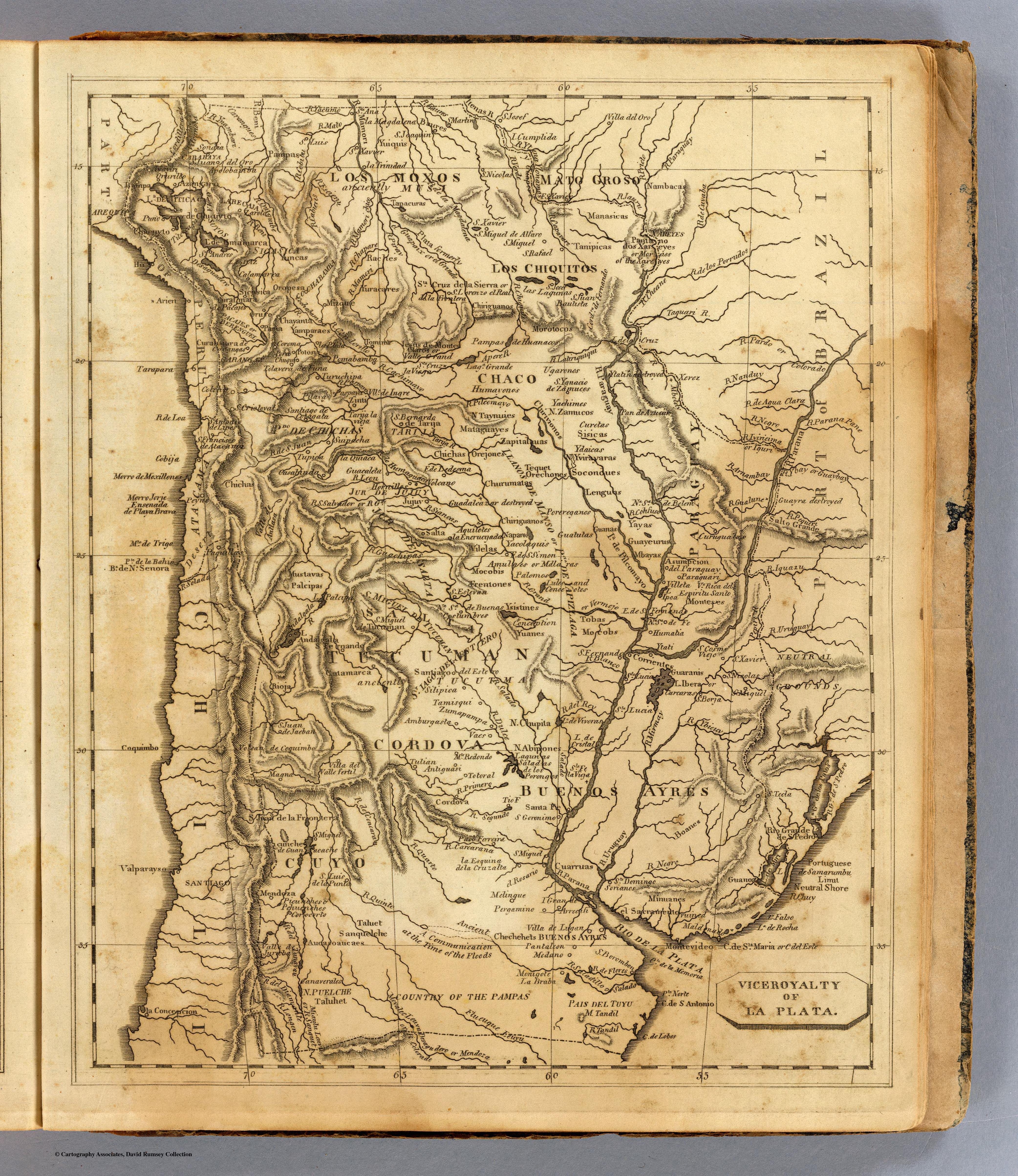
Viceroyalty of La Plata
Mapa 1812![[Carte manuscrite de l'embouchure de Rio da Prata]](https://dnet8ble6lm7w.cloudfront.net/maps/URU/URU0025.jpeg)
[Carte manuscrite de l'embouchure de Rio da Prata]
Mapa 1740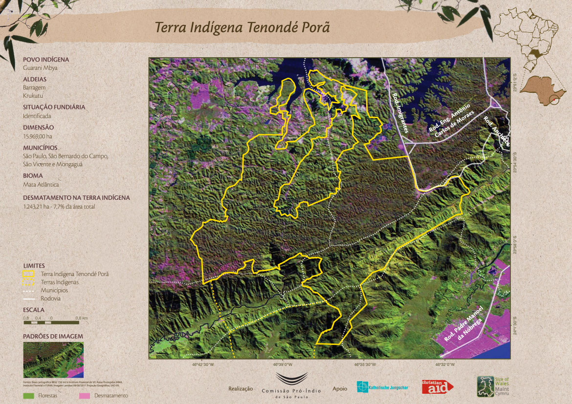
Terra Indígena Tenondé Porã
Mapa 2011
Carte du gouvernement de Cayenne avec le Nombre des habitations, le lieu ou elles sont situées et le nom de ceux a qui elles appartiennent
Mapa 1600 - 1699
Pueblos indígenas en el Perú amazónico
Mapa 2009
Maya Land Use and Outside Threats
Mapa 1997