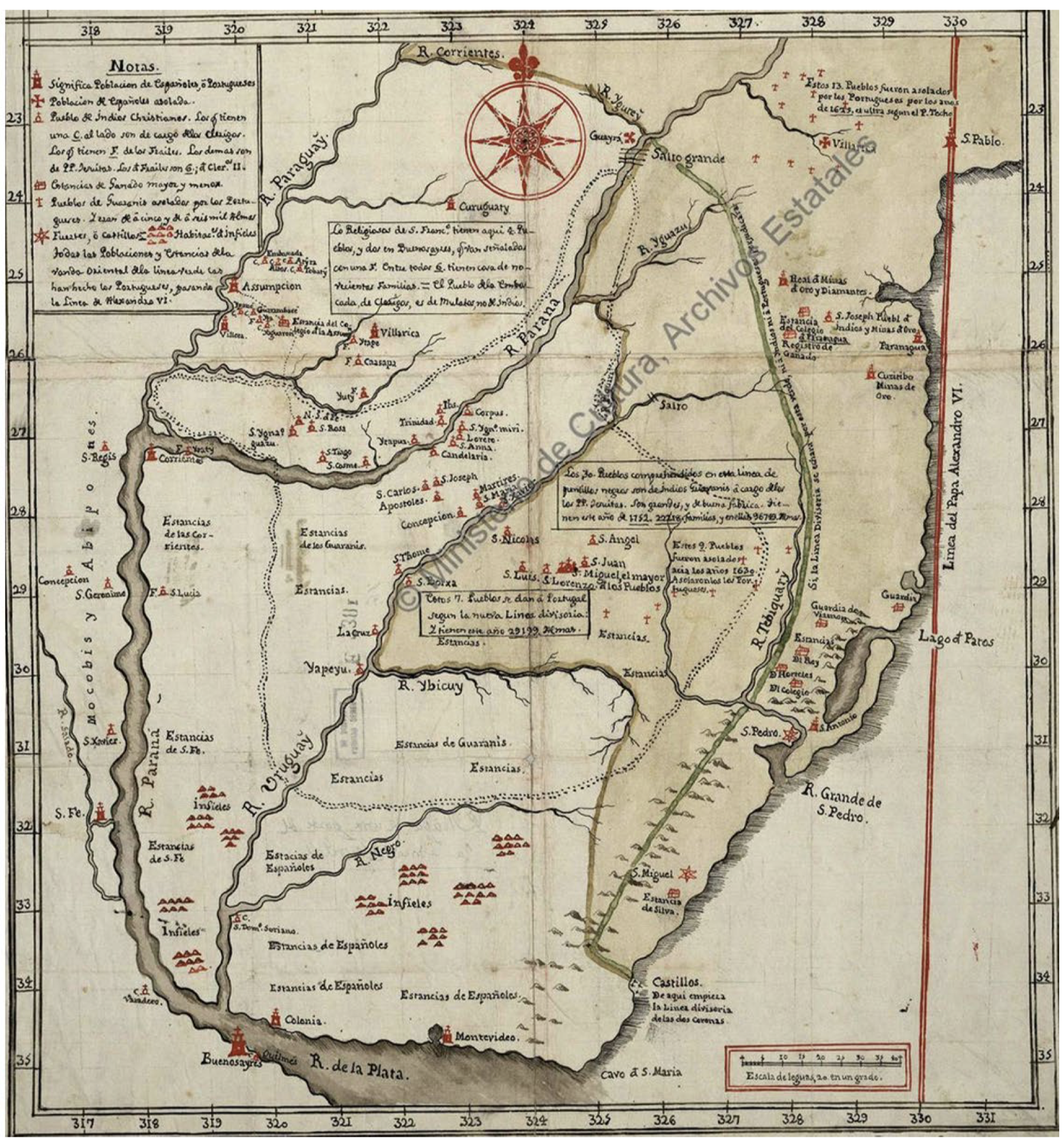
Dispossesions in the Americas

Dispossesions in the Americas

  • Lar
  • Explorar
  • Autores
  • Sobre
  • Arte
  • Corpos
  • Currículos
  • Patrimônio Cultural
  • Mapas
  • Territórios
Voltar à seção Explorar

Lendo em Inglês

Mapa 1752

Mapa De La Gobernación Del Paraguay Y Buenos Aires, Con La Línea Divisoria De Las Tierras De España Y Portugal_1752.

  • NN

Publicado: 1752

  • Baixar Imagens
  • Baixar Imagens

Lendo em Espanhola

Mapa 1752

Mapa De La Gobernación Del Paraguay Y Buenos Aires, Con La Línea Divisoria De Las Tierras De España Y Portugal_1752.

  • NN

Publicado: 1752

  • Baixar Imagens
  • Baixar Imagens
Mapa 1752

Mapa De La Gobernación Del Paraguay Y Buenos Aires, Con La Línea Divisoria De Las Tierras De España Y Portugal_1752.

  • NN

Publicado: 1752

  • Baixar Imagens

Povos

  • GUARANI
  • INDIOS
  • MOCOVI
  • ABIPONES

Citation

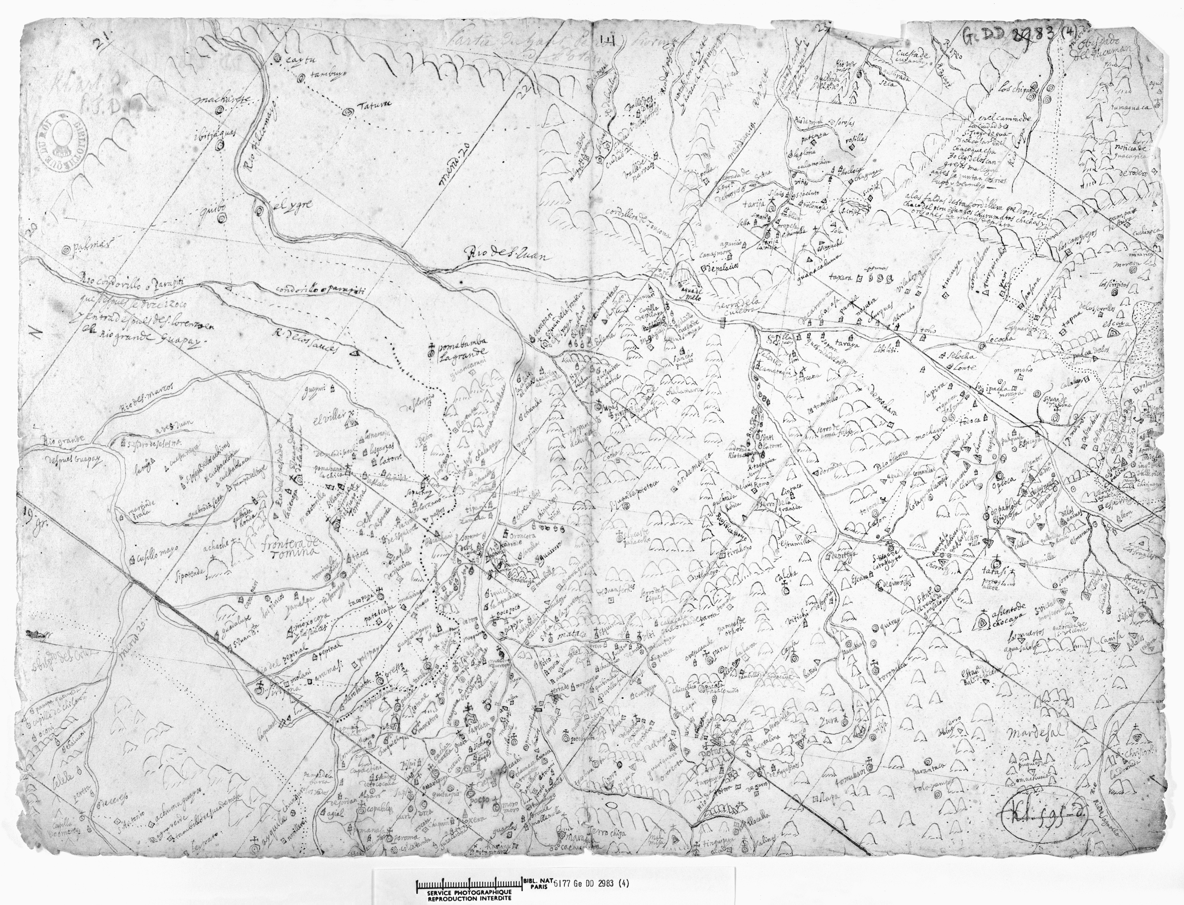
NN. "Mapa De La Gobernación Del Paraguay Y Buenos Aires, Con La Línea Divisoria De Las Tierras De España Y Portugal_1752." Map. In Anales De Investigación En Arquitectura, by Nadia Jacob, 77. Vol. 8 of La pesquisa cartográfica. Indicios de la configuración del paisaje ganadero del litoral rioplatense. Accessed June 3, 2022. https://revistas.ort.edu.uy/anales-de-investigacion-en-arquitectura/article/view/2864

  • Baixar Imagens

Itens Relacionados

Mabil Ha

Mabil Ha

Mapa 1997
COAST OF GUYANA FROM THE OROONOKO TO THE RIVER OF AMAZONS AND THE INLAND PARTS AS FAR AS THEY HAVE BEEN EXPLORED BY THE FRENCH & DUTCH ENGINEERS WITH THE ISLANDS OF BARBADOS TOBAGO & CA.

COAST OF GUYANA FROM THE OROONOKO TO THE RIVER OF AMAZONS AND THE INLAND PARTS AS FAR AS THEY HAVE BEEN EXPLORED BY THE FRENCH & DUTCH ENGINEERS WITH THE ISLANDS OF BARBADOS TOBAGO & CA.

Mapa 1781
Fig. 1.1 Locations of peoples discussed in this volume

Fig. 1.1 Locations of peoples discussed in this volume

Mapa 1900 - 1999
LA PROVINCIA DE POTOSÍ EN EL ALTO PERÚ EN EL SIGLO XVII

LA PROVINCIA DE POTOSÍ EN EL ALTO PERÚ EN EL SIGLO XVII

Mapa 1600 - 1699
CROQUIS DE LOS RÍOS NAPO Y PUTUMAYO Según datos traídos por el Coronel D. PEDRO PORTILLO

CROQUIS DE LOS RÍOS NAPO Y PUTUMAYO Según datos traídos por el Coronel D. PEDRO PORTILLO

Mapa 1905
GUERRERO

GUERRERO

Mapa 2015
Area of Tarascan Speech around 1800

Area of Tarascan Speech around 1800

Mapa 1800
LIENZO DE ZACATEPEC

LIENZO DE ZACATEPEC

Mapa 1500 - 1599

Desapropriações nas Américas

Um projeto de

University of Pennsylvania

Copyright 2024

Com o apoio de

Mellon Foundation

Projeto e desenvolvimento do site

Element 84

Créditos da arte

NN. “Mapa De La Gobernación Del Paraguay Y Buenos Aires, Con La Línea Divisoria De Las Tierras De España Y Portugal_1752.” Map. In Anales De Investigación En Arquitectura, by Nadia Jacob, 77. Vol. 8 of La pesquisa cartográfica. Indicios de la configuración del paisaje ganadero del litoral rioplatense. Accessed June 3, 2022. https://revistas.ort.edu.uy/anales-de-investigacion-en-arquitectura/article/view/2864

Páginas do site

  • Lar
  • Explorar
  • Autores
  • Sobre
  • Arte
  • Corpos
  • Currículos
  • Patrimônio Cultural
  • Mapas
  • Territórios