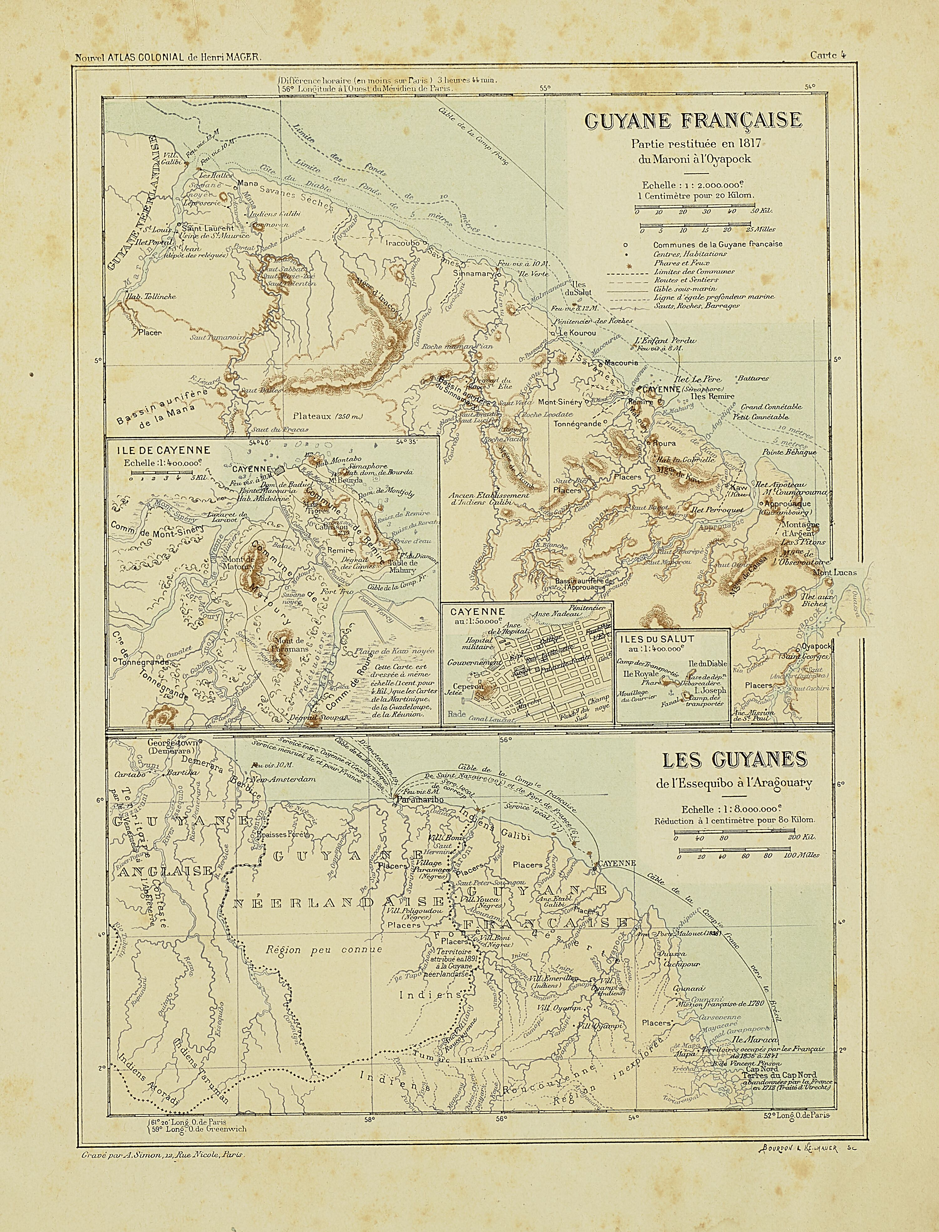
Pueblos
- ARAWAK
- GUARUANA
- GUAICAS
- WARAO
- ARNACOTO
- MAKU
- WAIKAS
- MUCUCHIES
- WAPISHANA
- ARAWAKEN
- KARIBENG
- DRIO
- ATORAI
- TARUMAS
- PIANOGHOTTOS
- CARIGUANOS
- SIRICUMES
Cita
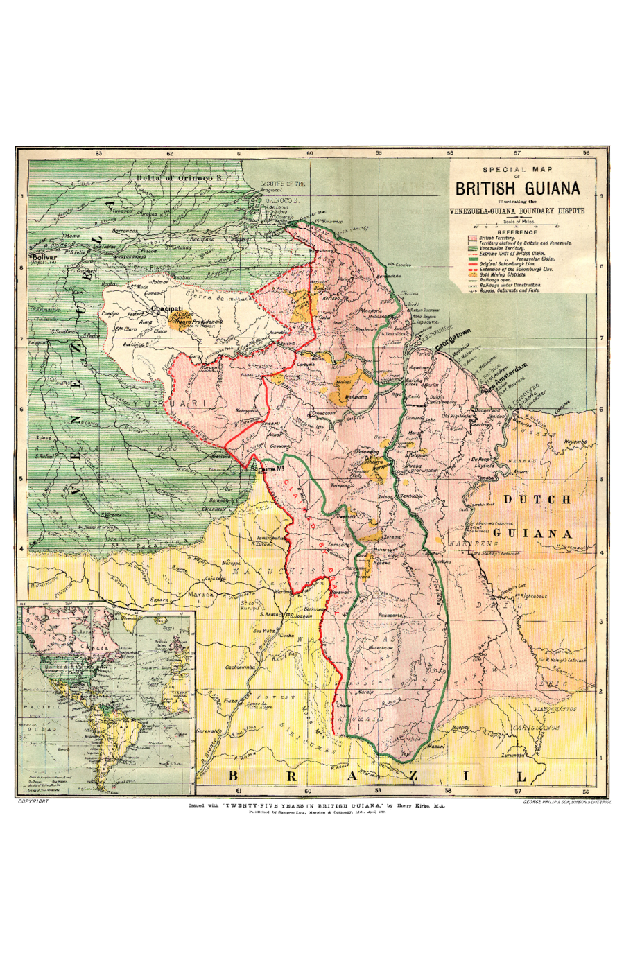
Special Map of British Guiana Illustrating the Venezuela-Guiana Boundary Dispute. Map. London & Liverpool: George Philip & Son;1898. Accessed March 4;2023. https://www.elibron.com/wp-content/uploads/745/map_1.pdf.