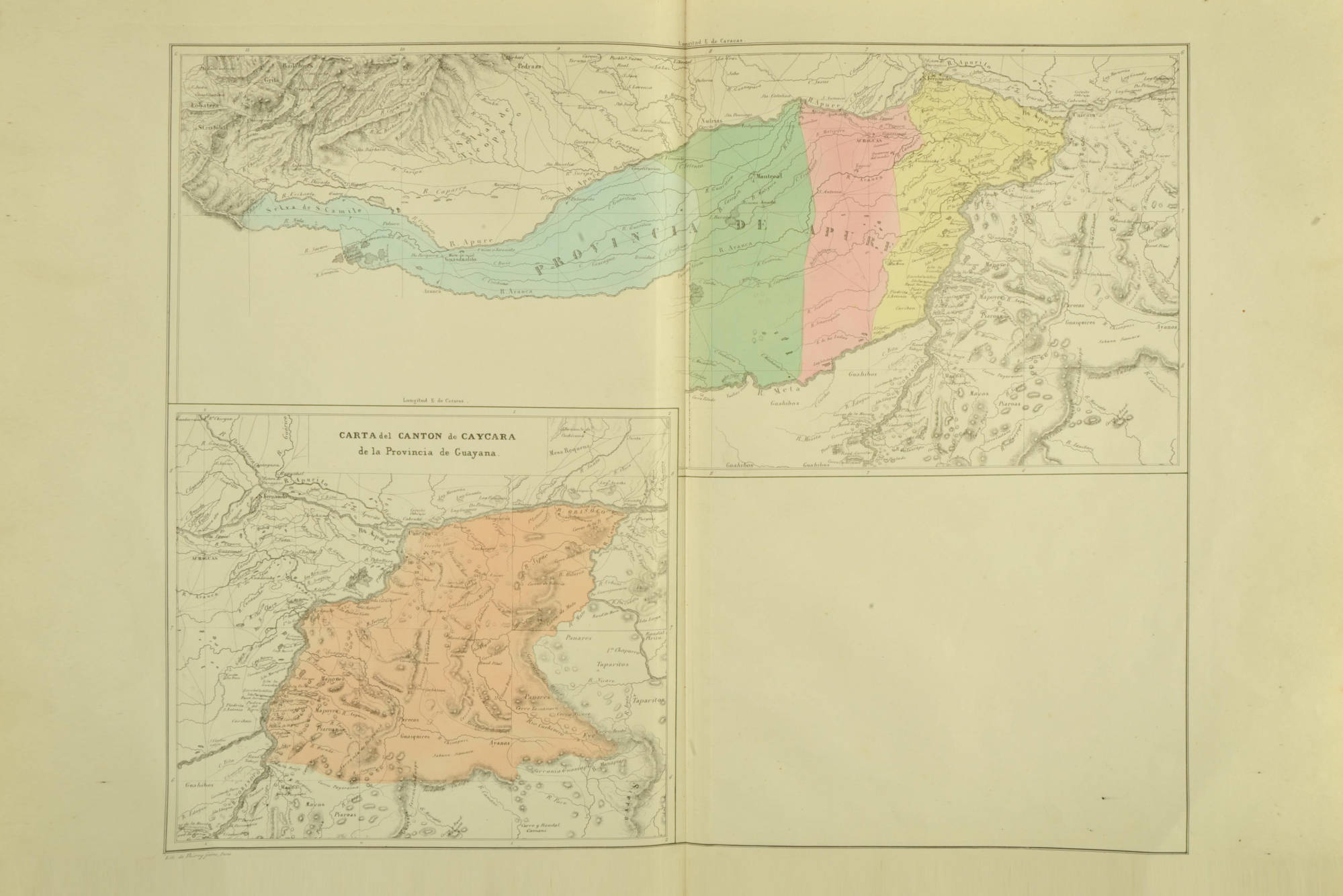
Dispossesions in the Americas

Dispossesions in the Americas

  • Inicio
  • Explorar
  • Autores
  • Sobre
  • Arte
  • Cuerpos
  • Planes de Estudio
  • Herencia Cultural
  • Mapas
  • Territorios
Volver a Explorar

Leyendo en Inglés

Mapa 1840

CARTA del CANTON de CAYCARA de la Provincia de Guayana

  • CODAZZI;AGUSTIN

Publicado: 1840

  • Descargar Imágen
  • Descargar Imágen
Mapa 1840

CARTA del CANTON de CAYCARA de la Provincia de Guayana

  • CODAZZI;AGUSTIN

Publicado: 1840

  • Descargar Imágen

Pueblos

  • JIVI
  • MAPOYO
  • PIAROAS
  • PAREKA
  • WARIKERI
  • AYANOS
  • ENEPA
  • TAPARITAS
  • MACOS

Cita

Codazzi;Agustín. Carta de la Provincia de Apure dividida por cantones. Map. Caracas;1840. Accessed January 22;2023. https://babel.banrepcultural.org/digital/collection/p17054coll13/id/125/rec/40.

  • Descargar Imágen

Leyendo en Portugués

Mapa 1840

CARTA del CANTON de CAYCARA de la Provincia de Guayana

  • CODAZZI;AGUSTIN

Publicado: 1840

  • Descargar Imágen

Pueblos

  • JIVI
  • MAPOYO
  • PIAROAS
  • PAREKA
  • WARIKERI
  • AYANOS
  • ENEPA
  • TAPARITAS
  • MACOS

Cita

Codazzi;Agustín. Carta de la Provincia de Apure dividida por cantones. Map. Caracas;1840. Accessed January 22;2023. https://babel.banrepcultural.org/digital/collection/p17054coll13/id/125/rec/40.

  • Descargar Imágen

Artículos Relacionados

Carte du Chili Méridional du Rio de la Plata, des Patagons, et
     du Détroit de Magellan;Ce qui fait l'extremité Australe de l'Amerique
     Merid[iona]le.

Carte du Chili Méridional du Rio de la Plata, des Patagons, et du Détroit de Magellan;Ce qui fait l'extremité Australe de l'Amerique Merid[iona]le.

Mapa 1779
"Territorio Indígena Cabécar de Tayní"

"Territorio Indígena Cabécar de Tayní"

Mapa 2010
Serie Patrones

Serie Patrones

Obra de Arte
Dialect geography of K'ichee'

Dialect geography of K'ichee'

Mapa
Revolución Puta

Revolución Puta

Obra de Arte
THE KARANQAS AYMARA POLITY - Instant shot of trans-border connections around 1900 (Google Earth adaptation)

THE KARANQAS AYMARA POLITY - Instant shot of trans-border connections around 1900 (Google Earth adaptation)

Mapa 1860 - 1930
Location of three ethno-linguistic groups in the highlands of Guatemala in which joint InHerit-Riecken community-participant mapping took place. Adapted from http://d-maps. com/carte.php?num_car=1717&lang=en)

Location of three ethno-linguistic groups in the highlands of Guatemala in which joint InHerit-Riecken community-participant mapping took place. Adapted from http://d-maps. com/carte.php?num_car=1717&lang=en)

Mapa 2000
Partie Occidentale de la Terre Ferme

Partie Occidentale de la Terre Ferme

Mapa 1749

Despojos en las Américas

Un Proyecto de

University of Pennsylvania

Copyright 2024

Con el apoyo de

Mellon Foundation

Diseño y Desarrollo del Sitio

Element 84

Créditos Artísticos

Codazzi;Agustín. Carta de la Provincia de Apure dividida por cantones. Map. Caracas;1840. Accessed January 22;2023. https://babel.banrepcultural.org/digital/collection/p17054coll13/id/125/rec/40.

Páginas del Sitio

  • Inicio
  • Explorar
  • Autores
  • Sobre
  • Arte
  • Cuerpos
  • Planes de Estudio
  • Herencia Cultural
  • Mapas
  • Territorios