Pueblos
- KUMANAGOTO
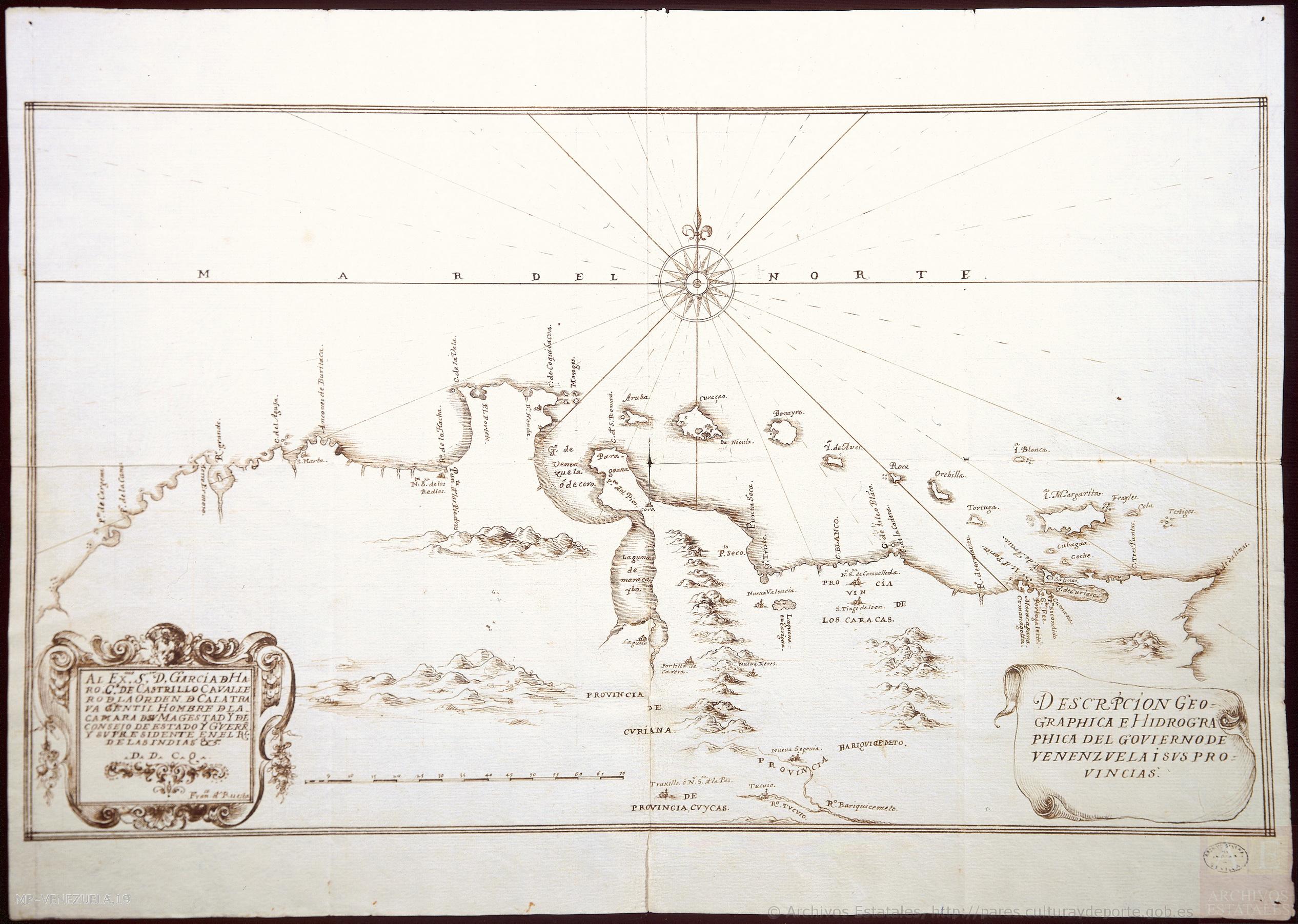
Cita
de Ruesta;Francisco. "Descripción geográphica e hidorgráphica del govierno de Venezuela i sus provinciaS." Map. 1634. Accessed August 19;2022. http://pares.mcu.es/ParesBusquedas20/catalogo/show/25929.
![Haec pars Peruvianae, regiones Chicam & Chile[nsem]
complectitur, & Regionem](https://dnet8ble6lm7w.cloudfront.net/maps/ARG/ARG0063.jpg)
Haec pars Peruvianae, regiones Chicam & Chile[nsem] complectitur, & Regionem
Mapa 1551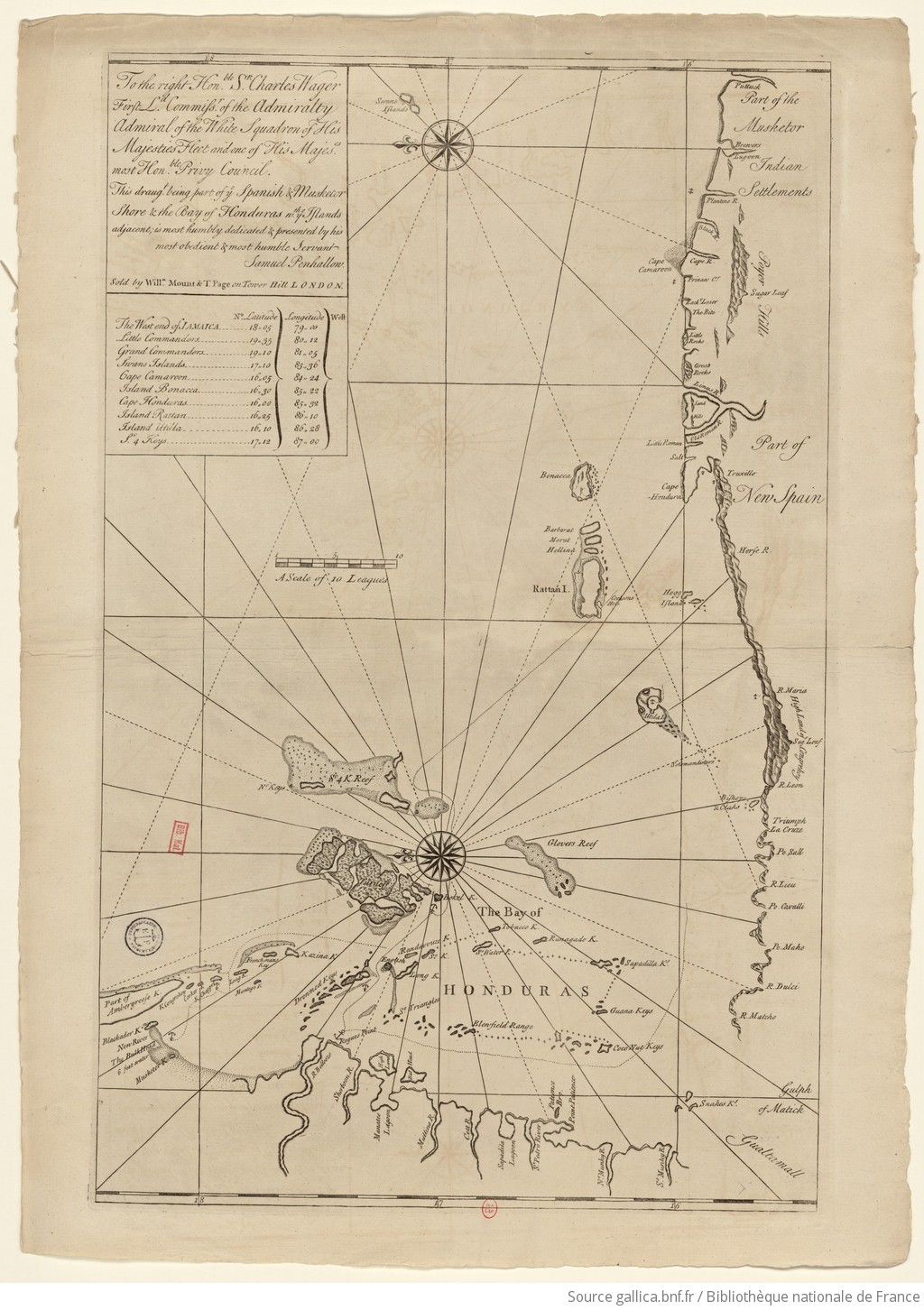
The Spanish and Musketor shore and the bay of Honduras and the islands adjacent
Mapa 1735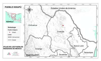
PUEBLO KIKAPU
Mapa 2020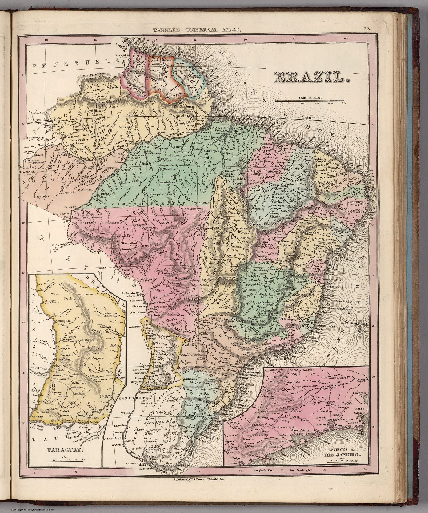
BRAZIL
Mapa 1800 - 1850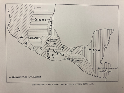
DISTRIBUTION OF PRINCIPAL NATIONS AFTER 1300 AD
Mapa 1300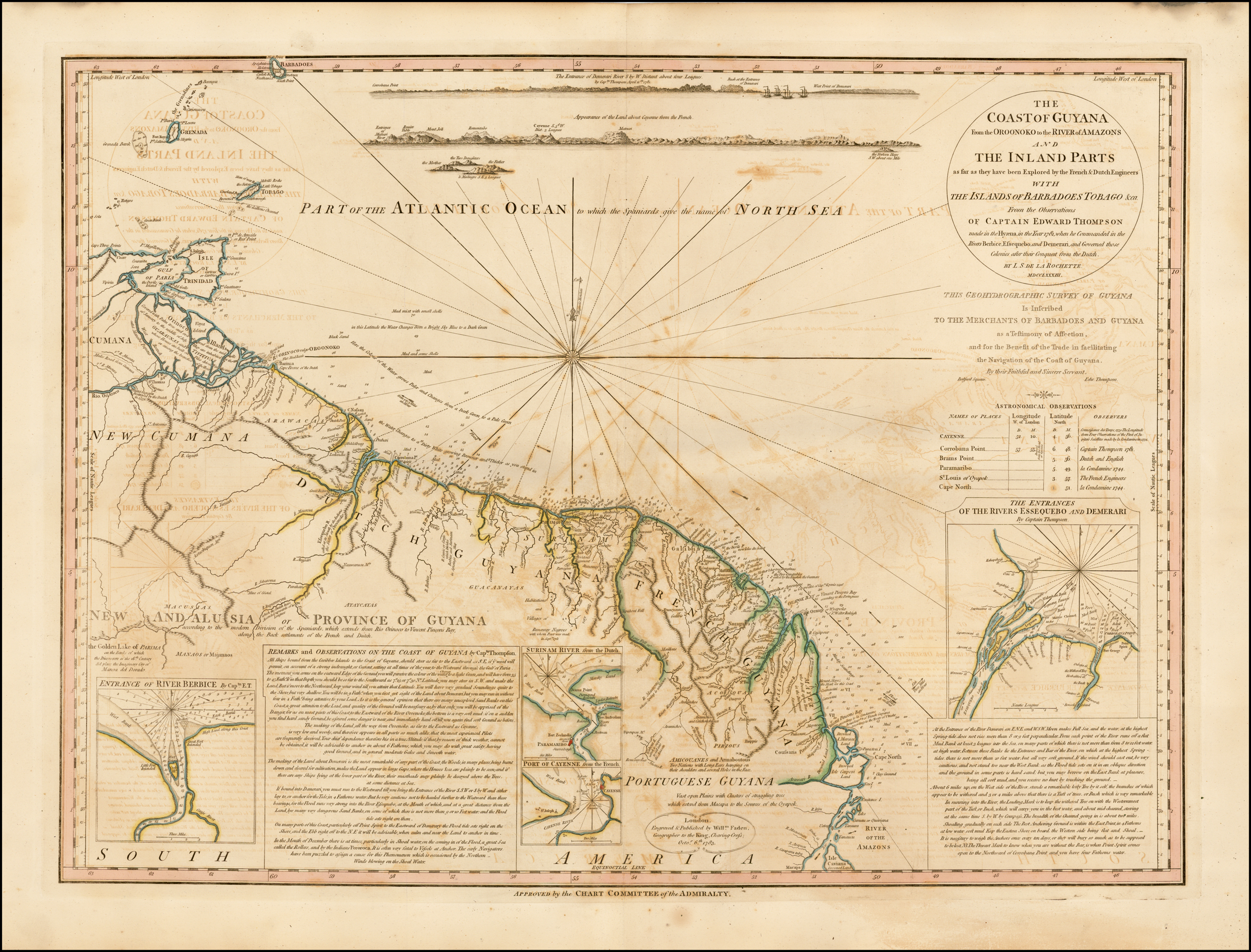
COAST OF GUYANA FROM THE OROONOKO TO THE RIVER OF AMAZONS AND THE INLAND PARTS AS FAR AS THEY HAVE BEEN EXPLORED BY THE FRENCH & DUTCH ENGINEERS WITH THE ISLANDS OF BARBADOS TOBAGO & CA.
Mapa 1781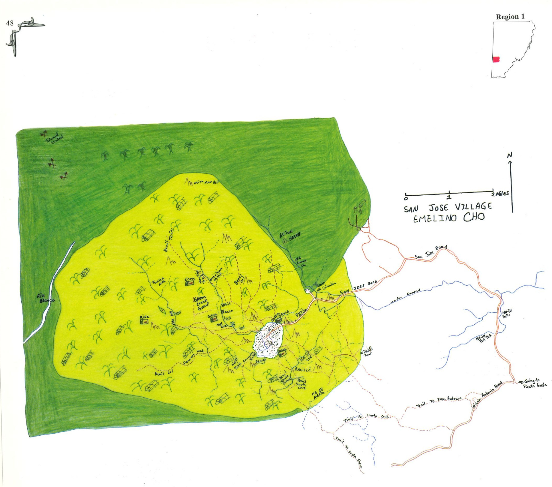
San Jose
Mapa 1997
Colección de diferentes versiones del Perú Jaguar, Perú Otorongo y los “perucitos”
Obra de Arte