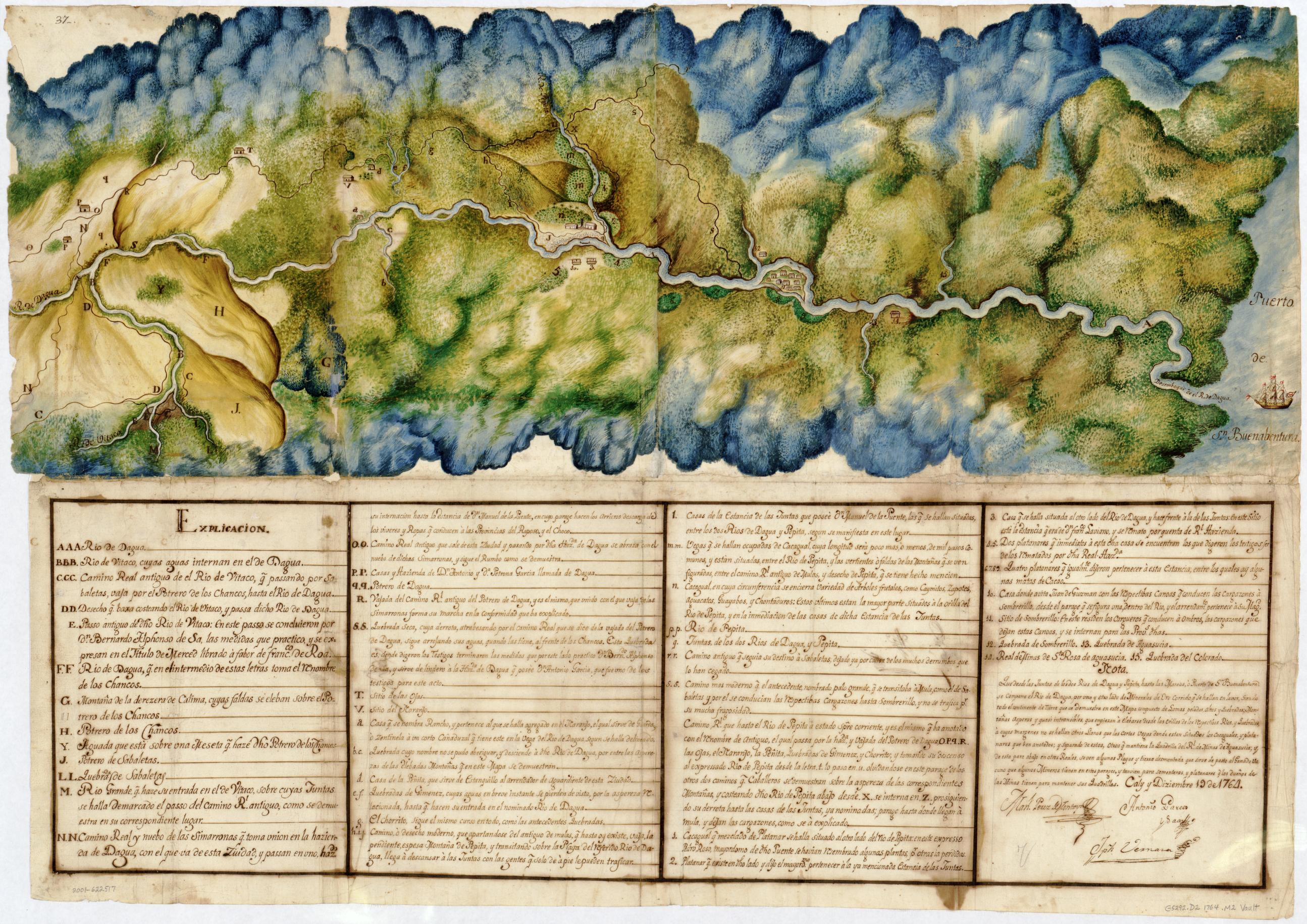
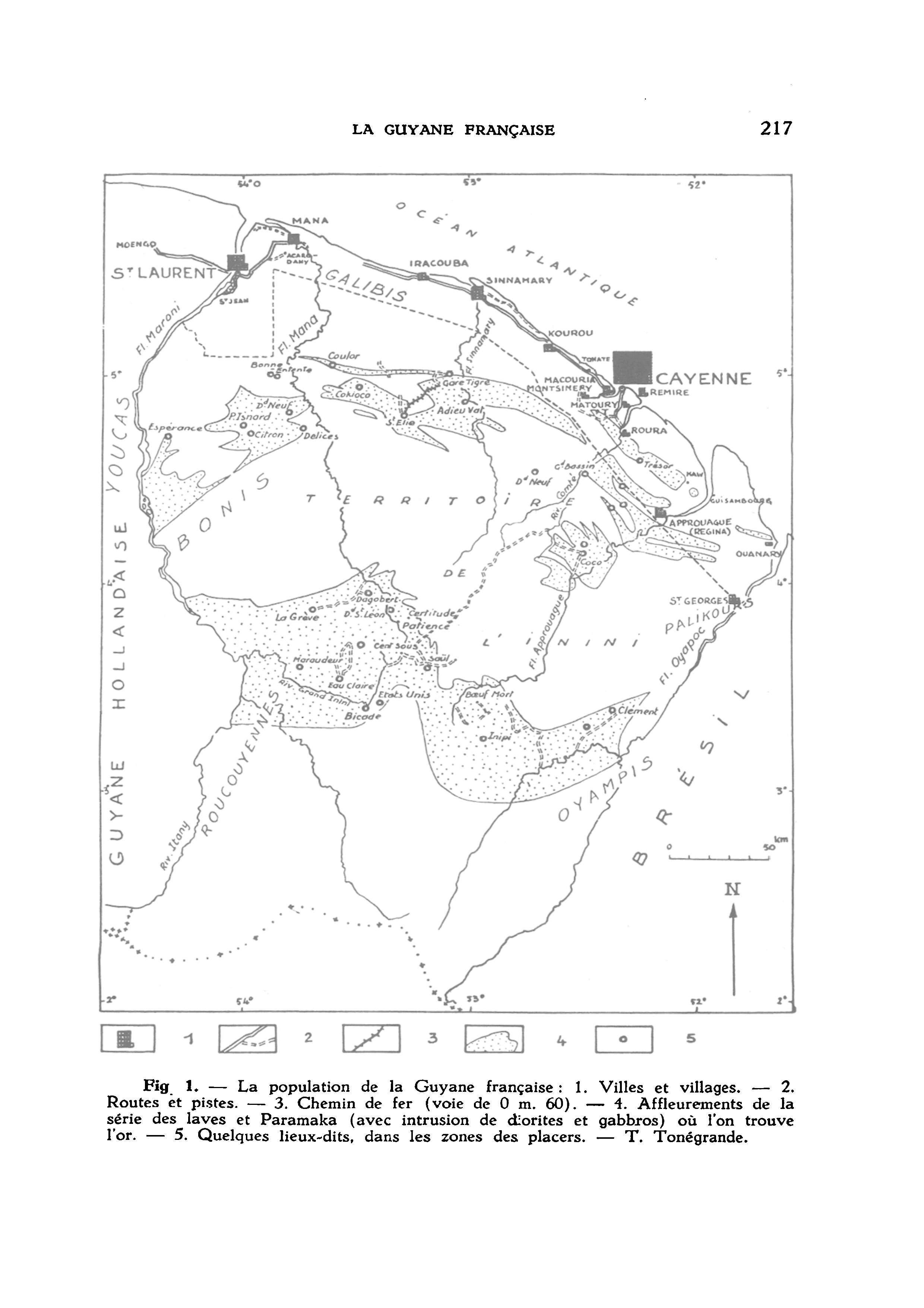
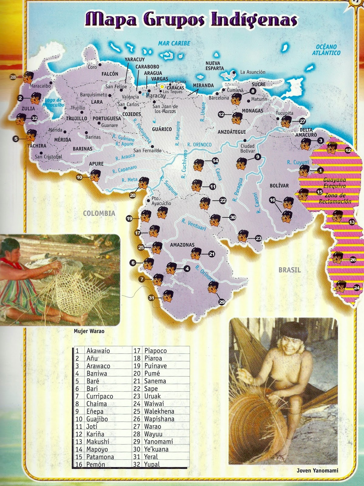
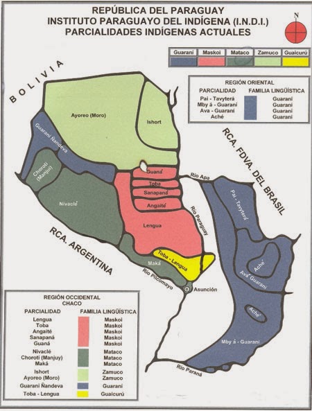
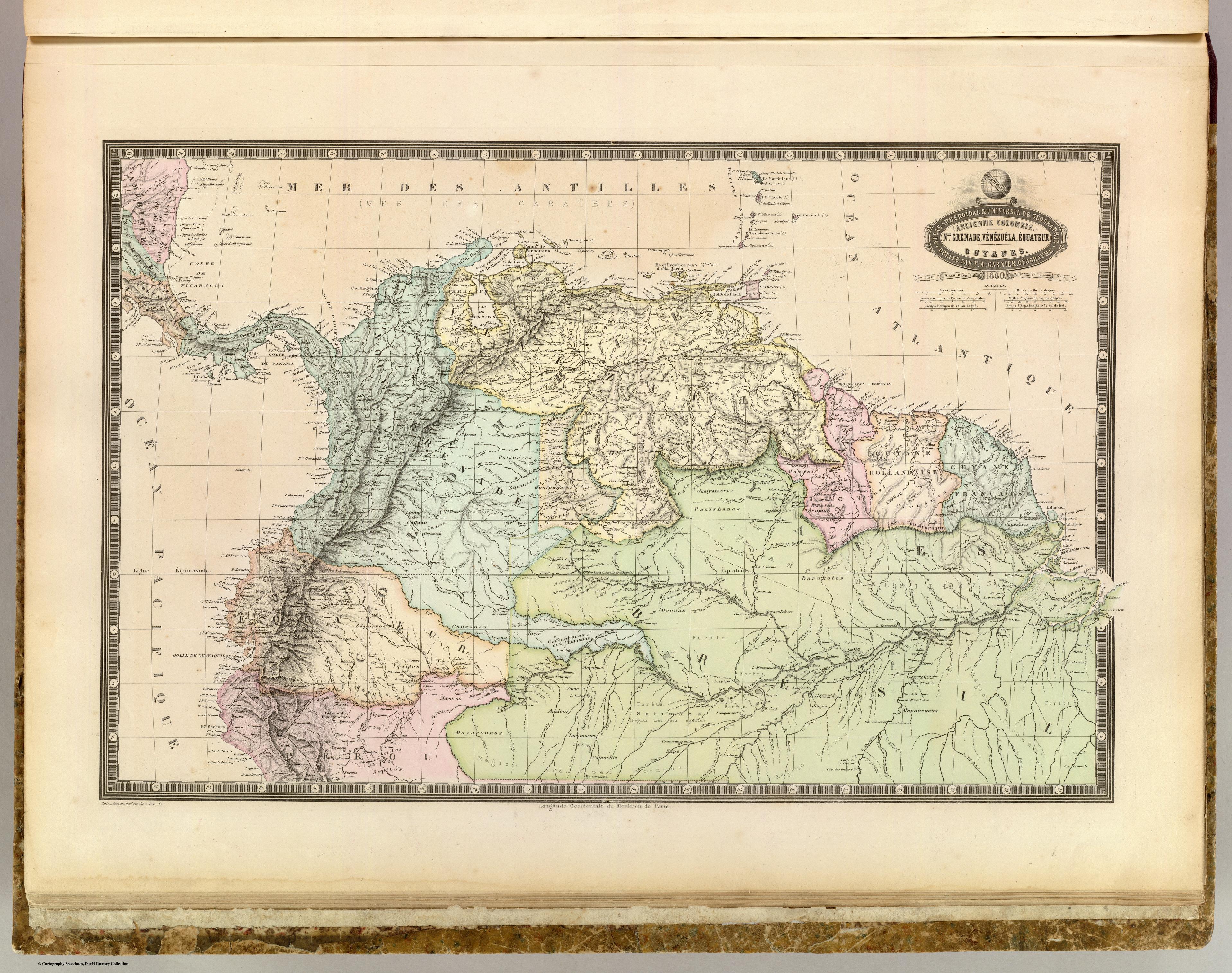
Dispossesions in the Americas

Dispossesions in the Americas

  • Inicio
  • Explorar
  • Autores
  • Sobre
  • Arte
  • Cuerpos
  • Planes de Estudio
  • Herencia Cultural
  • Mapas
  • Territorios
Volver a Explorar

Leyendo en Inglés

Mapa 1741

Mapa de la Provincia y Missiones de la CompañÍa de IHS del Nuevo Reyno de Granada

  • MINGUET;PAULUS

Publicado: 1741

  • Descargar Imágen
  • Descargar Imágen
Mapa 1741

Mapa de la Provincia y Missiones de la CompañÍa de IHS del Nuevo Reyno de Granada

  • MINGUET;PAULUS

Publicado: 1741

  • Descargar Imágen

Pueblos

  • ACHAGUA
  • ANDAQUIRES
  • CABERRE
  • MAIPURE
  • CHIRICOA
  • MAPOYO
  • ARAWAK
  • SALIVA
  • BANIVA
  • SARURA
  • GUARAUNA
  • GUAMOS
  • PALENQUES
  • CARIVA
  • PAOS
  • OTOMACA
  • QUIRRUBA

Cita

Minguet;Paulus. "MAPA DE LA PROVINCIA Y MISSIONES DE LA COMPAÑIA DE IHS DELNUEVO REYNO DE GRANADA." Map. Biblioteca Nacional de España. Accessed December 11;2021. http://bdh-rd.bne.es/viewer.vm?id=0000000500&page=1.

  • Descargar Imágen

Leyendo en Portugués

Mapa 1741

Mapa de la Provincia y Missiones de la CompañÍa de IHS del Nuevo Reyno de Granada

  • MINGUET;PAULUS

Publicado: 1741

  • Descargar Imágen

Pueblos

  • ACHAGUA
  • ANDAQUIRES
  • CABERRE
  • MAIPURE
  • CHIRICOA
  • MAPOYO
  • ARAWAK
  • SALIVA
  • BANIVA
  • SARURA
  • GUARAUNA
  • GUAMOS
  • PALENQUES
  • CARIVA
  • PAOS
  • OTOMACA
  • QUIRRUBA

Cita

Minguet;Paulus. "MAPA DE LA PROVINCIA Y MISSIONES DE LA COMPAÑIA DE IHS DELNUEVO REYNO DE GRANADA." Map. Biblioteca Nacional de España. Accessed December 11;2021. http://bdh-rd.bne.es/viewer.vm?id=0000000500&page=1.

  • Descargar Imágen

Artículos Relacionados

Manuscript Map of the Dagua River Region

Manuscript Map of the Dagua River Region

Mapa 1764
Fig. 1. La population de la Guyana française

Fig. 1. La population de la Guyana française

Mapa 1955
Mapa Grupos Indígenas

Mapa Grupos Indígenas

Mapa 2011
REPÚBLICA DEL PARAGUAY INSTITUTO PARAGUAYO DEL INDÍGENA (I.N.D.I.) PARCIALIDADES INDÍGENAS ACTUALES

REPÚBLICA DEL PARAGUAY INSTITUTO PARAGUAYO DEL INDÍGENA (I.N.D.I.) PARCIALIDADES INDÍGENAS ACTUALES

Mapa
NLE. GRENADE;VENEZUELA;EQUATEUR;GUYANES.

NLE. GRENADE;VENEZUELA;EQUATEUR;GUYANES.

Mapa 1860
"Territorio Indígena Cabécar de Ujarrás"

"Territorio Indígena Cabécar de Ujarrás"

Mapa 2010
Colonies Françaises. Amérique

Colonies Françaises. Amérique

Mapa 1800 - 1899
Plan topográfico de las Provincias de Chocó, Antioquia y Popayán

Plan topográfico de las Provincias de Chocó, Antioquia y Popayán

Mapa 1700

Despojos en las Américas

Un Proyecto de

University of Pennsylvania

Copyright 2024

Con el apoyo de

Mellon Foundation

Diseño y Desarrollo del Sitio

Element 84

Créditos Artísticos

Minguet;Paulus. “MAPA DE LA PROVINCIA Y MISSIONES DE LA COMPAÑIA DE IHS DELNUEVO REYNO DE GRANADA.” Map. Biblioteca Nacional de España. Accessed December 11;2021. http://bdh-rd.bne.es/viewer.vm?id=0000000500&page=1.

Páginas del Sitio

  • Inicio
  • Explorar
  • Autores
  • Sobre
  • Arte
  • Cuerpos
  • Planes de Estudio
  • Herencia Cultural
  • Mapas
  • Territorios