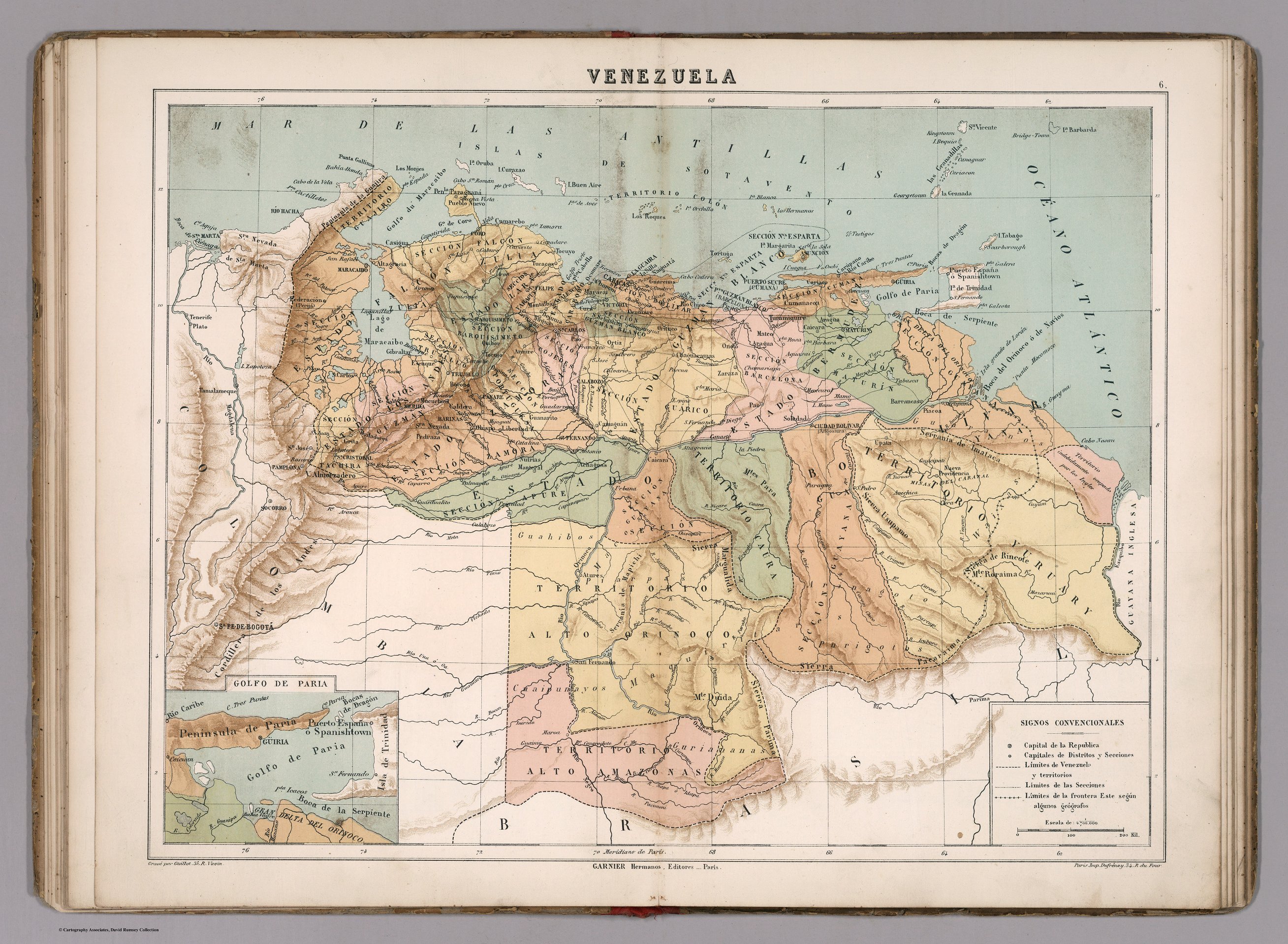
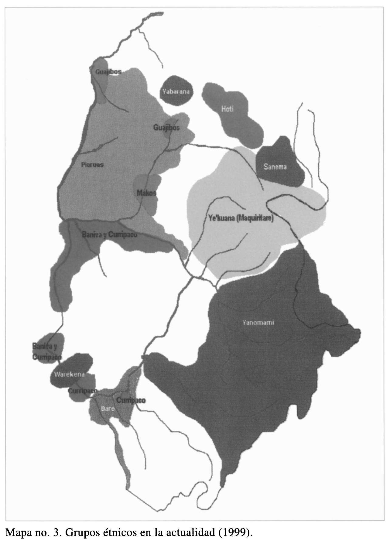
Dispossesions in the Americas

Dispossesions in the Americas

  • Inicio
  • Explorar
  • Autores
  • Sobre
  • Arte
  • Cuerpos
  • Planes de Estudio
  • Herencia Cultural
  • Mapas
  • Territorios
Volver a Explorar

Leyendo en Inglés

Mapa 1999

Grupos étnicos en la actualidad (1999)

  • DEOGENES EDGILDO PALAU;GEOG.

Publicado: 1999

  • Descargar Imágen
  • Descargar Imágen
Mapa 1999

Grupos étnicos en la actualidad (1999)

  • DEOGENES EDGILDO PALAU;GEOG.

Publicado: 1999

  • Descargar Imágen

Pueblos

  • GUAJIBOS
  • YABARANA
  • PIAROAS
  • MAKOS
  • BANIVA
  • CURRIPACO
  • HOTI
  • SANEMA
  • YEKUANA
  • WAREKENA
  • BARE
  • YANOMAMI

Citas

Diógenes Edgilgo Palau;Geóg. "Los Pueblos Indigenas del Amazonas Venezolano desde Humboldt a Nuestros Dias: Preservacion del Ambiente Y Manejo Sostenible." Northeastern Naturalist 8;no. 1 (2001): 135-56. https://www-jstor-org.proxy.library.upenn.edu/stable/4130731?seq=1#metadata_info_tab_contents.

  • Descargar Imágen

Artículos Relacionados

Territorios actuales de los pueblos indígenas en México

Territorios actuales de los pueblos indígenas en México

Mapa 2008
Outlines of the physical and political division of South America: Delineated by A. Arrowsmith partly from scarce and original documents, published before the year 1806 but principally from manuscript maps & surveys made between the years 1771 and 1806, corrected from accurate astronomical observations to 1810.

Outlines of the physical and political division of South America: Delineated by A. Arrowsmith partly from scarce and original documents, published before the year 1806 but principally from manuscript maps & surveys made between the years 1771 and 1806, corrected from accurate astronomical observations to 1810.

Mapa 1800 - 1899
PUEBLO KIKAPU

PUEBLO KIKAPU

Mapa 2020
APPROXIMATE BORDERS OF TERRITORY OF THE AYMARA POLITY KARANQAS (OR CARANGAS) IN THE 19TH CENTURY

APPROXIMATE BORDERS OF TERRITORY OF THE AYMARA POLITY KARANQAS (OR CARANGAS) IN THE 19TH CENTURY

Mapa 1894
Midway

Midway

Mapa 1997
PUEBLO ACHUAR

PUEBLO ACHUAR

Mapa 2021
Map of the Inca Empire

Map of the Inca Empire

Mapa 1490 - 1499
Croquis III. (b) La región andina septentrional ecuatoriana (Moreno Yanez;1989;2)

Croquis III. (b) La región andina septentrional ecuatoriana (Moreno Yanez;1989;2)

Mapa -500 - 1530

Despojos en las Américas

Un Proyecto de

University of Pennsylvania

Copyright 2024

Con el apoyo de

Mellon Foundation

Diseño y Desarrollo del Sitio

Element 84

Créditos Artísticos

Diógenes Edgilgo Palau;Geóg. “Los Pueblos Indigenas del Amazonas Venezolano desde Humboldt a Nuestros Dias: Preservacion del Ambiente Y Manejo Sostenible.” Northeastern Naturalist 8;no. 1 (2001): 135-56. https://www-jstor-org.proxy.library.upenn.edu/stable/4130731?seq=1#metadata_info_tab_contents.

Páginas del Sitio

  • Inicio
  • Explorar
  • Autores
  • Sobre
  • Arte
  • Cuerpos
  • Planes de Estudio
  • Herencia Cultural
  • Mapas
  • Territorios