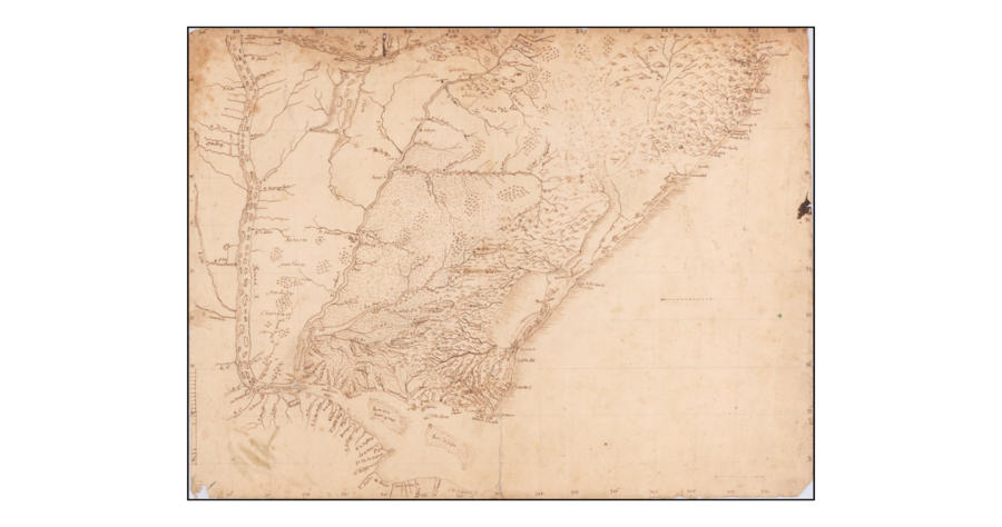
Pueblos
- BOHANES
- MINUANES
- CHARRUAS
- MANCHADOS
Cita
"[Rio De La Plata, Uruguay, Southern Brazil]." Map. 1765. Accessed May 1, 2022. https://www.raremaps.com/gallery/detail/59814/rio-de-la-plata-uruguay-southern-brazil-anonymous.
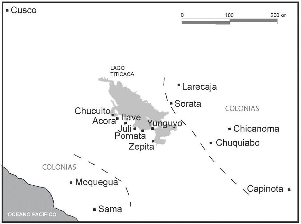
THE AYMARA POLITY OF THE LUPAQA: COMMERCIAL DESTINIES AND VERTICALITY IN THE 16TH CENTURY
Mapa 1500 - 1599
La madre sin cabeza
Obra de Arte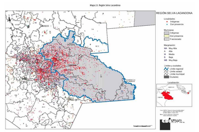
REGIÓN SELVA LACANDONA
Mapa 2000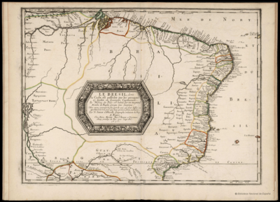
LE BRESIL, dont la Coste est posse dée par les portugais et divisée en Quatorze Capitanieries.
Mapa 1656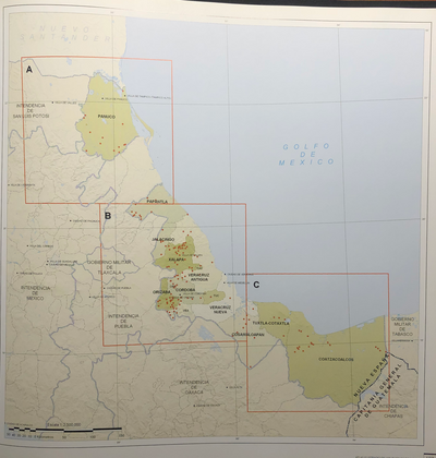
INTENDENCIA DE VERACRUZ
Mapa 1800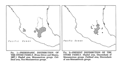
Prehispanic Distribution of the Otomí Family
Mapa 1969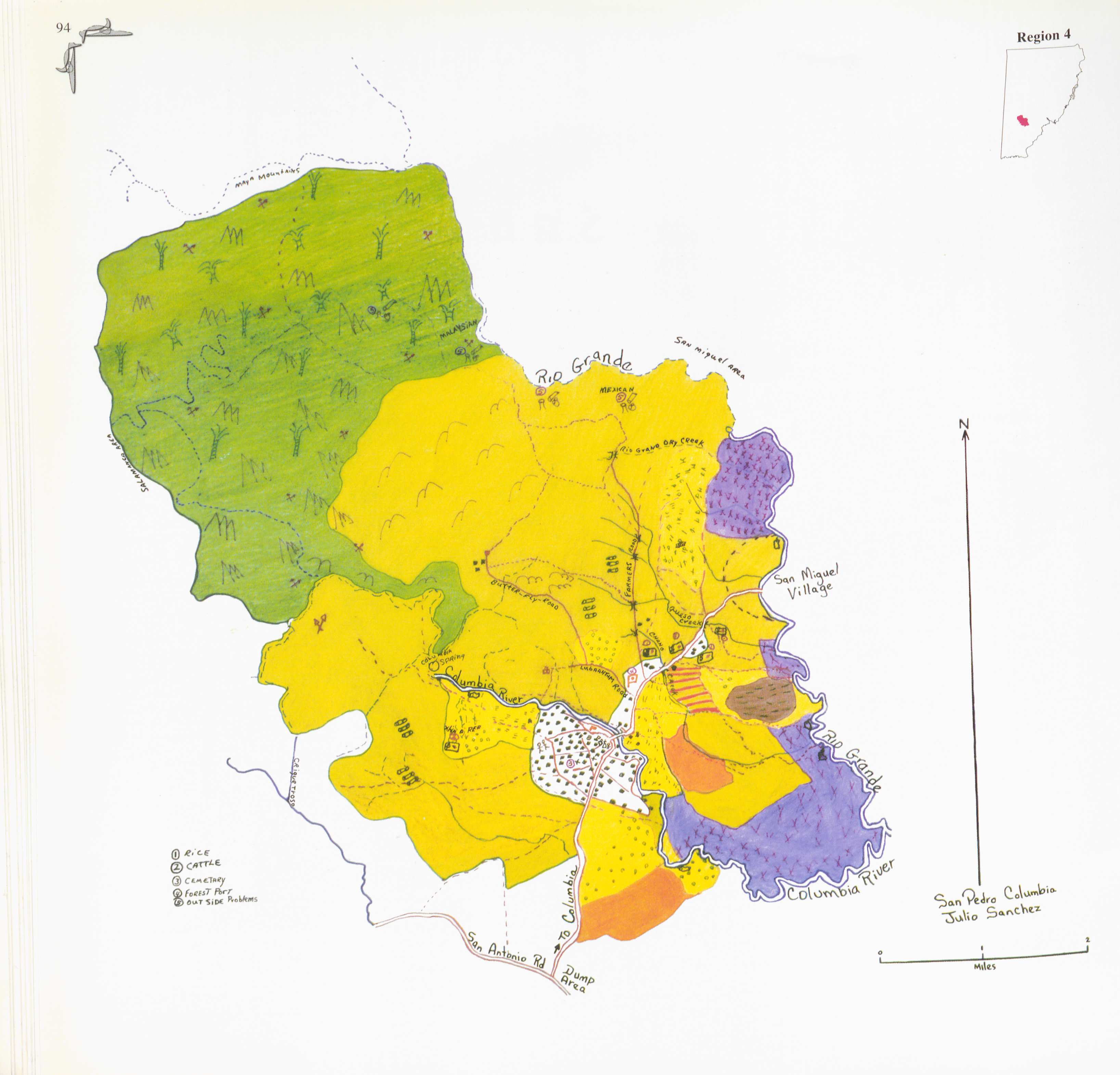
San Pedro Columbia
Mapa 1997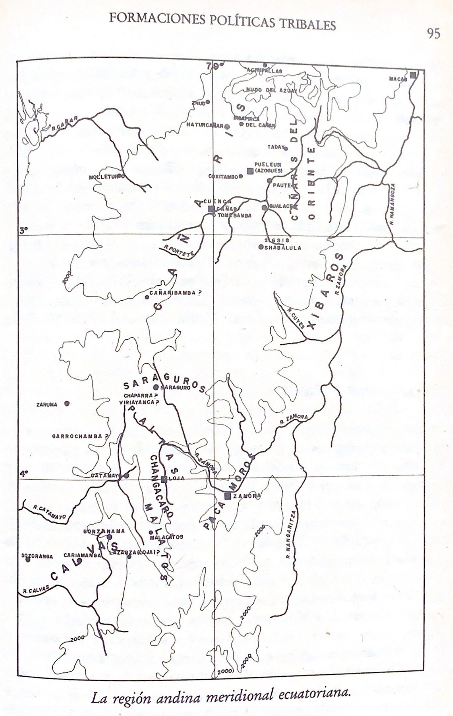
La región andina meridional ecuatoriana
Mapa -500 - 1550