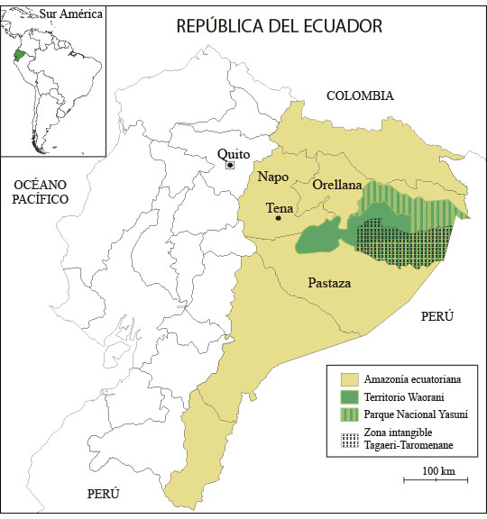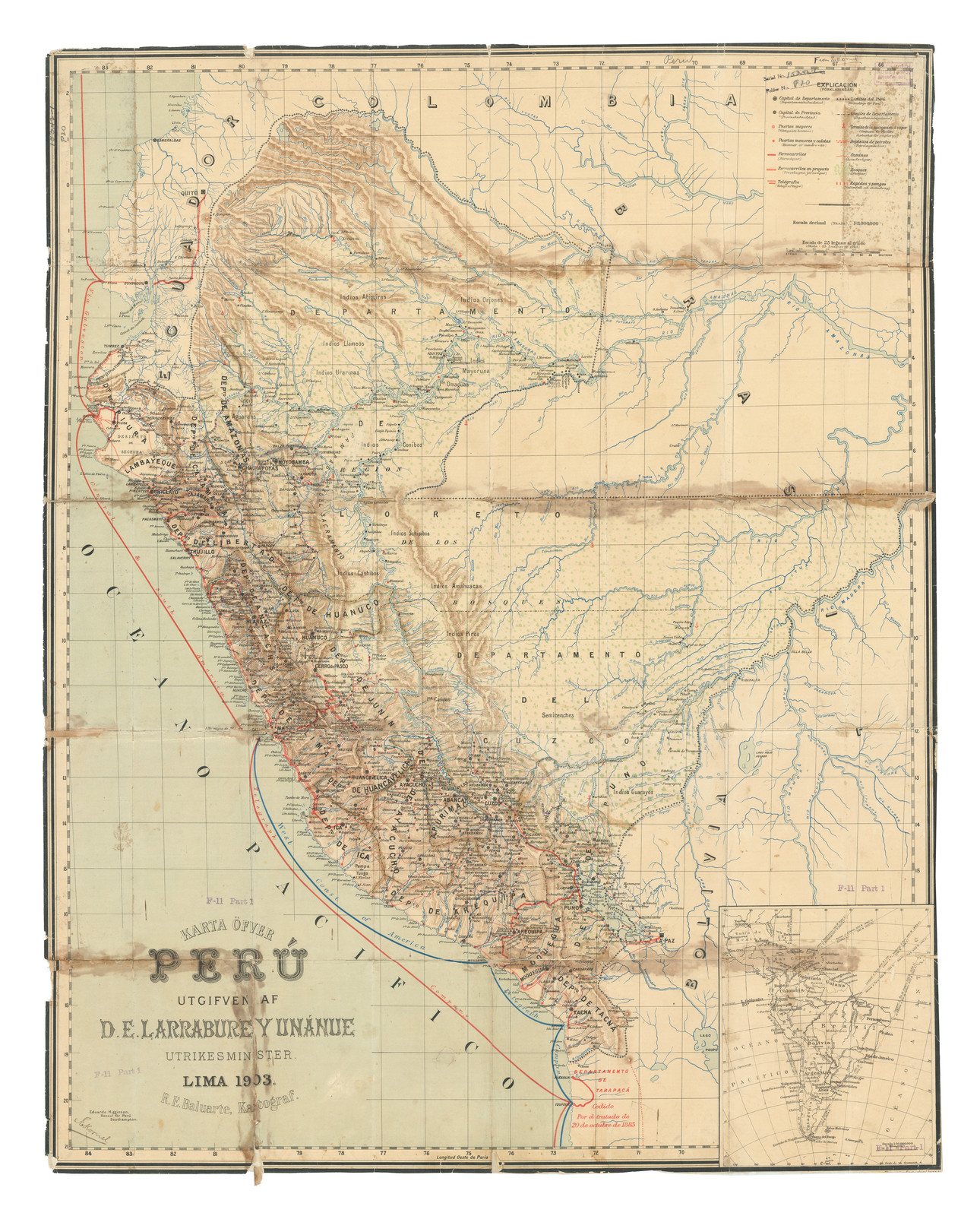
Pueblos
- IGUARAYOS
- PIROS
- AMAHUACAS
- CASHIBOS
- SHIPIBOS
- CONIBOS
- MAYORUNA
- OMAGUAS
- URARINAS
- LLAMEOS
- AGUARANS
- ABIQUIRAS
- ORJONES
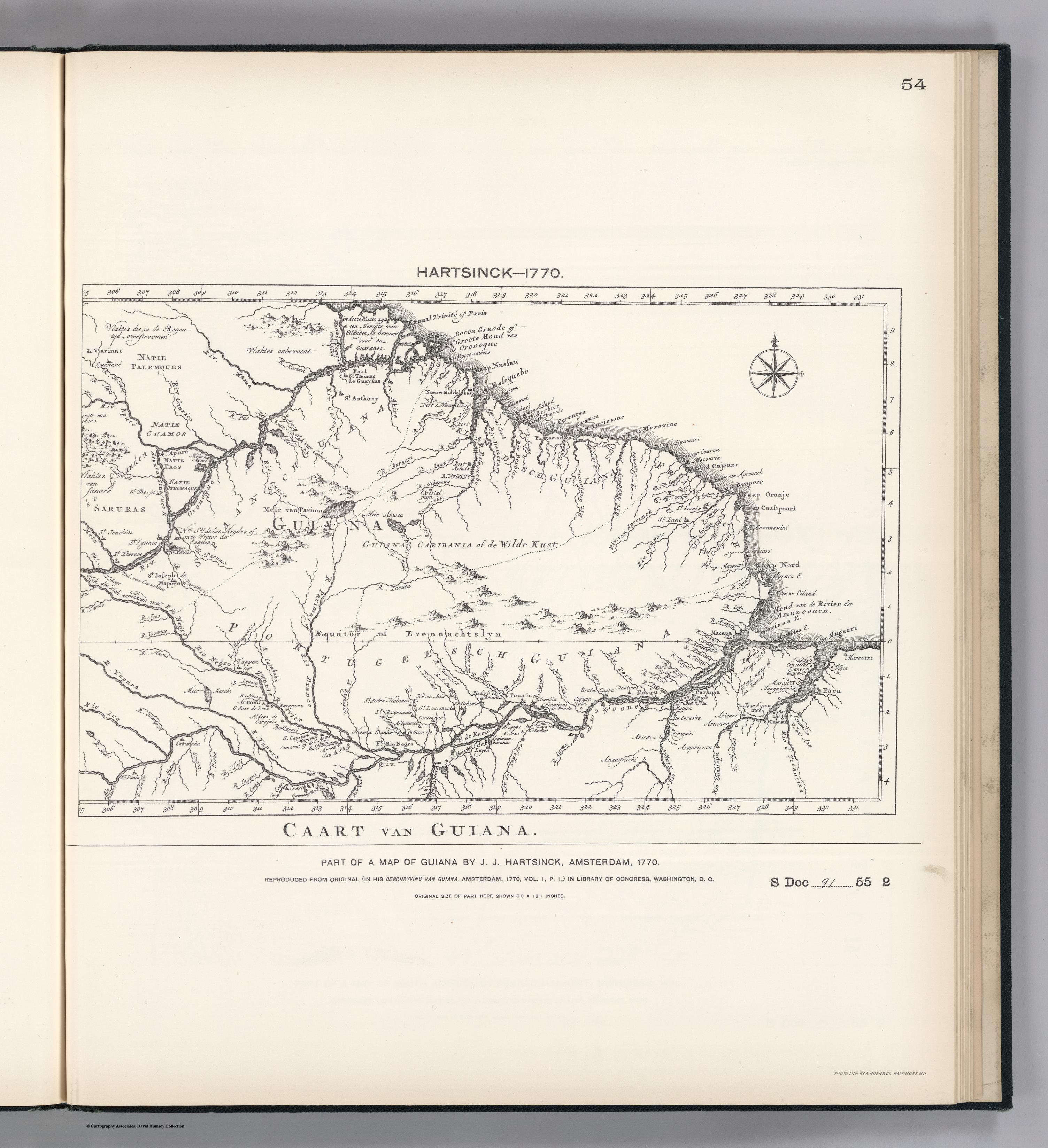
Cita
Beluarte, R. (Cartographer). (1903). Karte Ofver Peru Utgifven D.E. Larrabure y Unnanue Utrikesminister [Map]. Barry Lawrence Ruderman. https://www.raremaps.com/gallery/detail/88215/karte-ofver-peru-utgifven-de-larrabure-y-unnanue-utrikesmi-beluarte