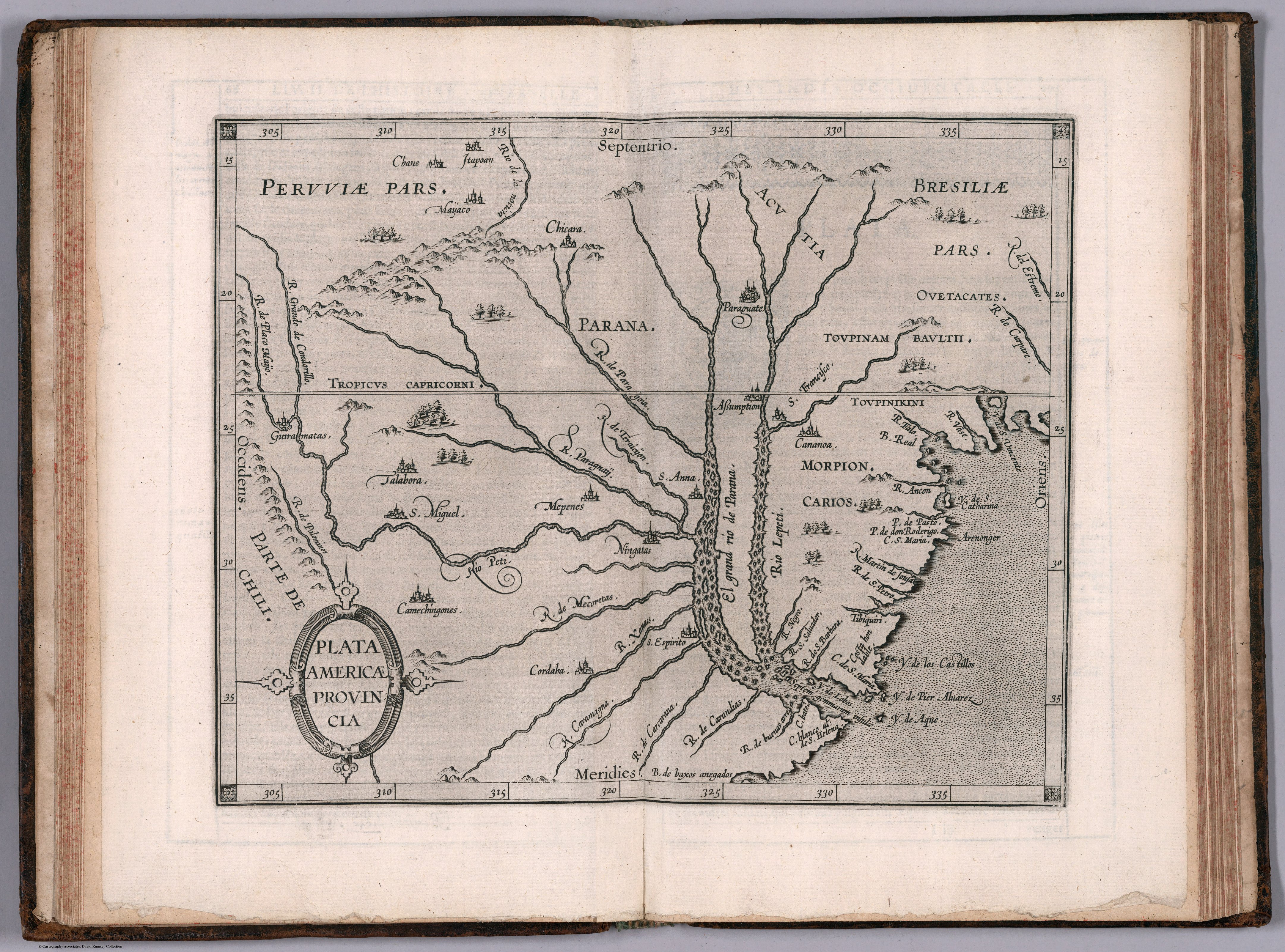
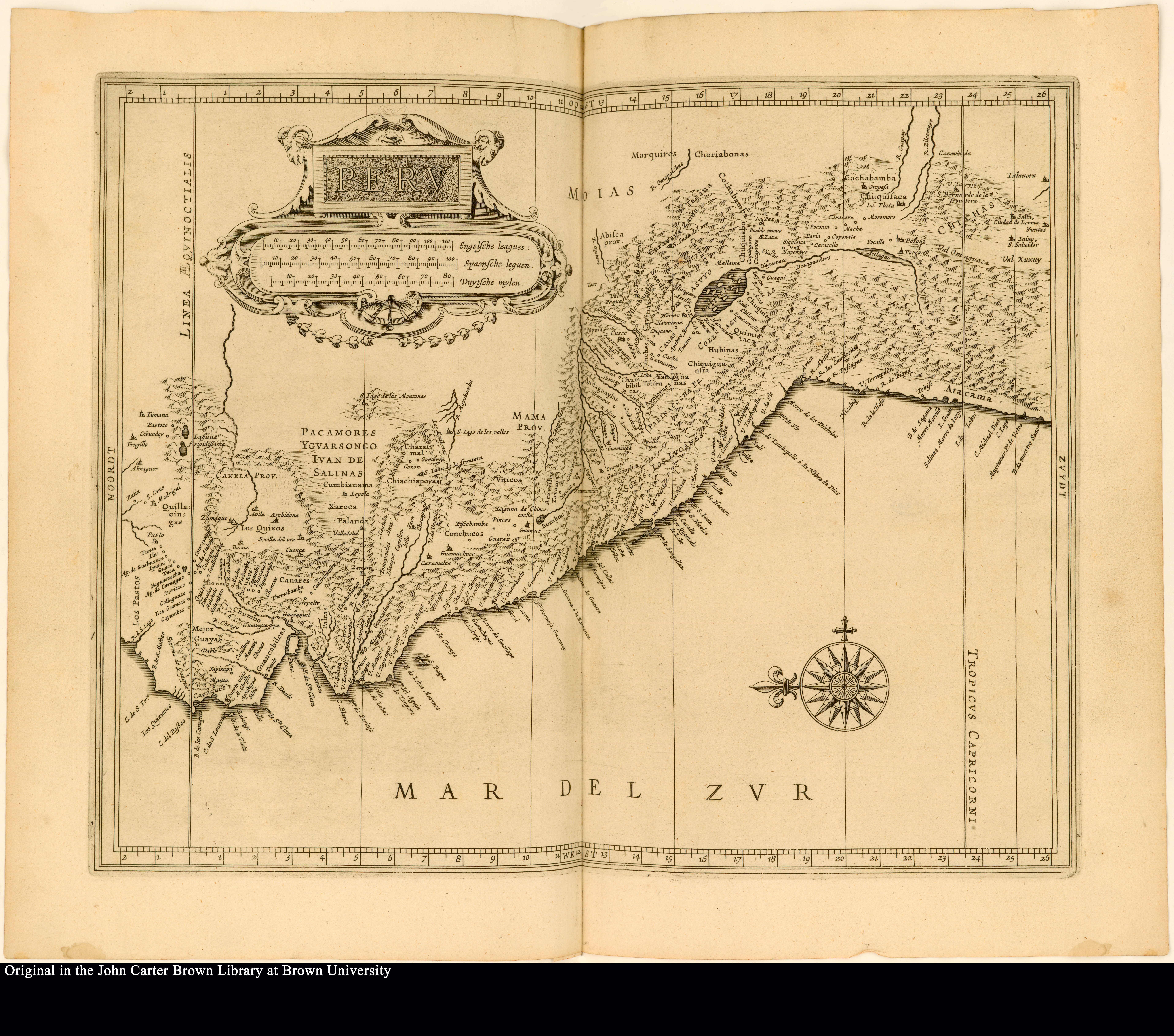
Dispossesions in the Americas

Dispossesions in the Americas

  • Inicio
  • Explorar
  • Autores
  • Sobre
  • Arte
  • Cuerpos
  • Planes de Estudio
  • Herencia Cultural
  • Mapas
  • Territorios
Volver a Explorar

Leyendo en Inglés

Mapa 1625

Peru

  • Joannes de Laet

Publicado: 1625

  • Descargar Imágen
  • Descargar Imágen
Mapa 1625

Peru

  • Joannes de Laet

Publicado: 1625

  • Descargar Imágen

Pueblos

  • QUICINGAS
  • LOS PASTOS
  • LOS QUIXOS
  • CANARES
  • GUANCABELICAS
  • PACAMORES
  • CHIACHIAPOYAS
  • VITICOS
  • CONCHUCOS
  • LOS SORAS
  • LOS LVCANES
  • MARQUIRES
  • CHERIABONAS
  • AYMERAES
  • CANAS
  • CANCHES
  • COLLAS

Citas

de Laet, J. (Cartographer). (1625). Peru [Map]. In de druckerye van Isaack Elzevier. John Carter Brown Library. https://jcb.lunaimaging.com/luna/servlet/detail/JCBMAPS~1~1~4568~102653:Peru?sort=normalized_date%2Cfile_name%2Csource_author%2Csource_title

  • Descargar Imágen

Artículos Relacionados

PROVINCIA DO ESPIRITO SANTO

PROVINCIA DO ESPIRITO SANTO

Mapa 1800 - 1850
Origin of Mayans according to HLA genes and the uniqueness

Origin of Mayans according to HLA genes and the uniqueness

Mapa
The Pech: Most important municipios, 2001

The Pech: Most important municipios, 2001

Mapa 2001
MAP 7.—The Highland tribes of Colombia and Ecuador. (Drawn from data compiled by Gregorio Hernández de Alba;John Murra;Sergio Elías Ortíz;and Henri Lehmann.)

MAP 7.—The Highland tribes of Colombia and Ecuador. (Drawn from data compiled by Gregorio Hernández de Alba;John Murra;Sergio Elías Ortíz;and Henri Lehmann.)

Mapa 1400
Mayan Access to Biomass Resources (Guatemala 2018).

Mayan Access to Biomass Resources (Guatemala 2018).

Mapa 2000
PUEBLO NAHUA DE DURANGO

PUEBLO NAHUA DE DURANGO

Mapa 2020
PUEBLO JAQARU

PUEBLO JAQARU

Mapa 2021
Indigenous Languages of Guatemala and British Honduras 1946

Indigenous Languages of Guatemala and British Honduras 1946

Mapa 1946

Despojos en las Américas

Un Proyecto de

University of Pennsylvania

Copyright 2024

Con el apoyo de

Mellon Foundation

Diseño y Desarrollo del Sitio

Element 84

Créditos Artísticos

de Laet, J. (Cartographer). (1625). Peru [Map]. In de druckerye van Isaack Elzevier. John Carter Brown Library. https://jcb.lunaimaging.com/luna/servlet/detail/JCBMAPS~1~1~4568~102653:Peru?sort=normalized_date%2Cfile_name%2Csource_author%2Csource_title

Páginas del Sitio

  • Inicio
  • Explorar
  • Autores
  • Sobre
  • Arte
  • Cuerpos
  • Planes de Estudio
  • Herencia Cultural
  • Mapas
  • Territorios