Pueblos
- QUECHUA
- AYMARA
Cita
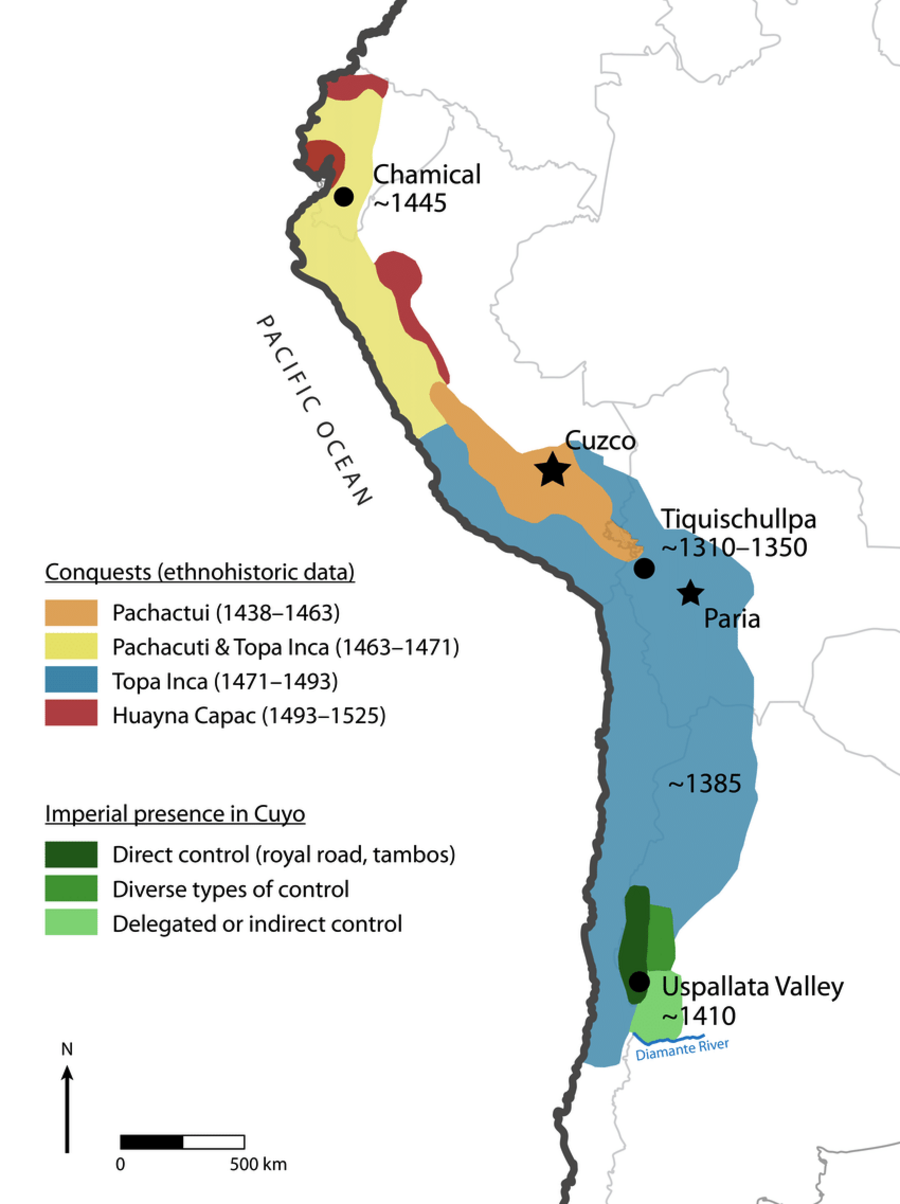
Article Marsh, E., Kidd, R., Ogburn, D., & Durán, V. (2017). Dating the Expansion of the Inca Empire: Bayesian Models from Ecuador and Argentina. Radiocarbon, 59(1), 1-24. https://doi.org/10.1017/RDC.2016.118
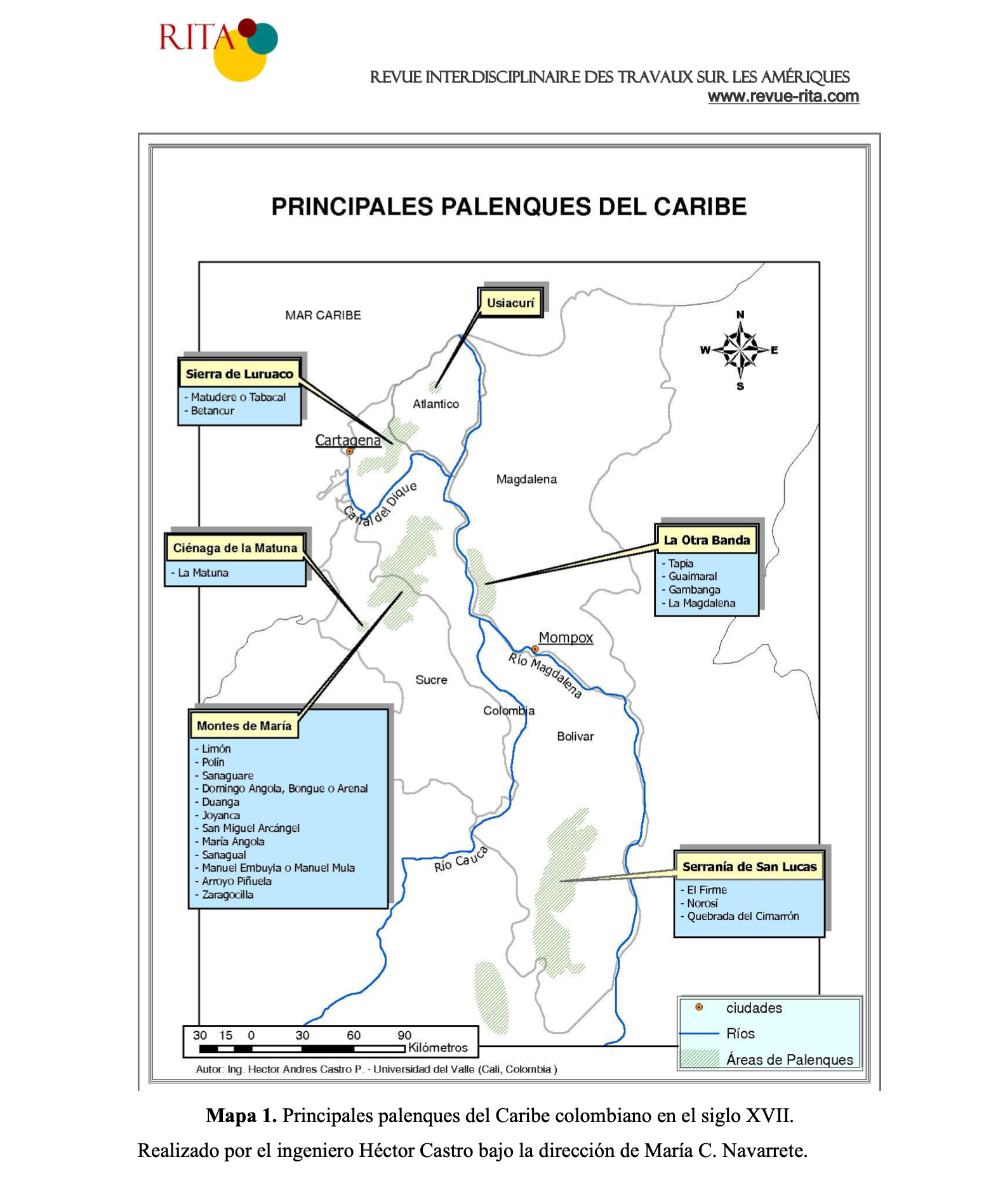
PRINCIPALES PALENQUES DEL CARIBE
Mapa 1600 - 1699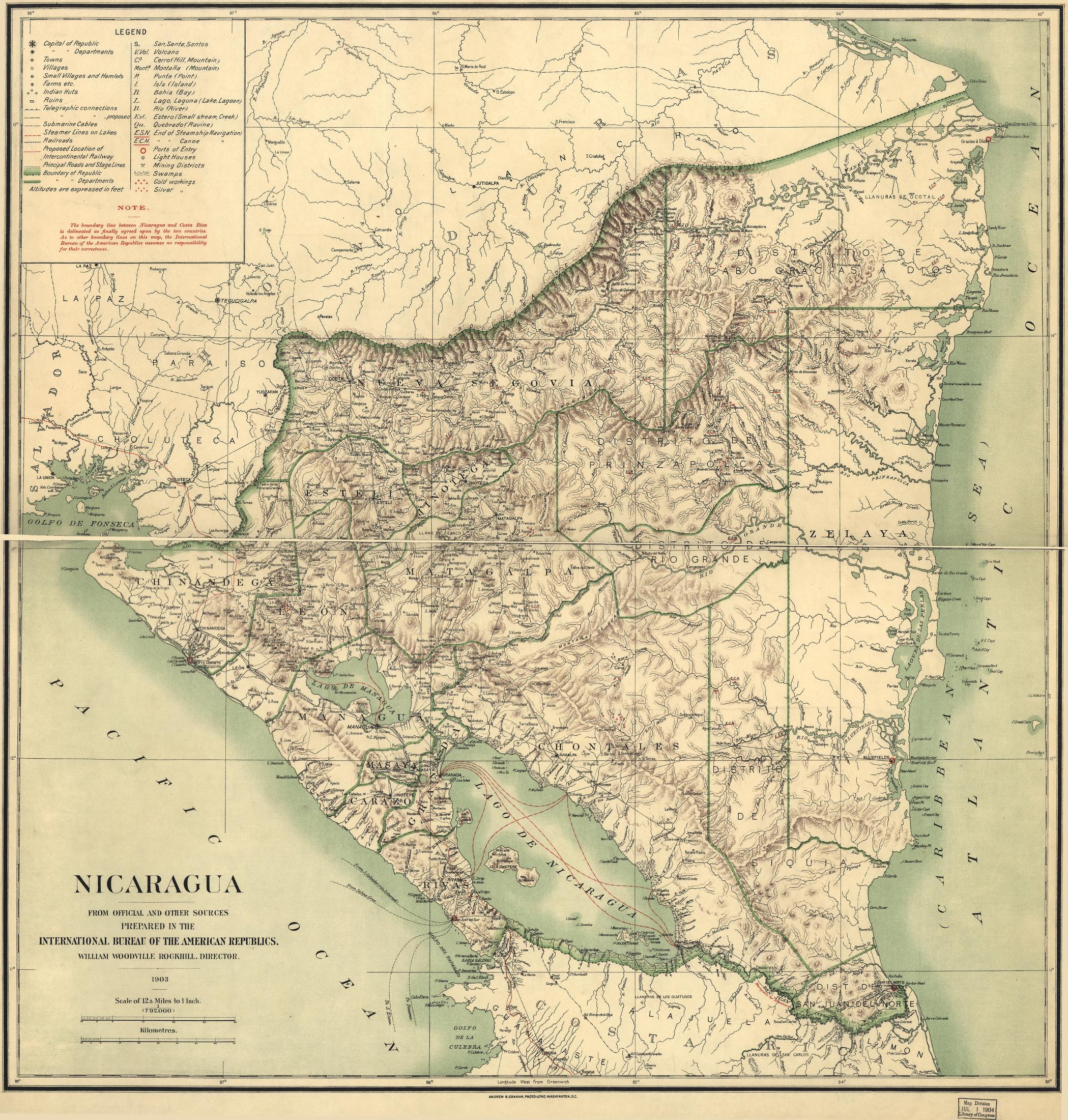
Nicaragua
Mapa 1900 - 1903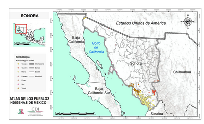
SONORA
Mapa 2015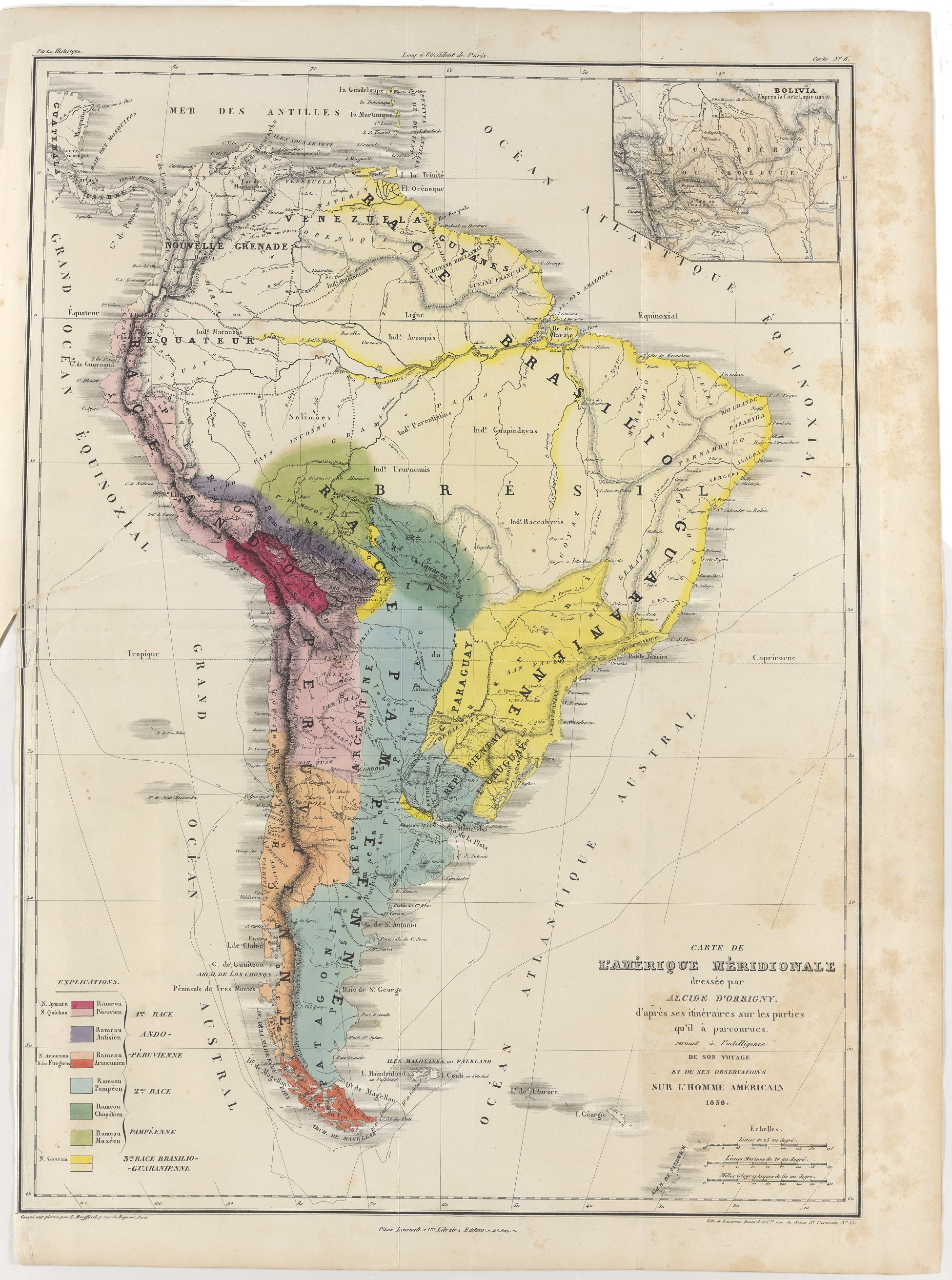
Carte de l'Amérique Méridionale dressée par Alcide d'Orbigny. d'aprés ses itinéraires sur les parties qu'il à parcourues servant à l'intelligence de son voyage et de ses observations sur l'homme américain
Mapa 1829![Descricción [sic] Plan del Río Tinto con su Pueblo, Barra y pies de agua que hai como demuestran los números;fortalezas como marca el Abezedario](https://dnet8ble6lm7w.cloudfront.net/maps/HON/HON0035.jpg)
Descricción [sic] Plan del Río Tinto con su Pueblo, Barra y pies de agua que hai como demuestran los números;fortalezas como marca el Abezedario
Mapa 1743 - 1744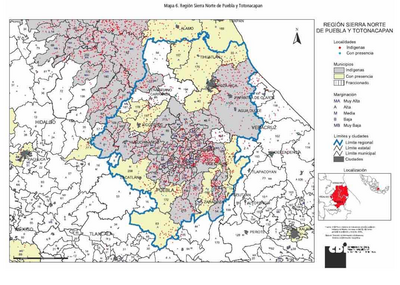
REGIÓN SIERRA NORTE DE PUEBLA Y TOTONACAPAN
Mapa 2000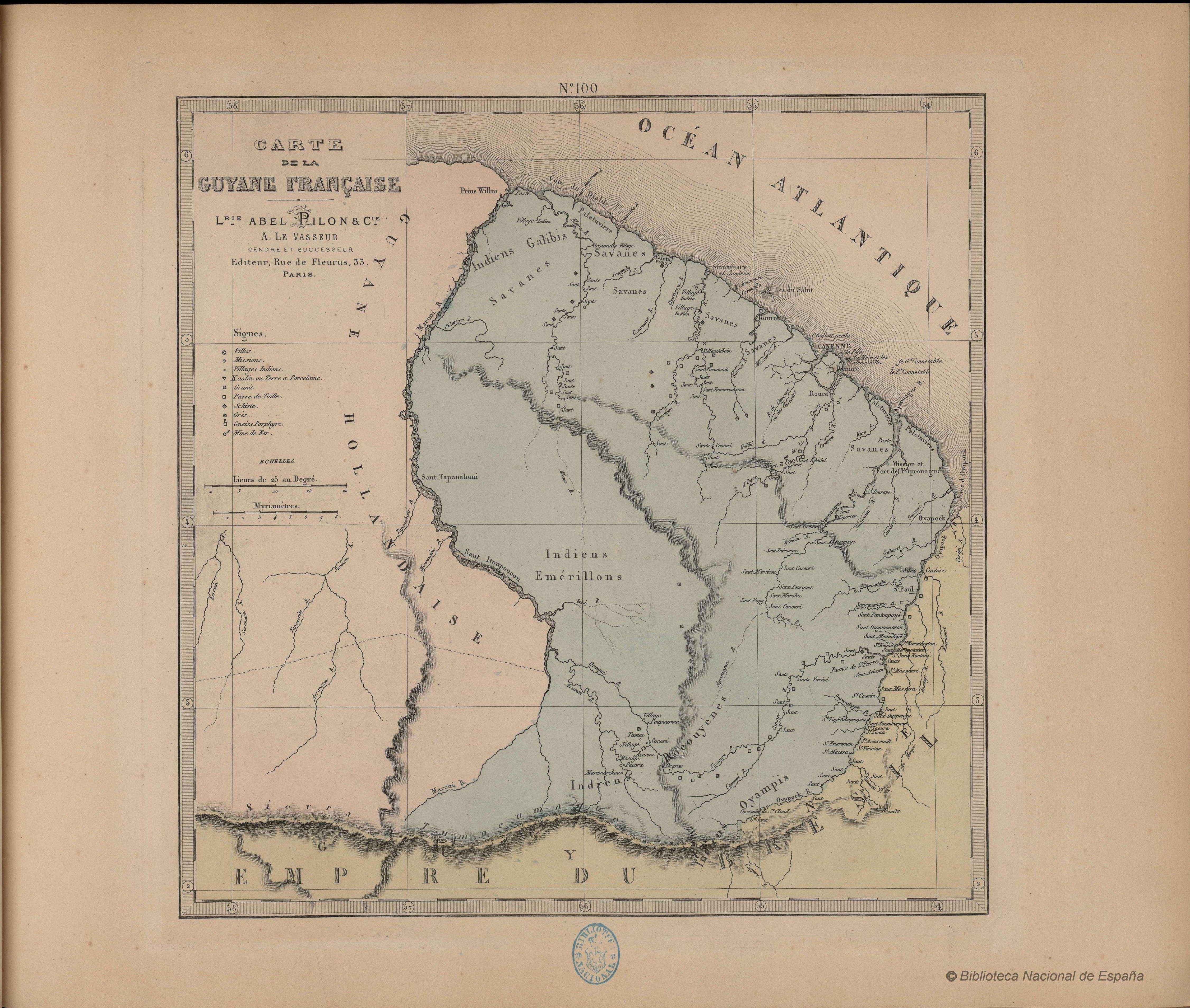
N. 100. Carte de la Guyane Française
Mapa 1878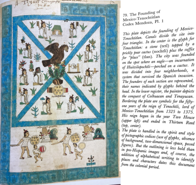
The Founding of Tenochtitlan-Mexico Codex Mendoza, Pl 1
Mapa 1541