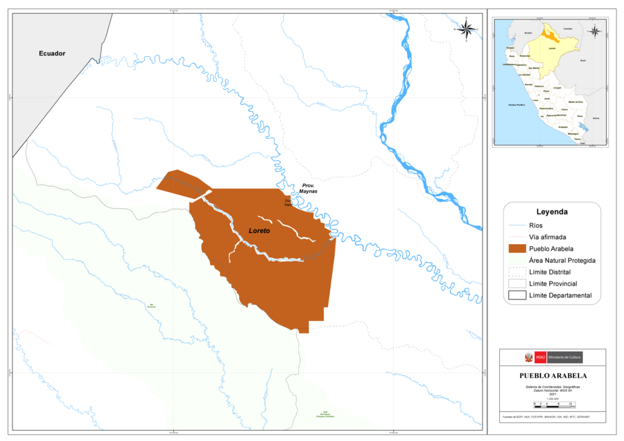
Pueblos
- ARABELA
Cita
Ministerio de Cultura Perú. (2020). Lista de pueblos indígenas u originarios. BDPI: Base de Datos de Pueblos Indígenas u Originarios. https://bdpi.cultura.gob.pe/pueblos-indigenas
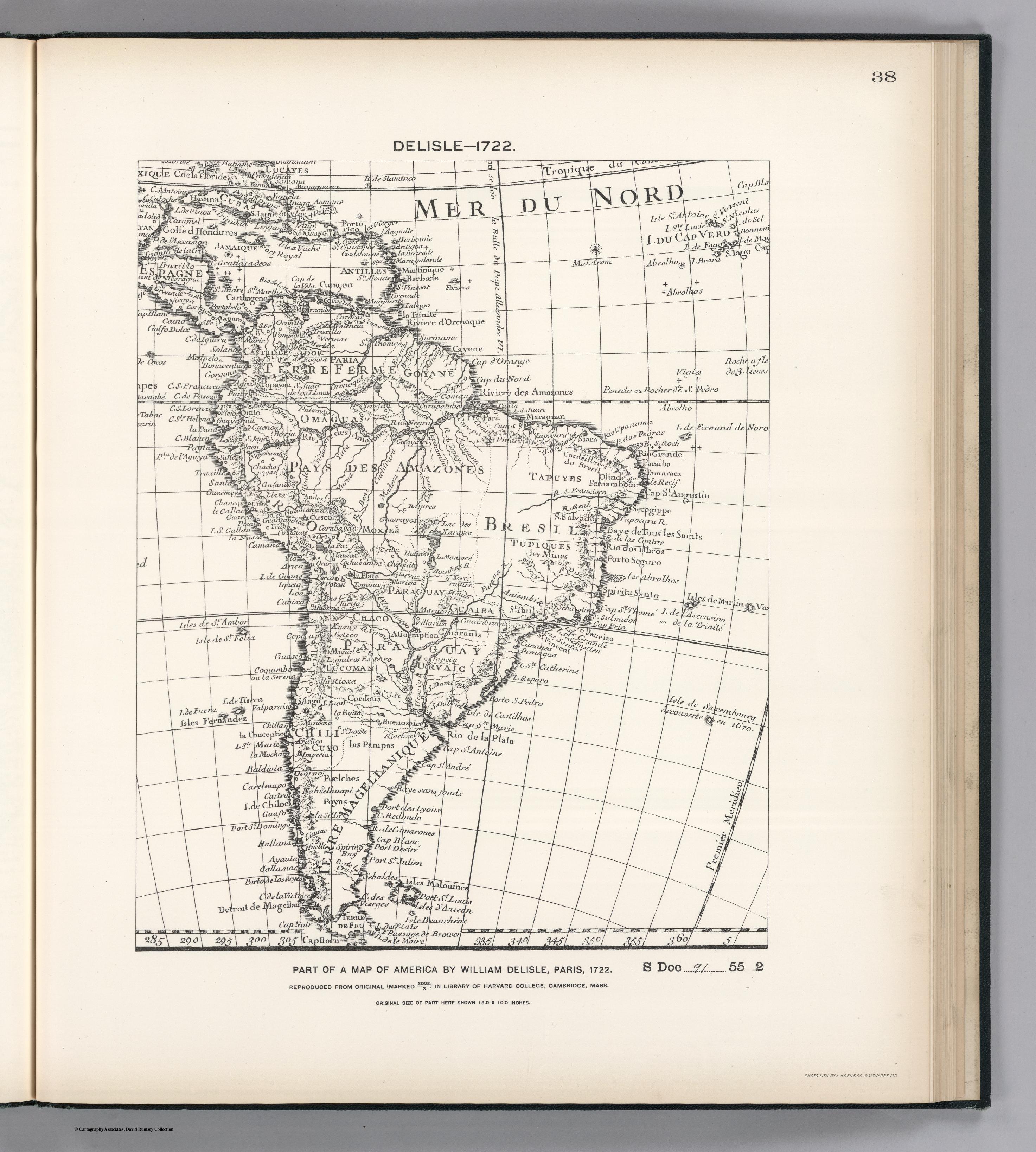
FACSIMILE PART OF AMERICA BY DELISLE
Mapa 1722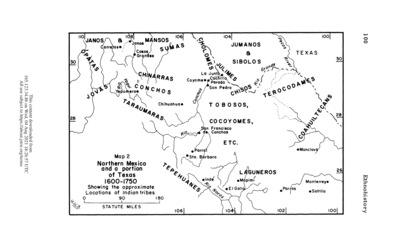
Northern Mexico and a Portion of Texas 1600-1750 Showing the approximate Locations of Indian tribes
Mapa 1600 - 1750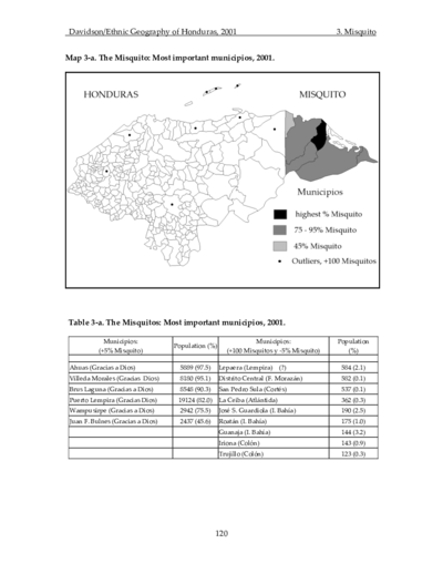
The Misquito: Most important municipios, 2001
Mapa 2001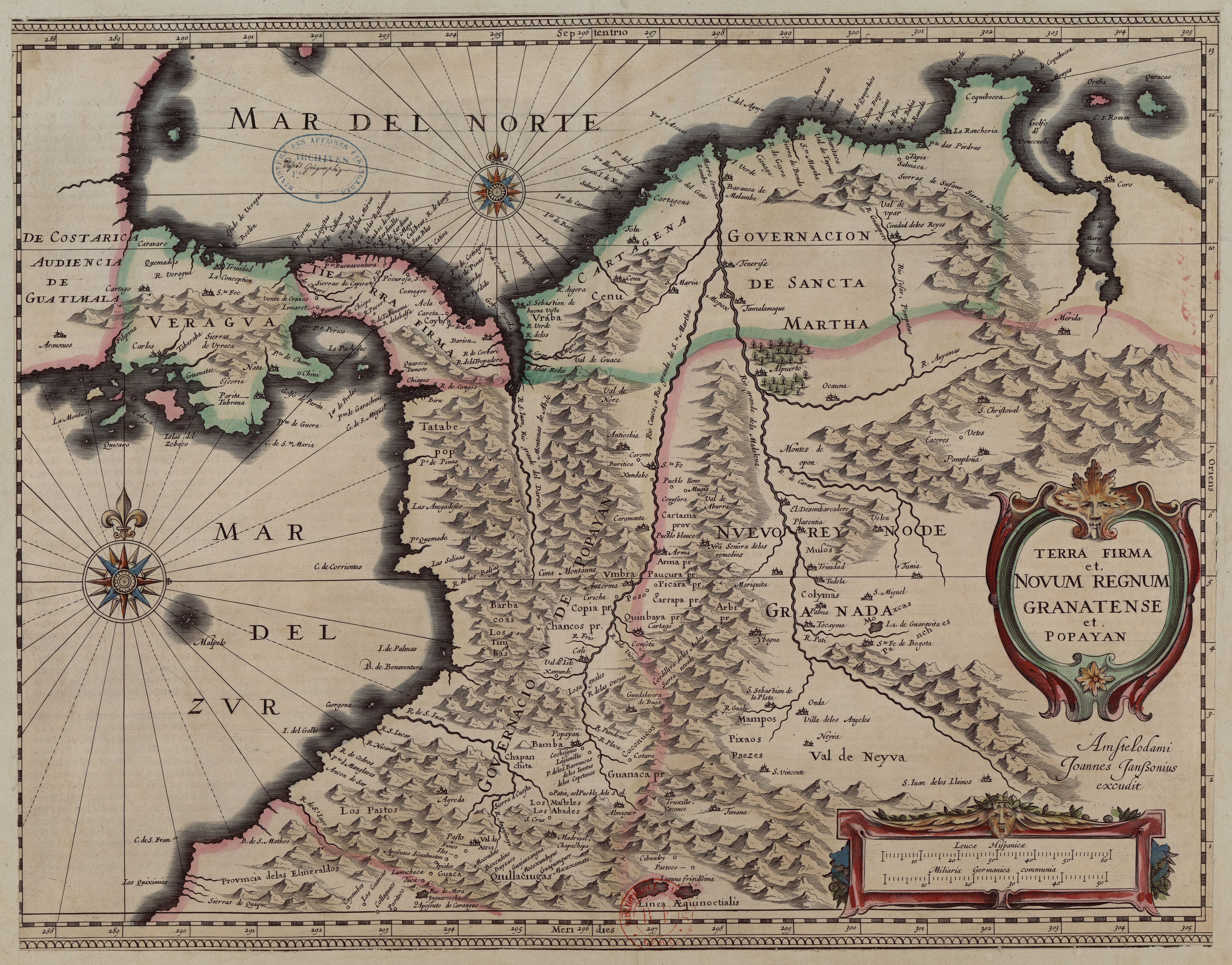
Terra Firma et Novum Regnum Granatense et Popayan
Mapa 1635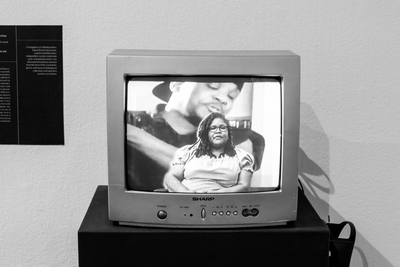
El mundo entero está mirando: Todas las mujeres son bienvenidas
Obra de Arte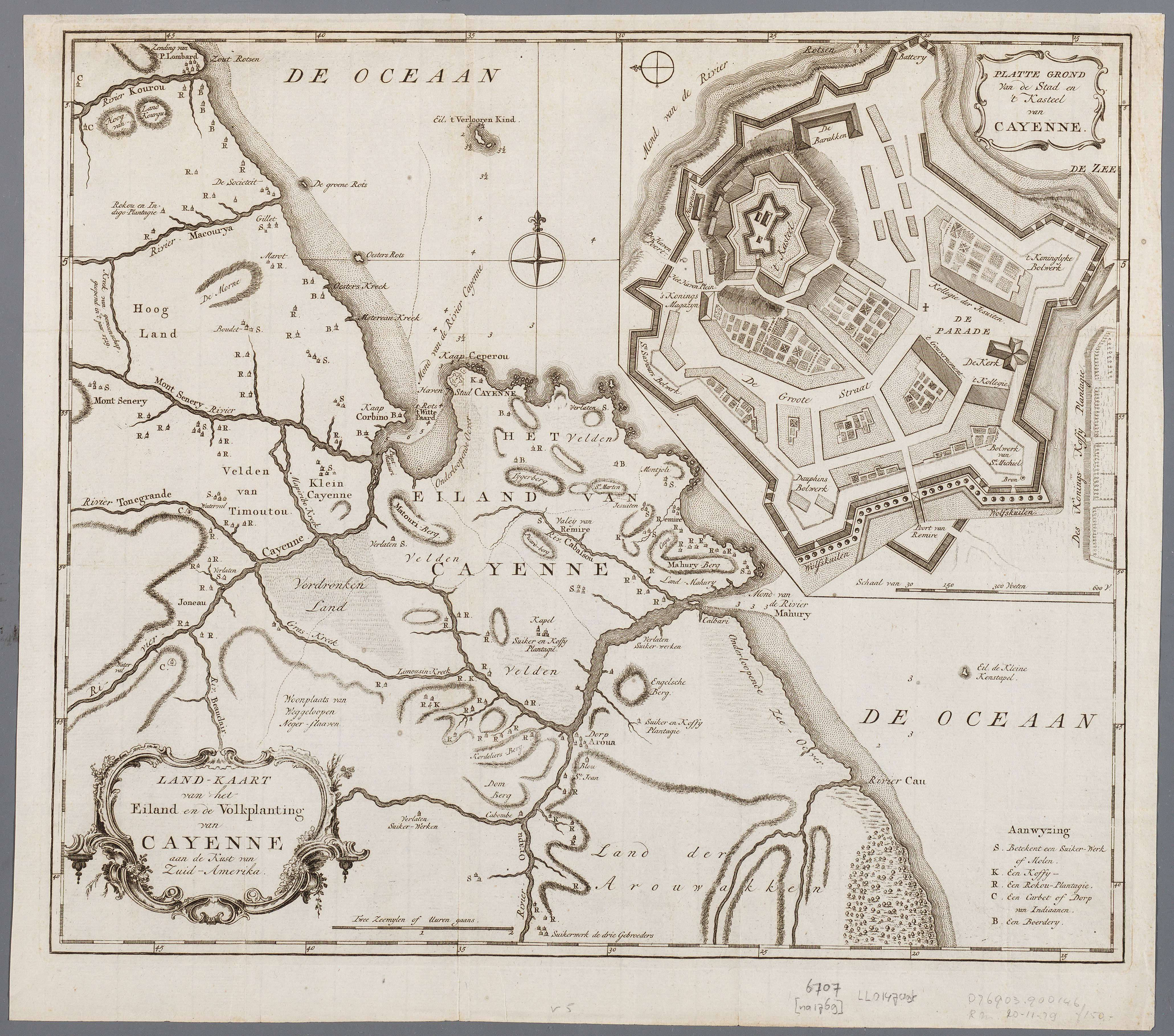
Land-kaart van het eiland en de volksplanting van Cayenne aan de kust van Zuid-Amerika
Mapa 1769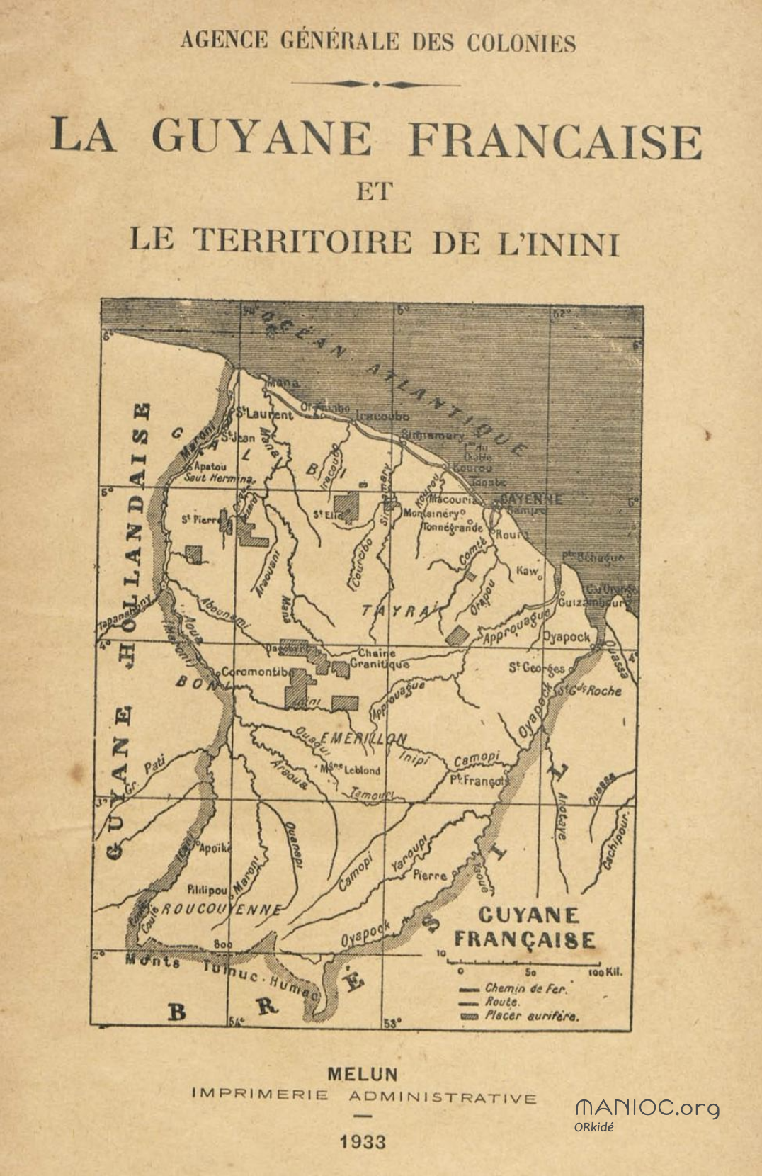
La Guyane française et le territoire de l'Inini.
Mapa 1933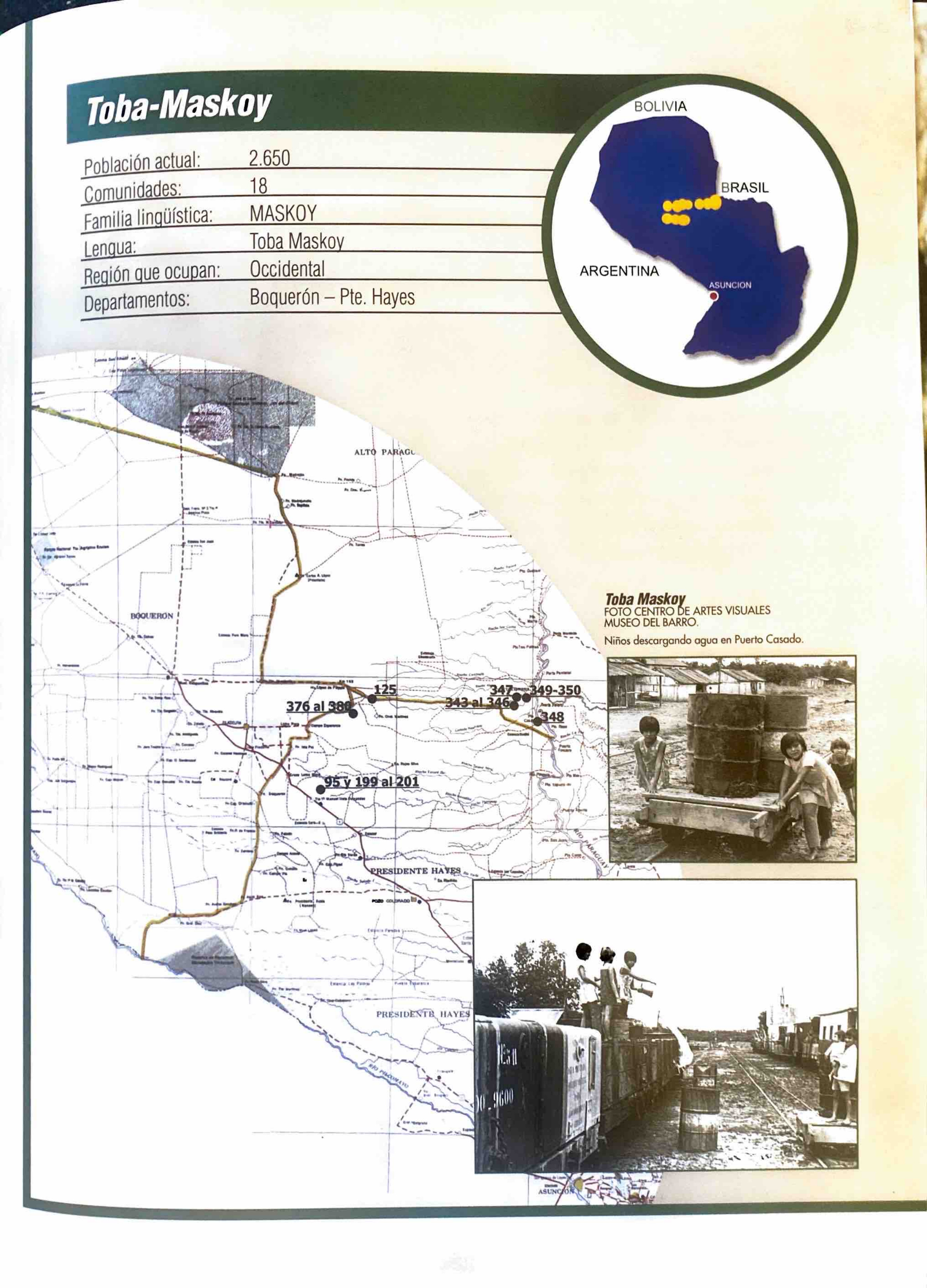
Toba-Maskoy
Mapa 2001