Pueblos
- GUARANI
Cita
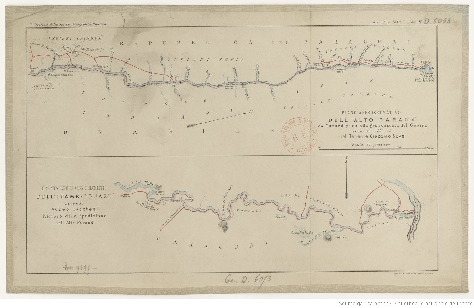
Lucchesi, Adamo. Trenta Leghe (166 chilometri) Dell' Itambe' Guazù. Map (Bottom). Rome: Bruno e Salomone, 1884. Accessed May 7, 2023. https://gallica.bnf.fr/ark:/12148/btv1b84449935#.

Outlines of the physical and political division of South America: Delineated by A. Arrowsmith partly from scarce and original documents, published before the year 1806 but principally from manuscript maps & surveys made between the years 1771 and 1806, corrected from accurate astronomical observations to 1810.
Mapa 1800 - 1899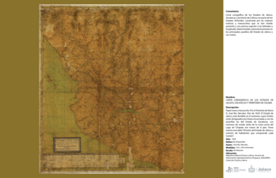
CARTA COROGRÁFICA DE JALISCO, ZACATECAS Y COLIMA
Mapa 1824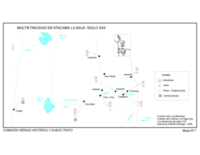
Pueblos del Chanar y el Algarrobo. Los Atacamas del Siglo XVII.
Mapa 1600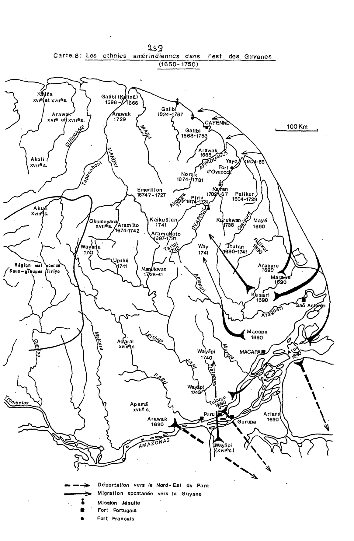
Carte 8: Les ethnies amérindiennes dans l'est des Guyanes (1650-1750)
Mapa 1650 - 1750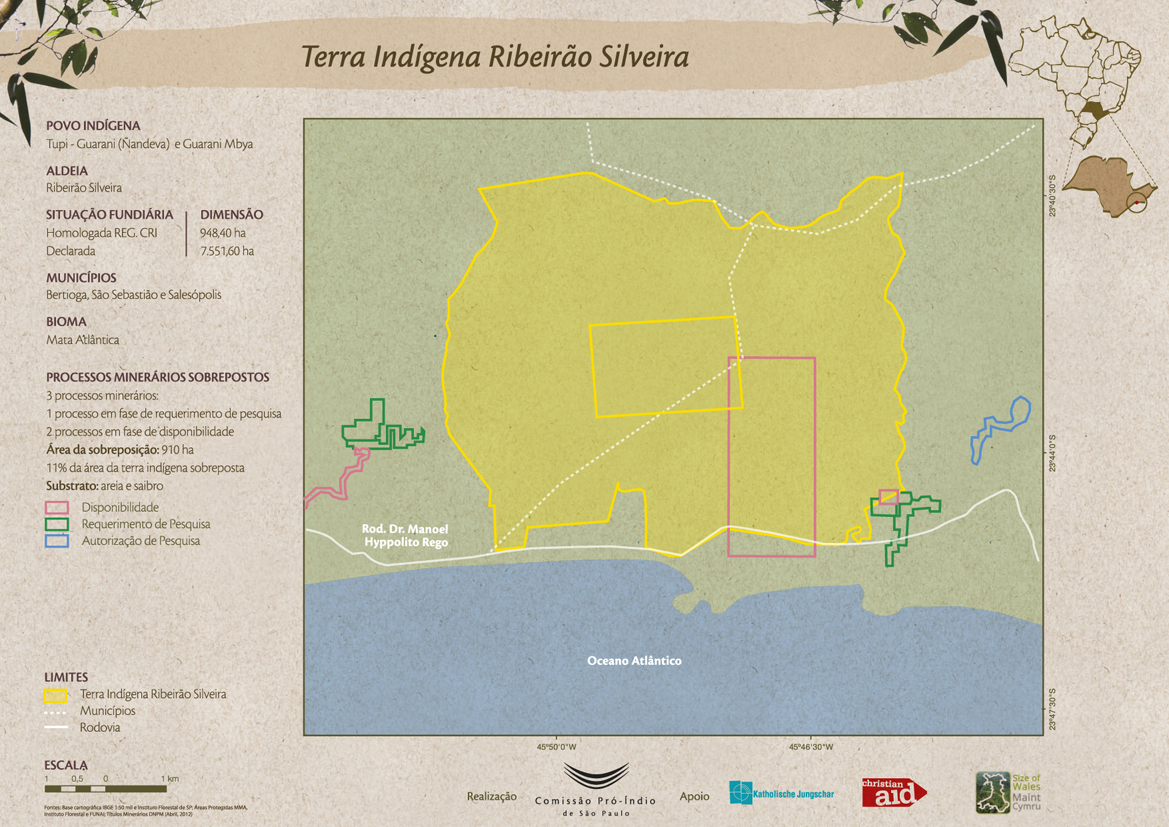
Terra Indígena Ribeirão Silveira
Mapa 2012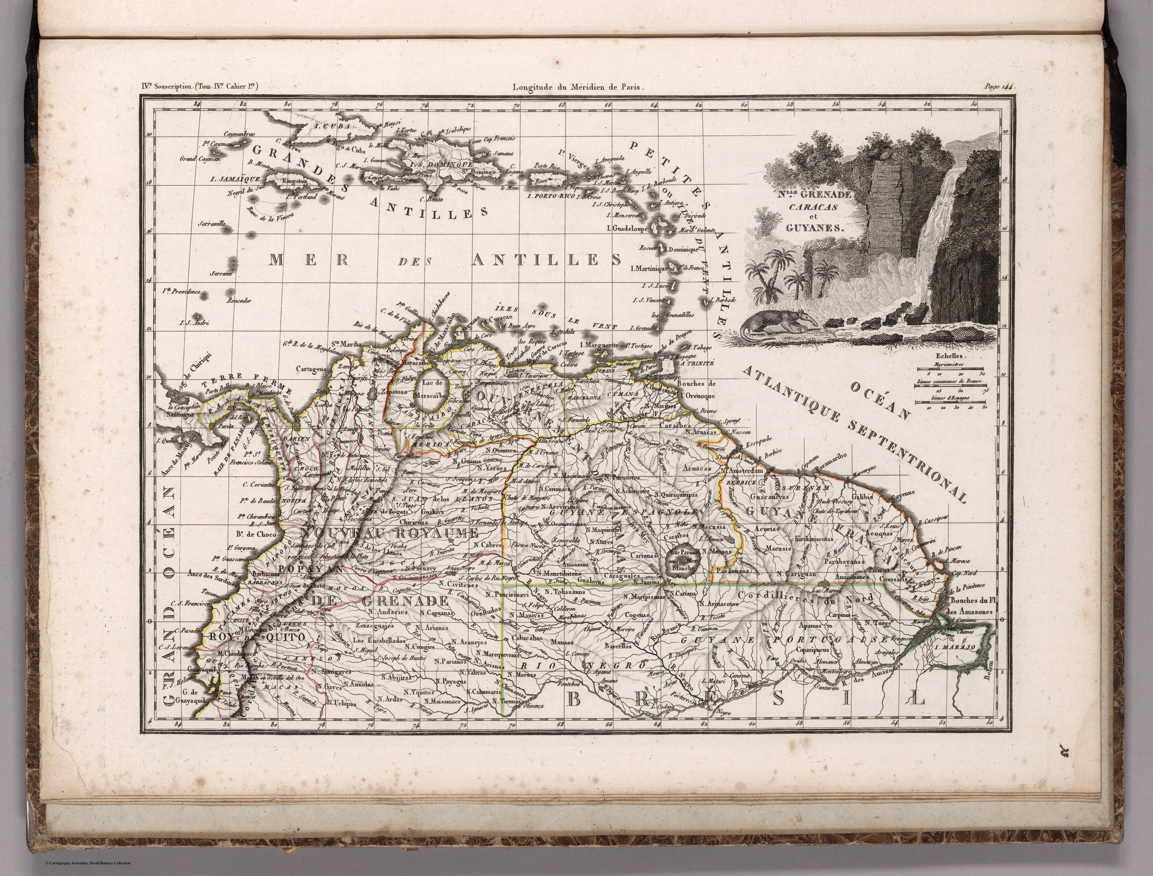
NLLE. GRENADE CARACAS ET GUYANES.
Mapa 1812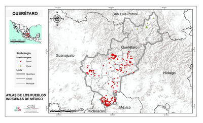
QUERÉTARO
Mapa 2015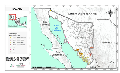
SONORA
Mapa 2015