Dispossesions in the Americas

Dispossesions in the Americas

  • Inicio
  • Explorar
  • Autores
  • Sobre
  • Arte
  • Cuerpos
  • Planes de Estudio
  • Herencia Cultural
  • Mapas
  • Territorios
Volver a Explorar

Leyendo en Inglés

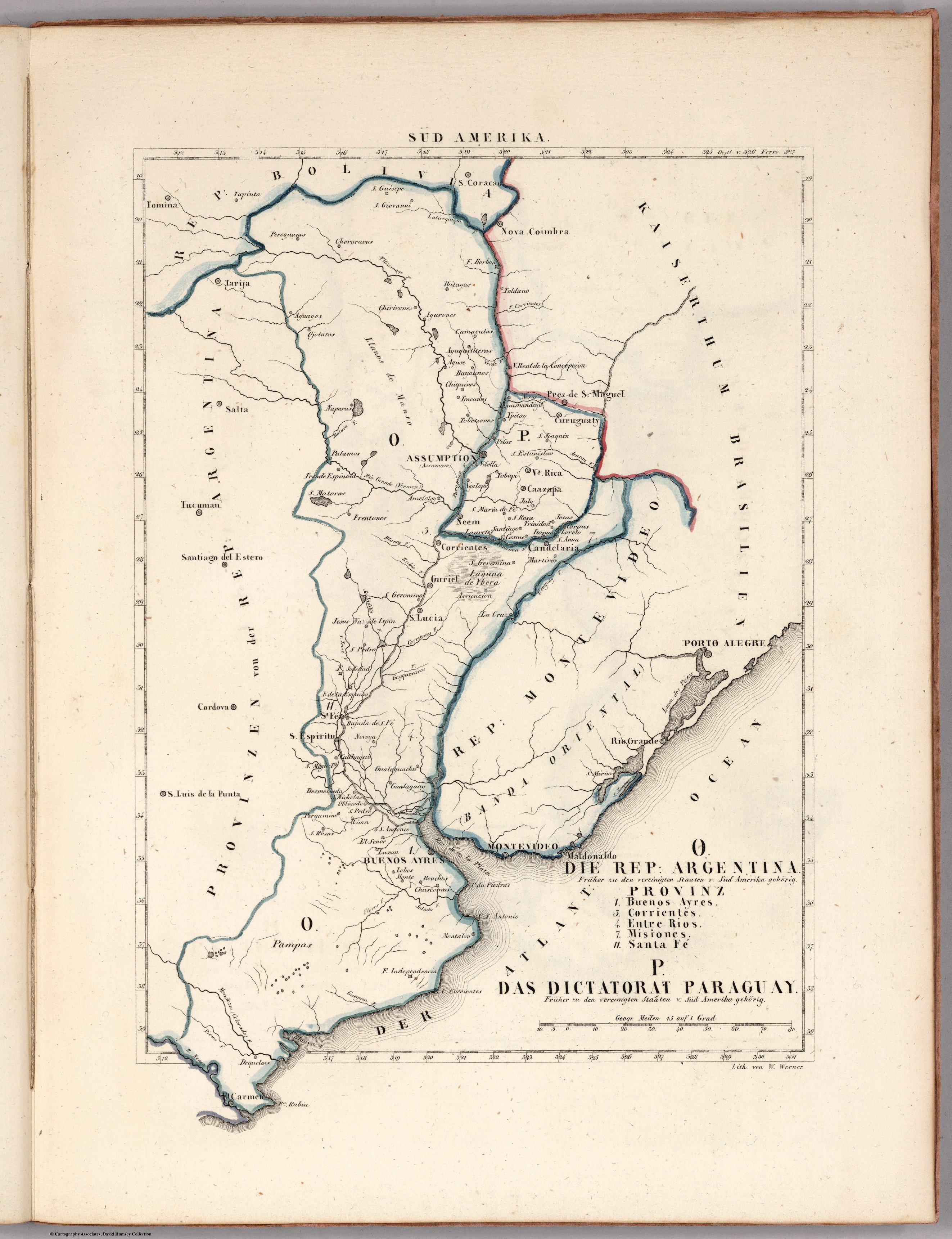
Mapa 1830

O. DIE REP: ARGENTINA. P. DAS DICTATORAT PARAGUAY.

  • SCHLIEBEN, WILHELM ERNST AUGUST VON

Publicado: 1830

  • Descargar Imágen
  • Descargar Imágen
Mapa 1830

O. DIE REP: ARGENTINA. P. DAS DICTATORAT PARAGUAY.

  • SCHLIEBEN, WILHELM ERNST AUGUST VON

Publicado: 1830

  • Descargar Imágen

Pueblos

  • CHORARACAS
  • IBITAYAS
  • CHIRIGUANO
  • OJOTAES
  • YGARONOS
  • CAMACUTAS
  • AYGUITERAS
  • AGUSE
  • TOBATINES
  • NAPARUS
  • VILELLA

Citas

Schlieben, Wilhelm Ernst August von. O. Die Rep. Argentina. Provinz 1,3,4,7, 11. P. Die Dictatorat Paraguay. Map. Leipzig: George Joachim Goschen, 1830. Accessed April 25, 2023. https://www.davidrumsey.com/luna/servlet/detail/RUMSEY~8~1~269911~90045182:O--Die-Rep--Argentina--Provinz-1,3,?sort=pub_list_no_initialsort%2Cpub_date%2Cpub_list_no%2Cseries_no.
  • Descargar Imágen

Artículos Relacionados

Eclipse Solar

Eclipse Solar

Obra de Arte
XXIV. Carte du Rio Grande de la Magdalena, depuis ses sources jusqu'a son embouchure.

XXIV. Carte du Rio Grande de la Magdalena, depuis ses sources jusqu'a son embouchure.

Mapa 1799 - 1804
Intendencias y gobiernos militares de la Nueva España en 1800

Intendencias y gobiernos militares de la Nueva España en 1800

Mapa 1800
"Pueblos Indígenas 1940 y Cacicazgos del Siglo XVI de Costa Rica"

"Pueblos Indígenas 1940 y Cacicazgos del Siglo XVI de Costa Rica"

Mapa 1500 - 1899
LOCALIZACIÓN GEOGRÁFICA DE BORAS Y MIRAÑAS

LOCALIZACIÓN GEOGRÁFICA DE BORAS Y MIRAÑAS

Mapa
"Territorio Indígena Brunka de Rey Curré"

"Territorio Indígena Brunka de Rey Curré"

Mapa 2010
INDIGENOUS DRAFT LABOR (MITA) FOR MINES OF POTOSI UNDER SPANISH COLONIAL RULE – THE CASE OF THE PAKAXA AYMARA POLITY IN THE LATE 16TH CENTURY

INDIGENOUS DRAFT LABOR (MITA) FOR MINES OF POTOSI UNDER SPANISH COLONIAL RULE – THE CASE OF THE PAKAXA AYMARA POLITY IN THE LATE 16TH CENTURY

Mapa 1570 - 1650
Matrimonios Duitama

Matrimonios Duitama

Mapa 1500 - 1600

Despojos en las Américas

Un Proyecto de

University of Pennsylvania

Copyright 2024

Con el apoyo de

Mellon Foundation

Diseño y Desarrollo del Sitio

Element 84

Créditos Artísticos

Schlieben, Wilhelm Ernst August von. O. Die Rep. Argentina. Provinz 1,3,4,7, 11. P. Die Dictatorat Paraguay. Map. Leipzig: George Joachim Goschen, 1830. Accessed April 25, 2023. https://www.davidrumsey.com/luna/servlet/detail/RUMSEY~8~1~269911~90045182:O--Die-Rep--Argentina--Provinz-1,3,?sort=pub_list_no_initialsort%2Cpub_date%2Cpub_list_no%2Cseries_no.
Páginas del Sitio

  • Inicio
  • Explorar
  • Autores
  • Sobre
  • Arte
  • Cuerpos
  • Planes de Estudio
  • Herencia Cultural
  • Mapas
  • Territorios