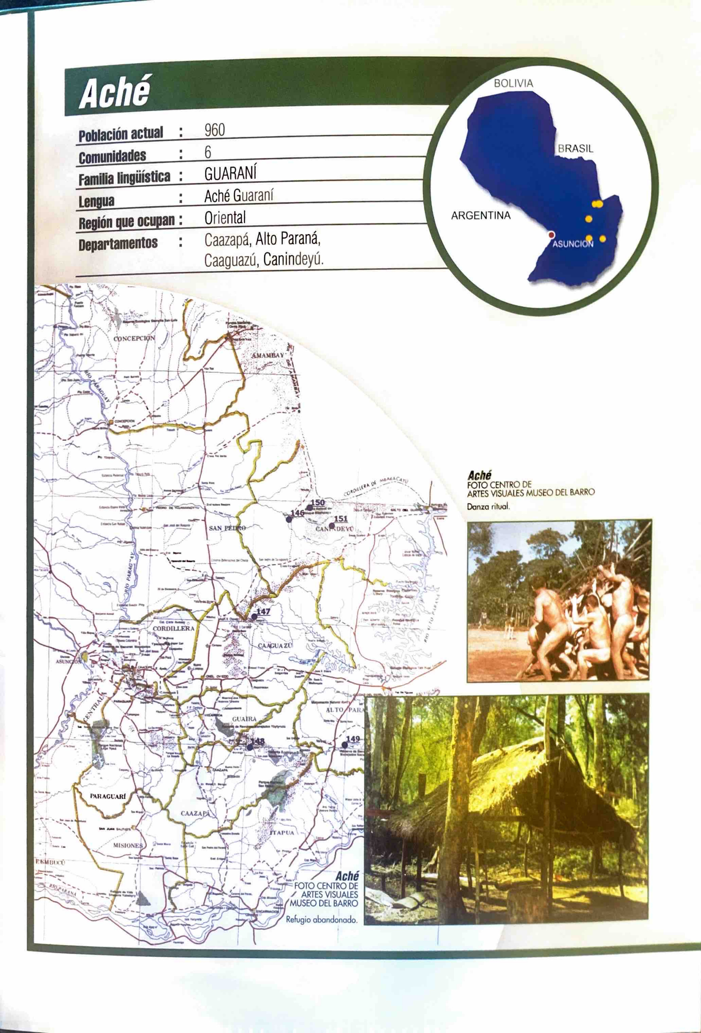
Pueblos
- ACHE
Cita
Zanardini, José, and Walter Biedermann. Los Indígenas Del Paraguay. 2nd ed. Asunción: ITAIPU Binacional, 2006.
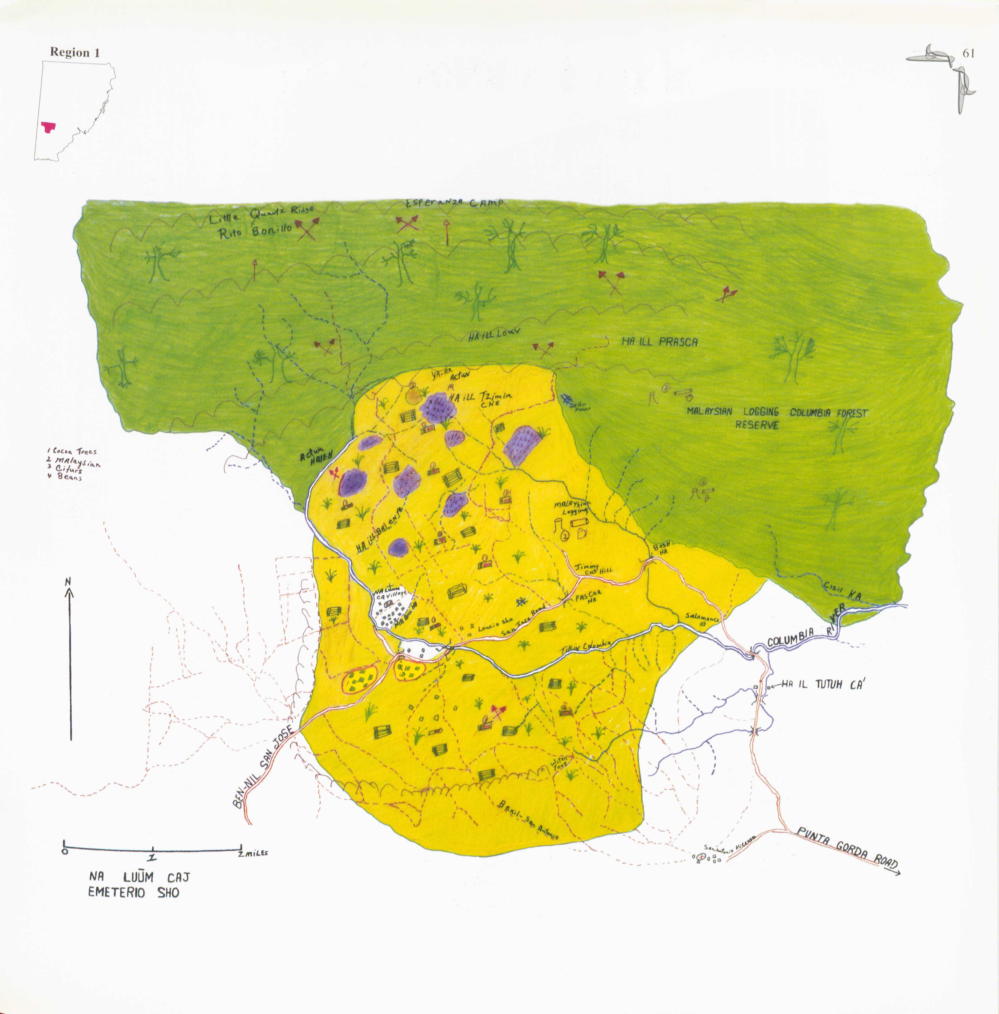
Na Luum Caj
Mapa 1997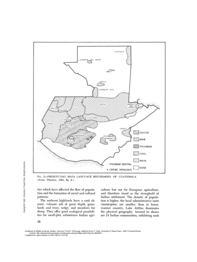
PRESENT-DAY MAYA LANGUAGE BOUNDARIES OF GUATEMALA
Mapa 1961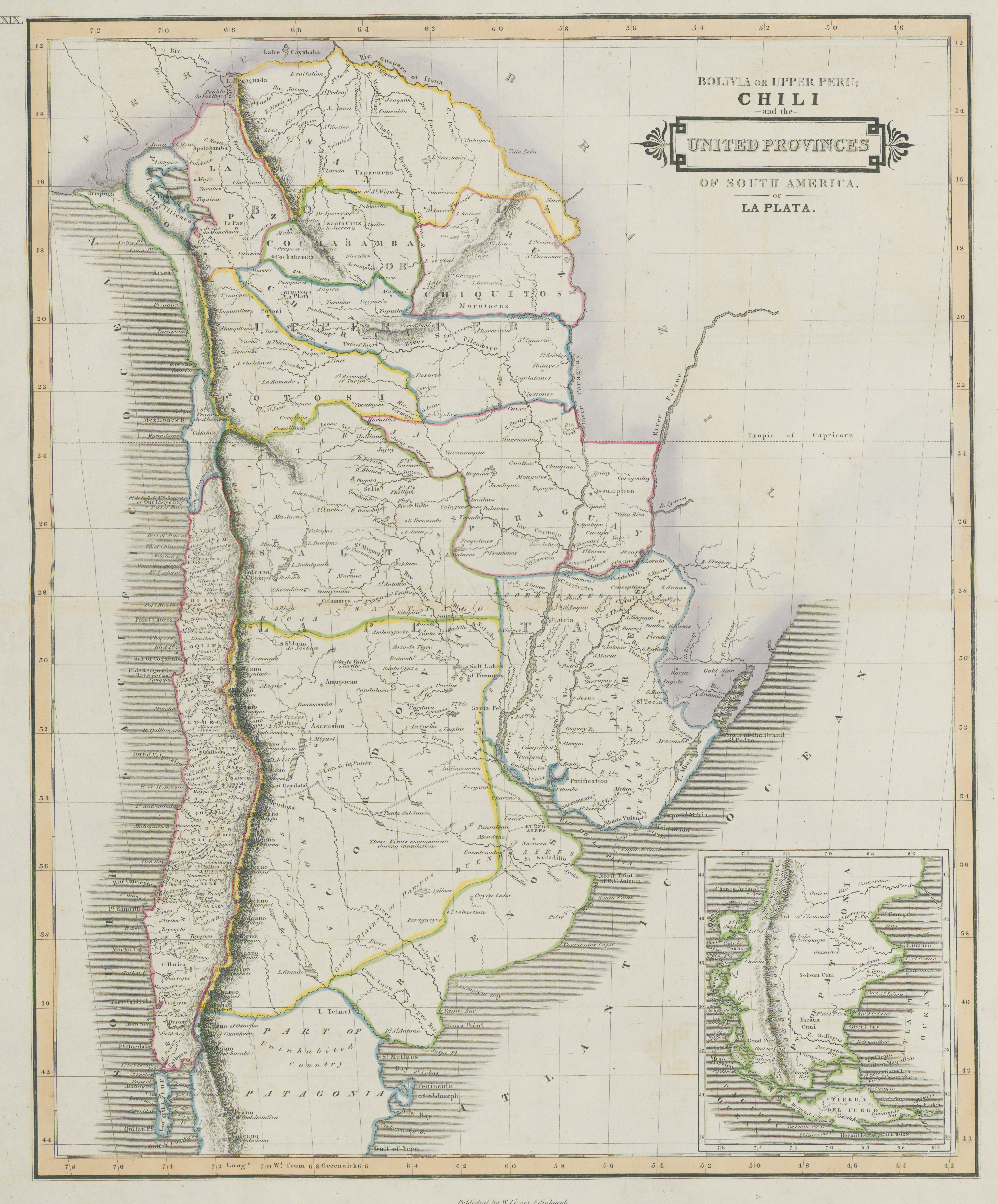
Bolivia Or Upper Peru;Chili and the United Provinces Of South America, or La Plata
Mapa 1800 - 1850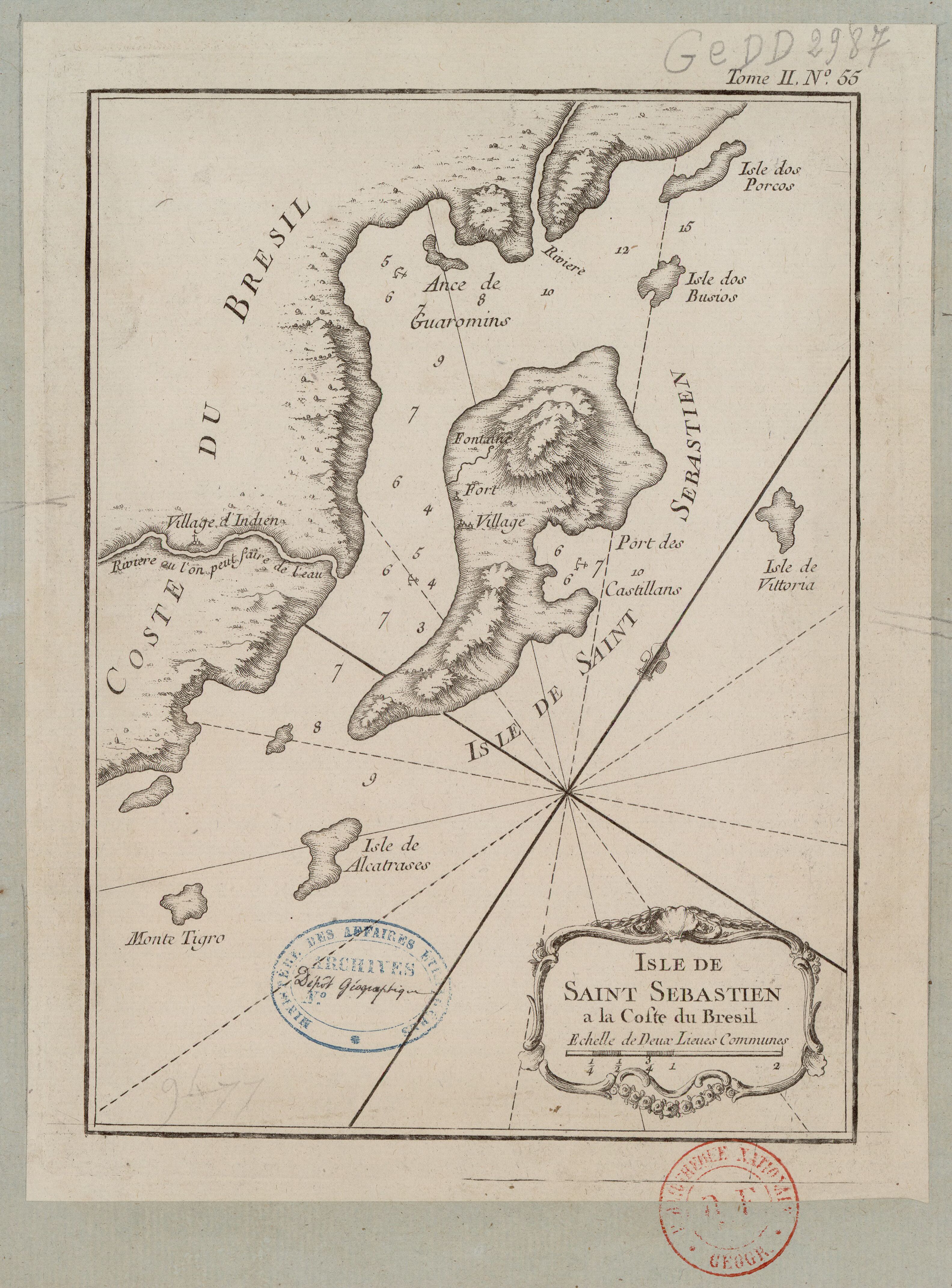
ISLE DE SAINT SÉBASTIEN a la Coste du Brésil
Mapa 1764
TOLTECA
Obra de Arte
Government map of Nicaragua : from the latest surveys ordered by President Patricio Rivas and Genl. William Walker ;executed under the supervision of the Señor Fermín Ferrer;Governor of the Western Department;1856
Mapa 1800 - 1856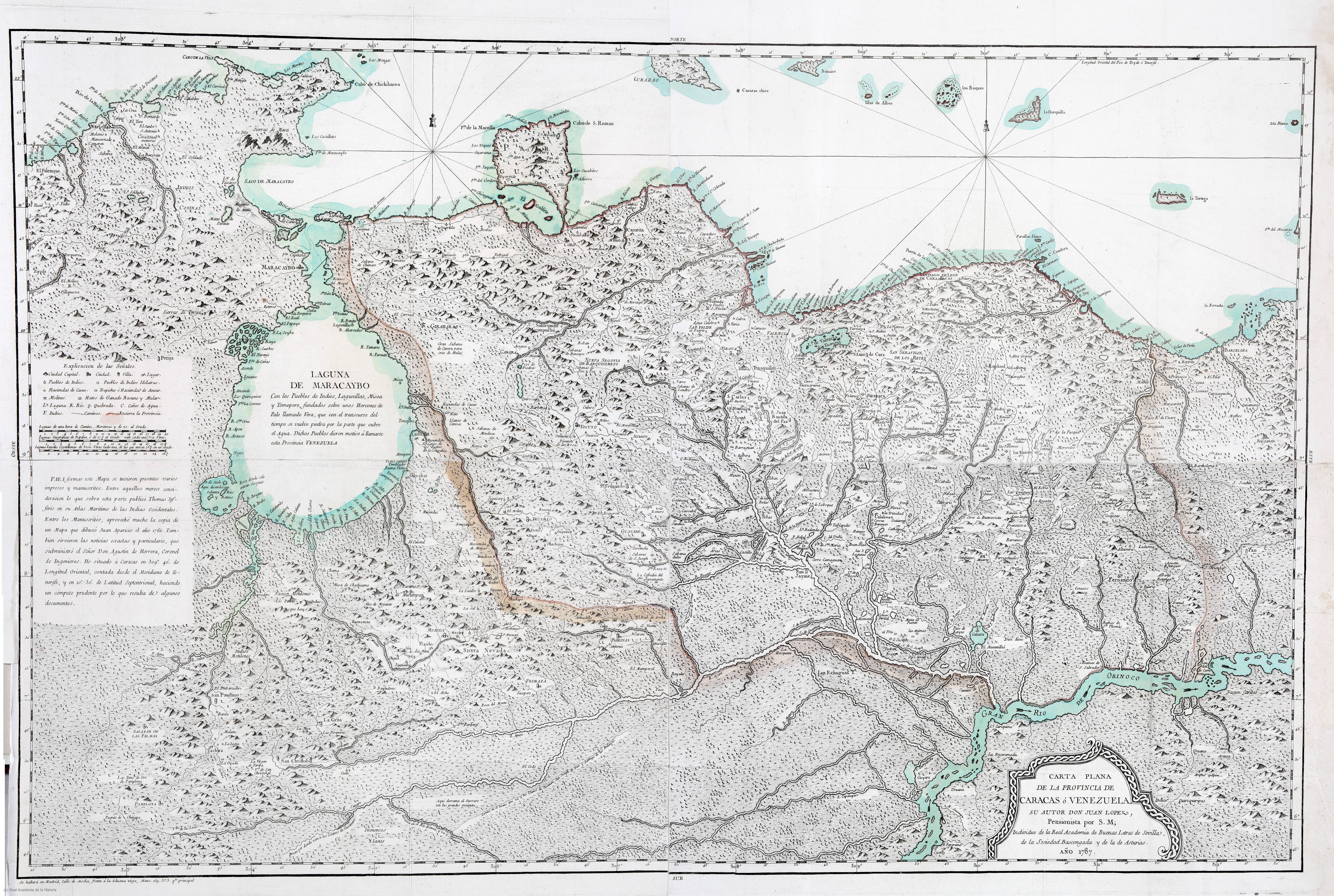
CARTA PLANA DE LA PROVINCIA DE CARACAS Ó VENEZUELA
Mapa 1787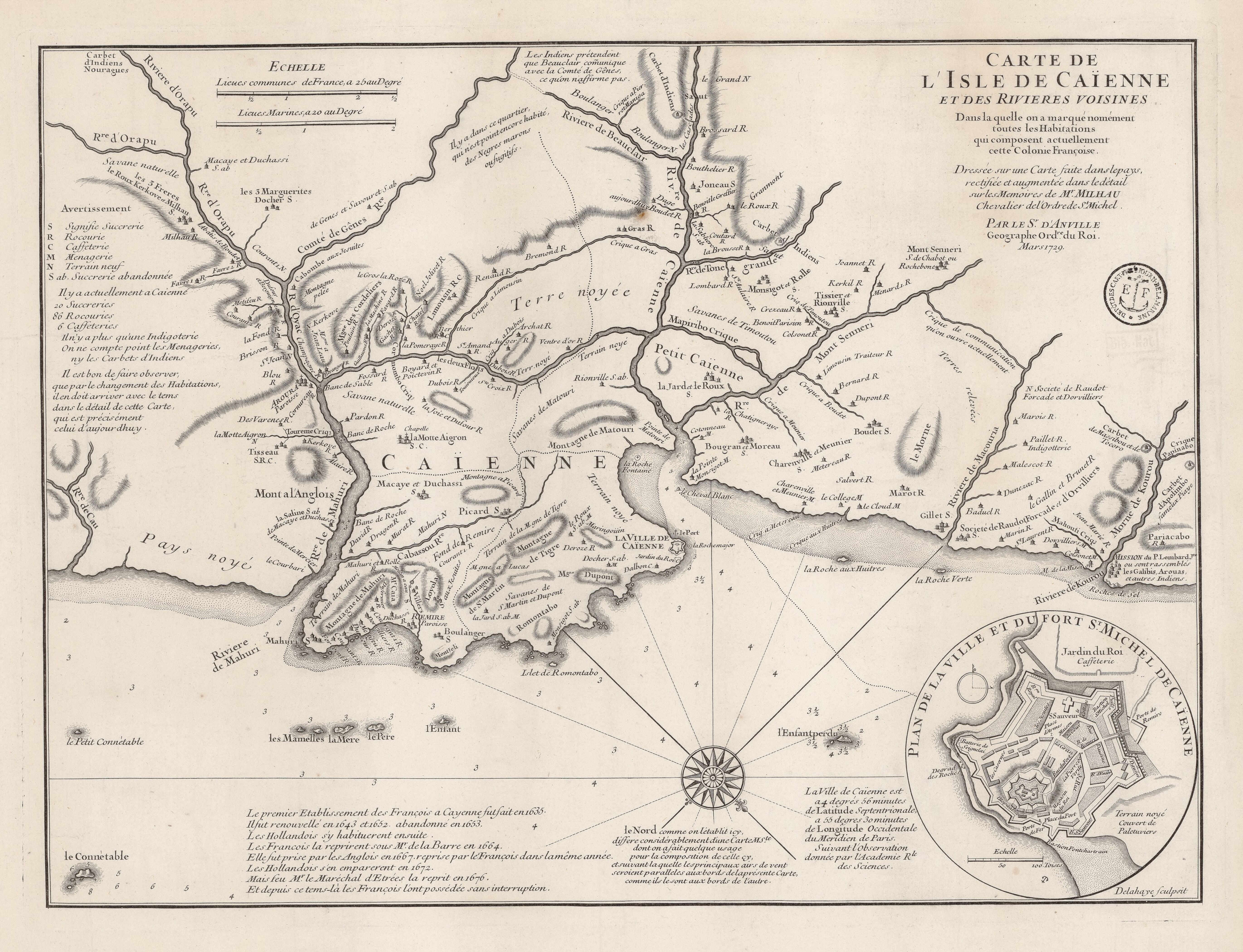
Carte de l'Isle de Caïenne et des rivières voisines dans laquelle on a marqué nommément toutes les habitations qui composent actuellement cette colonie françoise
Mapa 1729