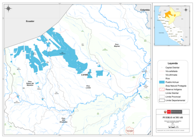
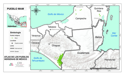
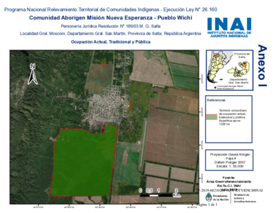
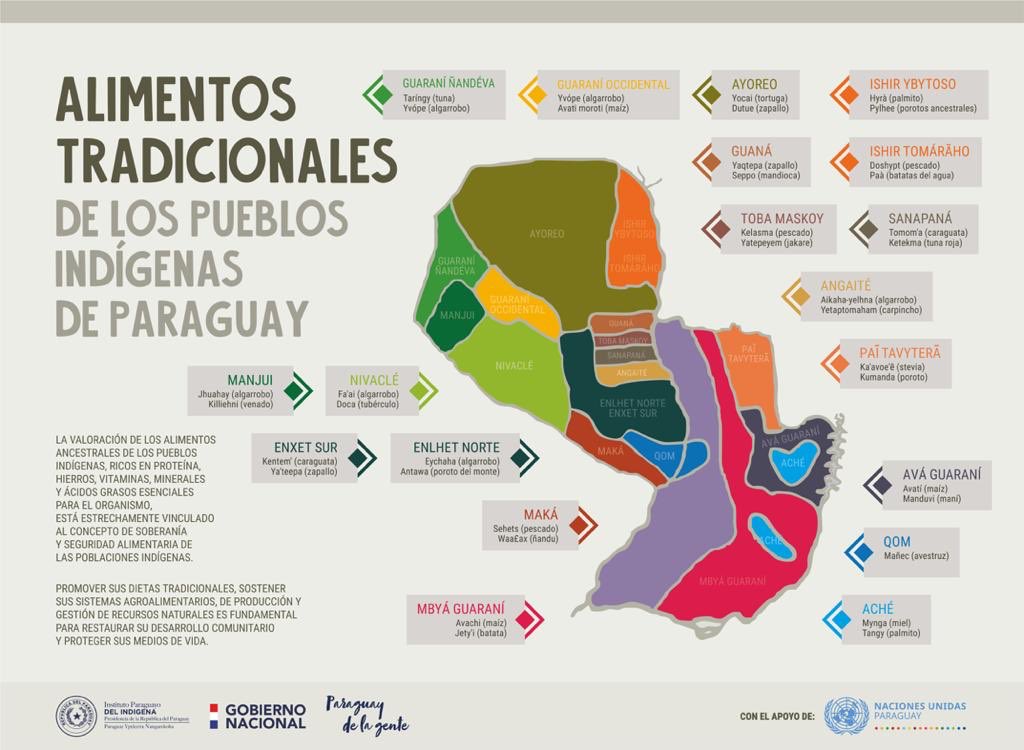
Dispossesions in the Americas

Dispossesions in the Americas

  • Inicio
  • Explorar
  • Autores
  • Sobre
  • Arte
  • Cuerpos
  • Planes de Estudio
  • Herencia Cultural
  • Mapas
  • Territorios
Volver a Explorar

Leyendo en Inglés

Mapa

ALIMENTOS TRADICIONALES DE LOS PUEBLOS INDÍGENAS DE PARAGUAY

  • INSTITUTO PARAGUAYO DEL INDIGENA

Publicado: 2020

  • Descargar Imágen
  • Descargar Imágen
Mapa

ALIMENTOS TRADICIONALES DE LOS PUEBLOS INDÍGENAS DE PARAGUAY

  • INSTITUTO PARAGUAYO DEL INDIGENA

Publicado: 2020

  • Descargar Imágen

Pueblos

  • GUARANI NANDEVA
  • GUARANI OCCIDENTAL
  • AYOREO
  • GUANA
  • TOBA MASKOY
  • CHAMACOCOS
  • ISHIR TOMARAHO
  • SANAPANA
  • ANGAITE
  • PAI TAYTERA
  • AVA-GUARANI
  • QOM
  • ACHE
  • MBYA
  • MAKA
  • ENLHET NORTE
  • ENXET SUR
  • NIVACLE
  • MANJUI

Citas

Instituto Paraguayo del Indígena. "Alimentos Tradicionales de los Pueblos Indígenas de Paraguay." Map. Twitter. August 19, 2020. Accessed April 16, 2023. https://twitter.com/INDIPY/status/1296154963991830531.

  • Descargar Imágen

Artículos Relacionados

Reducción del territorio Barí 1500-1900

Reducción del territorio Barí 1500-1900

Mapa 1500 - 1900
CARTA COROGRAFICA DE LA REPÚBLICA DEL ECUADOR / MANUEL VILLAVICENCIO ;LIT. E IMP. DE F. MAYER Y CA.

CARTA COROGRAFICA DE LA REPÚBLICA DEL ECUADOR / MANUEL VILLAVICENCIO ;LIT. E IMP. DE F. MAYER Y CA.

Mapa 1817
Colonies Françaises. Amérique

Colonies Françaises. Amérique

Mapa 1800 - 1899
THE KARANQAS AYMARA POLITY - Instant shot of trans-border connections around 1900 (Google Earth adaptation)

THE KARANQAS AYMARA POLITY - Instant shot of trans-border connections around 1900 (Google Earth adaptation)

Mapa 1860 - 1930
Northern Mexico and a Portion of Texas 1600-1750 Showing the approximate Locations of Indian tribes

Northern Mexico and a Portion of Texas 1600-1750 Showing the approximate Locations of Indian tribes

Mapa 1600 - 1750
PUEBLO AKATECO

PUEBLO AKATECO

Mapa 2020
The Caribee Islands and Guyana.

The Caribee Islands and Guyana.

Mapa 1700 - 1799
PLAN of the Isle GRANDE & the adjacent parts of the COAST of BRAZIL

PLAN of the Isle GRANDE & the adjacent parts of the COAST of BRAZIL

Mapa 1764

Despojos en las Américas

Un Proyecto de

University of Pennsylvania

Copyright 2024

Con el apoyo de

Mellon Foundation

Diseño y Desarrollo del Sitio

Element 84

Créditos Artísticos

Instituto Paraguayo del Indígena. “Alimentos Tradicionales de los Pueblos Indígenas de Paraguay.” Map. Twitter. August 19, 2020. Accessed April 16, 2023. https://twitter.com/INDIPY/status/1296154963991830531.

Páginas del Sitio

  • Inicio
  • Explorar
  • Autores
  • Sobre
  • Arte
  • Cuerpos
  • Planes de Estudio
  • Herencia Cultural
  • Mapas
  • Territorios