Dispossesions in the Americas

Dispossesions in the Americas

  • Inicio
  • Explorar
  • Autores
  • Sobre
  • Arte
  • Cuerpos
  • Planes de Estudio
  • Herencia Cultural
  • Mapas
  • Territorios
Volver a Explorar

Leyendo en Inglés

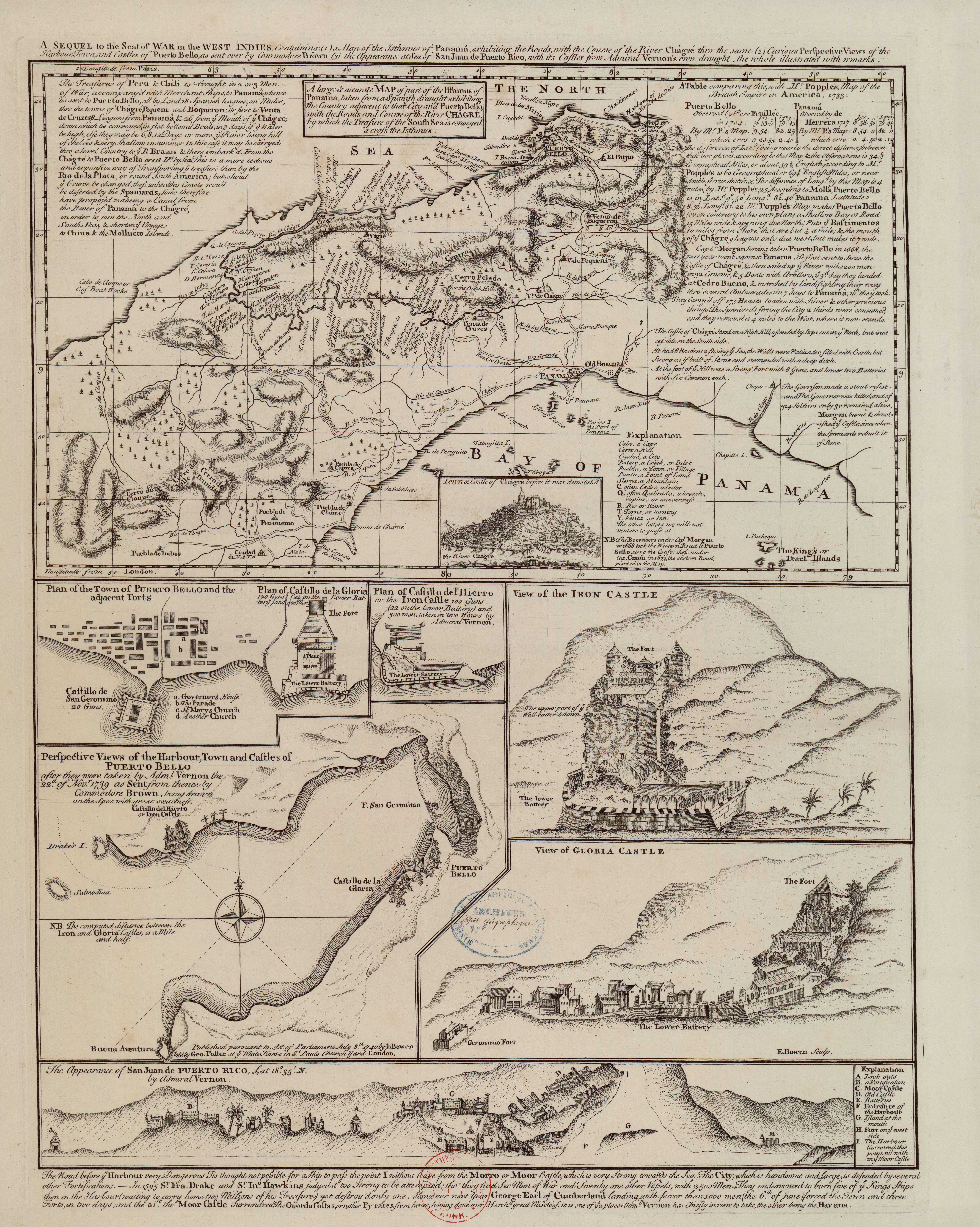
Mapa 1740

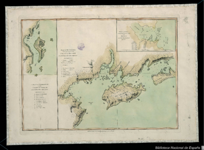
A Sequel of the Seat of War in the West Indies containing… Sub-map title: A large & accurate MAP of part of the Isthmus of Panama, taken from a Spanish drought exhibiting the Country adjacent to that City and Puerto Bello, with the Roads and Course of the River CHAGRE, by which the Treasure of the South Sea is conveyed a cross the Isthmus

  • BOWEN, EMANUEL

Publicado: 1740

  • Descargar Imágen
  • Descargar Imágen
Mapa 1740

A Sequel of the Seat of War in the West Indies containing… Sub-map title: A large & accurate MAP of part of the Isthmus of Panama, taken from a Spanish drought exhibiting the Country adjacent to that City and Puerto Bello, with the Roads and Course of the River CHAGRE, by which the Treasure of the South Sea is conveyed a cross the Isthmus

  • BOWEN, EMANUEL

Publicado: 1740

  • Descargar Imágen

Pueblos

  • PUEBLA DE INDIOS

Citas

Bowen, E. (1740). A large & accurate MAP of part of the Isthmus of Panama, taken from a Spanish drought exhibiting the Country adjacent to that City and Puerto Bello, with the Roads and Course of the River CHAGRE, by which the Treasure of the South Sea is conveyed a cross the Isthmus [Map]. Gallica. https://gallica.bnf.fr/ark:/12148/btv1b8493166k/f1.item.r=Panama.zoom
  • Descargar Imágen

Artículos Relacionados

Insulae Americanae in Oceano Septentrionali ac Regiones Adiacentes, a C. de May usque ad Lineam Aequinoctialem.

Insulae Americanae in Oceano Septentrionali ac Regiones Adiacentes, a C. de May usque ad Lineam Aequinoctialem.

Mapa 1700 - 1799
GALL & INGLIS' MAP OF SOUTH AMERICA

GALL & INGLIS' MAP OF SOUTH AMERICA

Mapa 1851
Atlas de Cartas Geográficas de los Países de la América Meridional en que estuvieron situadas las más importantes misiones de los jesuitas;como también de los territorios sobre cuya posesión versaron allí las principales cuestiones entre España y Portugal ;acompañado de varios documentos sobre estas últimas, y precedido de una introducción histórica

Atlas de Cartas Geográficas de los Países de la América Meridional en que estuvieron situadas las más importantes misiones de los jesuitas;como también de los territorios sobre cuya posesión versaron allí las principales cuestiones entre España y Portugal ;acompañado de varios documentos sobre estas últimas, y precedido de una introducción histórica

Mapa 1750 - 1850
Plano del Puerto de Quilqua

Plano del Puerto de Quilqua

Mapa 1700 - 1799
ZACATECAS

ZACATECAS

Mapa 2015
PUEBLO YINE

PUEBLO YINE

Mapa 2021
Radicación de Comunidades Mapuche. Titulos de Comisario y Titulos de Merced

Radicación de Comunidades Mapuche. Titulos de Comisario y Titulos de Merced

Mapa 1884 - 1929
Descripción de las Provincias del Chaco, y confinantes segun las relaciones modernas, y noticias adquiridas por diversas entradas de los Misioneros de la Compañía de Jesús que se han hecho en este siglo de 1700.

Descripción de las Provincias del Chaco, y confinantes segun las relaciones modernas, y noticias adquiridas por diversas entradas de los Misioneros de la Compañía de Jesús que se han hecho en este siglo de 1700.

Mapa 1800 - 1899

Despojos en las Américas

Un Proyecto de

University of Pennsylvania

Copyright 2024

Con el apoyo de

Mellon Foundation

Diseño y Desarrollo del Sitio

Element 84

Créditos Artísticos

Bowen, E. (1740). A large & accurate MAP of part of the Isthmus of Panama, taken from a Spanish drought exhibiting the Country adjacent to that City and Puerto Bello, with the Roads and Course of the River CHAGRE, by which the Treasure of the South Sea is conveyed a cross the Isthmus [Map]. Gallica. https://gallica.bnf.fr/ark:/12148/btv1b8493166k/f1.item.r=Panama.zoom
Páginas del Sitio

  • Inicio
  • Explorar
  • Autores
  • Sobre
  • Arte
  • Cuerpos
  • Planes de Estudio
  • Herencia Cultural
  • Mapas
  • Territorios