Pueblos
- INDIGENA
Cita
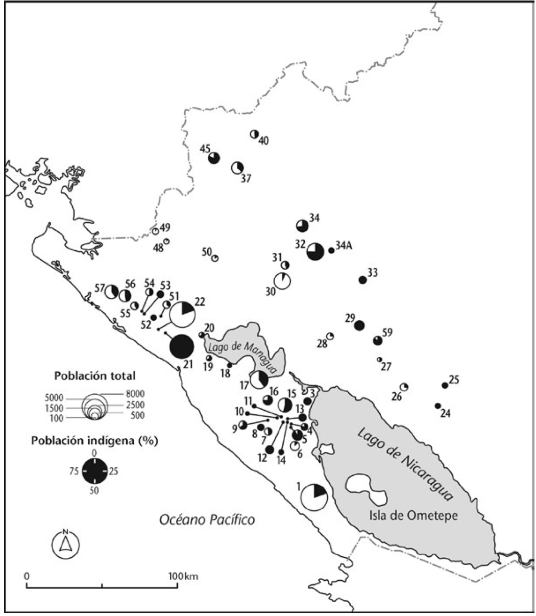
NEWSON;LINDA. Mapa de la población total y porcentaje de indios;1776. Extracto del número de personas…capaces de tomar bulas de Santa Cruzada 6.6.1778. Los números se refieren a poblados indicados en Fig 8. https://library.oapen.org/bitstream/id/4e4ed88b-ba43-4f17-96a3-dd55884c84c5/9781908857873.pdf
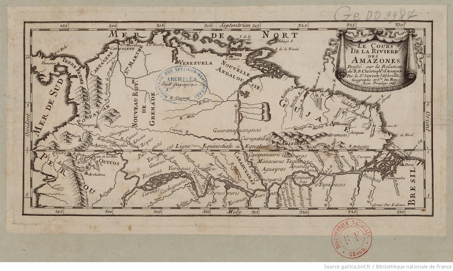
![[Carte de la Guyane, des bassins de l'Orénoque et de l'Amazone]](https://dnet8ble6lm7w.cloudfront.net/maps/CNT/CNT0174.jpeg)