Pueblos
- CARIBS
Cita
Geographical Map of the Republic of NIcaragua. Ferrer;Fermin. 1855. Library of Congress Geography and Map Division. G4850 1855 .F4 TIL. http://hdl.loc.gov/loc.gmd/g4850.ct000427AccessedJuly252023.

Noa Night
Obra de Arte
PUEBLO TEPEHUANO DEL NORTE
Mapa 2020
VENEZUELA - KOLUMBIEN – EKUADOR
Mapa 1924
An exact draught of the Gulf of Darien & the coast to Porto Bello with Panama in the South sea & the Scotch settlement in Calledonia
Mapa 1700 - 1799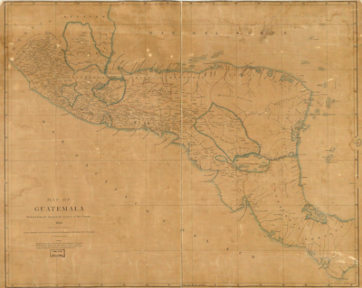
Map of Guatemala: reduced from the survey in the archives of that country.
Mapa 1826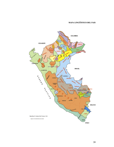
MAPA LINGÜÍSTICO DEL PAIS
Mapa 2009 - 2010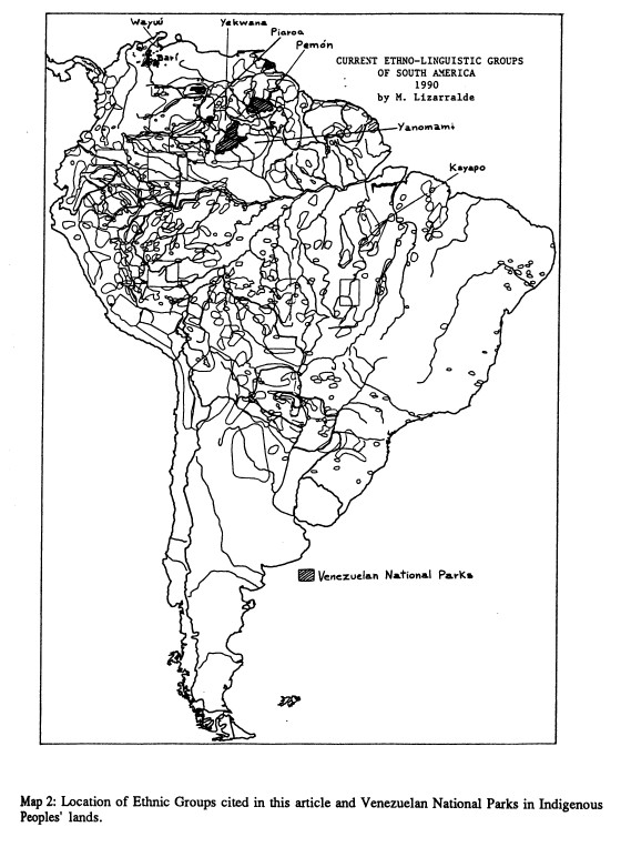
Current Ethno-Linguistic Groups of South America
Mapa 1990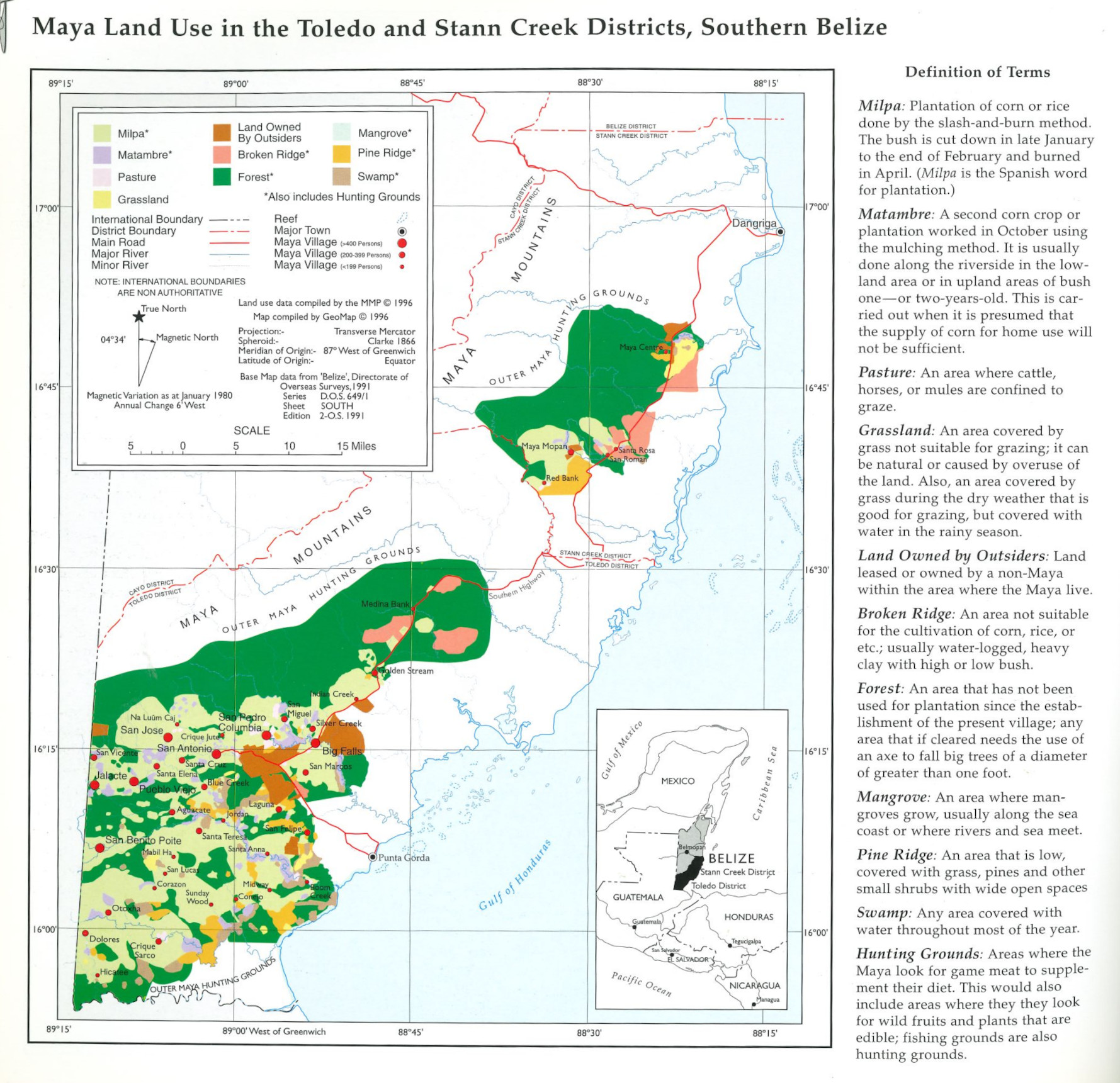
Maya Land Use in the Toledo and Stann Creek Districts, Southern Belize
Mapa 1997