Pueblos
- RAMA
- KRIOL
Cita
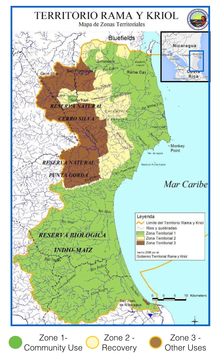
Territorio Rama y Kriol: Mapa de Zonas Territoriales. Three Zones proposed by the PADA to ensure a sustainable future for the communities of Rama and Kriol. Image produced from Strategic Management Plan of the Territory of Rama and Kriol. From "Natural Reserves' no more: illegal colonists deforest huge portions of NIcaraguan protected areas." Watsa;Mrinalini Erkenswick August 13 2014. Mongabay: News and inspiration from Nature's Frontline. Accessed July 11 2023. https://news.mongabay.com/2014/08/natural-reserves-no-more-illegal-colonists-deforest-huge-portions-of-nicaraguan-protected-areas/