Cita
Unkown. "Pintura de Teozacoalco." Map. 1580. https://collections.lib.utexas.edu/catalog/utblac:059d9312-d77c-41d9-81ed-da65bda50a15.BensonLatinAmericanCollection,LLILASBensonLatinAmericanStudiesandCollections,TheUniversityofTexasatAustin
NOVA ET EXACTA DELINEATIO AMERICA
Mapa 1534
DISTRIBUCION DE GRUPOS CHIBCHAS MENCIONADOS EN EL TEXTO
Mapa 2019
A New Chart of Guayana with the colonies of Cayenne;Surinam;&c.
Mapa 1700 - 1799
Cours de l’Orenoque Depuis ses sources jusqu'à la Mer Avec les Rivieres qui s'y déchargent
Mapa 1764
PROVINCIA DO MARANHAO
Mapa 1800 - 1850
"Carta Maritima del Reyno de Tierra Firme ú Castilla del Oro : Comprehende el Istmo y Provincia de Panamá, las Provincias de Veragua, Darien y Biruquete"
Mapa 1729 - 1776
AMERICA MERIDIONIALE
Mapa 1770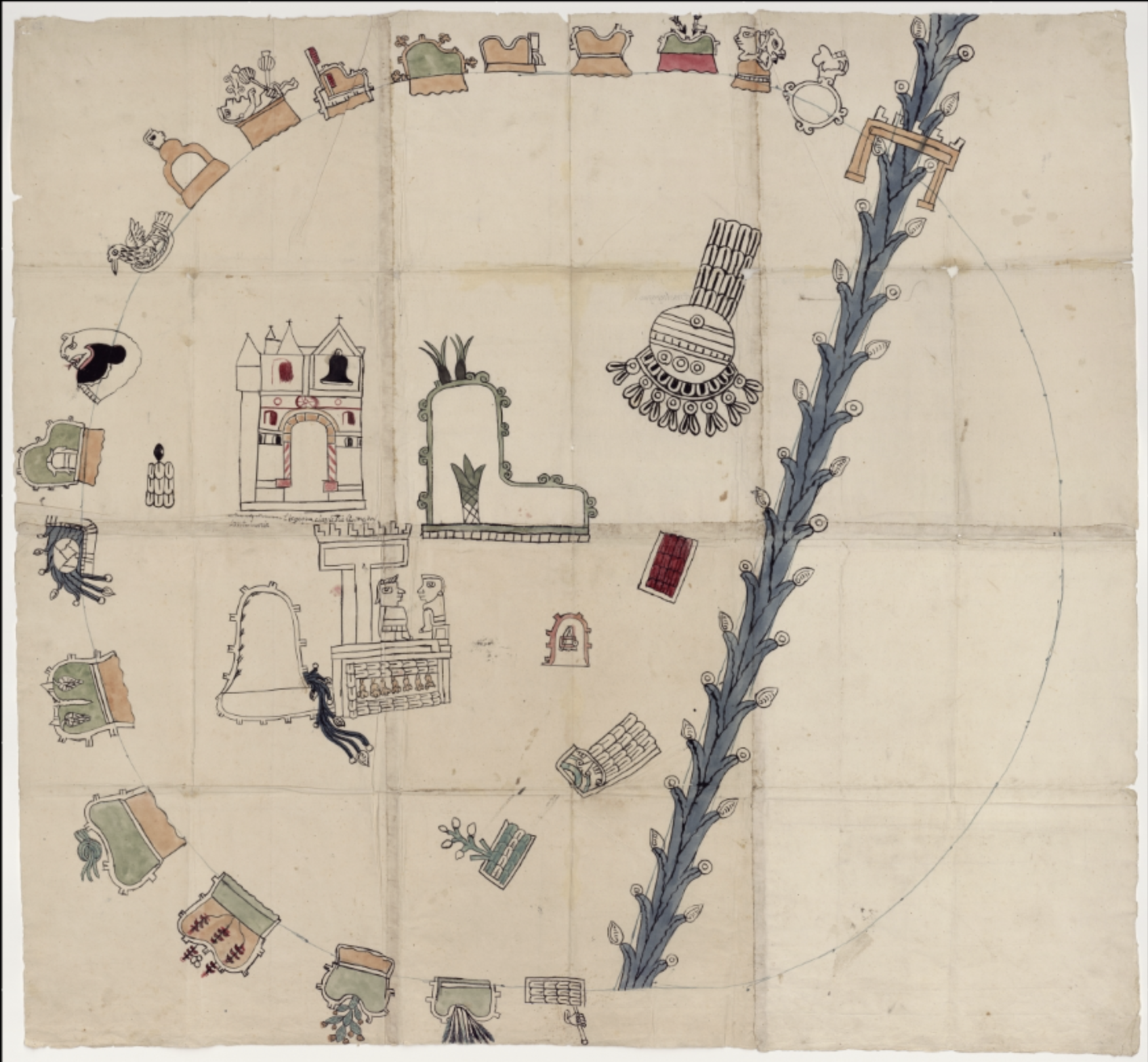
MAPA DE LA RELACION GEOGRÁFICA DE AMOLTEPEC
Mapa 1580