Cita
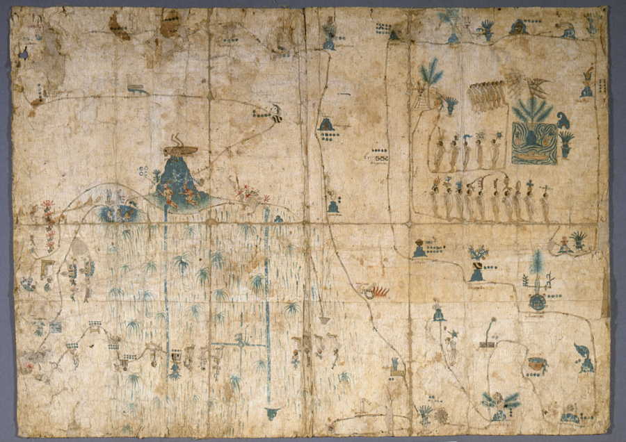
"Mapa de Siguenza." Map. Siglo XVI. https://www.jstor.org/stable/community.15678379.
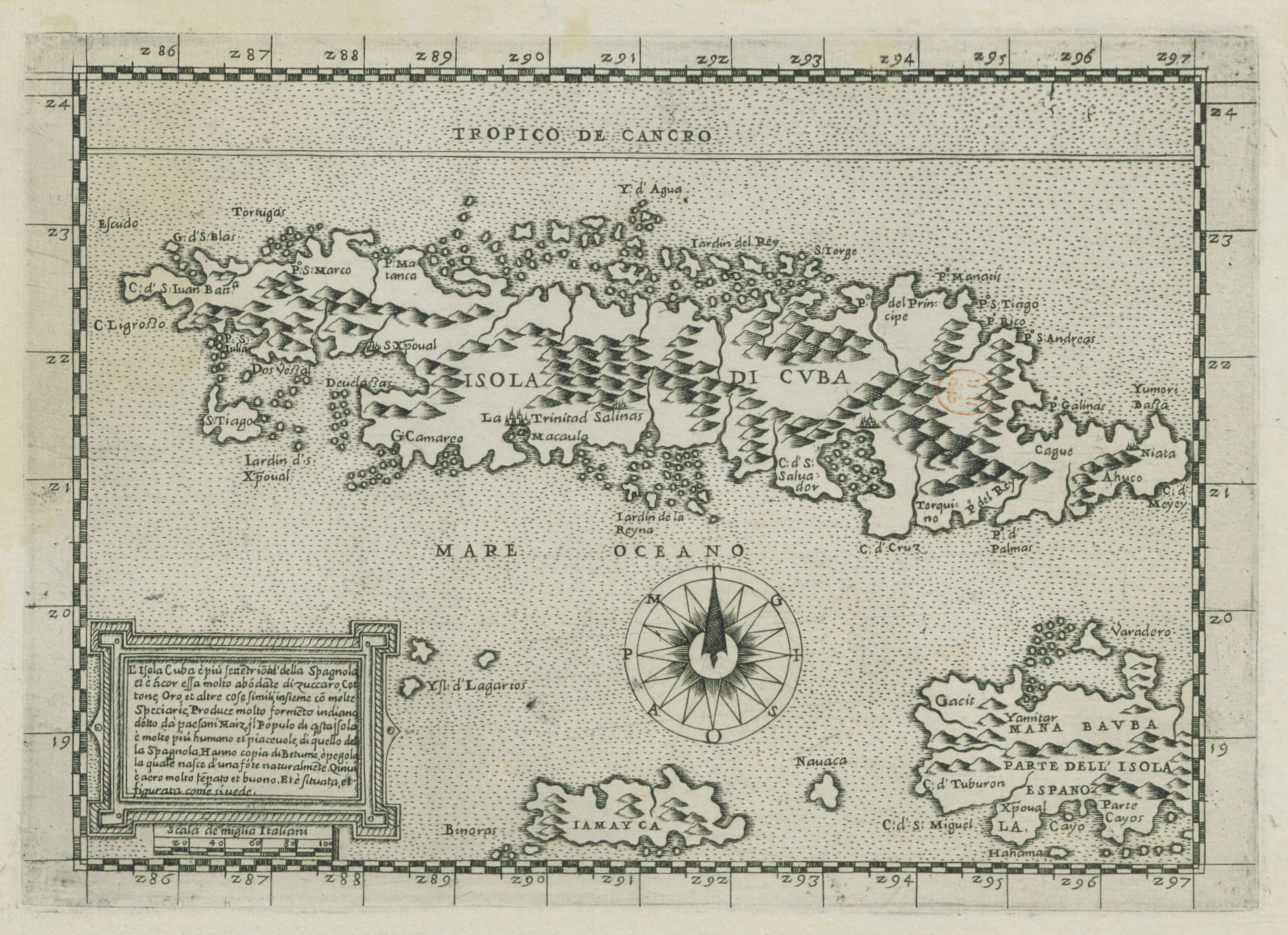
L'Isola Cuba è piu Settetrioal'della Spagnolei et è acor essa molto abodate di zuccaro, cottone, oro et altre cose simili
Mapa 1500 - 1599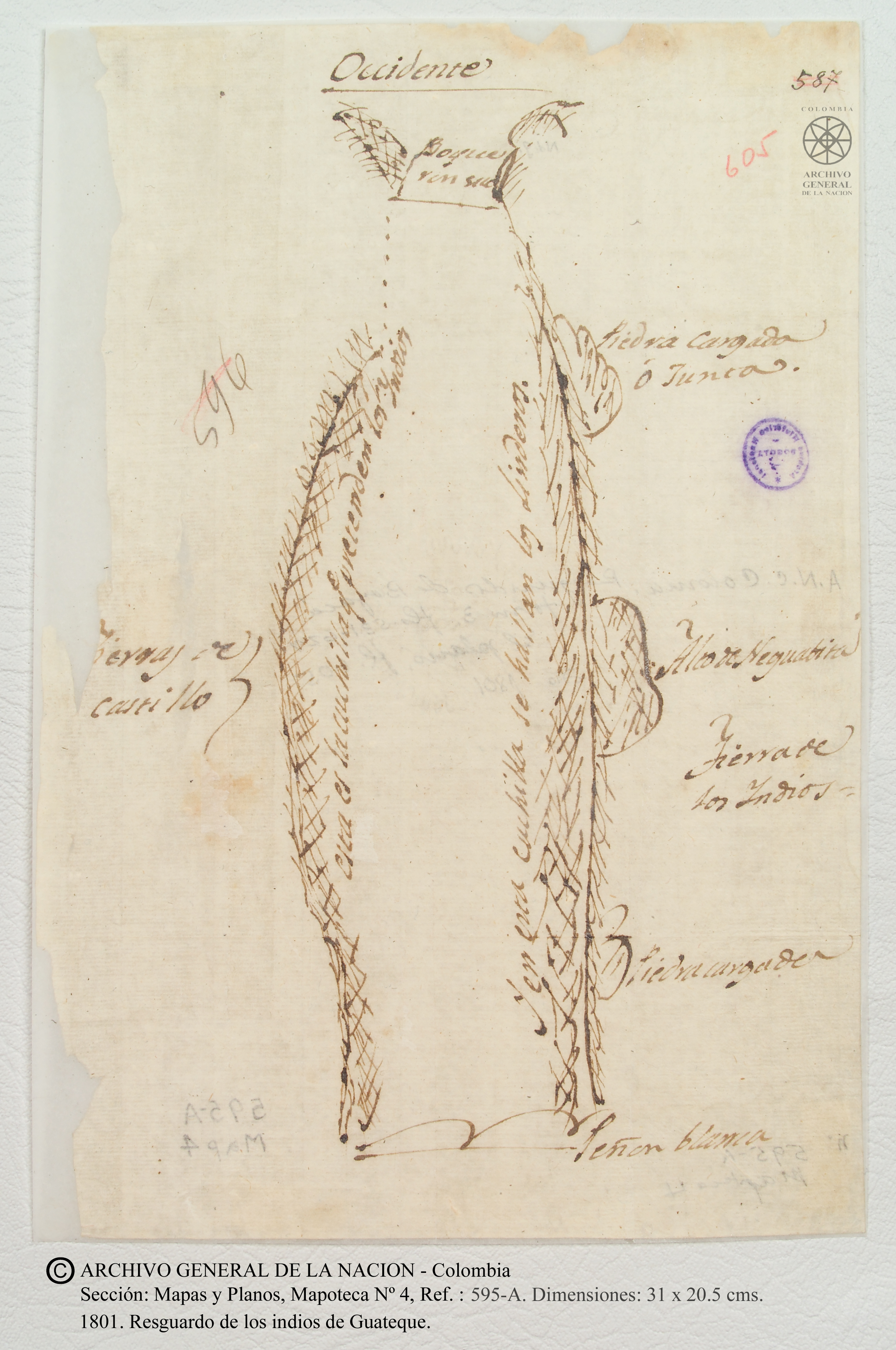
Resguardo de los indios de Guateque. Plano en trazo simple de la cuchilla que pretenden los indios. Corresponde al expediente seguido por los indios con Francisco Javier del Castillo, por deslinde de tierras
Mapa 1801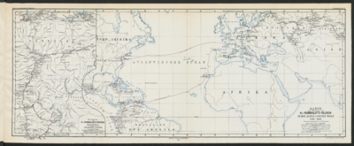
Specialkarte von A. v. HUMBOLDT’S REISEN in VENEZUELA und am ORINOKO-STROM
Mapa 1799 - 1800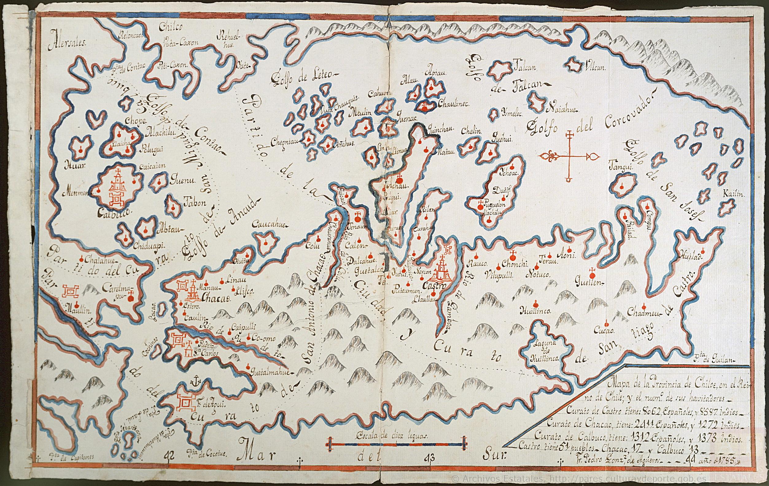
Mapa de la Provincia de Chiloé en el Reino de Chile y el número de sus habitantes
Mapa 1785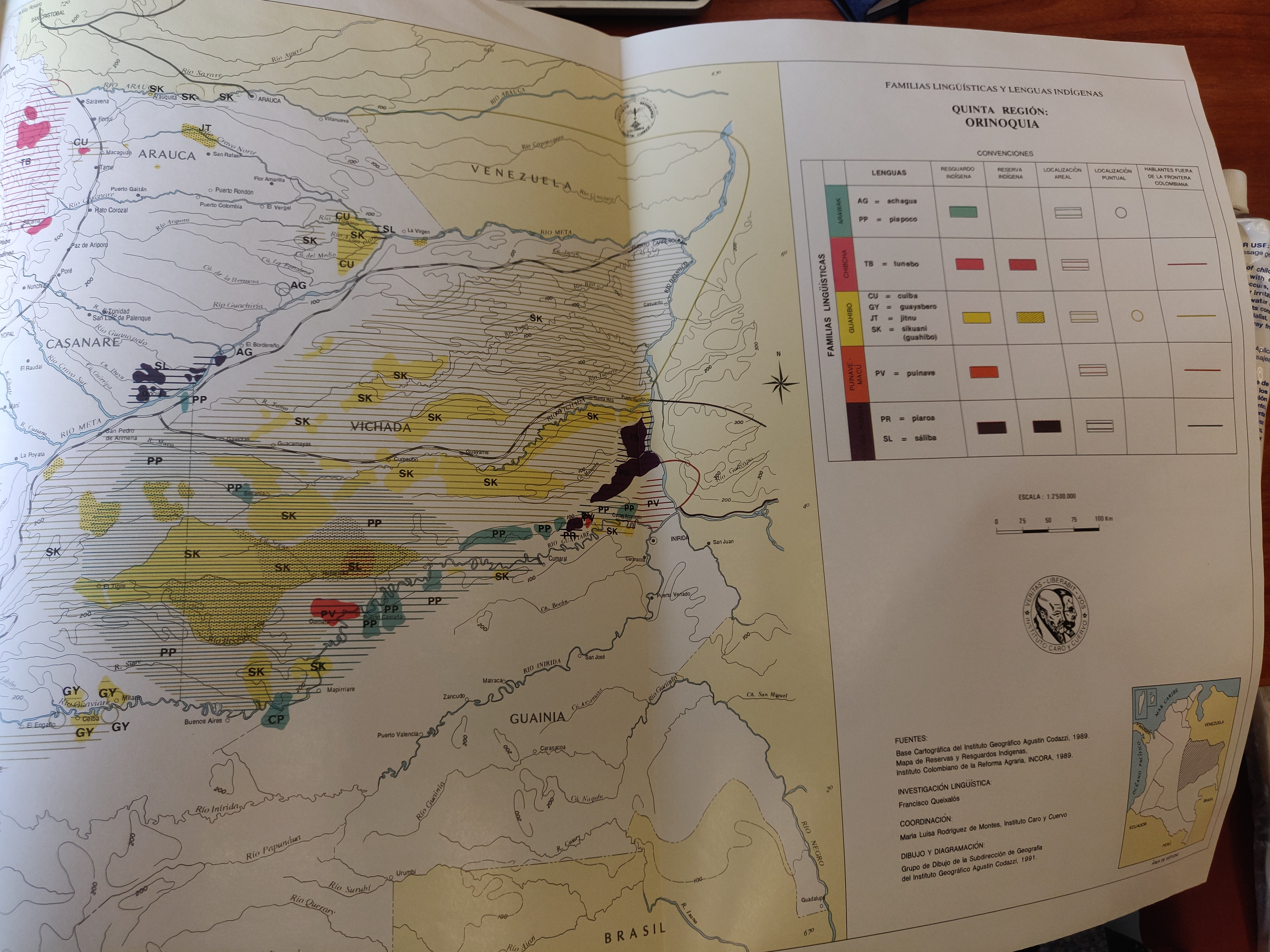
FAMILIAS LINGUISTICAS Y LENGUAS INDÍGENAS. QUINTA REGION: ORINOQUIA.
Mapa 1989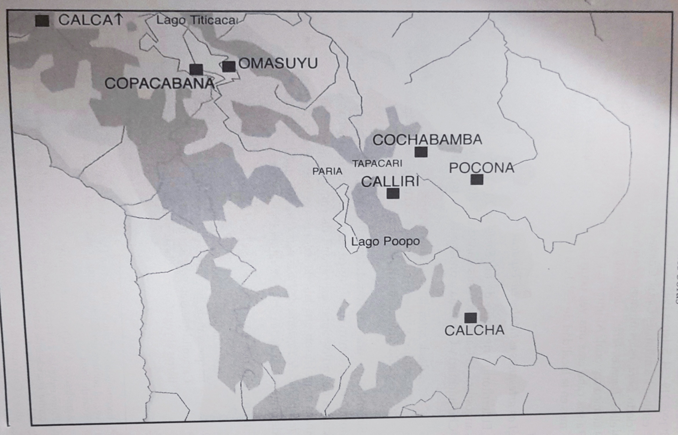
EL SEÑORÍO AYMARA DE LOS SURAS: COLONIAS DE SURA BAJO EL DOMINIO INCA EN EL SIGLO XVI
Mapa 1500 - 599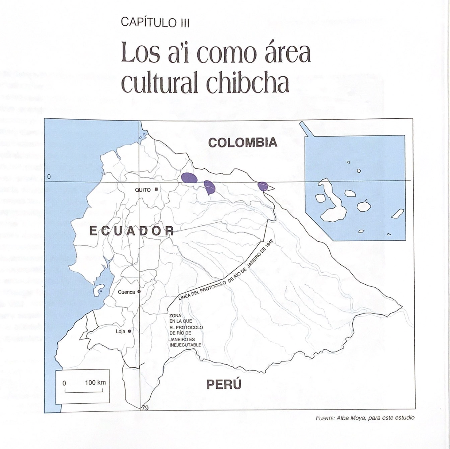
Los a'i como área cultural chibcha
Mapa 1997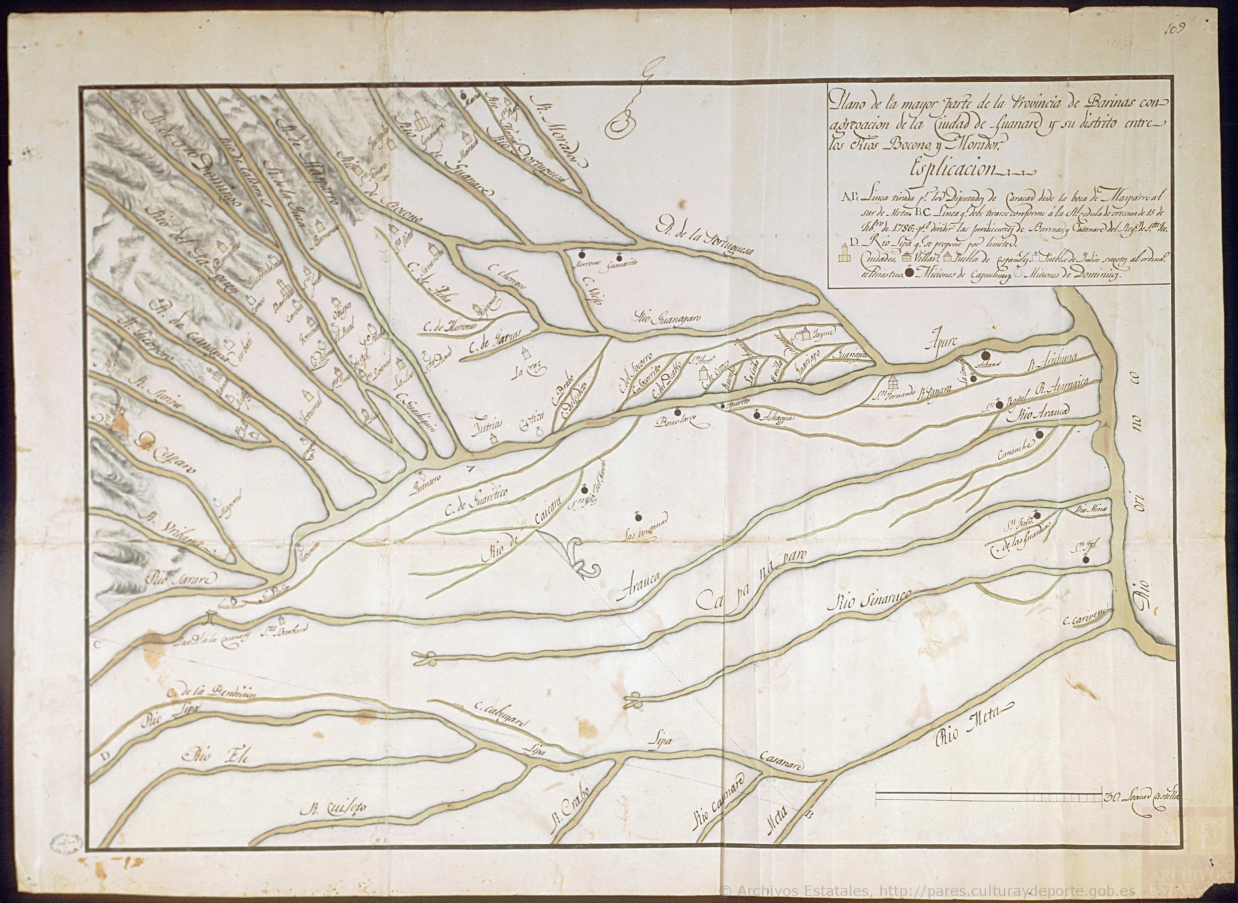
Plano de la mayor parte de la Province de Barinas con agregacion de la ciudad de Guarare y su distrito entre lo Ríos Bocono, y Morador.
Mapa 1801