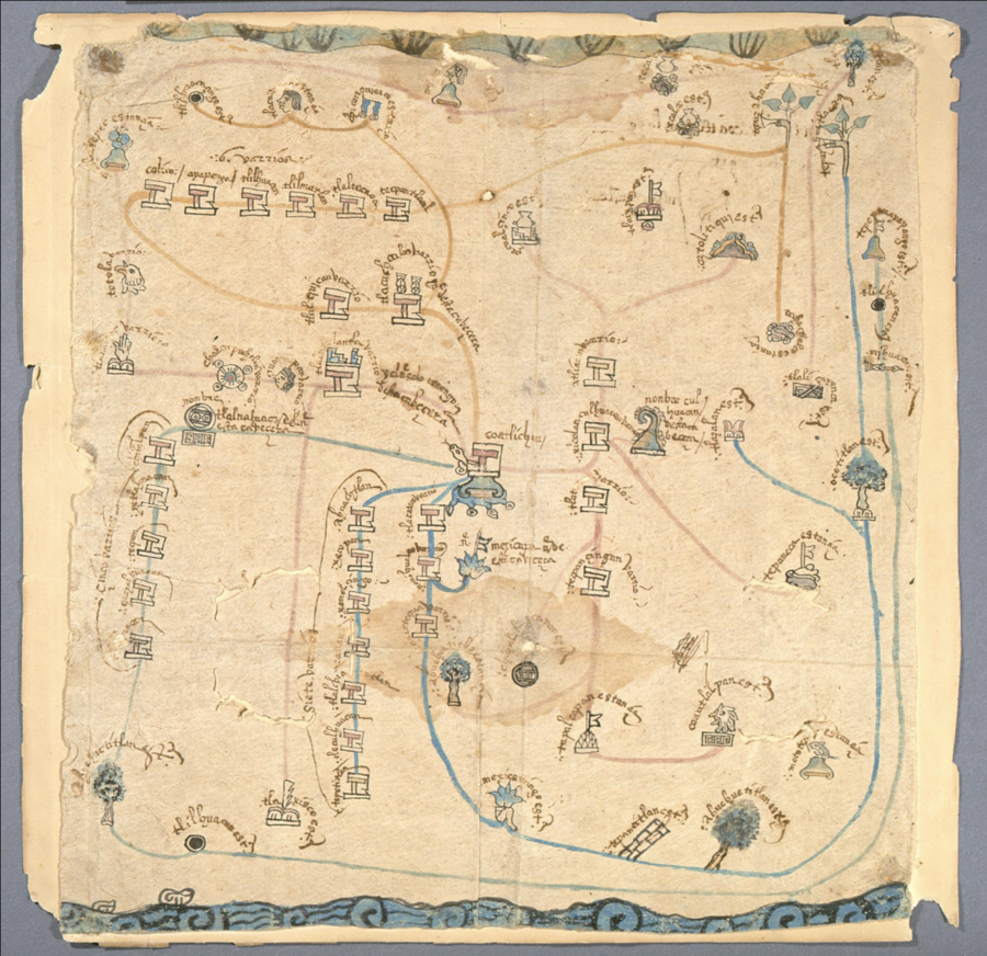
Cita
"Mapa de Coatlinchan." Map. Siglo XVI. https://www.jstor.org/stable/community.15683753.
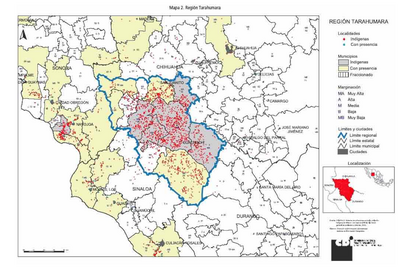
REGIÓN TARAHUMARA
Mapa 2000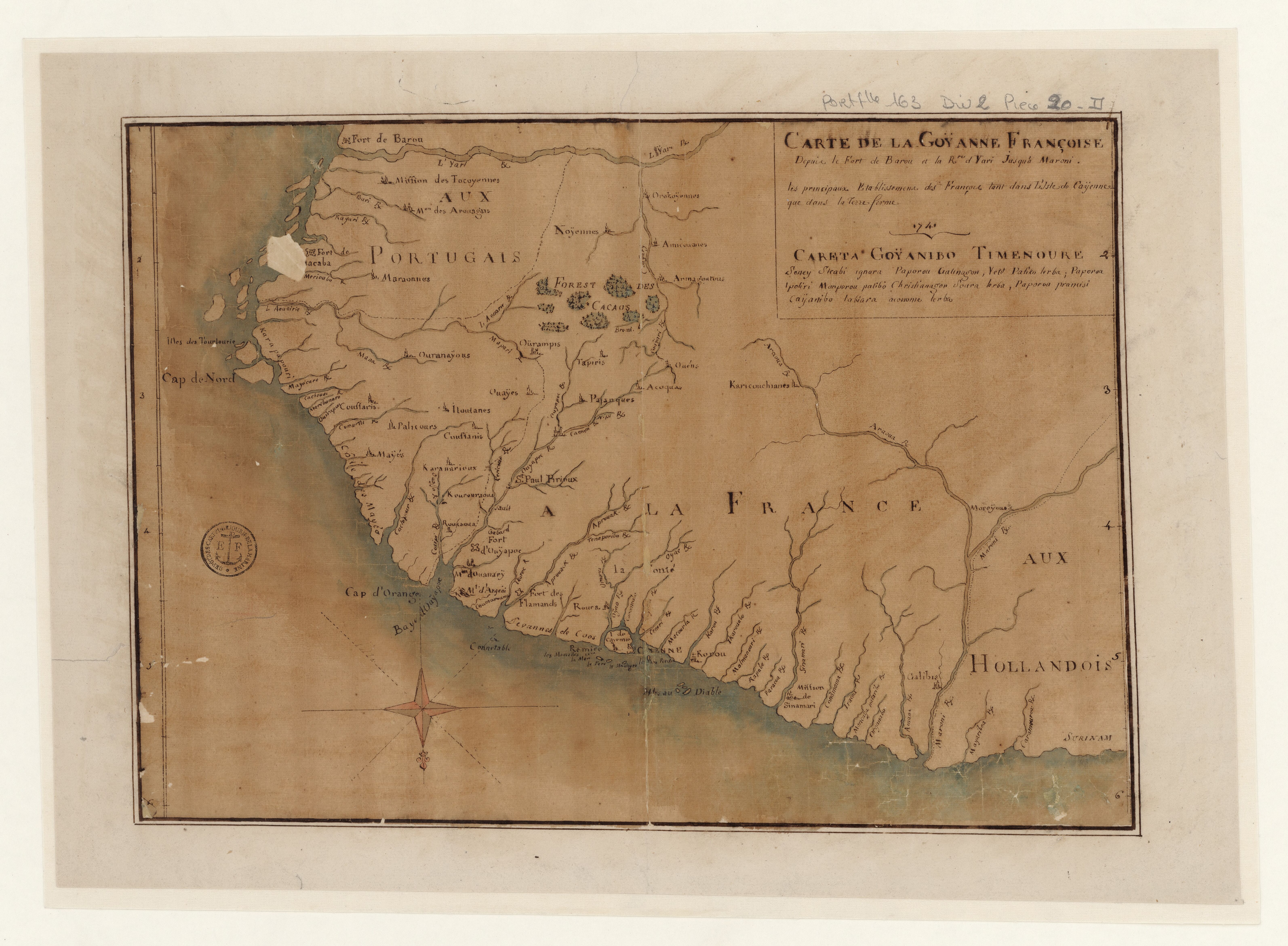
Carte de la Goÿanne Françoise depuis le fort de Barou et la Rte. d Yari jusqu'a Maroni. Les principaux établissements des François tant dans l'isle de Caÿenne que dans la Terre Ferme
Mapa 1741
Mapa Nova Cartografia Social dos Babaçuais: Mapeamento Social da Região Ecológica do Babaçu
Mapa 2014 - 2017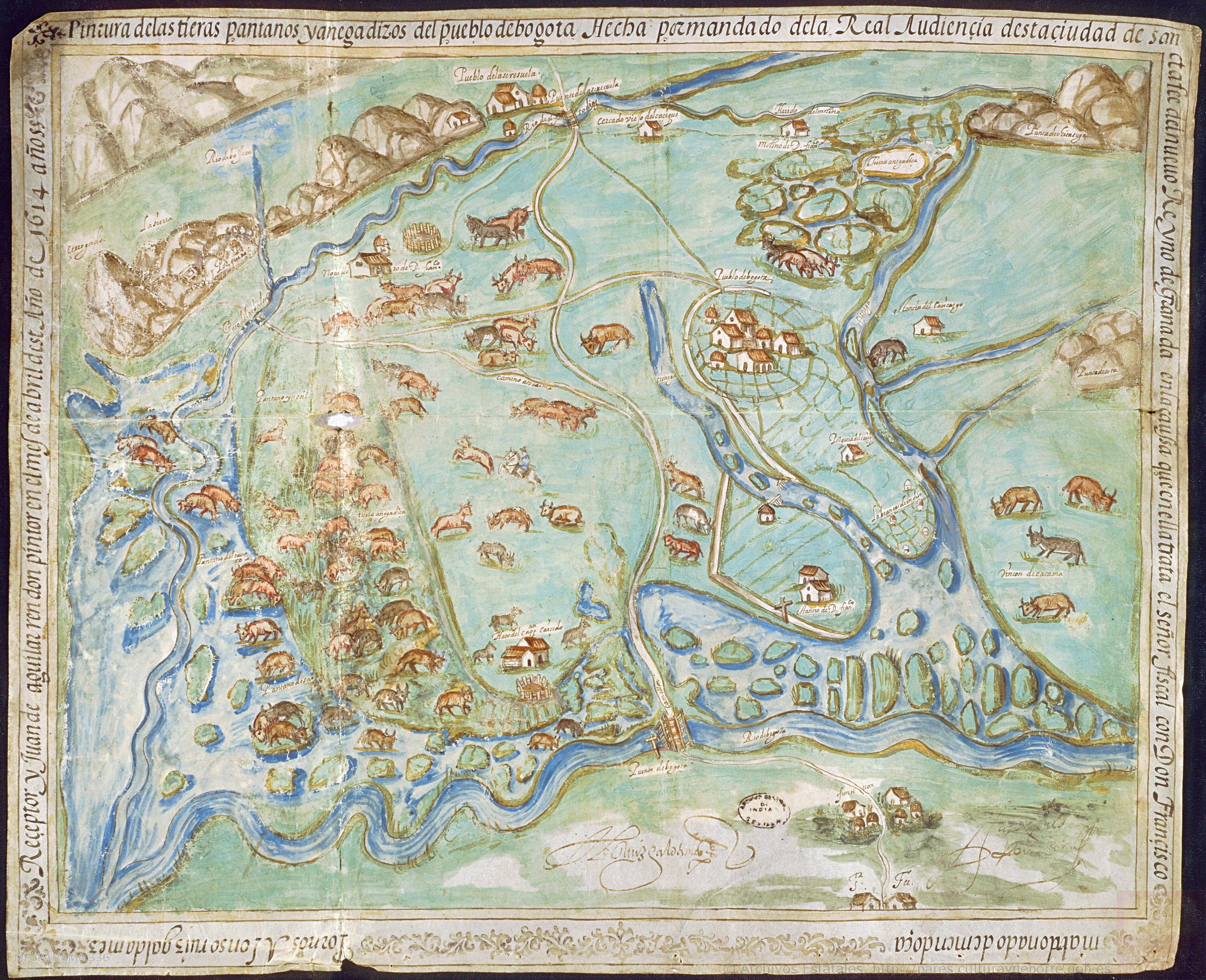
Pintura de las tierras, pantanos y anegadizos del pueblo de Bogotá hecha por mandato de la Real Audiencia desta çiudad de Sancta Fee del Nuevo Reyno de Granada en la causa que en ella trata el señor fiscal con don Francisco Maldonado de Mendoça.
Mapa 1614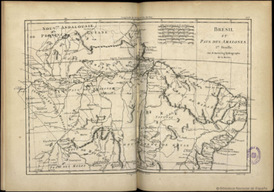
Brésil et Pays des Amazones
Mapa 1788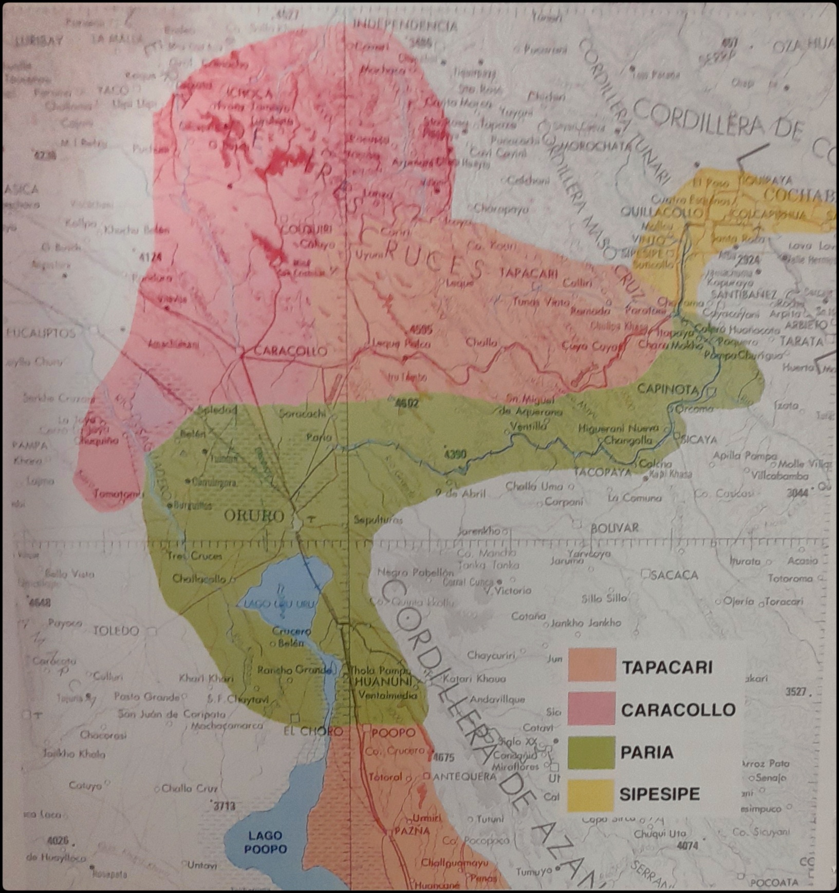
EL SEÑORÍO AYMARA DE LOS SURAS EN EL SIGLO XVI
Mapa 1500 - 1699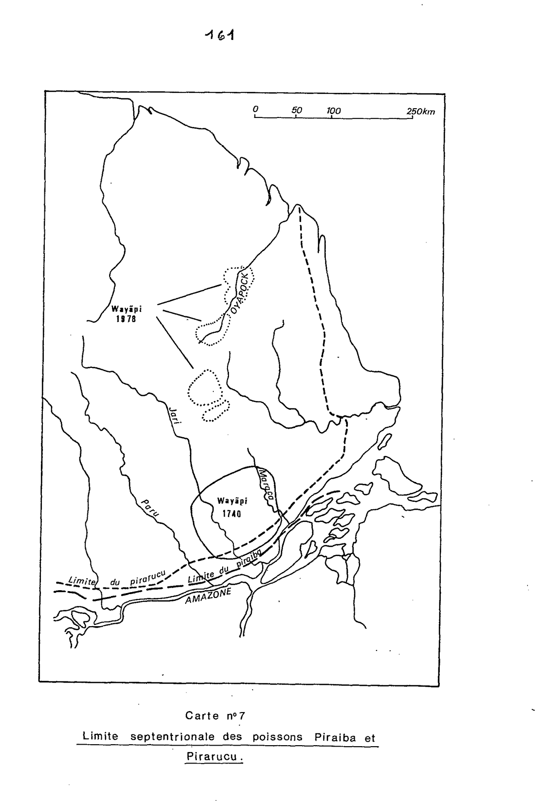
Carte n°7: Limite septentrionale des poissons Paraiba et Pirarucu
Mapa 1740 - 1978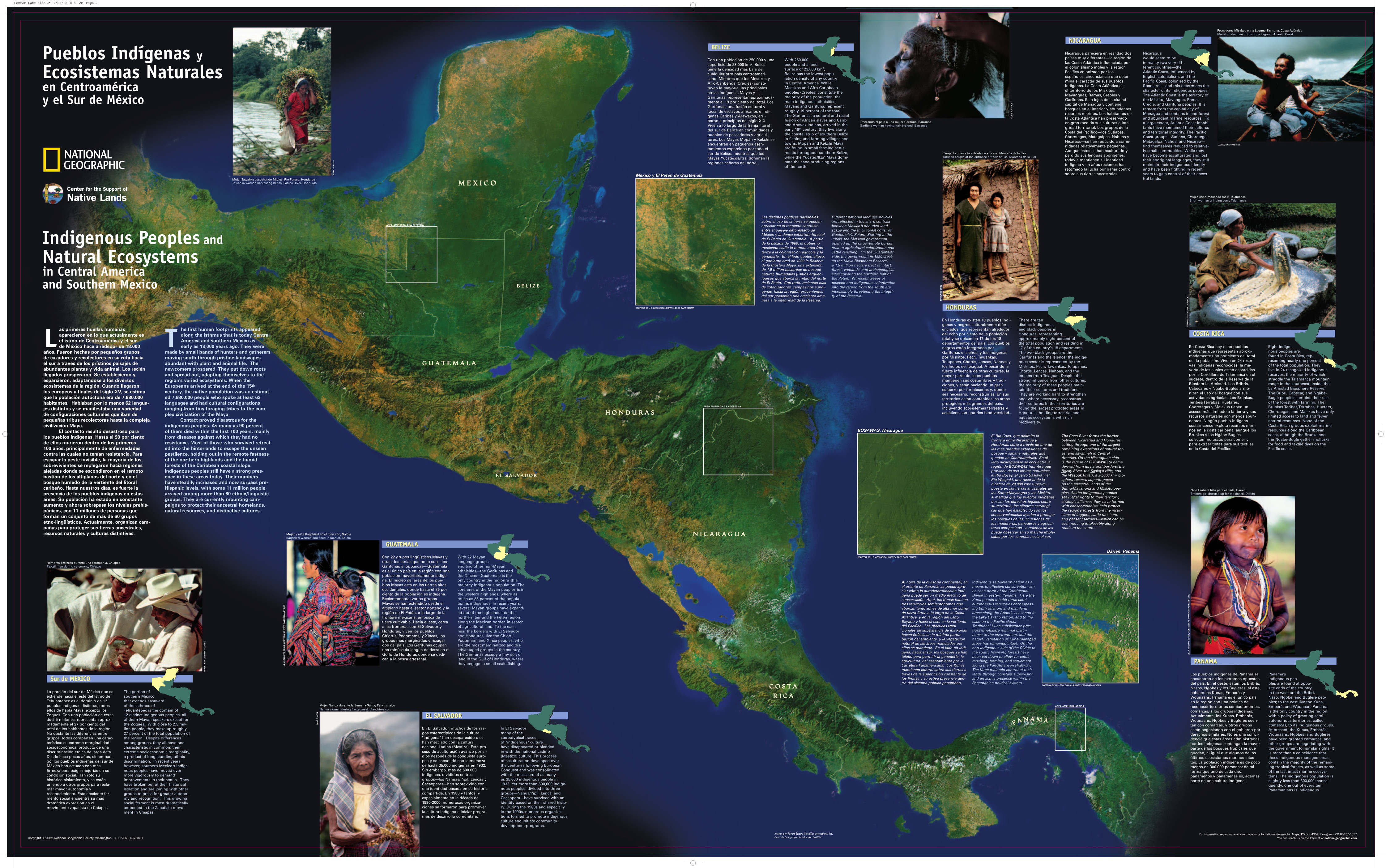
Pueblos Indígenas y Ecosistemas Naturales en Centroamérica y el Sur de México
Mapa 2000 - 2024